Key Points – Tuesday, February 28, 2017
Synopsis: Good Monday morning! Let’s dive right into the forecast this morning, every detail is in the video so we will keep the blog portion short and sweet. We continue to monitor for the threat for strong to severe storms to move through the Midwest later today into the overnight period, where damaging winds, large hail and tornadoes are all possible modes of severe weather. Latest data also suggest pre-frontal supercells out ahead of the main line late tonight which would make for a very dangerous scenario. Isolated heavy rain will be possible with such high precipitable water (PWAT) values for this time of year (PWAT refers to the moisture content in the atmosphere), wouldn’t be shocked to see isolated areas receive 2.0″+. We HIGHLY recommend everyone to stay up-to-date with our forecasts, to have a way of receiving severe weather alerts and to stay weather-aware. Please reach out to us if you have any questions, we will be posting updates throughout the entirety of this event.
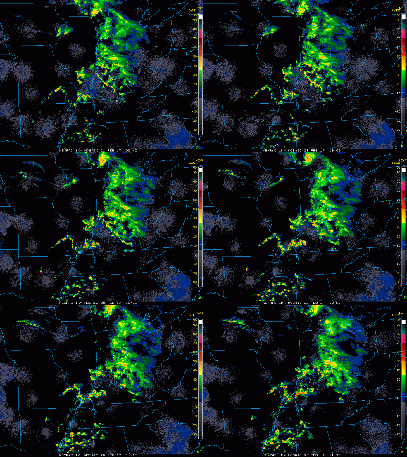
Latest radar across the Midwest this morning shows showers and storms continuing east.
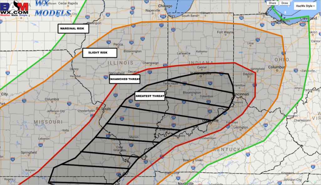
Here’s our latest thoughts on where the greatest potential for severe weather tonight into Wednesday morning. All modes of severe weather are on the table: damaging winds, large hail and isolated tornadoes.
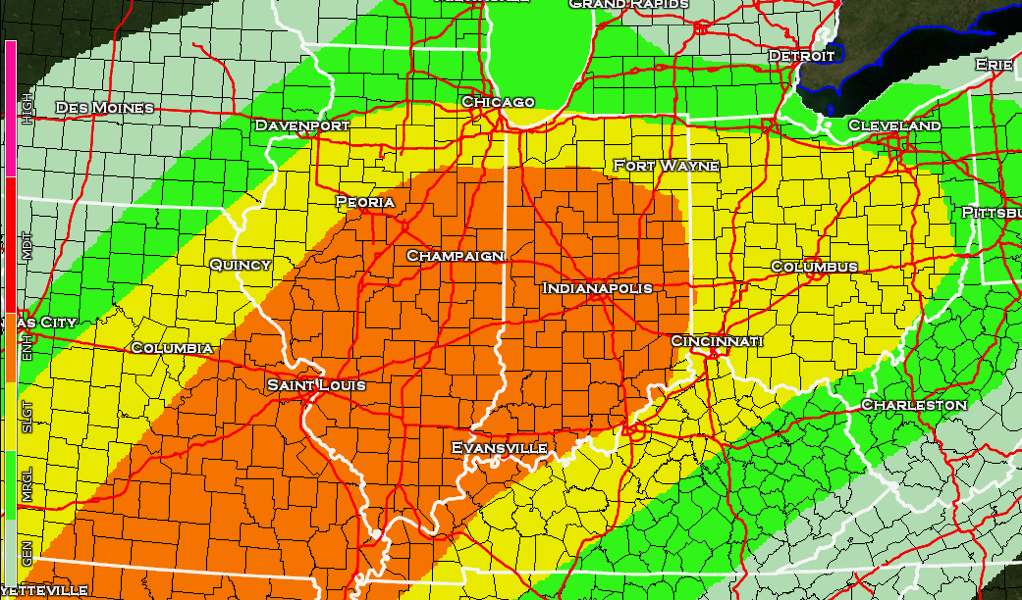
Here’s the latest SPC Enhanced Risk…definitely has shifted further northeast as we mentioned yesterday that it might. The orange is the “Enhanced Risk”, the yellow is the “Slight Risk” and the green is the “Marginal Risk”; the enhanced risk is where they think the greatest threat for severe storms would occur. Wouldn’t be shocked to see portions of this risk area be upgraded to a Moderate Risk for severe storms.
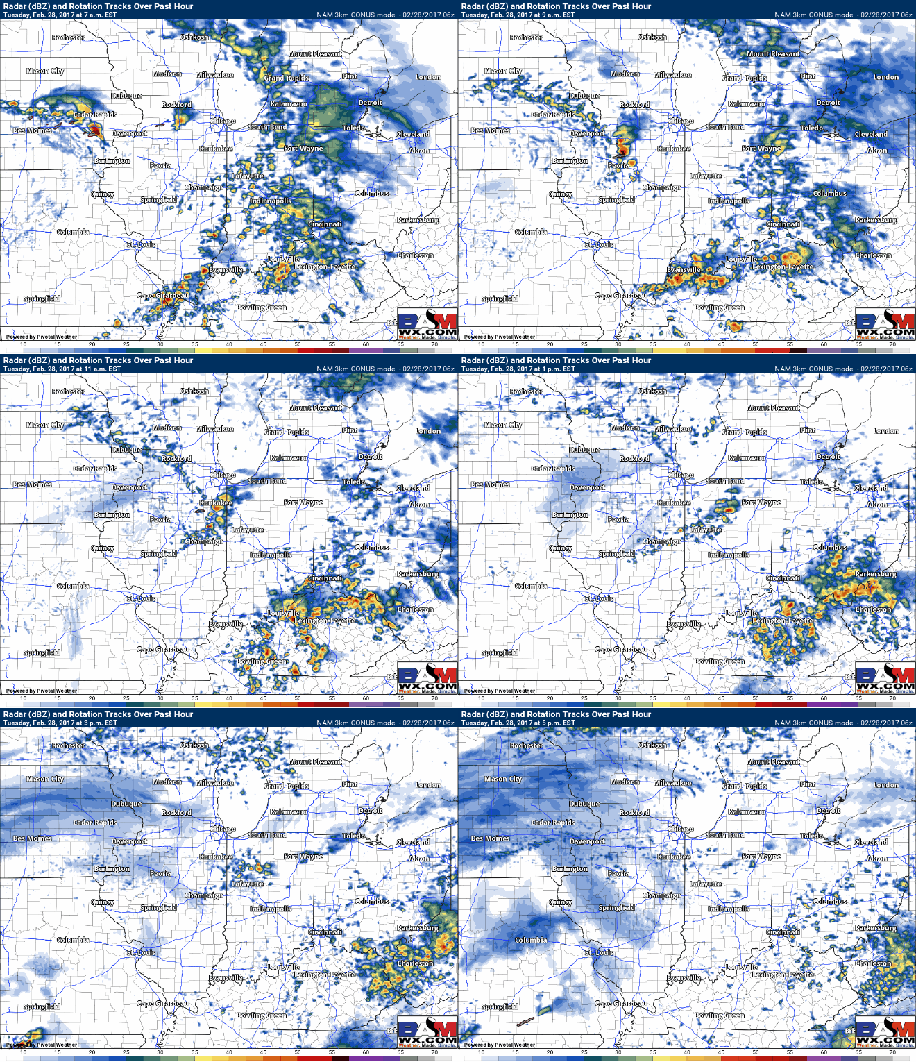
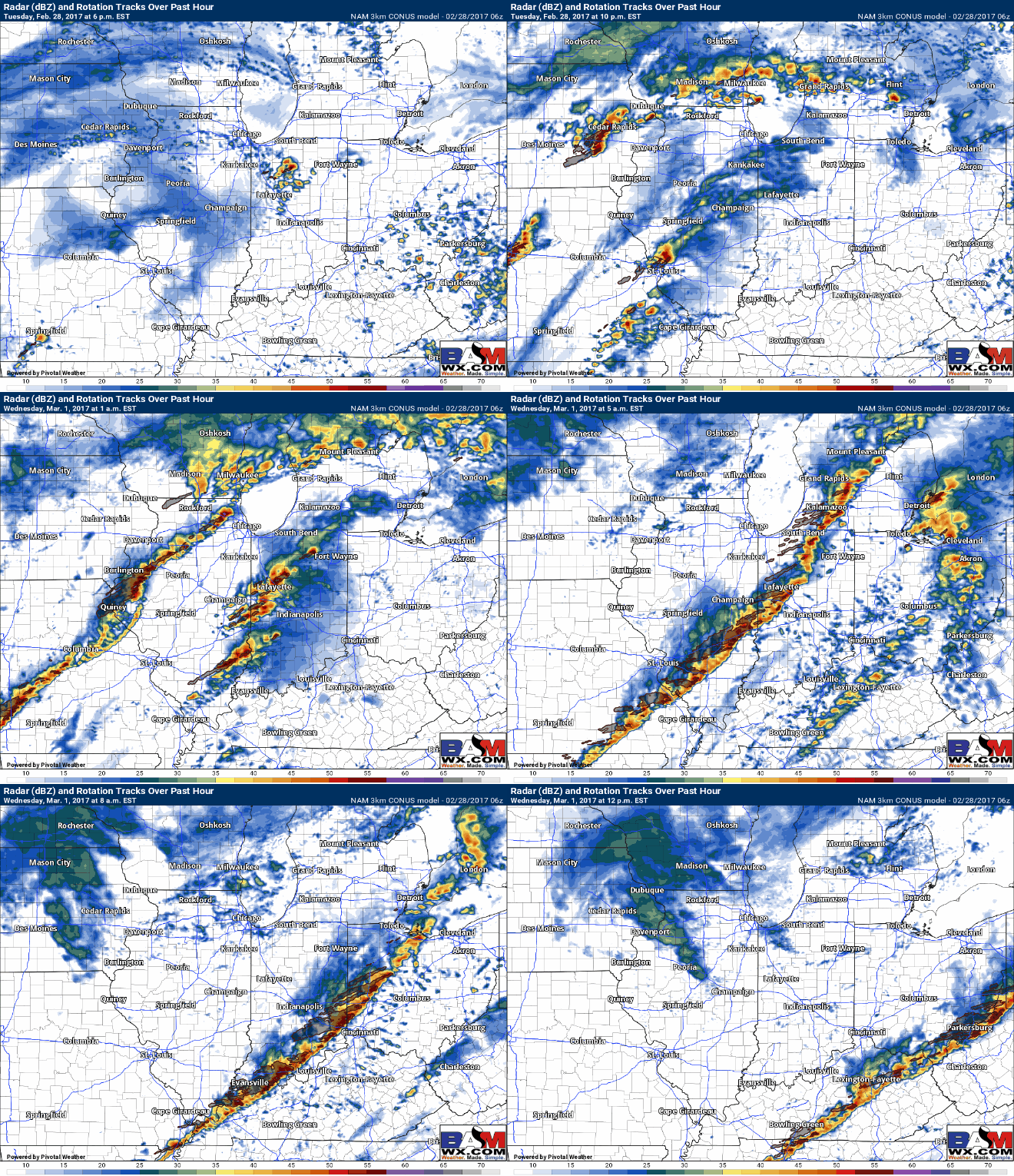
Below is a simulated radar from the latest 3km NAM as it’s handling current convection very well. This goes through late morning into early evening as the warm front continues to lift into the Ohio Valley. Showers and storms likely with this wave, wouldn’t be shocked to see a few hail reports associated with these cells as well.
The main event moves through tonight into Wednesday morning, we have a growing concern for a wave of pre-frontal supercells out ahead of the cold front ~12:00amEST moving west to east. All modes of severe weather (damaging winds, large hail, heavy rains and isolated tornadoes) would possible if these were to pan out, confidence is average but is increasing. Behind the supercells would be the main line of storms which would also pose a damaging wind, hail and tornado threat as well. So, if you couldn’t tell, we are dealing with a very complex, dangerous scenario tonight that requires our full attention.
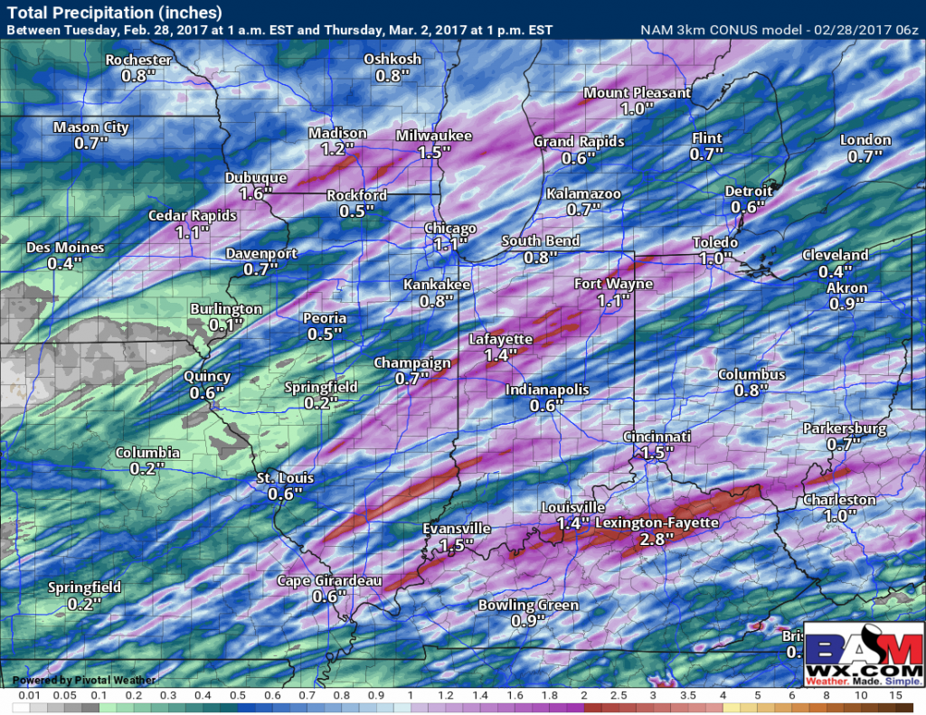
Total precipitation from the 3km NAM shows how not everyone gets in on heavy rains, but those that do could see 1.0″+, wouldn’t be shocked to see isolated locations receive 2.0″+ where the strong storms/supercells move through especially given how strong the precipitable water values are (250%+ above the normal values for this time of year).
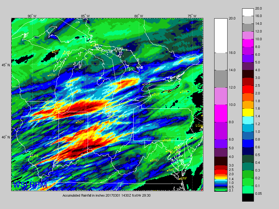
For a comparison, here’s the latest RPM model, which suggests isolated swaths of 3.0″+ where the heaviest rain sets up…we don’t think this is impossible to get some of these values, and are monitoring the heavy rain threat closely as well.
Again, we urge everyone to pay extreme close attention to our forecasts throughout this event, this is a precarious situation especially considering it will occur overnight. Make sure you have a way of receiving severe weather alerts, and reach out to us if you have any questions.
Confidence and Risk:
- High risk for strong to severe storms later today into the overnight Wednesday morning.
- Average risk for isolated heavy rains in excess of 2.0″+ given the high precipitation water (PWAT) values.
- High confidence of another day of above normal warmth forecasted across the Midwest today.
Today’s video (8 min):
