Key Points – Monday, February 27, 2017
Synopsis: Good Monday morning we hope you had a great weekend…boy, do we have ANOTHER active week ahead of us in terms of potential strong to severe storms, a roller coaster temperature forecast as well as some wintry weather possibly mid-week along an arctic front; let’s dive right in! This morning we still have some showers moving east across Indiana into Ohio that will continue to move out of the Midwest as the day progresses…otherwise a mix of sun and clouds expected today, with more sunshine likely across our western locations. Temperatures warm overnight with warm air advection taking place, our next chance for showers and storms comes overnight into Tuesday morning as a warm front lifts into the Midwest, expecting things to move west to east. Things get VERY interesting Tuesday night into Wednesday morning with serious severe weather implications…with that being said, this is still a VERY fluid situation where things are still subject to change, but the dynamics associated with this system can’t be ignored. We are trying to stay as subjective as possible with this forecast and give this no “hype”, but the fact that this would occur overnight is concerning and we need to make sure everyone is weather-aware. Why this is different than what came through this past Friday is because we have high pressure to our east, which would usher in more Gulf moisture and a better thermal gradient. This is a scenario where we highly encourage you watch every update. We also mention in the video the potential for some snow showers Thursday night into Friday morning along an arctic front. Again, if you have any questions in regards to the forecast please reach out to us, have a great week!
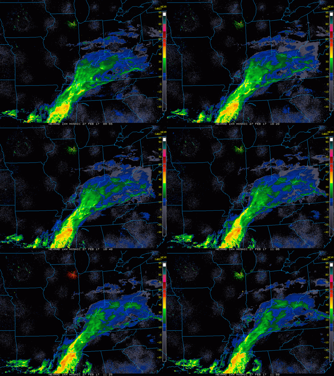
Latest radar across the Midwest this morning…rain showers continue to move east as the morning progresses.
A mix of sun and clouds are the forecast today, with highs in the 40s and 50s. The big story is the severe weather potential early this week. We are staying very subjective to this scenario, but we can’t ignore the signals. The presence of high pressure to the east gives us more confidence why this set-up is different than what came through on Friday…meaning, a higher likelihood of Gulf moisture and a better thermal gradient. We see showers and thunderstorm lift off of a warm front overnight through midnight to ~6am across Zones 3/4, then around 6am-noon we see more scattered showers and thunderstorms mainly across Zones 1/2.
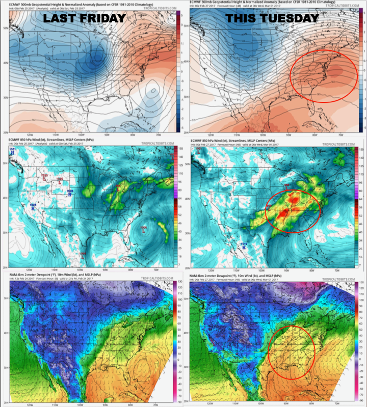
Here’s a graphic showing the differences between Friday’s event and the one forecasted Tuesday into Wednesday. The high pressure to our east will help usher in better moisture from the Gulf and allow us to have a better thermal gradient.
The warm front lifts into the Midwest overnight into Tuesday morning, showers and storms will be possible.
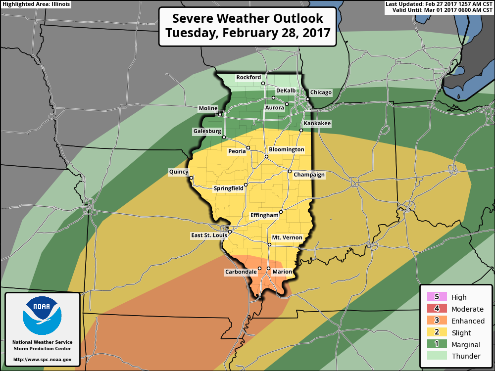
A slight “lull” in precipitation during the day on Tuesday before a powerful cold front moves west to east Tuesday night overnight into Wednesday. If the models are correct (which they have been consistent over the last 4 runs), all modes of severe weather are still on the table, including tornadoes. The last thing we want to do is ignore the threat especially considering it will occur during the overnight hours.
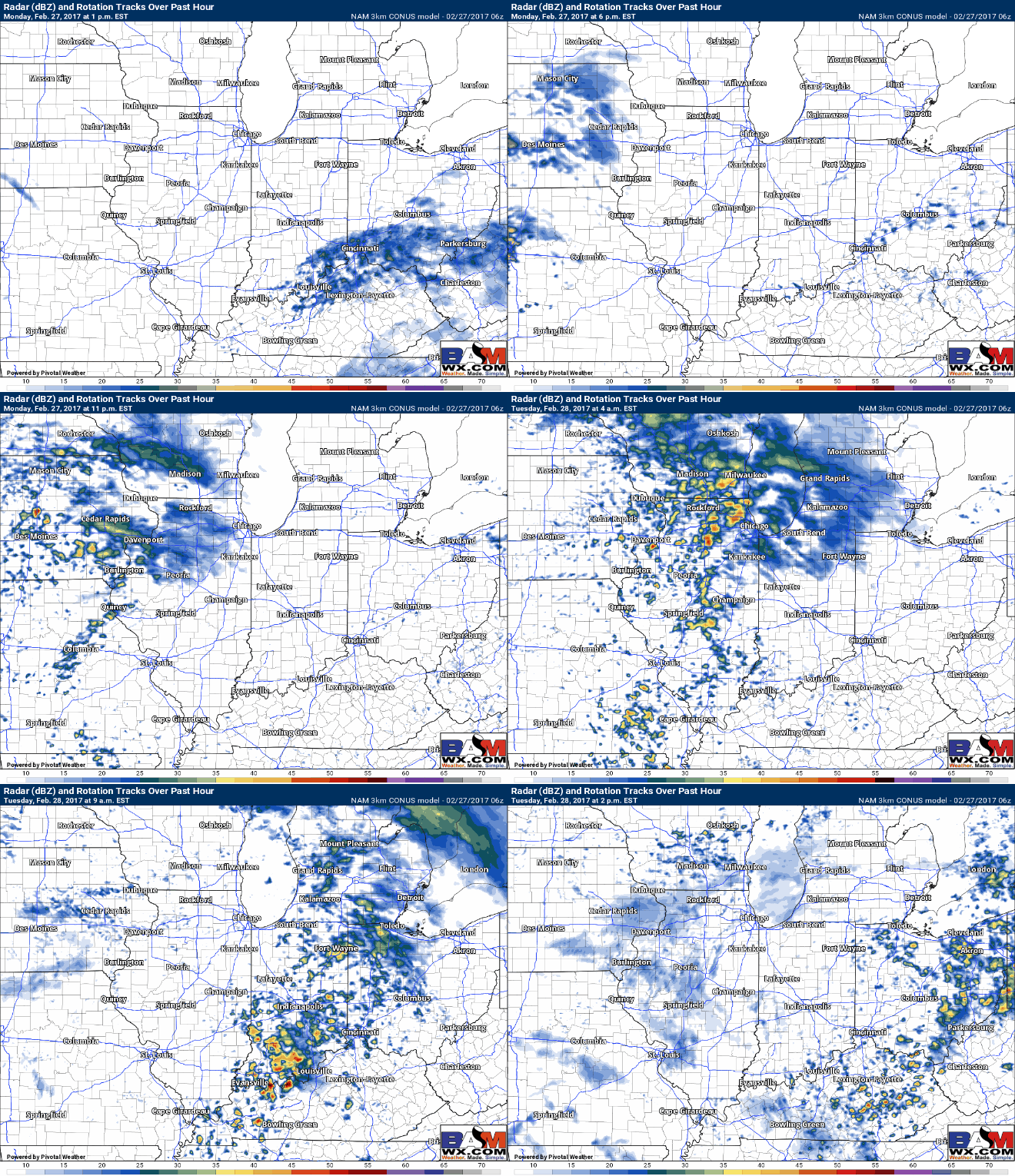
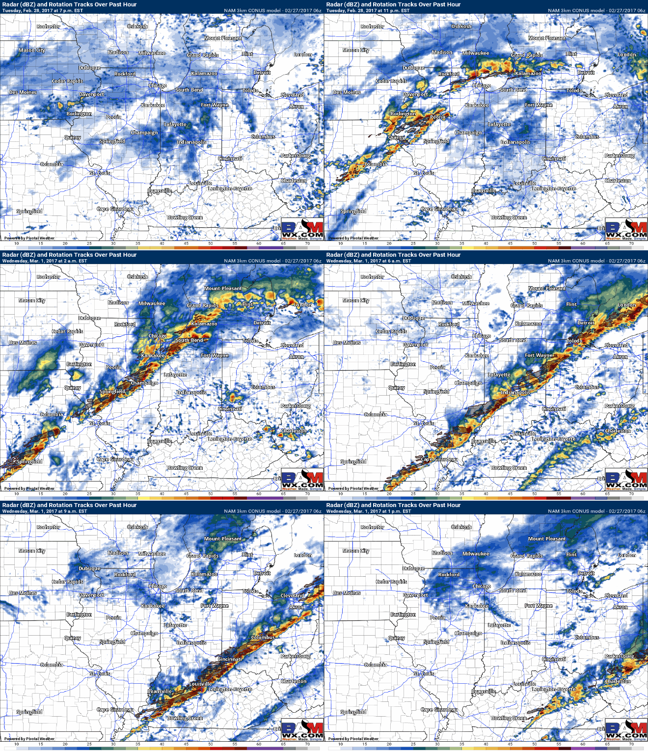
Below is a model loop of simulated radar from the last 3km NAM which shows an impressive line of strong to severe storms Tuesday night into Wednesday, we time out things in the video. Again, the biggest concern here is that the threat will occur overnight, so we need to have a heightened awareness. Damaging winds, large hail and tornadoes are all possible at this time.
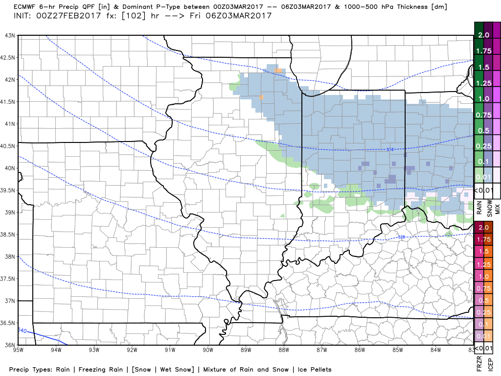
The next system comes Thursday night into Friday as another blast of cooler air moves in…the energy is evident on the models so potential snow showers overnight is something that we will continue to monitor especially across Zones 1/2.
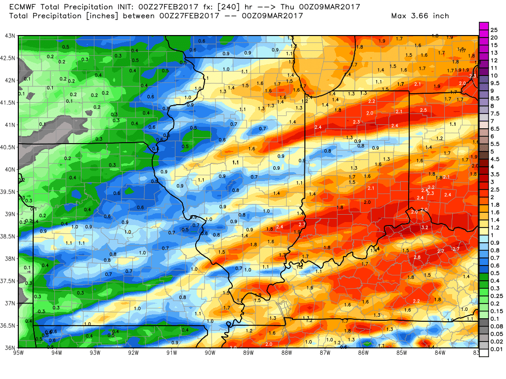
Total precipitation over the next 10 days…as we mentioned in the synopsis, it’s ACTIVE, with multiple disturbances moving through!
Confidence and Risk:
- Above average confidence of a mix of sun and clouds forecasted today with highs in the 40s/50s.
- Increasing confidence of showers and storms overnight as a warm front lifts into the Midwest.
- Increasing confidence of strong to severe storms Tuesday night into Wednesday along a powerful cold front…all modes of severe weather are on the table at this time.
- Increasing confidence of a shot of winter precipitation Thursday into Friday along an arctic front that swings into the Ohio Valley.
Today’s video (7:40 min):
