#ILwx #INwx #OHwx Sat short-term: Latest thoughts on #Midwest accumulating snow Sun into early next wk. K.
Synopsis: Good afternoon, we hope you all are having a wonderful weekend. Today’s update we discuss the threat (and risks) for accumulating snow late Sunday night through early next week across the Midwest. Interestingly enough, this is the same piece of energy that is forecasted to give folks in the Northeast a potential big-time snow storm early next week as well! The only difference is the lack of a “phase” of our northern and southern streams of energy. Nonetheless, with temperatures forecasted to be hovering around freezing as the energy moves through, some accumulating snow will be possible.
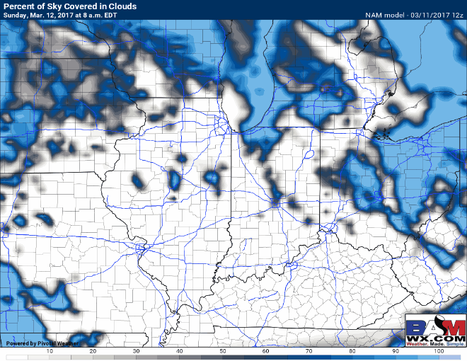
Most of Sunday likely starts out cloud-free or mostly sunny for the first half of the day, with skies becoming progressively cloudy during the afternoon into the evening.
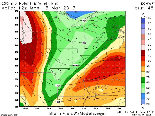
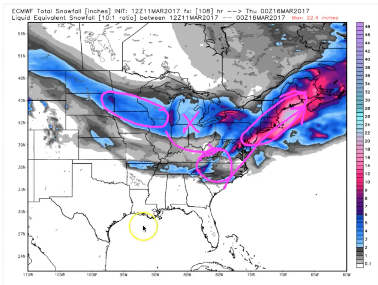
The issue that’s arising is the lack of consistency at the surface that models are struggling with (despite consistency with upper-level energy placement)…specifically, accumulation amounts as discussed in the video. The tricky part with this forecast is the transfer of energy to the east and the East Coast…if the models miss it, the forecast will suffer.
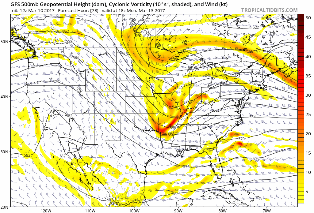
The upper-level jet fires up right over the center of the Ohio Valley on Monday, this too plays an impact as to when and where the transfer of energy begins. If you can’t already tell, there is a lot of little details that still need refined with this event.
We discuss timing, precipitation-type and temperatures in the video…as these details are critical as to how much snow accumulation will be possible. Below is the latest simulated radar loop from the European…the low looks to track around I-70, northern locations having a higher probability for snow showers and southern location seeing a rain/snow or rain mix as temperatures will get into the upper 30s to lower 40s Monday.
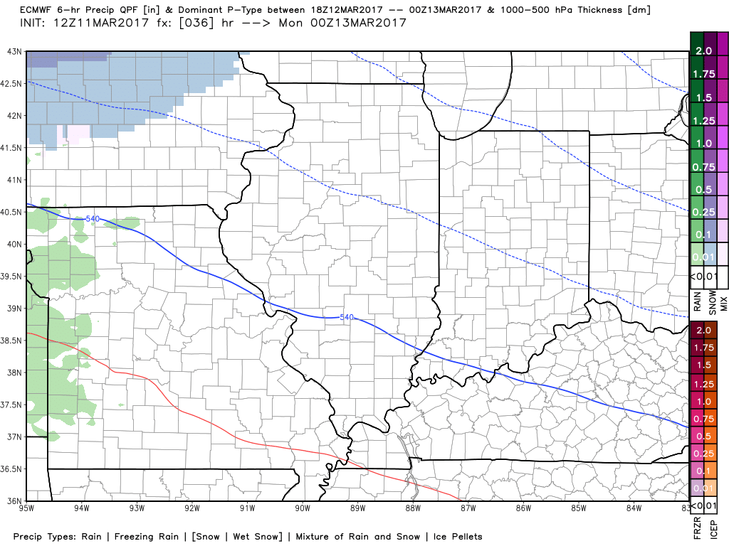
Latest thoughts on accumulation…I-70 is a good boundary for where this snow looks to set-up given the latest data. We are using a 10:1 snow to liquid ratio given how warm temps are at the surface, but how cold they are above it.
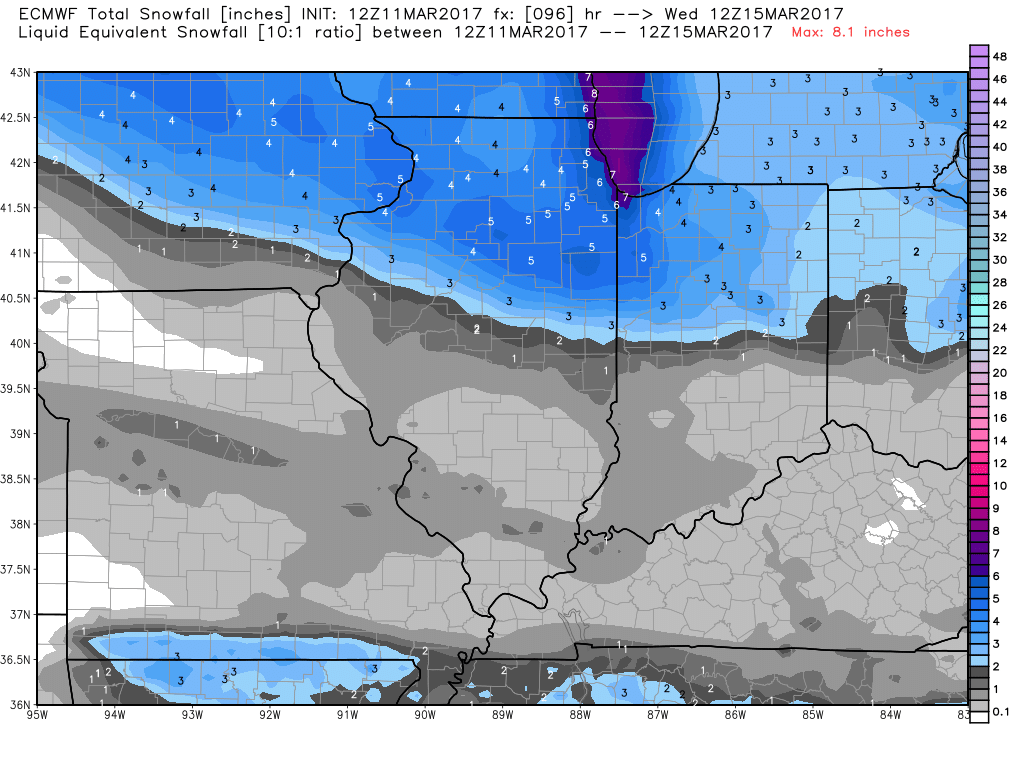
As mentioned above, we are dealing with an energy transfer situation, which is why we are seeing the heavier snow totals of 4-6″+ across eastern Iowa and northern IL even into northwestern Indiana, and the lower totals across the remainder of Zones 1/2…then the heavier totals across the East Coast. It needs to be noted as well that we will lose a large chunk of these snow totals due to surface temps being quite warm on Monday as well. A refreeze scenario Monday night is not off the table given temps fall below freezing (something we will monitor closely).
We will continue to monitor the latest data with this event and update as necessary…confidence is about average on the this as a whole with a lot of things a play…check back often!
Confidence and Risk:
- Above average confidence we begin Sunday off with mostly sunny skies…progressively getting cloudier throughout the day.
- Above average confidence snow showers begin late Sunday night into Monday from west to east.
- Increasing confidence of warm air concerns that will likely eat away at some of these forecasted snow totals especially around I-70.
- Average but increasing confidence in possible slippery surfaces Monday night into Tuesday as temps fall below freezing again.
Today’s video (7 min):