Key Points – Tuesday, March 7, 2017:
Synopsis: Good Tuesday morning and thanks for checking out today’s forecast update! A line of showers and storms continues east this morning marching across the Midwest, laying down moderate to heavy rain at times and gusty winds. As the cold front makes its way out of our forecast area, skies will gradually clear from west to east with temperatures expected in the low to mid 50s. Wednesday we will see mostly sunny skies, highs in the 50s and 60s with winds out of the southwest at 10-15mph, gusting upwards of 40+mph at times. Clouds increase Thursday with a small wave of energy moving through late into Friday morning mainly I-70 south that will bring a slight chance for a mix of rain and snow showers. We continue to watch closely as our data tries to sort itself with the weekend winter potential…confidence, unfortunately, hasn’t increased in terms of a consistent solution and is still low. The best we can do is relay the risks to the forecast and watch as things unfold. The issue we are having is this system is being suppressed to the south because of the models strengthening an upper level low pressure in southeast Canada.
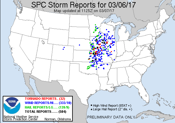
Before diving into the forecast I wanted to share this incredible graphic of the severe weather event that moved through to the west. As of this morning, at total of 32 tornadoes and 504 severe weather reports…that makes 2 tornado outbreaks within a week’s time! This also brings our total to 96 tornadoes, again, incredible. We certainly meant it when we said Feb into Mar would be very active with severe weather.
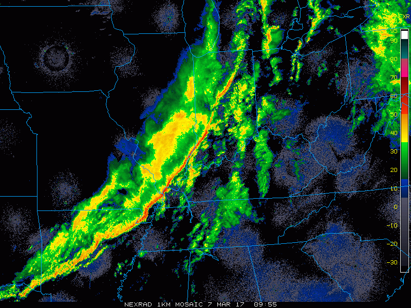
Latest radar loop this morning shows the line of showers and storms ahead of the cold front progressing east. Most of this rain clears to the east by around lunch time today.
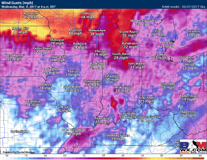
Mostly sunny skies, warm with windy conditions expected on Wednesday…winds gusting upwards of 40+mph expected at times during the day as well.
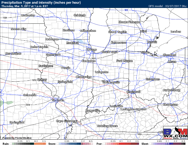
A small wave of energy is forecasted to move west to east late Thursday into Friday morning that will bring small chances for a rain to snow mix.
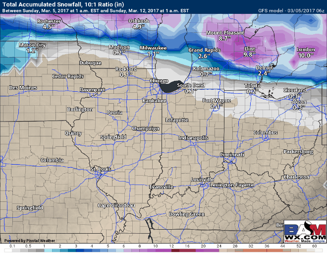
The big issue with our weekend winter threat is that lack of forecast model consistency, even within 5 days…confidence is still low on a solution. Our models continue to suppress the heavy snow threat south towards the Ohio River because of a strengthening upper level low pressure across southeast Canada. Below is a model trend from the latest GFS runs and you can easily see the south trend from every single model run from 2 days ago until now. However, confidence is increasing that locations south of I-70 will see accumulating snow, the details on where that heaviest sets up and how much is still to be determined.
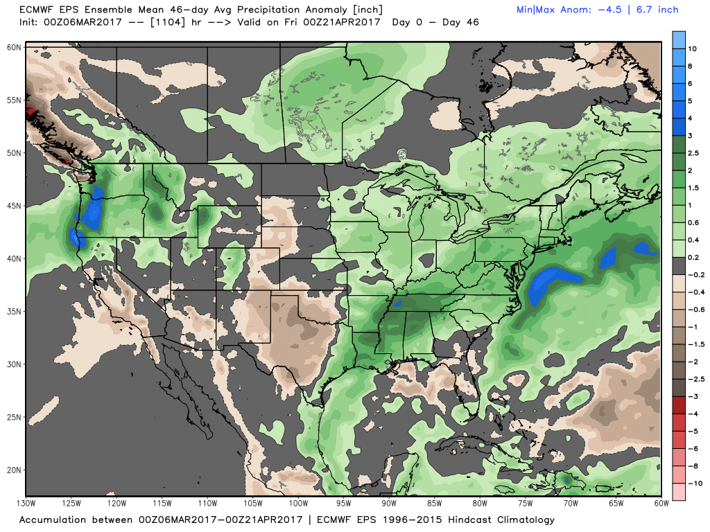
Glancing at the latest European Weeklies that came out last night, its 46 day precipitation anomaly is very wet and active for the Midwest. We touch more in the long-range later this morning so make sure to check that out!
Confidence and Risk:
- High confidence the showers and storms will move off to the east by lunch time with skies clearing behind it.
- Above average confidence we are windy again tomorrow with gusts up to 40+mph possible out of the southwest…more sunshine is expected.
- Average confidence of a small wave of rain/snow showers moving mainly south of I-70 Thursday night into Friday morning.
- Low confidence the details of this weekend’s winter weather threat…models continue to shift the heaviest snow threat south, something we are watching closely.
Today’s video (7 min):