Key Points – Thursday, June 1, 2017:
Synopsis: Good Thursday morning, thanks to all who participated in our growing season webinar yesterday! Today marks the first day of meteorological spring and the first day of hurricane season…so a lot of firsts! The forecast has dried up a bit since our update yesterday and we want to make sure to be transparent in this with you all. A scattered chance for storms across southern IL and for SW IN possible today, otherwise mostly sunny skies will be possible today into Friday across the Midwest. Need to still watch for a cluster of storms waking up early Saturday morning across eastern Iowa into northern IL, a warm front will lift into the Midwest as well some scattered showers will be possible given the large amounts of energy present. The cold front swings through on Sunday which will bring additional showers and storms as well. All the details in the video, have a blessed day!
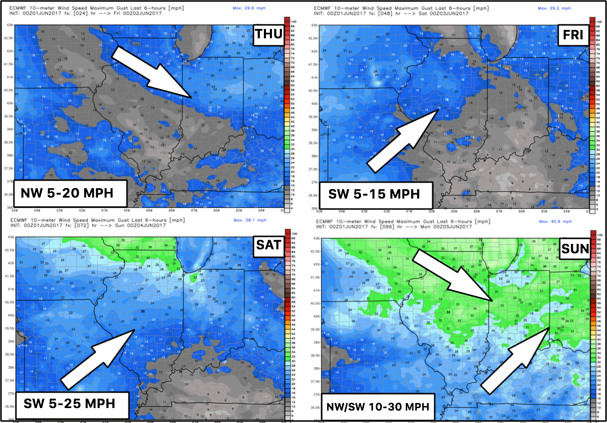
Current Wind forecast next 4 days…calm overall until the cold front sweeps east on Sunday.
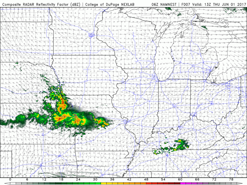
Simulated radar of possible storms across southern IL today into Friday morning…otherwise most of the Midwest stays sunny and dry here.
Next storm chance that need to monitor is waking up early Saturday morning across eastern Iowa and northern IL…the 3km NAM shows the energy fairly well…there is a chance this cluster continues east into northern IN as well…something that we will monitor closely.

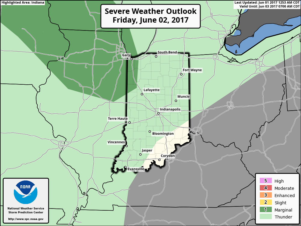
Overall I do agree with where the marginal risk for a strong storm is here late Friday night into Saturday morning across eastern IA into IL and NW IN…main risks will be gusty winds and hail.
On the day on Saturday will feature partly sunny skies and a scattered risk ~30/40% chance for a thunderstorm as the warm front lifts into the Midwest. Need to note here not everyone gets in on the rains.
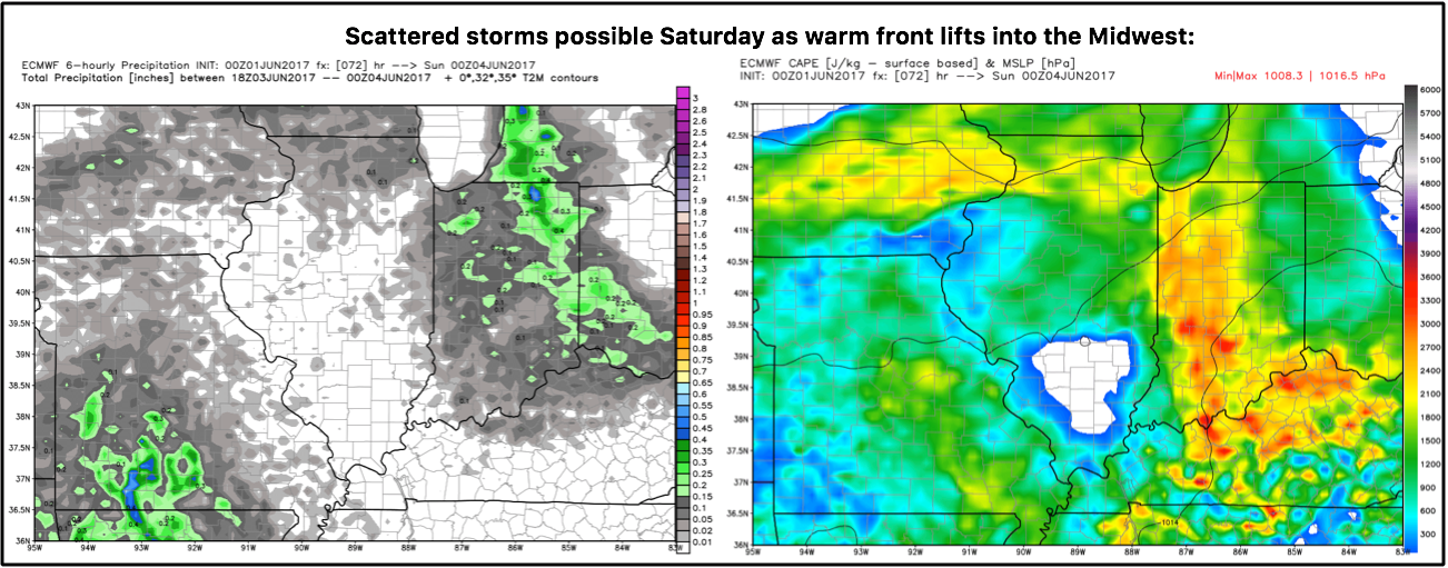
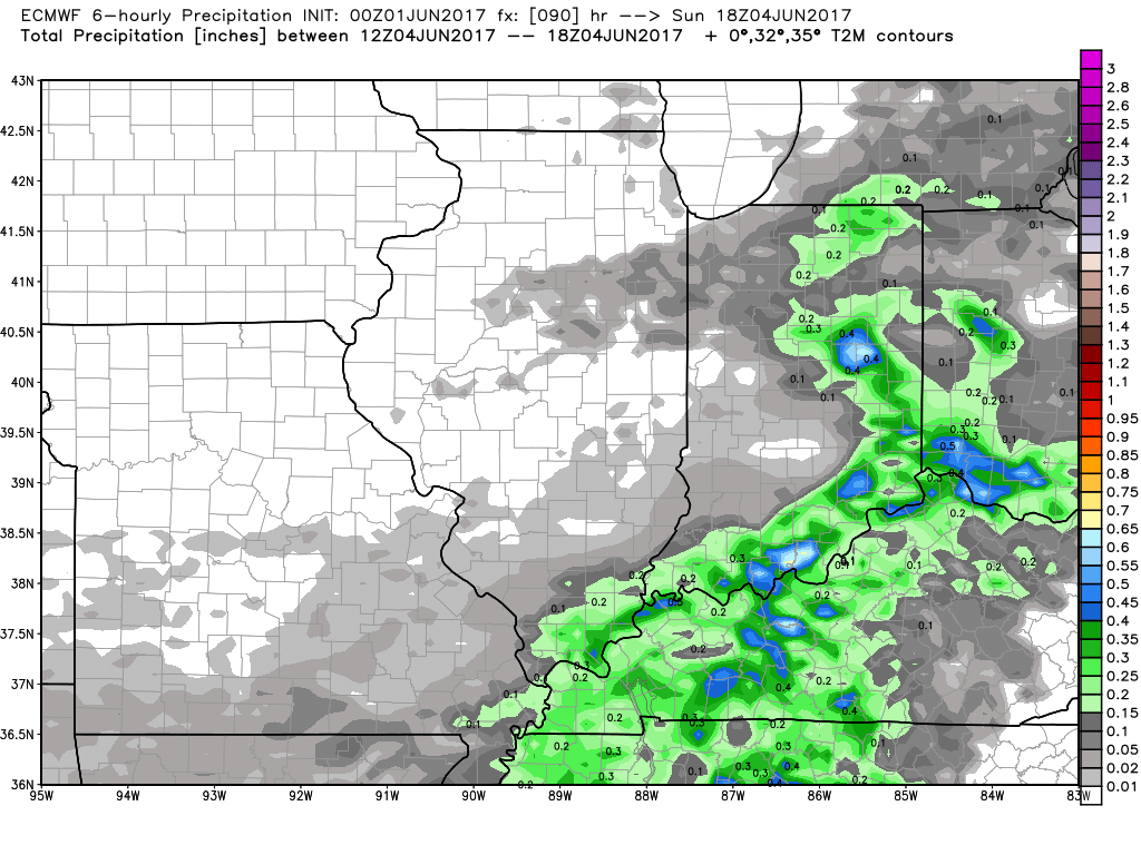
The cold front sweeps from west to east on the day on Sunday presenting ~50% chance for showers and storms as it does so. As it passes some sunshine will be possible on the backside…cooler temperatures as well will be expected.
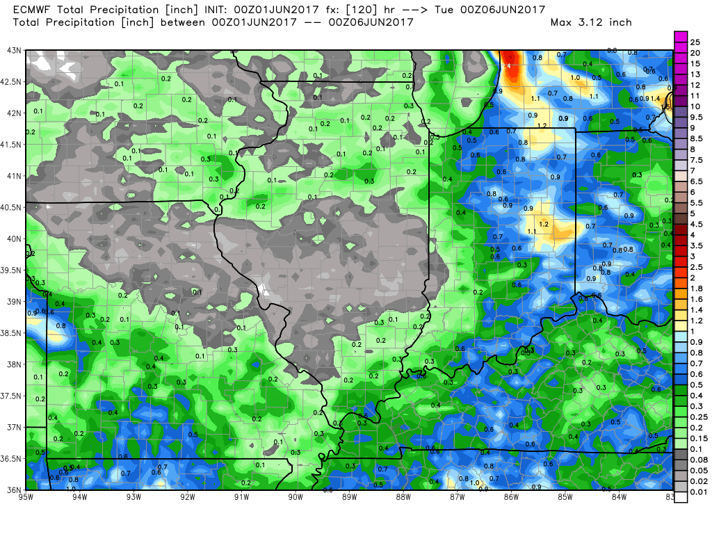
Total rainfall from the European over the next 5 days…again, not everyone gets in on the rains here as these are more of a scattered threat until the cold front comes through on Sunday. I think the model may be off across eastern Iowa and northern IL if that storm cluster moves through, we’d place a risk for 0.5-1.0″ with isolated higher amounts possible here as well as Indiana and western Ohio.
Confidence:
- Average confidence of a few storms across the southern Midwest, but overall we stay dry with sunshine across the Midwest through Friday.
- Below average confidence of the details on a potential storm cluster moving east across Iowa and northern IL Saturday morning.
- Average confidence of scattered storms and partly sunny skies across the Midwest on Saturday as well as a warm front lifts into the Zones.
- Average confidence additional storms possible from west to east as the cold front moves through on Sunday.
Today’s video (7 min):