Key Points – Thursday, April 13, 2017:
Synopsis: Good Thursday morning! Showers continue east this morning that will slowly weaken today…showers and a few storms develop overnight as the warm front lifts in the Midwest on Friday and then multiple rounds of scattered showers and storms Saturday and Sunday (gusty too!). We are dry early next week before our next heavy rain maker looks to settle in mid-next week that we need to watch closely as it’s been giving us hints of stalling out. Otherwise, we continue the very warm trend over the next week! Have a great day.
Current Radar:
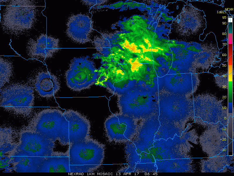
Simulated radar…these showers will continue to move off to the east and will continue to weaken as they do so. There may be a little development overnight along a boundary that’s hanging out as discussed in the video, we will need to watch as this unfolds throughout the day.
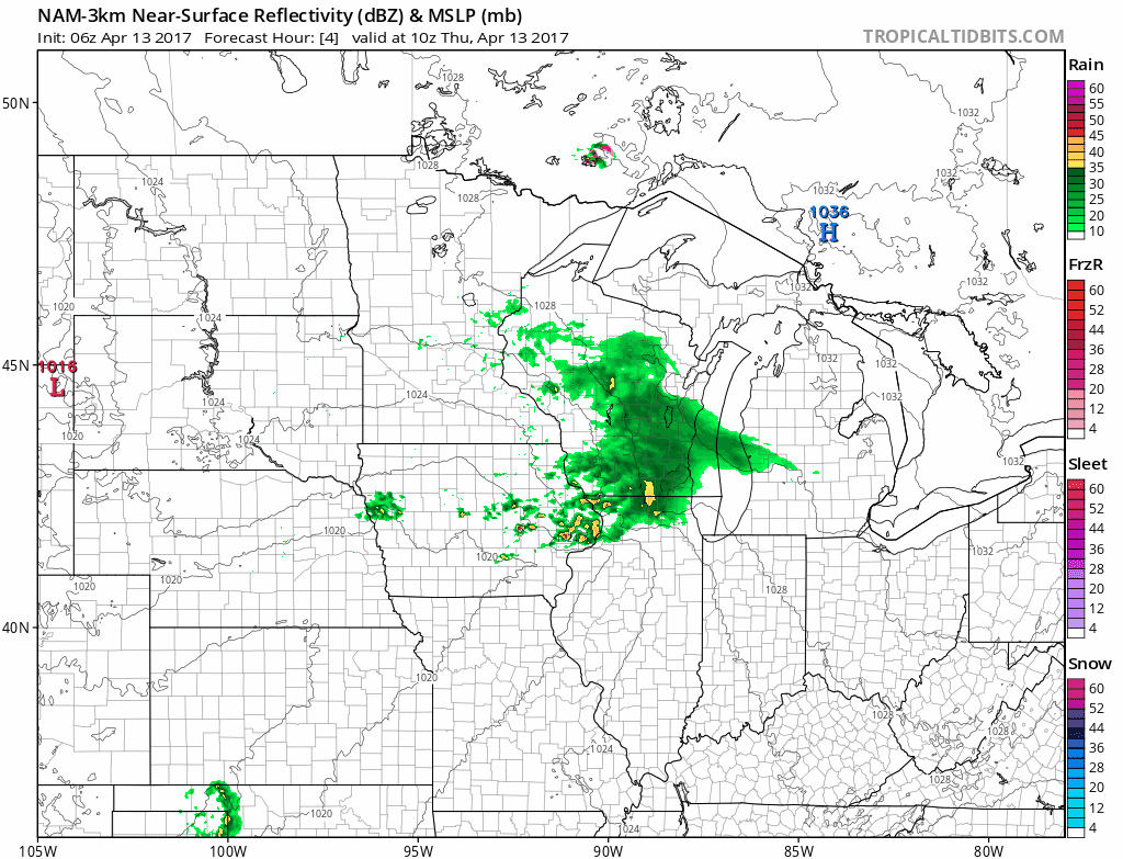
A look at Friday as the warm front lifts into the area early morning and throughout the day, coverage will be 30-40% for showers and a few storms possible. Some peaks of sunshine will also be possible here.
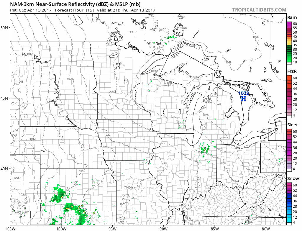
Following right on the heals is our next disturbance that moves east the second half of Saturday across eastern Iowa and Illinois and into Indiana and western Ohio by Sunday as a cold front sweeps from west to east. Coverage will likely be ~40-50% as this line of showers and storms moves east as well. Can’t rule out some heavier rainfall later Saturday and overnight across eastern Iowa into western Illinois.
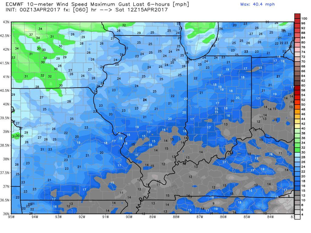
Very windy Saturday into Sunday with wind gusts possible upwards of 35-40+mph at times out of the southwest!
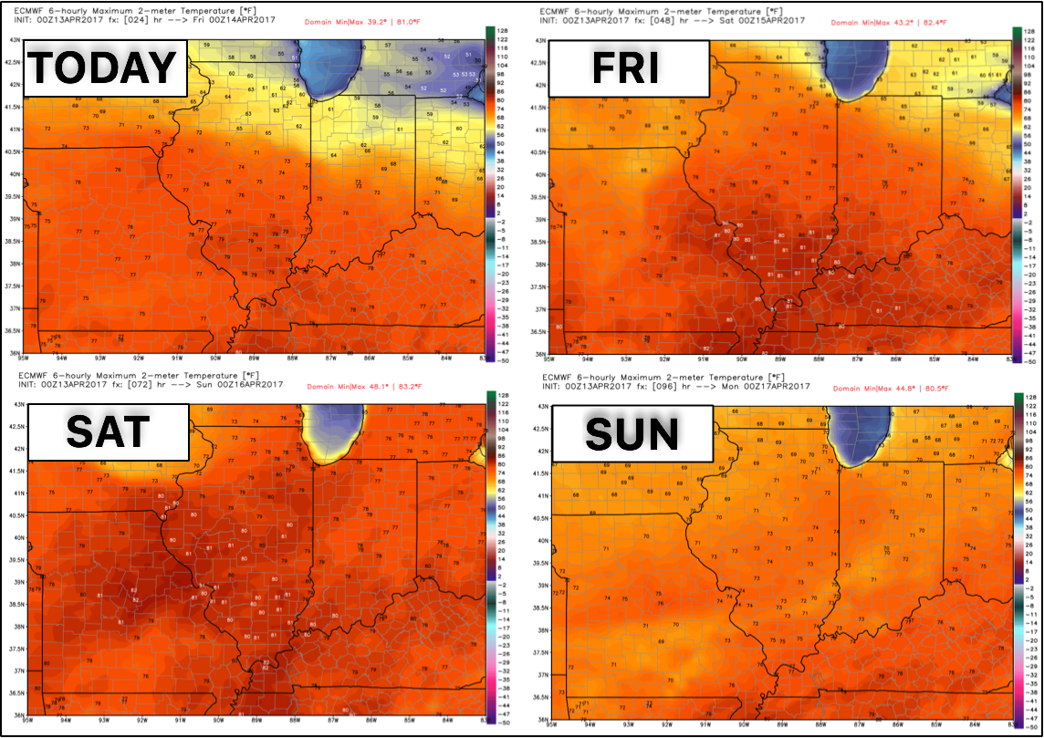
Temps very warm over the next 4 days with widespread 70s even some 80s working in as we get some solid warm air advection (warm air getting pushed into the Midwest from southwest winds).
Monday through Wednesday morning looks dry next week…before our next rainmaker moves through mid-next week that matches our organic forecasting thoughts. We need to watch this closely as it’s been giving us hints of stalling out, which could really dump some heavy rainfall.
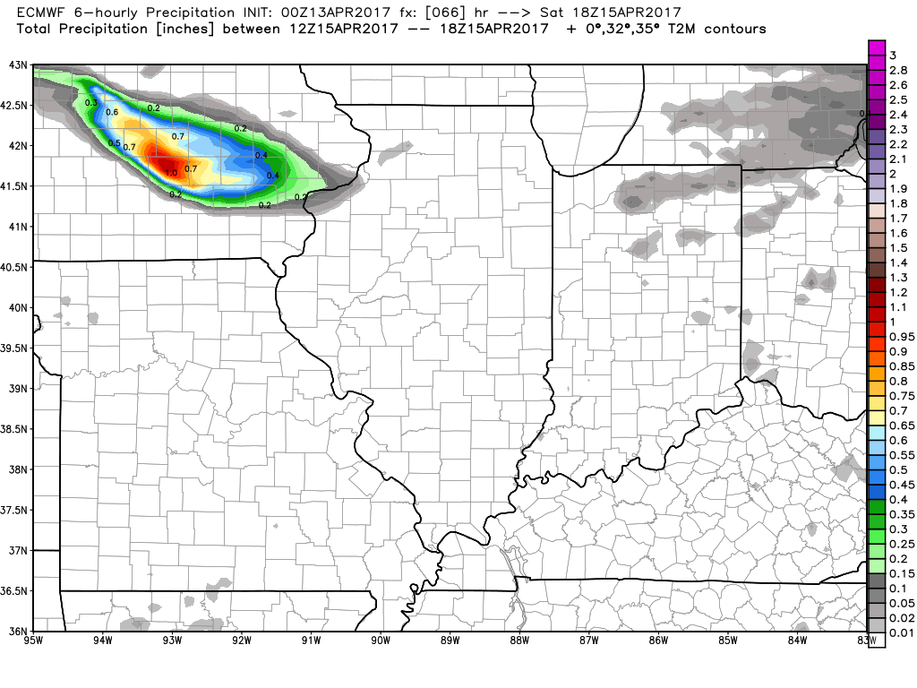
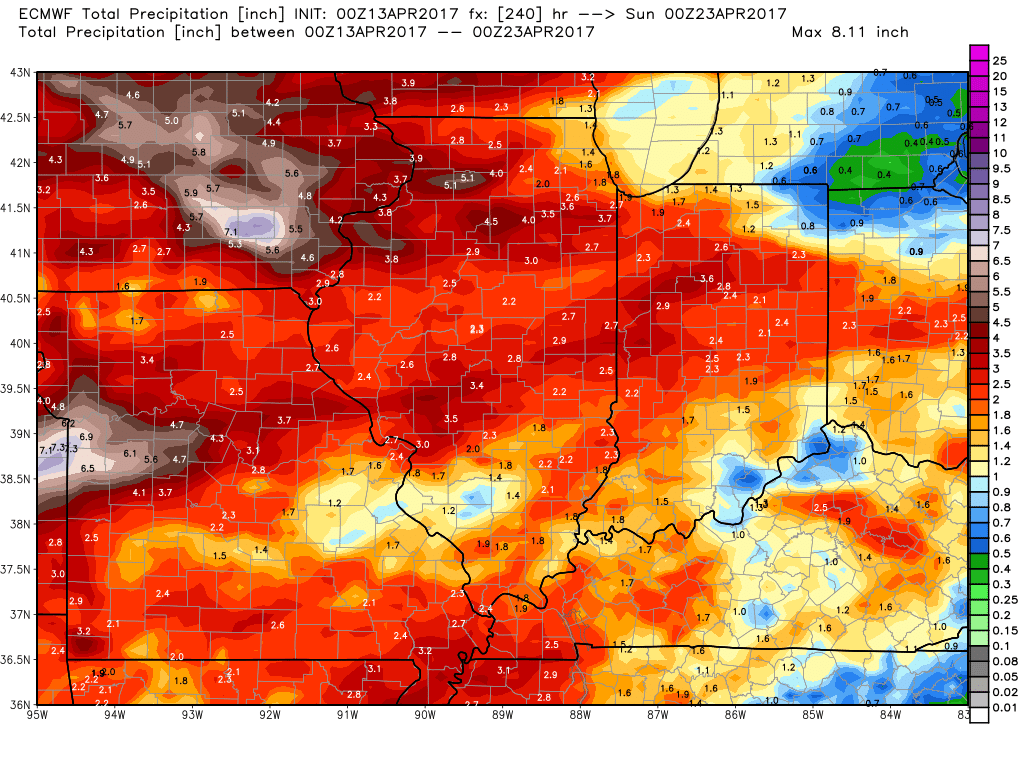
10-day rainfall totals are very impressive especially across the northern and western Midwest locations. Western Illinois into Iowa we have continued concern for saturated soils going deeper into April.
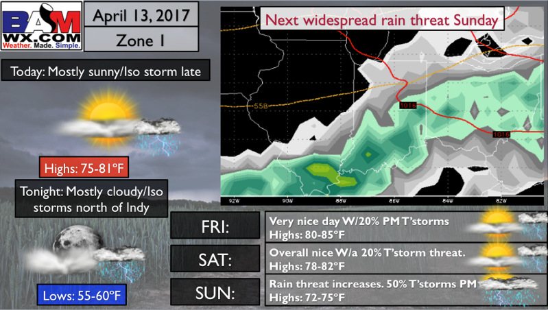
Zone 1 Quickcast:
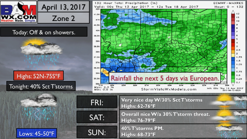
Zone 2 Quickcast:
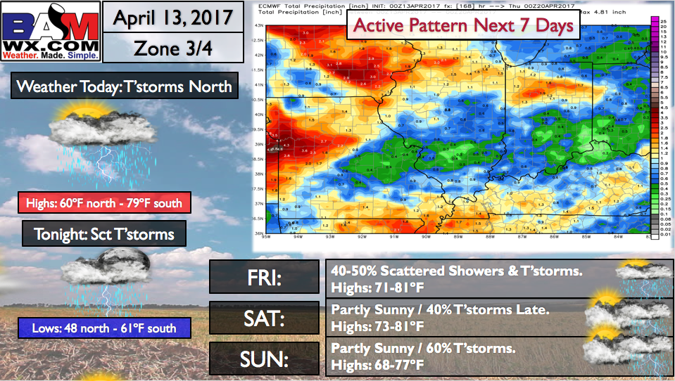
Zone 3/4 Quickest:
Confidence and Risk:
- Above average confidence showers continue to push east throughout the morning hours and weaken as they do so as well.
- Average risk storms redevelop overnight from a lingering boundary hanging around…something we need to watch throughout the day.
- Above average confidence scattered showers and storms lifts north on Friday as a warm front lifts into the Midwest.
- Above average confidence we also have an active weekend as the cold front sweeps east the second half of Saturday into Sunday bringing more showers and storms.
- Above average risk of a heavy rain maker middle of next week as the latest data has been suggesting a stalled out front dumping some heavy rains…need to watch closely.
Today’s video (8 min):