Key Points – Wednesday, April 26, 2017:
Synopsis: Good Wednesday morning! As we go throughout the day today into the weekend we discuss the excessive rainfall as well as the strong to severe storms threat next 5 days. Showers and storms increase in coverage from southwest to northeast today into Thursday, bringing very heavy rains and potential localized flash flooding across Illinois. Very impressive low pressure moves into the Midwest Friday lifting a warm front north later Friday into Saturday that has the potential to bring widespread very heavy rainfall, strong storms and flash flooding. A cold front sweeps west to east on Sunday into Monday that is forecasted to bring gusty winds and more heavy rain before exiting east. So as you can see, it’s a loaded pattern so we encourage you to pay close attention and let us know if you have any questions. Have a blessed day!
- Current Radar:
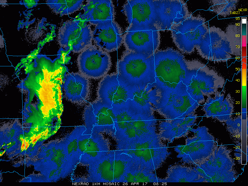
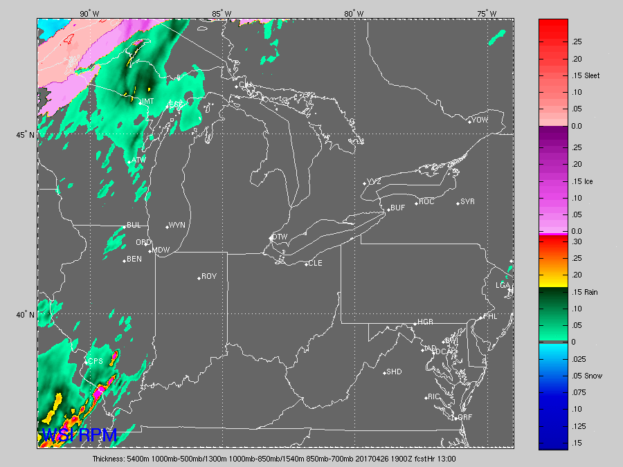
- Simulated radar RPM: ~4-5pm storms across southern IL and western IN moving northeast, between 7-9pm heavy rainfall and storms across northern IN into southern MI…heavy rain and t’storms moving across IL overnight headed east early Thursday morning. Can’t rule out a few gusty storms as well.
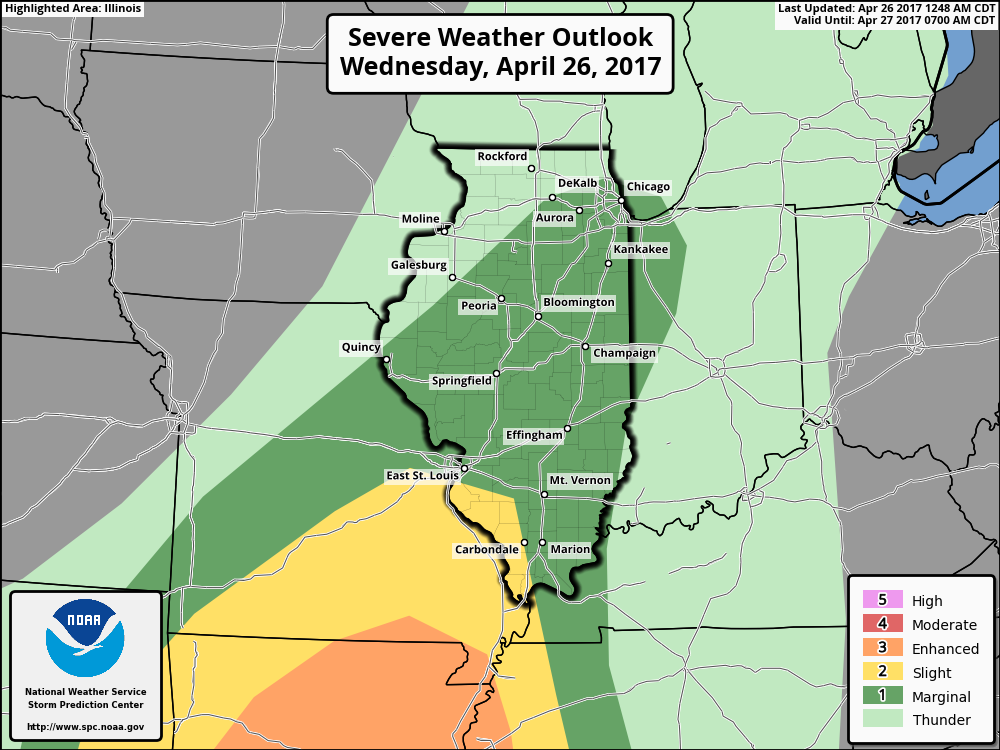
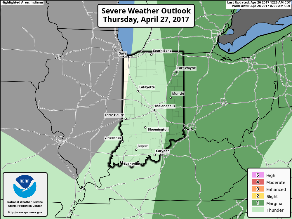
- Marginal Risk storms today with the main risks being gusty winds and isolated large hail across portions of Illinois into Indiana.
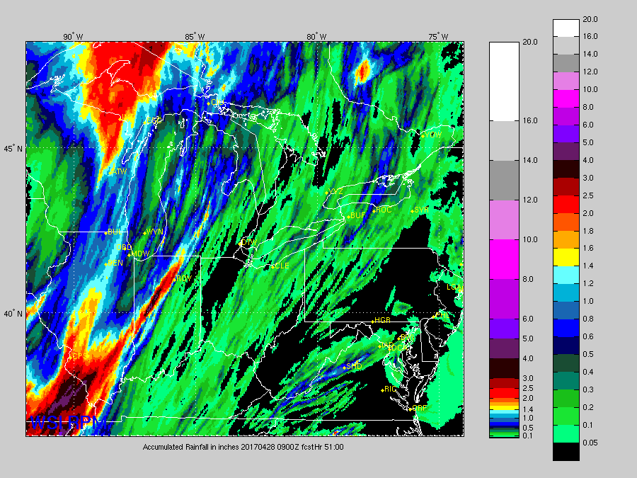
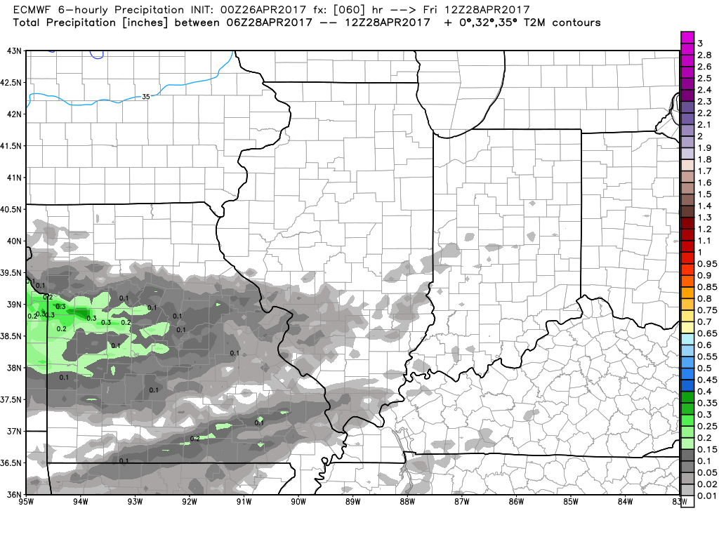
- Round 1 of multiple rounds of heavy rainfall over the next 51 hours: locally 3″+ possible especially across IL into Indiana.
- Marginal Risk Thursday as the front tracks east out of the Midwest with isolated gusty winds and hail possible across portions of eastern Indiana into Ohio.
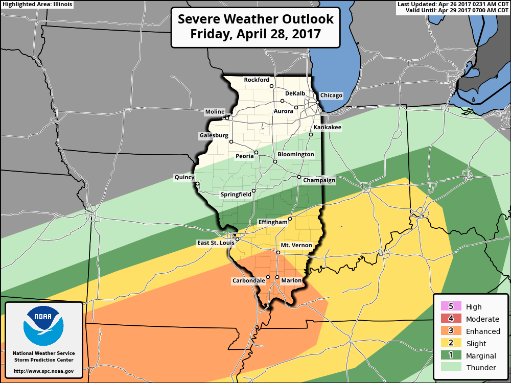
- An area of low pressure with a warm front with tons of Gulf moisture moves in Friday night into Saturday. Heavy rain breaks out by ~1-2pm on Saturday and then watching as the warm front looks to stall out across the Midwest through Sunday.
- Strong storms Friday night into Saturday risk: some damaging winds, isolated large and an isolated tornado cannot be ruled out along the warm front across the southern parts of the Midwest.
- Sunday night into Monday morning the cold front moves through and finally departs east. Some gusty winds and more heavy rainfall will be possible here.
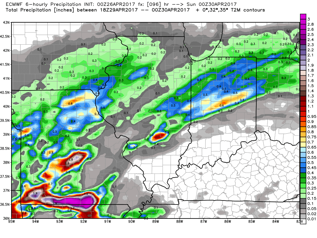
- Total rain next 5-6 days…looking for a serious risk for flash flooding and fields under water with a look of many locations 5″+.
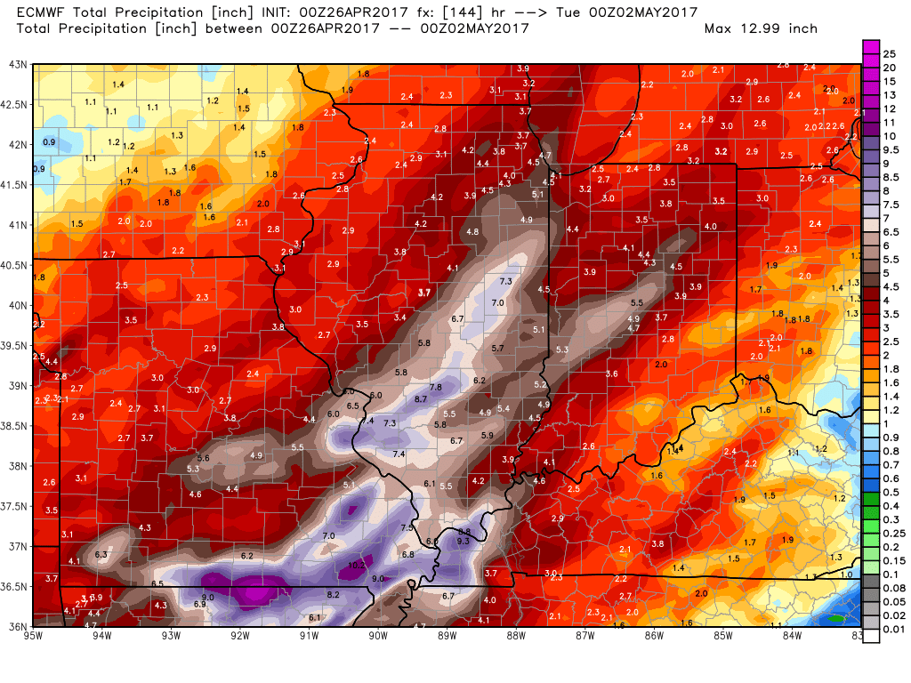
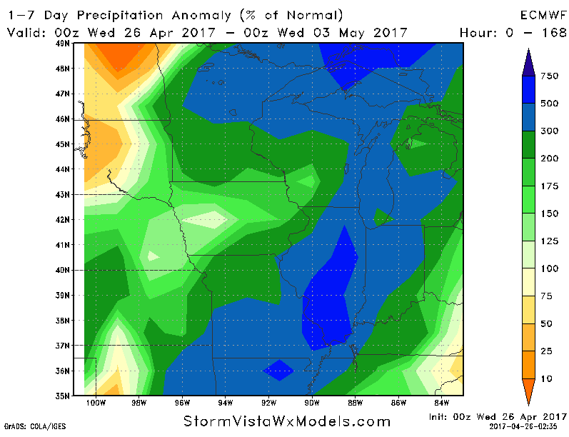
- When comparing this rainfall from normal, a widespread swath of 300% the normal, even as high as 500% the normal in some spots the next 7 days.
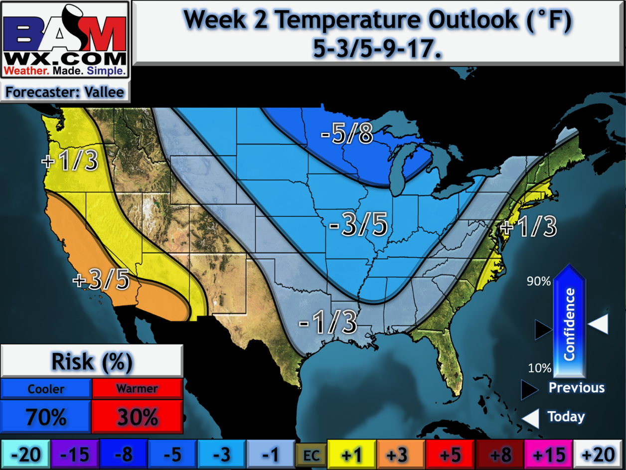
- Watching for a cool down getting into week 2 via our in-house long-range outlooks…chillier times ahead for the Midwest which certainly won’t help evaporate any of the heavier rains that linger over the next week.
Confidence and Risk:
- Above average confidence showers and storms move southwest to northeast today across the Midwest.
- Average to above average risk for some strong storms as well with this first round, but some heavy rainfall definitely is possible.
- Average to above average confidence showers and storms lift from a warm front Friday into Saturday with very rainfall likely.
- Average risk strong to severe storms here across the southern parts of the Midwest, right now all modes of severe are on the table with a higher risk for tornadoes.
- Cold front sweeps east Sunday into Monday with average confidence in the final details of the timing and placement, but additional gusty winds and heavy rainfall possible here as well.
Today’s video (8 min):