Key Points – Friday, March 10, 2017:
Synopsis: Hey there and welcome to another Friday and forecast update this morning! Mostly sunny skies expected across the Midwest today, much cooler with highs mainly in the upper 30s to lower 40s. Still watching for some snow showers especially for locations south and west late tonight into Saturday…snowfall accumulations are minimal and not too much to be concerned with. Watching our next system come in early next week…we aren’t overly concerned with the wintry threat as of right now. Overall in the next 5-7 days we are MUCH colder than normal, but by days 11-15 day warmer temperatures return. As we become warmer, we also see a signal for a return to more a more active pattern with severe weather potential to end March and open April. Make sure check out later this morning an update long-range post and updated long-range outlooks on the site! Have a great weekend.
Still watching for snow showers across western and southern locations late tonight and into Saturday…accumulations will be minimal in areas within the Zones.
Wintry activity picks back up early next week across the Midwest. At this time, we just aren’t overly excited about snow accumulation as confidence is about average on the details…areas to the north and the west may see a couple inches out of it, it’s something we will monitor over the weekend and keep close eyes on.
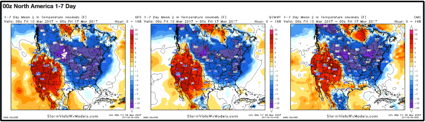
The next week will be quite chilly as shown well by the consistency amongst our top forecast models below. This will translate with highs likely hovering around in the 30s.
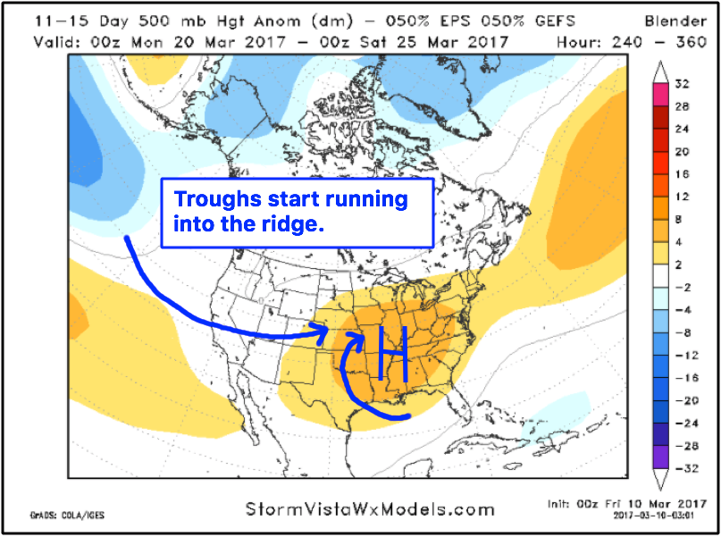
Warmth returns in the 11-15 day period, and along with it is our chances for severe weather with a clashing of air masses (a trough running into a ridge scenario as discussed in the video).
New European weeklies came out last night, which we touch more in the long-range update later this morning…overall, the active pattern continues into April, as will our chances for severe weather.
Confidence and Risk:
- High confidence of mostly sunny skies today with chillier highs into the upper 30s to lower 40s.
- Above average confidence that the snow showers overnight into Saturday will largely to be a non-event for our Zones in terms of accumulations.
- Average confidence wintry weather potential early next week…details on accumulation and timing are still fluid, it’s something we are watching closely going forward.
- High confidence the next 5-7 days will be below normal in the temperature department.
Today’s Video (6 min):