#ILwx #INwx #OHwx Mon Short-term
Synopsis: Good Monday afternoon! Today we focus on the remaining showers and storms today through tonight and the potential for some stronger to severe storms on Wednesday. As outlined in this morning’s update some heavier rainfall will be possible keeping things very wet once again this week. Some mixed precipitation will also be possible on Thursday morning as colder air rushes in on the backside of the low pressure system. It’ll be a roller coaster of weather patterns this week, that’s for sure.
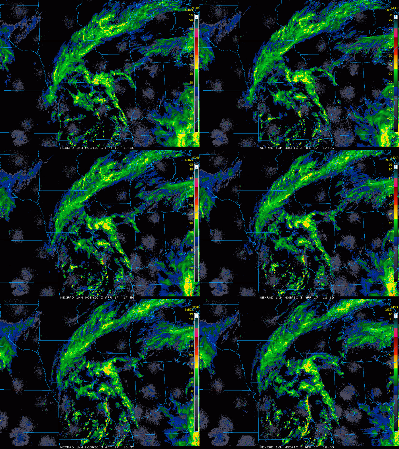
Current Radar:
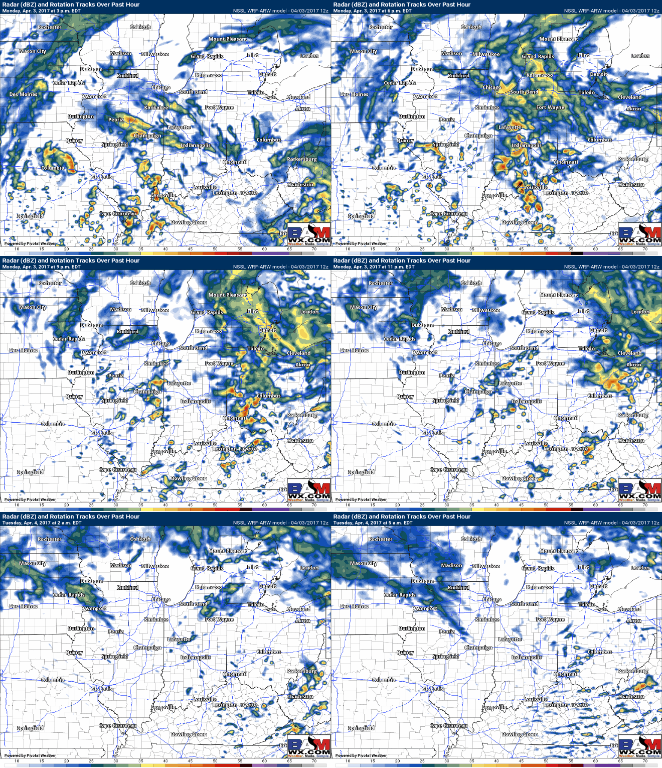
Simulated Radar: These showers and storms increase in coverage by ~4pm into SW IN and southern IL today. More widespread showers and storms expected by 6-7pm across central Indiana and remain scattered throughout the Zones through late tonight before exiting and diminishing off to the east. Can’t rule out a few linger showers into Tuesday at this time.
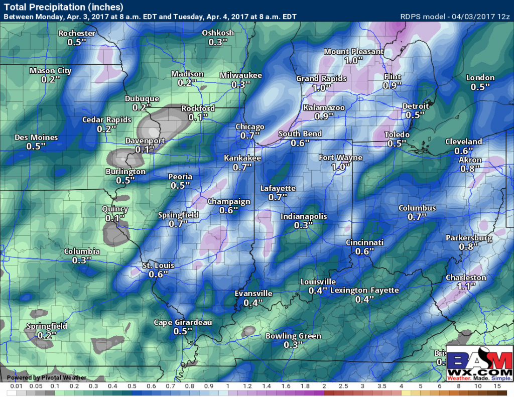
Total rainfall expected through Tuesday morning shows mainly 0.25-0.75″ with isolated higher amounts over 1.0″ possible.
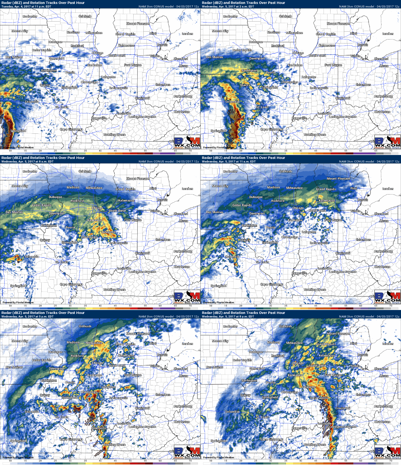
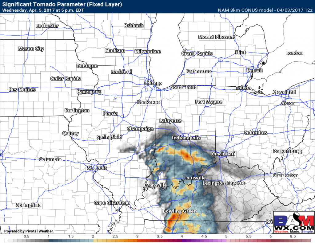
Next chance for showers and storms comes late Tuesday night to early Wednesday morning lifting off of the warm front. We talked about this morning where the severe threat largely depends on, as did last week’s event, on how much sunshine we receive to fuel these storms. The 3km NAM has more widespread storms popping across Illinois between 2-5pm from southwest to northeast. A pretty potent area of strong storms then moves east into Zones 1/2 between 5-8pmEDT.
We also talked about in the video how some of our latest data even suggests an elevated tornado threat from southern Illinois to the southern half of Indiana Wednesday evening…it’s a threat we are monitoring very closely, especially if one of these storms latches on to the warm front. We are targeting for potential stronger storms in the hours of 4-11pmEDT at this time.
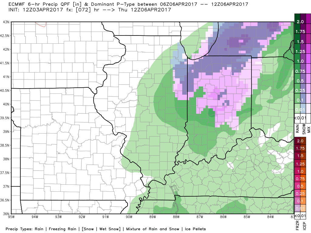
As temperatures drop near freezing early Thursday morning a wintry mix will be possible before turning back to rain as we warm up on the day Thursday.
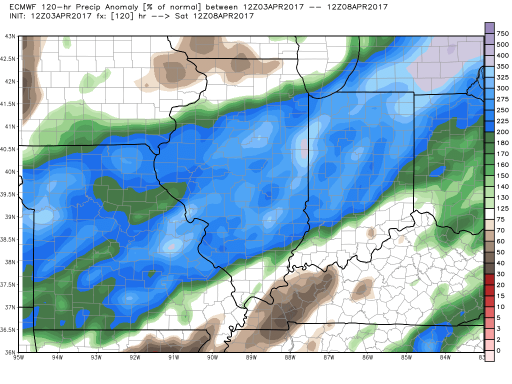
Precipitation from normal over through the end of the week will be 150-250%+ the normal; this equates to 1-2″ of rainfall with isolated higher amounts possible.
Confidence and Risk:
- Above average confidence of showers and storms continuing tonight from west to east.
- Above average confidence additional showers and storms move in on Wednesday ahead of another pressure system.
- Average risk for the call of severe storms, even a tornado threat on Wednesday as well due to concerns on cloud cover and other factors lining up correctly.
- Increasing confidence of a wintry mix moving in on the backside of the low pressure Thursday morning as temps plummet near freezing.
Today’s video (6 min):
