#ILwx #INwx #OHwx Mon Short-term:
Synopsis: Good Monday afternoon! Today we discuss the remaining snow showers into tonight, likely refreeze and slick surfaces overnight, a few lake effect snow showers even a snow squall…and also discuss the incredible snow storm about to hit the northeast tomorrow.
Latest Northeast snowfall accumulation map…incredible totals! And what is incredible is how quickly this system will lay down the snow…some locations may see over 2 feet of snow!
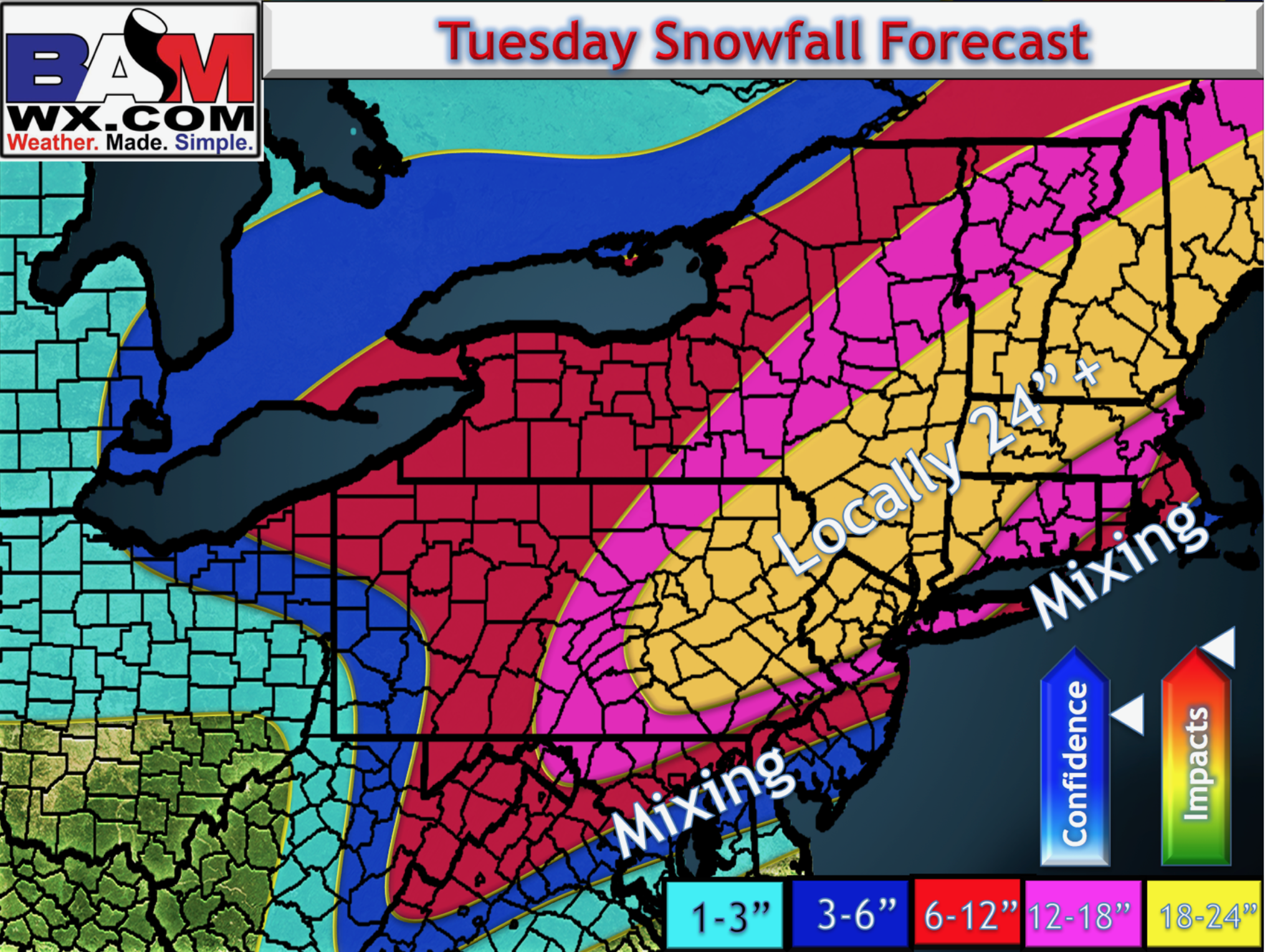
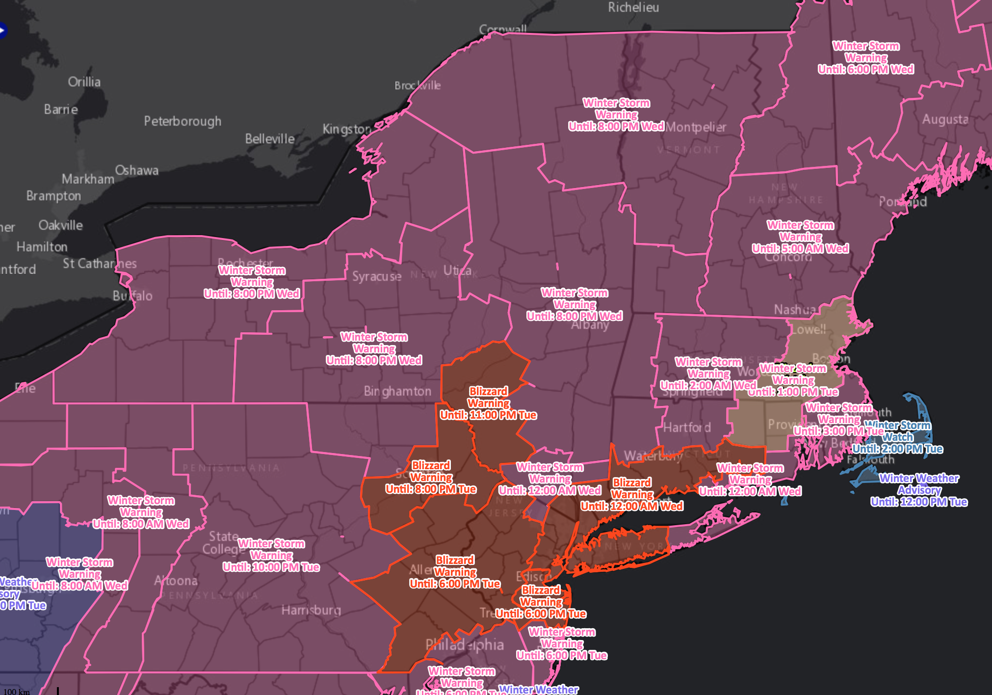
Incredible to see how far inland these blizzard warnings are…will be a very dangerous situation considering total snow and winds possibly over 60mph at times.
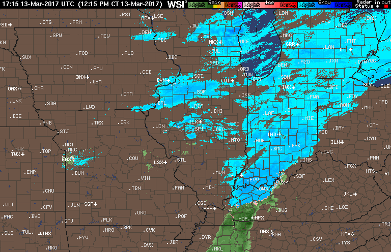
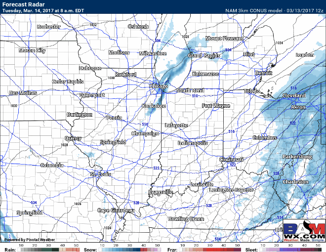
Current radar…snow showers ending across Iowa and continuing across IL, IN, MI and OH this afternoon.
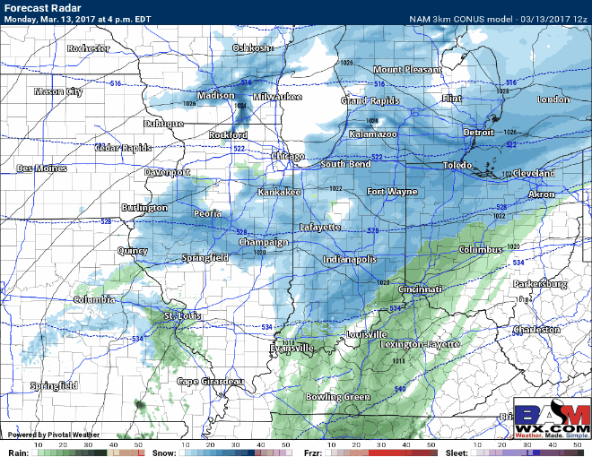
Remaining snow showers via simulated radar through Tuesday morning…the snow is mostly out of Illinois by around midnight and pushing east into Ohio by early Tuesday morning.
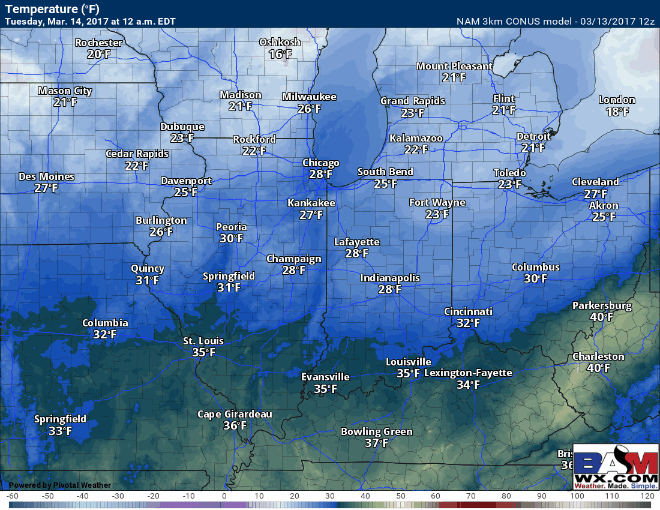
Temperatures overnight get into the teens to lower 20s…there’s a real possibility for a refreeze so we recommend monitoring your lots and applying treatment as necessary.
Overall we should see a mix of sun and clouds Tuesday which will help things melt away…A few lake enhanced snow showers possible mainly across Zones 1/2…can’t rule out a few snow squalls or heavy bursts of snow…watching for possible slick surfaces from this tomorrow night into Wednesday morning.
Confidence and Risk:
- Above average confidence on the timing and remainder of our snow showers into early Tuesday morning.
- Above average confidence in slick spots developing overnight as temps dip down into the teens to lower 20s.
- Increasing confidence of lake effect showers tomorrow mainly across Zones 1/2, a few snow squalls possible as well.
- Today’s video (5 min):