#ILwx #INwx #OHwx Mon Short-term:
Synopsis: Good afternoon! Today’s afternoon update focuses on the storms overnight and briefly touches on the latest developments in regards to the potential late week winter storm our data has been hinting at.
Pesky showers, mild temperatures and cloudy skies have lingered across many Midwest locations today and continue into the afternoon hour.
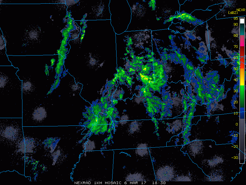
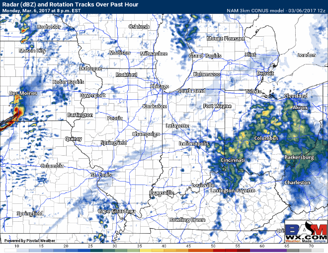
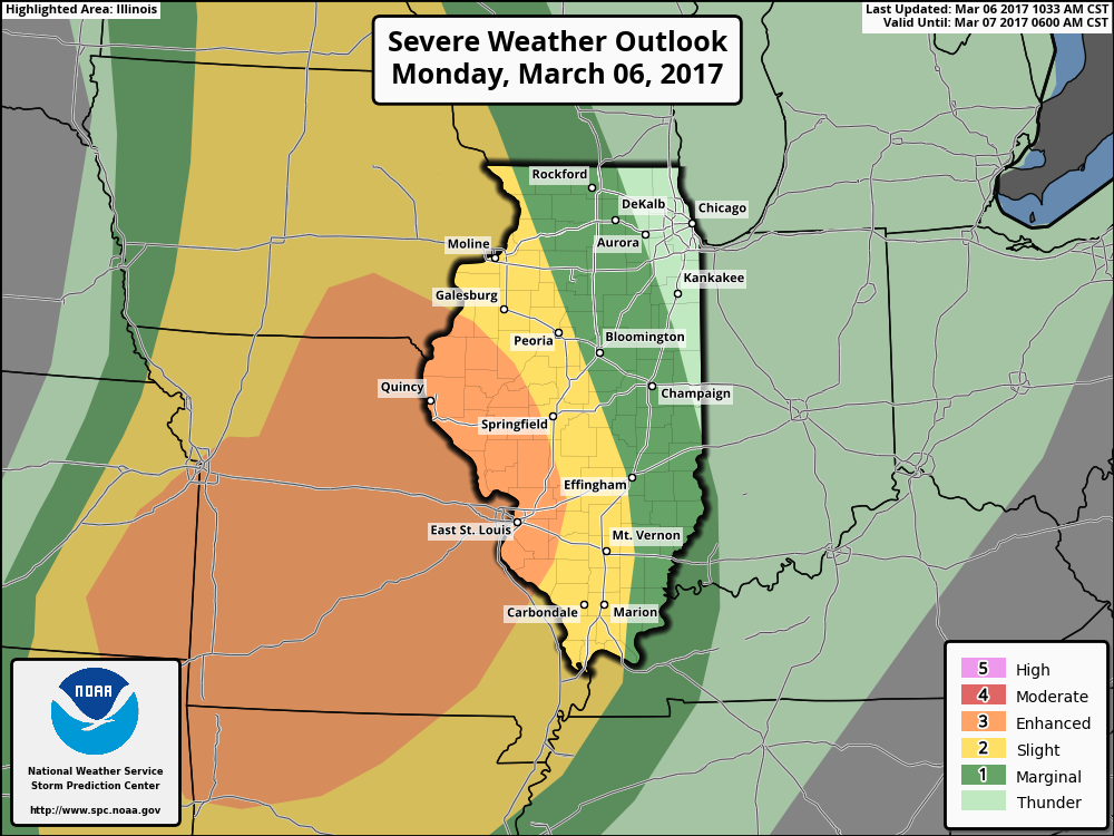
Gusty to strong storms (especially west) move east across the Midwest tonight into Tuesday along a cold front. The main threat for “stronger” storms is closer to the IL/IN border and we expect the intensity of the storm threat to slowly diminish as the line progresses further east. 50-60mph wind gusts and heavy rainfall are possible.
Here’s the latest strong to severe weather risk issued…the main threat exists west across Iowa, Missouri and western Illinois…but a few strong, gusty storms will be possible as the cold front advances further east overnight.
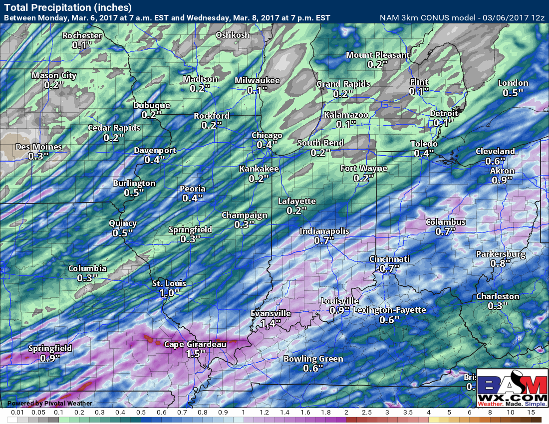
The heaviest of rains are forecasted to fall across southern IL, central/southern IN into central OH as the line of showers and storms moves east into Tuesday…1″ to locally 2″ is possible.
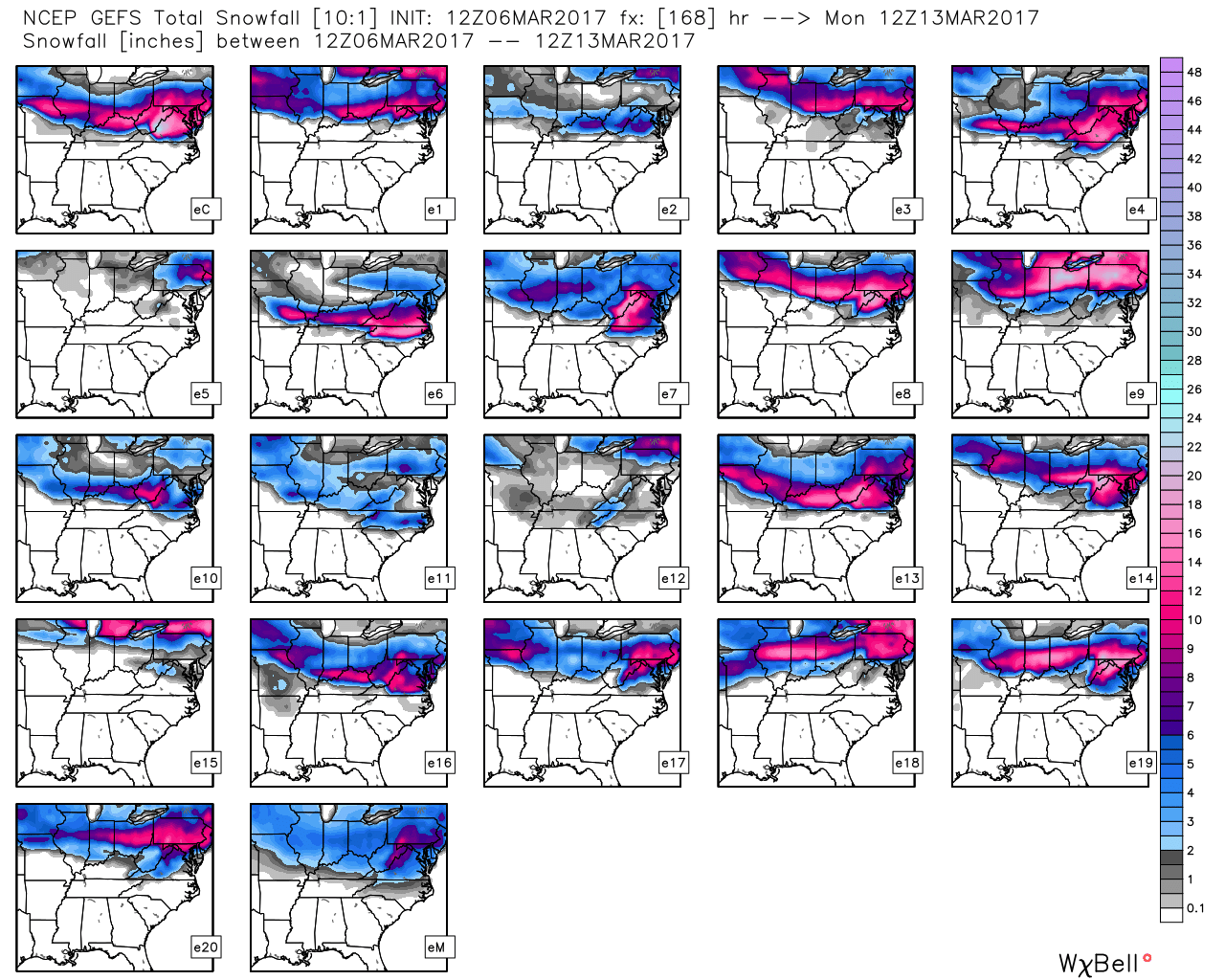
Our attention continues to turn to late week/early weekend at a potential winter storm. Our forecast models are far from a lock on a solution unfortunately even within 5 days of the event…this should come as no surprise as it’s been the same story all winter. However, it is encouraging, as seen below, to see the model ensemble data increase probabilities on accumulating snow.
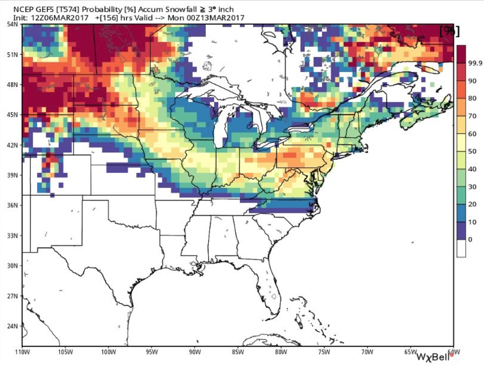
Looking at each individual ensemble member from the America model, 12-13 out of the 21 members show a good hit of accumulating snow. It’s something we will monitor very closely throughout the week and update often on…so we urge you to pay close attention to each update.
Confidence and Risk:
- High confidence of showers and storms moving east tonight along a cold front…wind gusts up to 50-60mph and locally heavy rains up to 1-2″ are possible.
- Below average confidence on a particular solution of accumulating snow this weekend…but confidence on the probability for accumulating snow is increasing.
Today’s video (6 min):