#ILwx #INwx #OHwx Mon Short-Term
Synopsis: Good Monday afternoon, we wanted to publish an afternoon update today discussing the showers (and a few rumbles of thunder possible) tonight into Tuesday as well as the latest data on severe weather late week.
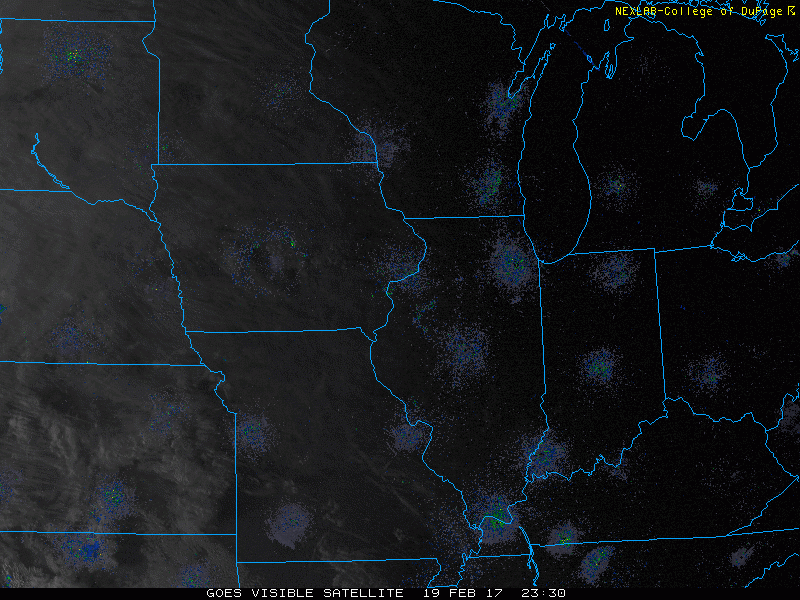
Latest glance at sat/radar across the Midwest shows plentiful sunshine, with showers and a few storms moving slowly across eastern Iowa this afternoon.
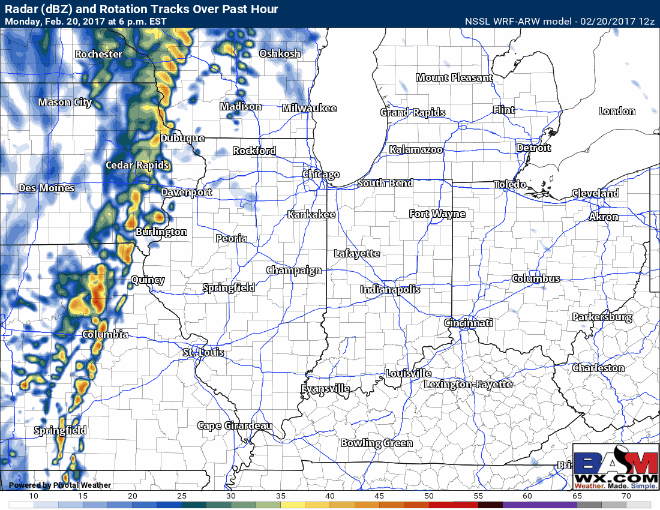
Here’s the latest look at simulated radar tonight through Tuesday, a few thunderstorms remain possible this evening across western Illinois, but as this line of showers moves east overnight into Tuesday it will slowly lose its steam, with coverage becoming 30-40%…overall tomorrow will be mostly cloudy as well.
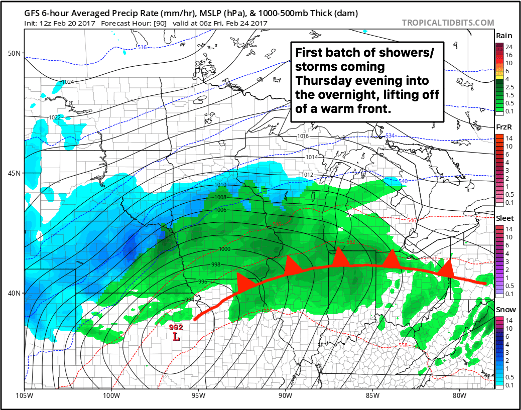
As we move mid-week, Wednesday stays warm and dry, and even most of the day Thursday is dry as well until evening. The first wave of showers and storms lifts north off of a warm front Thursday evening into the overnight on Friday.
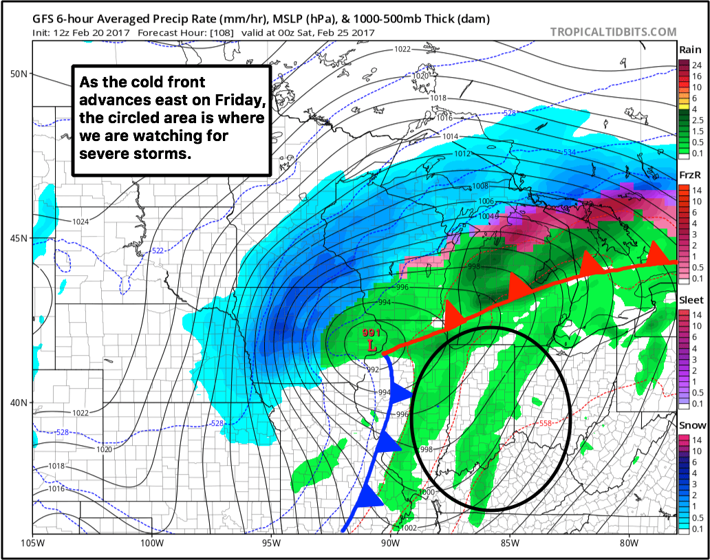
Where we see the risk for stronger to severe storms comes on the day on Friday as a trailing powerful cold front sweeps from west to east through the Ohio Valley. The circle is the area we are keying in on right now for severe storms. The threats will will be as followed, in order: damaging winds, large hail, and tornadoes cannot be ruled out at this time. We are still a few days out so the target area is subject for slight adjustments.
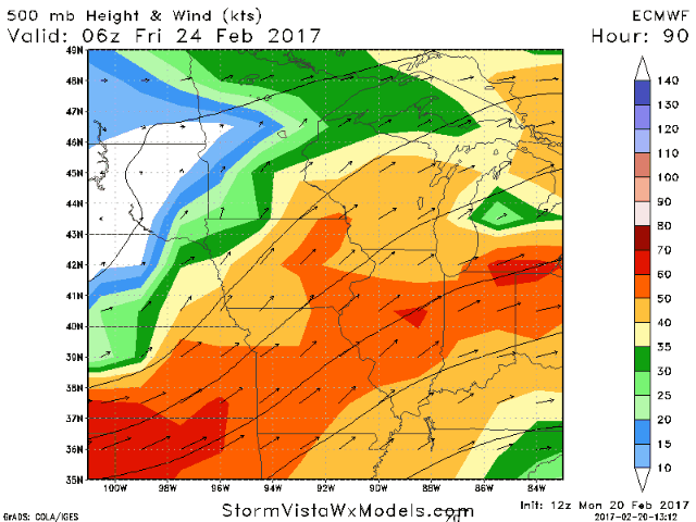
One of the biggest reasons why this scenario has our attention is because of the dynamics, as seen below. We are looking here at the jet max exit right over the Midwest, where winds at ~20,000 feet up are over 100+ knots. This would increase lift (rising motion in the atmosphere) and be an area of focus for where strong storms to develop.
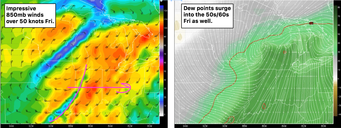
Other ingredients including 850mb winds (or as we like to call it, our low-level jet) over 50mph and dew points surging into the mid 50s and 60s even on Friday add more confidence to the potential for severe storms.
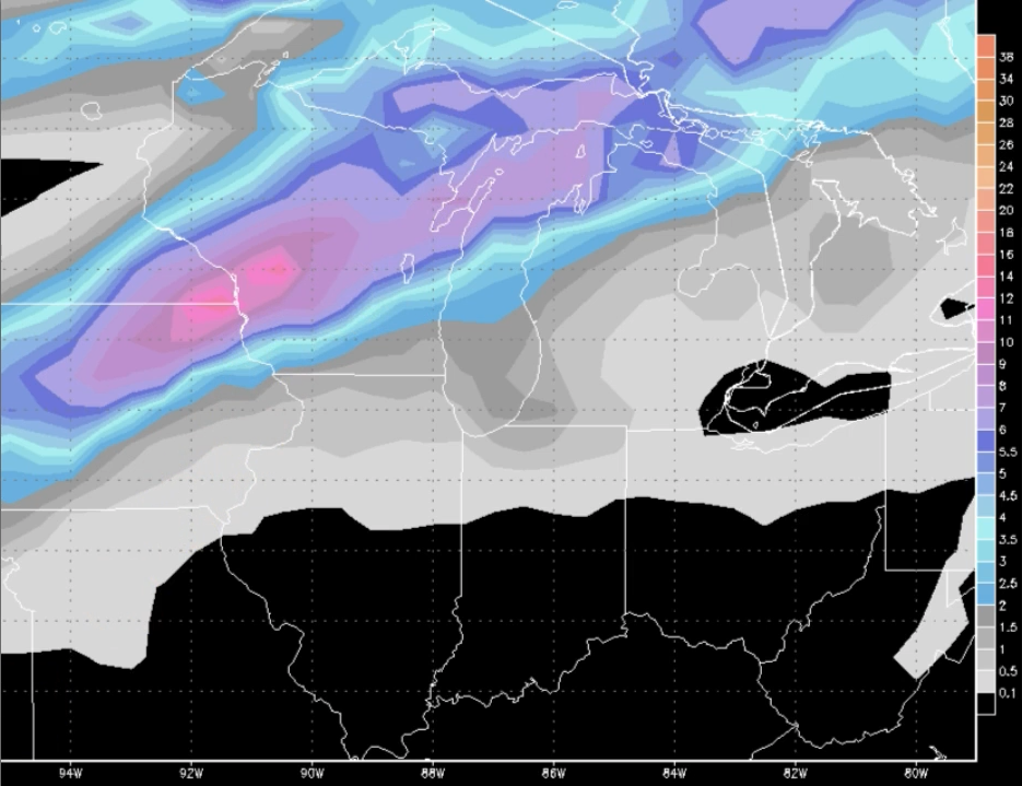
Places on the northwest side of this powerful low pressure will likely cash in on double-digit snowfall totals as well across northern Iowa into Wisconsin.
Given the latest data, we are going to see a very active period over the next 2 weeks, so we urge you to read and watch every update and reach out to us if you have any questions!
Confidence and Risk:
- Above average confidence in showers moving east tonight into Tuesday, coverage like 30-40% on Tuesday as the disturbance slowly weakens.
- Increasing confidence in strong to severe storms on Friday given how consistent our data has been over the past few days.
- Increasing confidence of significant snowfall possible on the Northwest side of the low pressure late week as well.
- Above average confidence we see a very active pattern over the next couple weeks as we say goodbye to February and usher in March.
Today’s video (6 min):