#ILwx #INwx #OHwx Mon short-term
Synopsis: Good afternoon, today’s update focuses exclusively on the next 36 hours of weather, including the showers/storms that lift from the warm front tonight and the main event that moves west to east Tuesday night into Wednesday. Concern continues to grow for a threat for damaging winds, large hail and isolated tornadoes along a strong line of thunderstorms. We also believe that the risk area is still fluid and has the potential to shift even further north and east, and we also think it is still on the table for a potential Moderate Risk for severe storms. Again, we can’t mention it enough, there is still SO much at play here, but we cannot downplay this event especially as it will move through in the overnight hours…we highly encourage folks to stay weather aware and stay glued to our forecasts going forward.
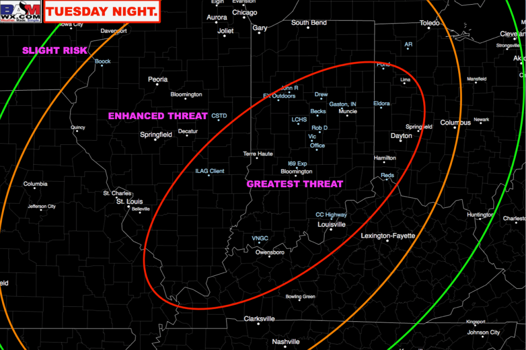
Below is our in-house thoughts on where the greatest threat for severe weather Tuesday night into Wednesday morning will pan-out.
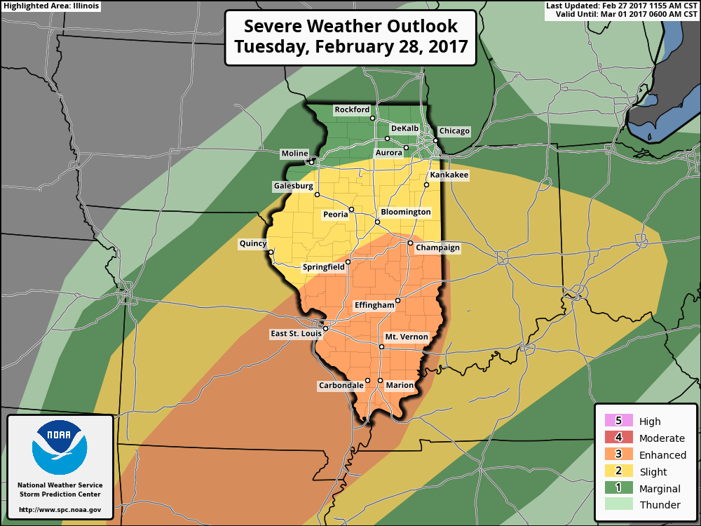
Latest SPC Day 2 Enhanced Risk has shifted slightly further north…we think they shift even further north and east similar to our latest thoughts above.
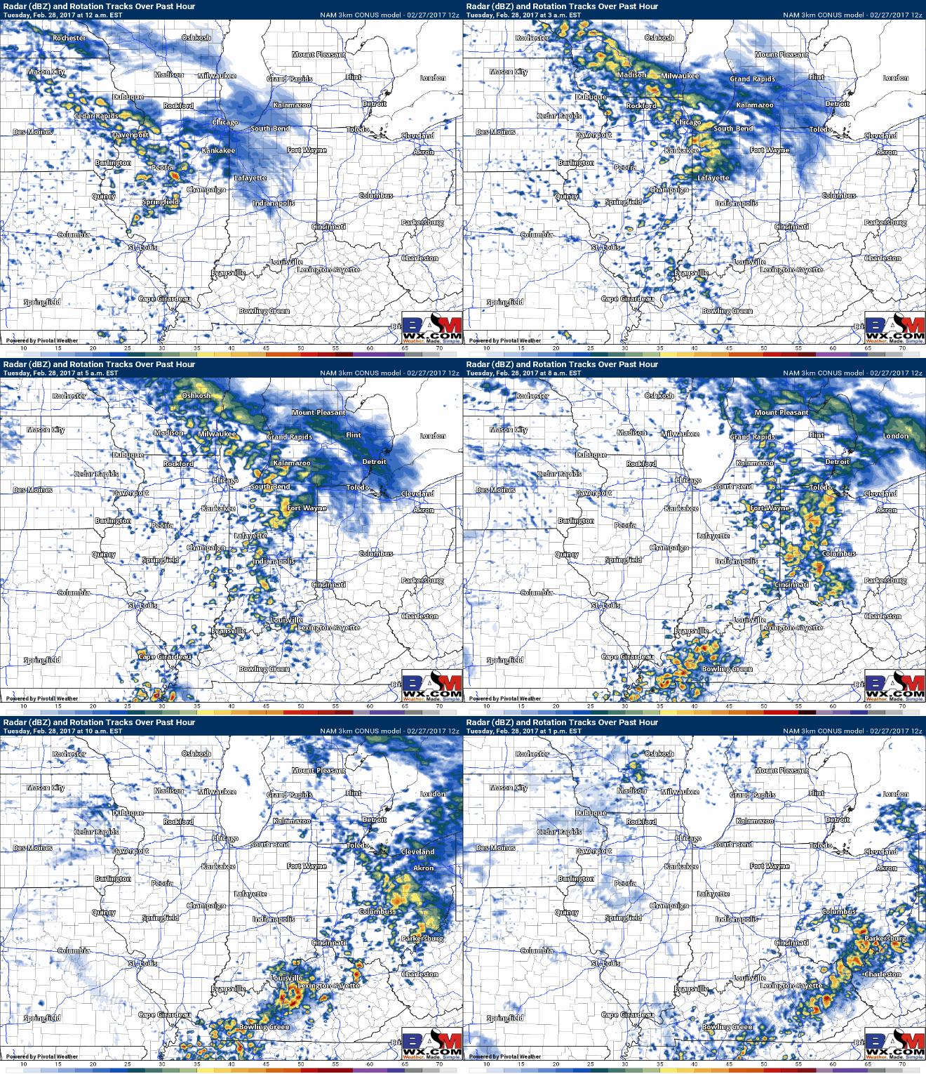
Warm front lifts north tonight…here are some bullet points in regards to timing and risks with the warm front:
- Timing: Starting ~12:00amEST through 10:00amEST from west to east.
- Risks: showers and thunderstorms…possibly some small hail.
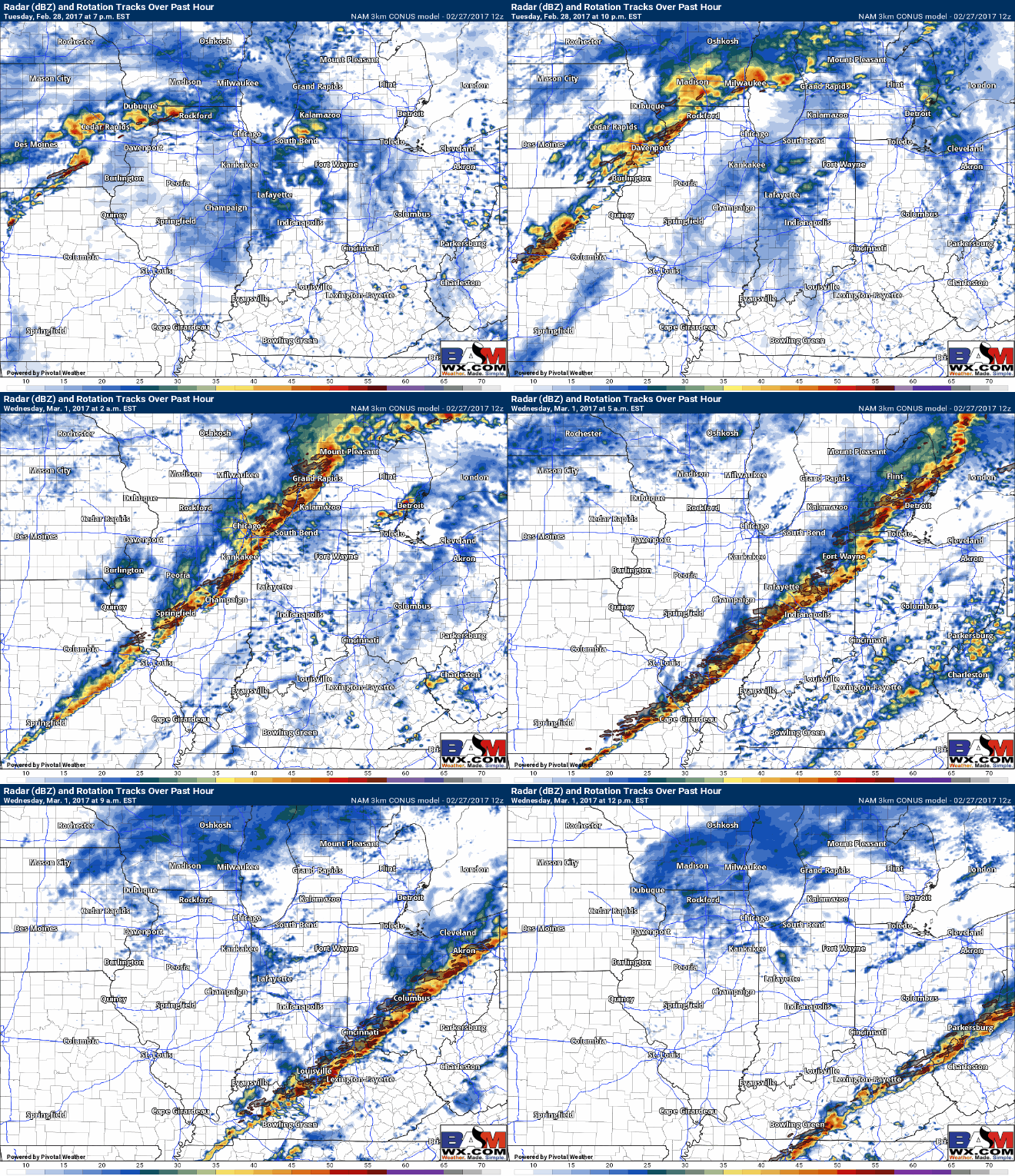
Here is the “main event” forecasted simulated radar from the latest 3km NAM, below is the timing and threats associated with this scenario:
- Timing: Starting ~6pmEST Tuesday night through 10-11amEST Wednesday morning from west to east.
- Risks: Damaging winds in excess of 60mph, large hail and isolated tornadoes.
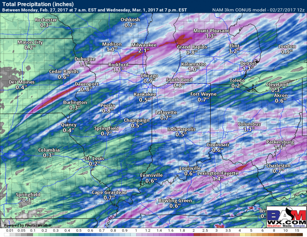
Total precipitation from this event from the latest 3km NAM model…not everyone gets in on the heavy rains, but isolated 1.0″+ will be possible especially in the strong thunderstorms.
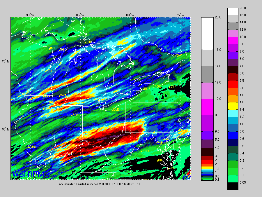
Total precipitation from this event from the latest RPM model…has a more southerly heavier rain threat across southeastern IN, southern OH and northern KY…maybe a little overdone, but something we need to keep in mind for sure.
Confidence and Risk:
- High confidence in showers and a few storms overnight as the warm front lifts into the Midwest.
- Average confidence of strong to severe storms along a powerful cold front moving west to east Tuesday evening into Wednesday morning.
- Today’s video (6 min):
