Key Points: Wednesday, March 15, 2017
Synopsis: Good Wednesday morning! We discuss in the video today the remaining lake effect snow showers moving through, our next chance for showers even a few rumbles of thunder late week, as well the weekend forecast. Have a great day!
Current radar:
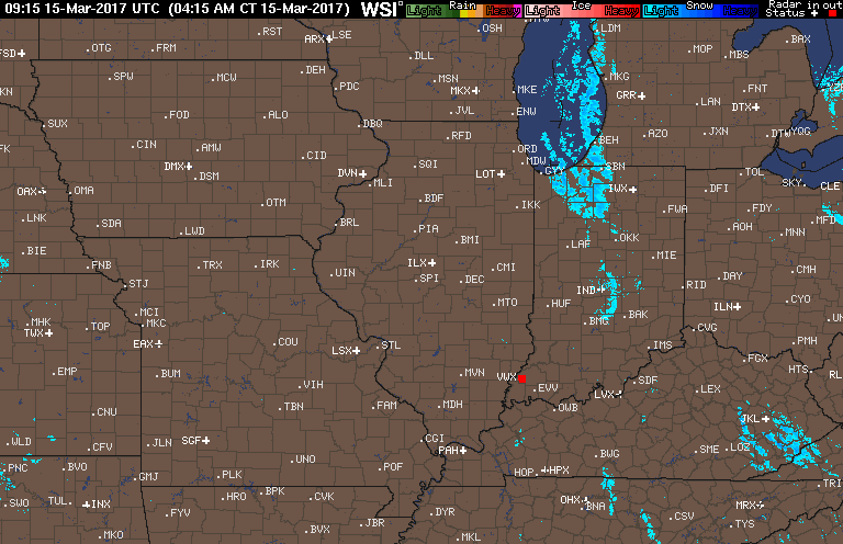
Energy moving through today mainly across Zones 1/2, will keep some lake effect snow showers even a few squalls around through late morning/early afternoon before moving off to the east. Otherwise, partly to mostly sunny skies today with highs in the lower 30s likely.
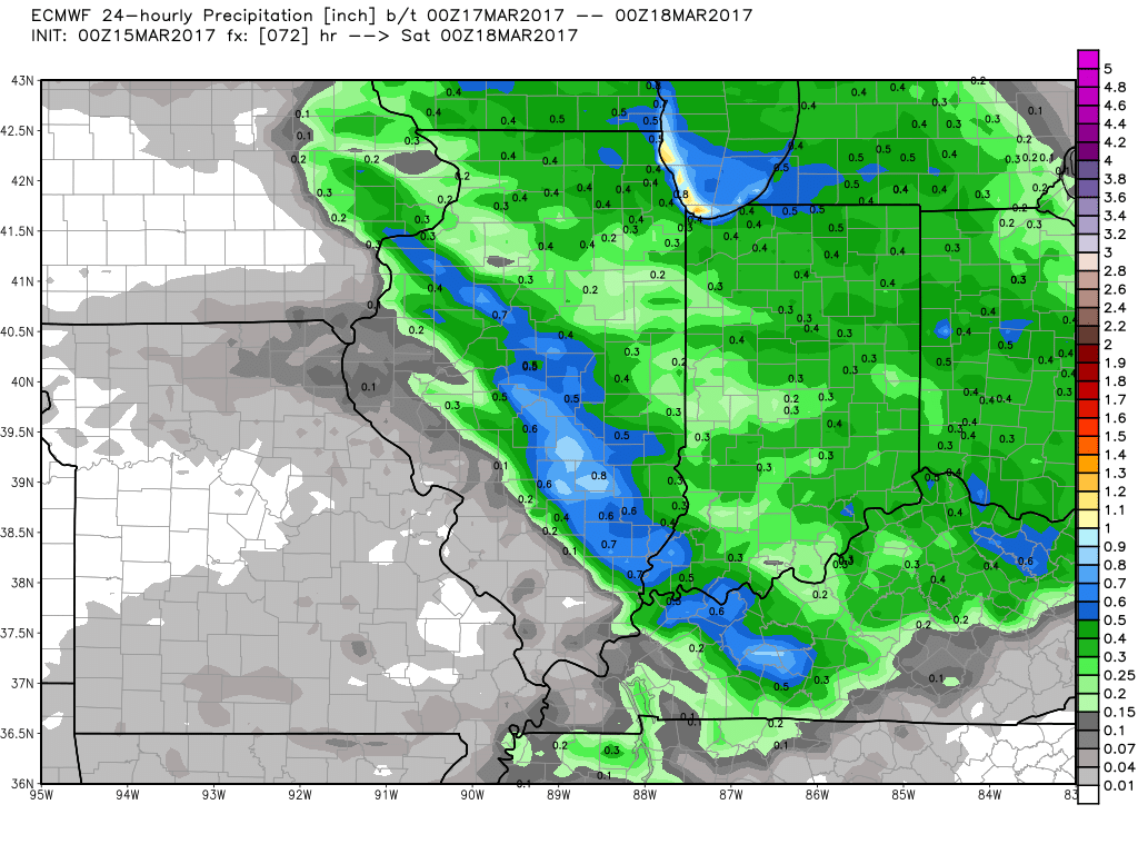
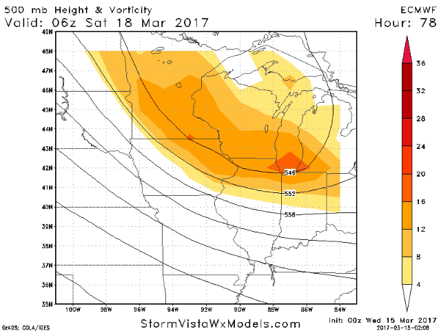
Watching for shower chances to increase from west to east later on Thursday, initially there could be a little wintry mix out ahead of the disturbance before switching to all rain as temps warm well above freezing into Friday. A few rumbles of thunder are possible with energy present. Expecting these to move east out of the Midwest by Saturday morning.
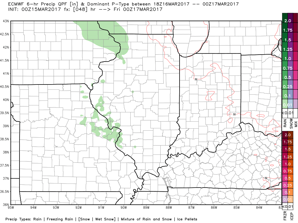
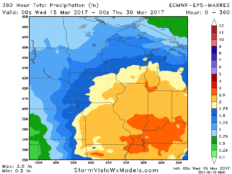
Total rain from this event mainly between 0.25-0.5″ with isolated higher amounts possible up to ~1.0″.
Moving into the weekend, we will see highs in the 40s mainly with a mix of sun and clouds…a few rain/snow showers will be possible across Zones 1/2 on Saturday as energy moves through from northwest to southwest.
It’ll be an active next couple weeks across the Midwest shown from the European Ensemble data…an ensemble mean showing 2-3″ through the end of the month is a pretty impressive signal.
Confidence and Risk:
- High confidence of some lingering lake effect snow showers across Zones 1/2 through late morning/early afternoon.
- Above average confidence of our next chance for showers and a few rumbles of thunder on Friday.
- Increasing confidence of an active pattern returning for the Midwest over the next 2 weeks.
Today’s video (5 min):