Key Points – Friday, June 30, 2017:
Synopsis: Good Friday morning! It’s dry for now but rain and storms pick up in coverage as we move towards the noon hour into tonight. Precipitation looks to linger early Saturday before pushing east along with the front, ushering in much more comfortable air and some sunshine…should be a nice second half of the weekend. However, the pattern looks to continue active into early next week as we’ve been discussing the return of the northwest flow in nearly every daily update. We hope you all have a blessed weekend!
Current Radar:
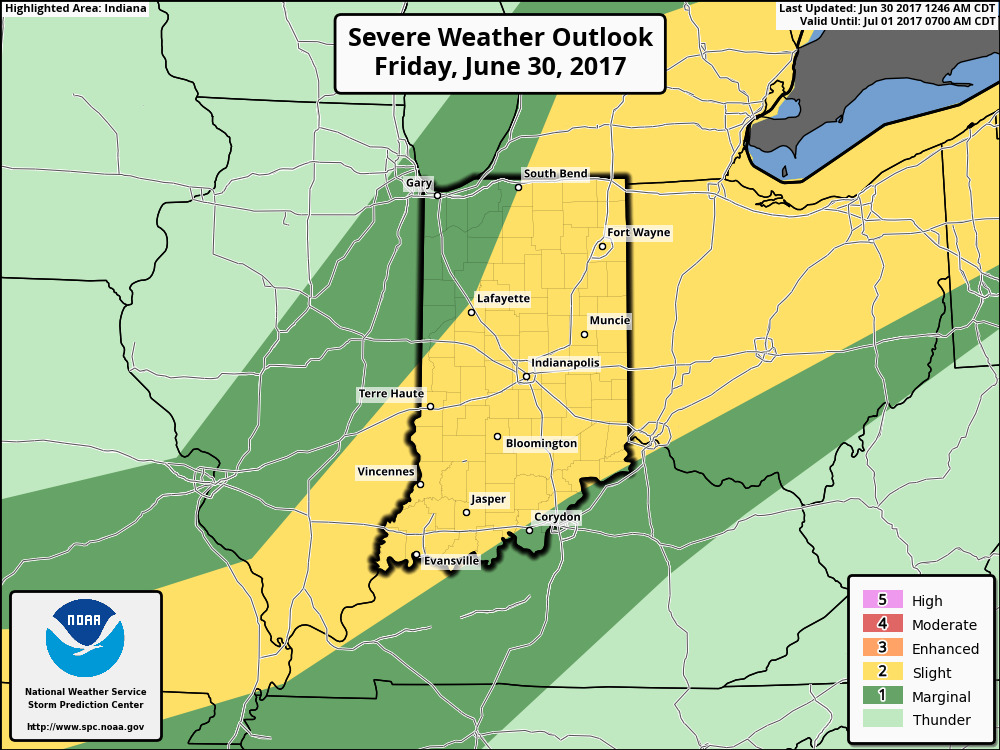
Strong storms risk today, yesterday we mentioned the risk needed to be upgraded to a more widespread slight risk which we see below…wouldn’t be shocked to see a watch box issued for severe storms.
Simulated radar guidance through Saturday morning shows the storms increasing in coverage after noon today pushing east into this evening and overnight. Need to watch a potential storm cluster forming overnight to the south that we covered in the video.
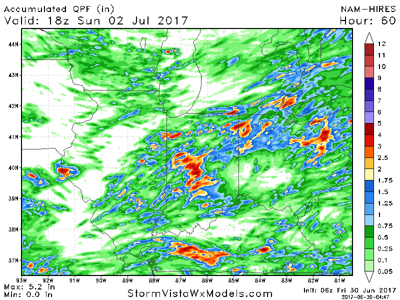
Total rainfall next 2 days shows the risk of 1-3″ mainly focused across Indiana and Ohio locations, lesser amounts more likely across Illinois.
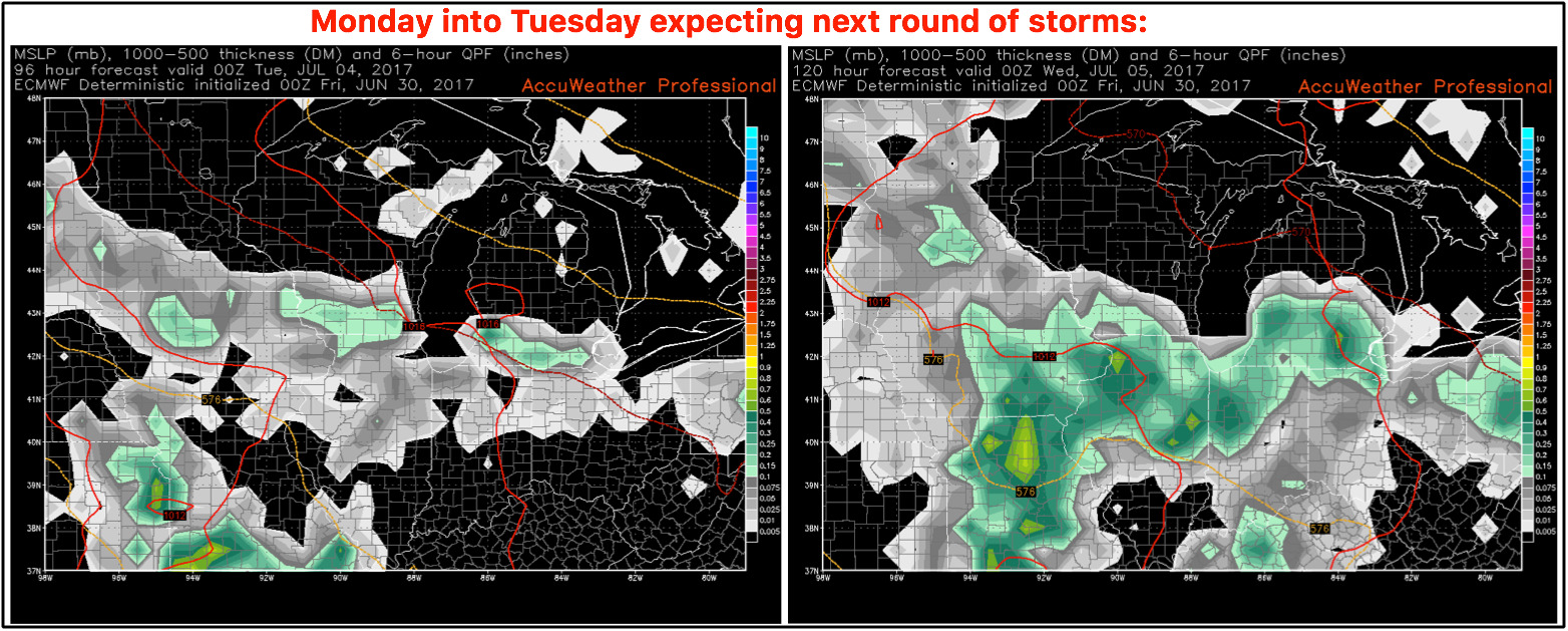
Watching for additional storm development early next week to the Midwest getting in on a more northwest flow (need to watch for storm clusters):
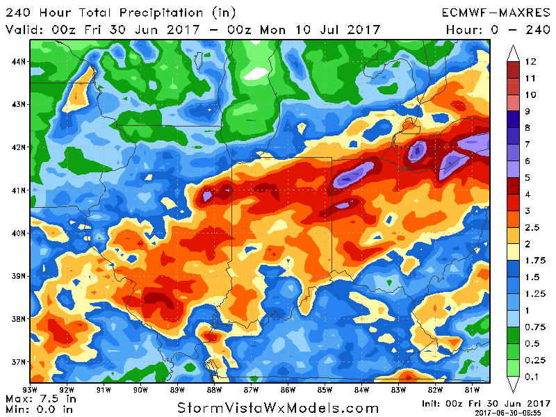
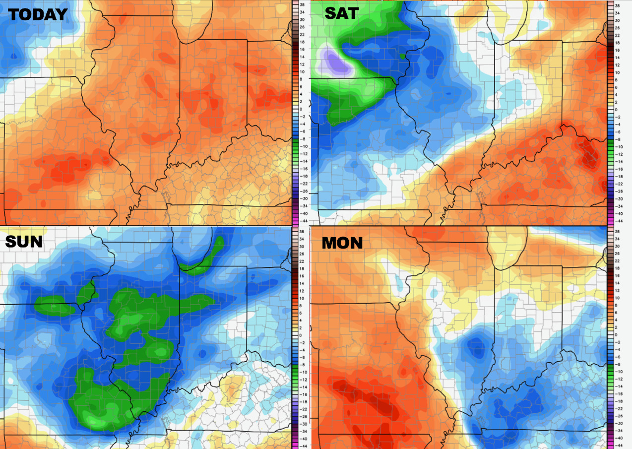
Total rainfall guidance from the latest European over the next 10 days…we wouldn’t be shocked with a little shifting of where the heaviest rainfall totals set up…a good bet of many locations seeing 1-3″ with isolated higher amounts on the table.
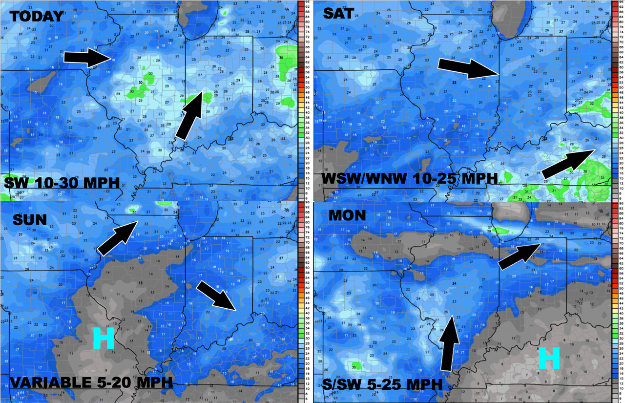
Latest wind forecast through the weekend into early next week:
A look at temperatures into early next week as well:
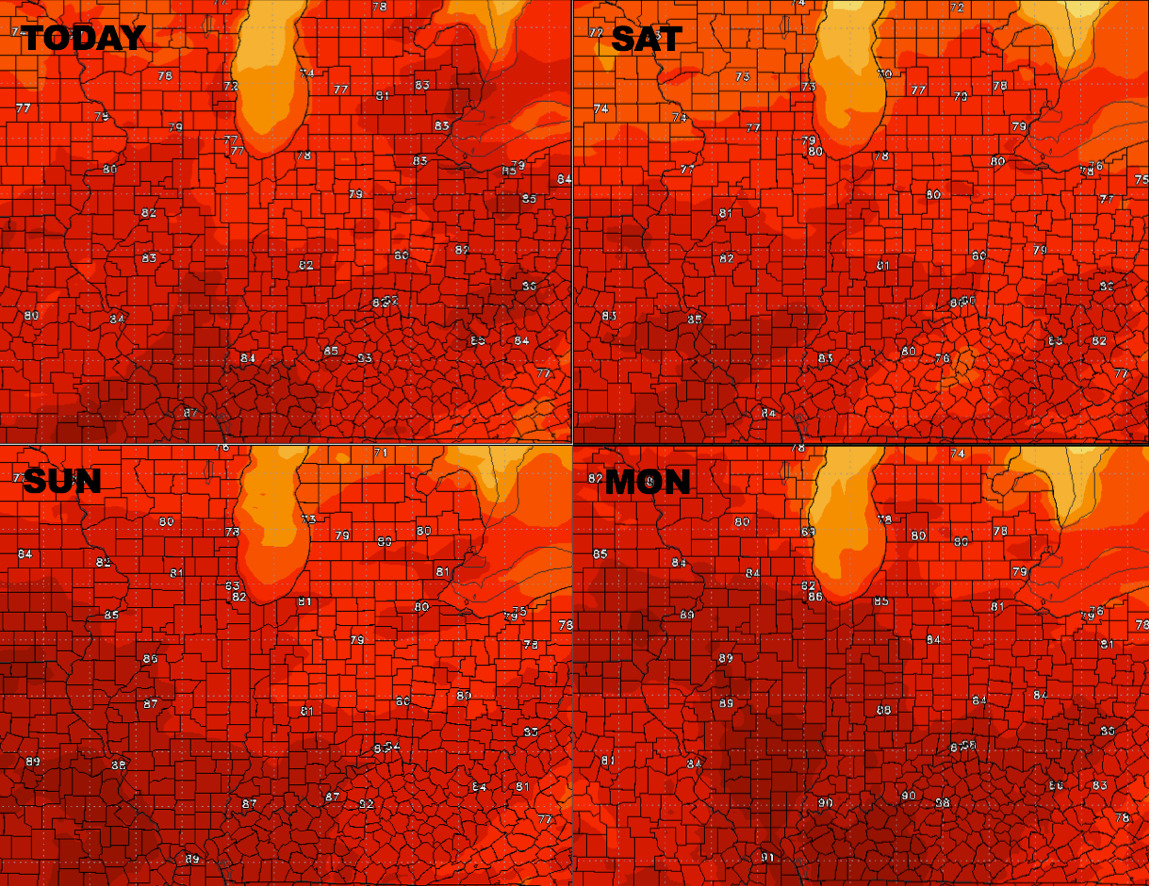
Much more comfortable weather will also settle in as the front pushes east this weekend:
Confidence:
- Above average confidence of additional storms pushing east noon and beyond today, can’t rule out some being strong to severe with heavy rainfall.
- Above average confidence the second half of the weekend is much nice and more comfortable as dew points drop beyond the frontal passage.
- Increasing confidence next week remains active as we see more of a northwest flow which increases the threat for storm clusters in the Midwest.
Video (6 min):