Key Points – Tuesday, June 20, 2017:
Synopsis: Good Tuesday morning! Very nice weather overall expected for most of the day today, watching for scattered storms ~40% this evening moving from northwest to southeast across the Midwest. Monitoring Wednesday night into Thursday as a piece of energy pushes east from Iowa into the Midwest for additional storm coverage as well. Moving later into the week is when a more widespread chance for showers and storms exists as a frontal boundary pushes through…we also discuss tropical implications to parts of the southern Midwest as well. Have a blessed day!
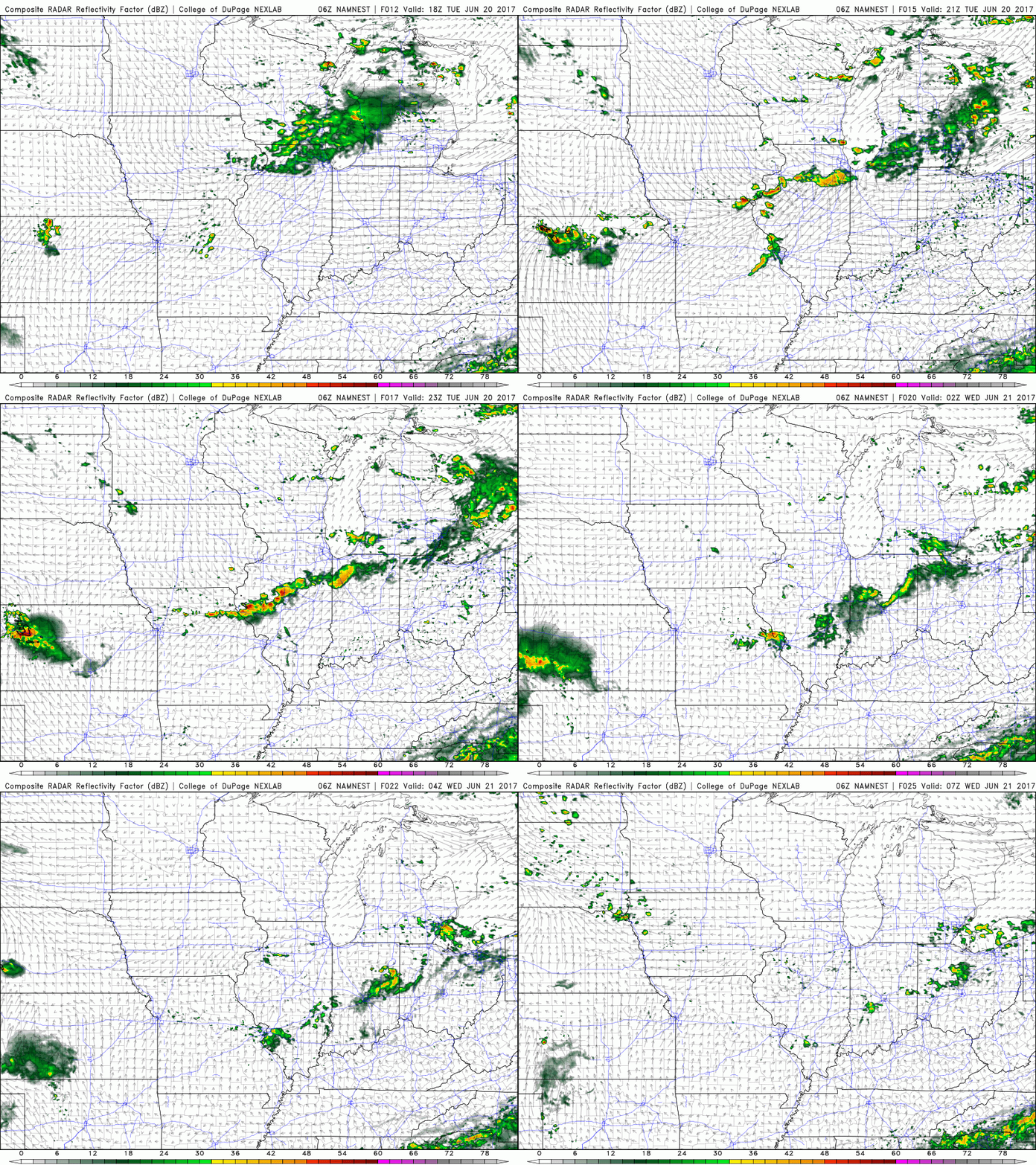
Best threat for storms today from ~3pm to the northwest to ~1am to the east…coverage ~40/50% at best.
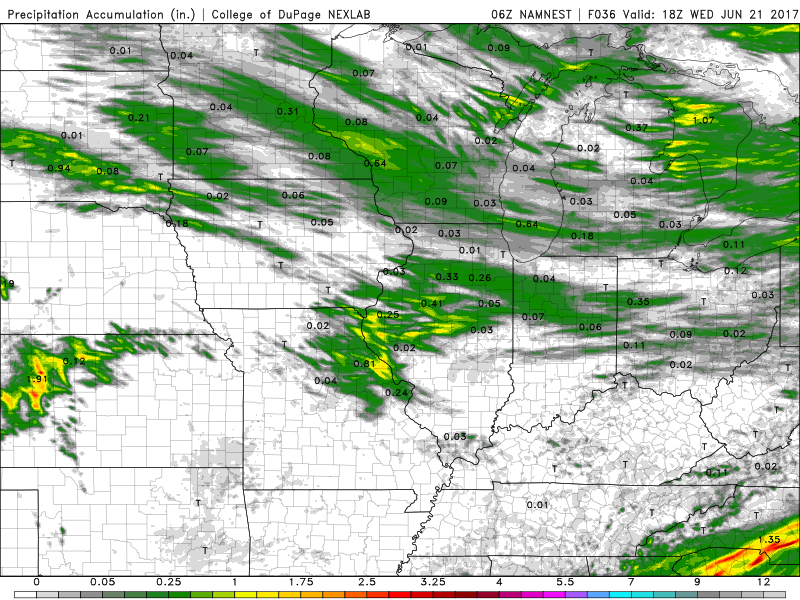
Thoughts on precipitation from this round…most stay dry, in isolated spots 0.5-1.0″ will be possible:
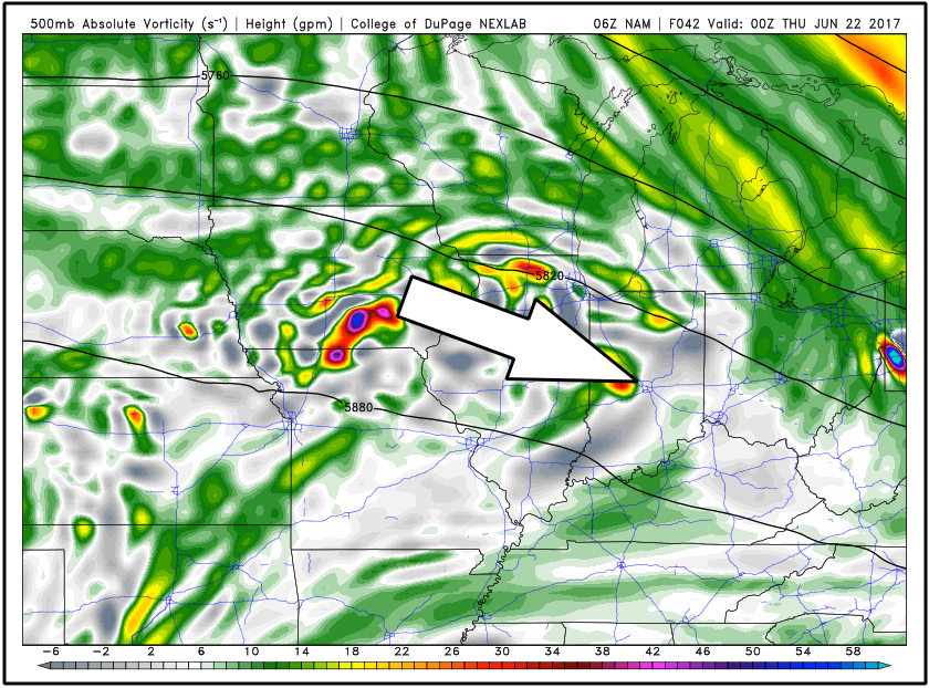
Watching Wednesday evening into Thursday morning for a piece of energy exiting east out of Iowa…wouldn’t be shocked to see an increase in storm coverage here despite simulated radar guidance not showing much yet.
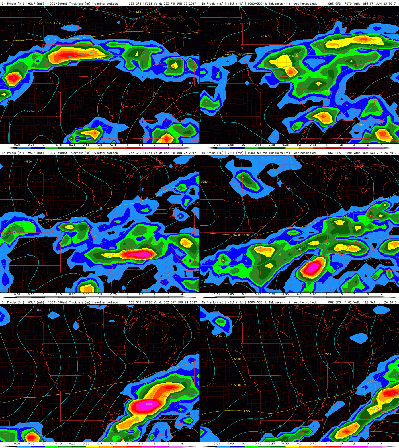
Latest GFS late week…Thursday night into Friday morning heavy rain moving through…near the Ohio River we are watching for some very heavy rain on Friday into the pre-dawn hours of Saturday.
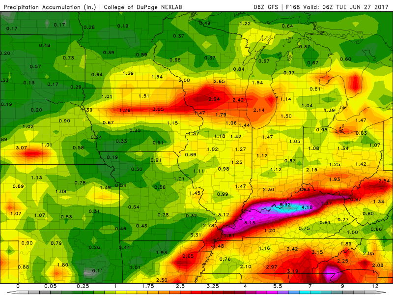
Precipitation over the next week…pending tropical activity, we could see an uptick in these totals especially south. Increasing confidence we see a decent swath of 1-1.5″+ with isolated higher amounts certainly possible.
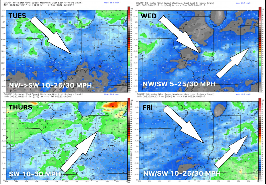
Wind forecast over the next 4 days:
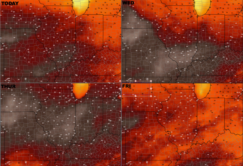
Temperature forecast over the next 4 days:
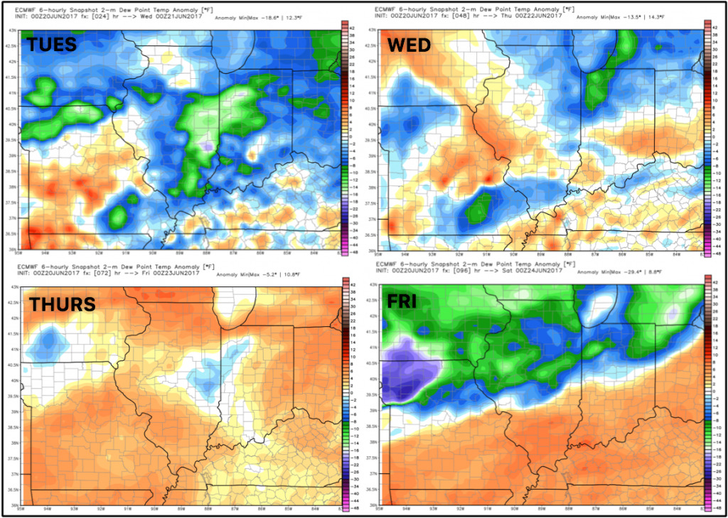
Dew points from normal over the next 4 days…getting more humid Wed/Thurs before front swings through on Friday.
Confidence:
- Average confidence for scattered storms from northwest to southeast tonight with a coverage ~40%.
- Lower confidence on a cluster of storms working east into the Midwest Wed night…need to see more data here.
- Average but increasing confidence of heavy rainfall working in Friday through Saturday as well.
- Average confidence we start seeing a cooler pattern work in late week into next week to close out June.
Video (6 min):
