Key Points – Thursday, July 13, 2017:
Synopsis: Good Thursday morning! Today we discuss the continued heavy rainfall and strong storm chances as we get into this afternoon and evening, eyeing potential for more wide-spread rains than model guidance as well. Much more comfortable air works in Friday and Saturday as a cold front swings through, but we are watching closely a disturbance move northwest to southeast on Sunday that could bring additional rainfall. All the details in the video, if you have any questions please let us know! Have a blessed day.
Current Radar:
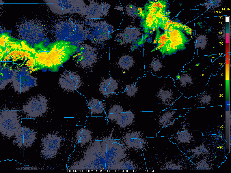
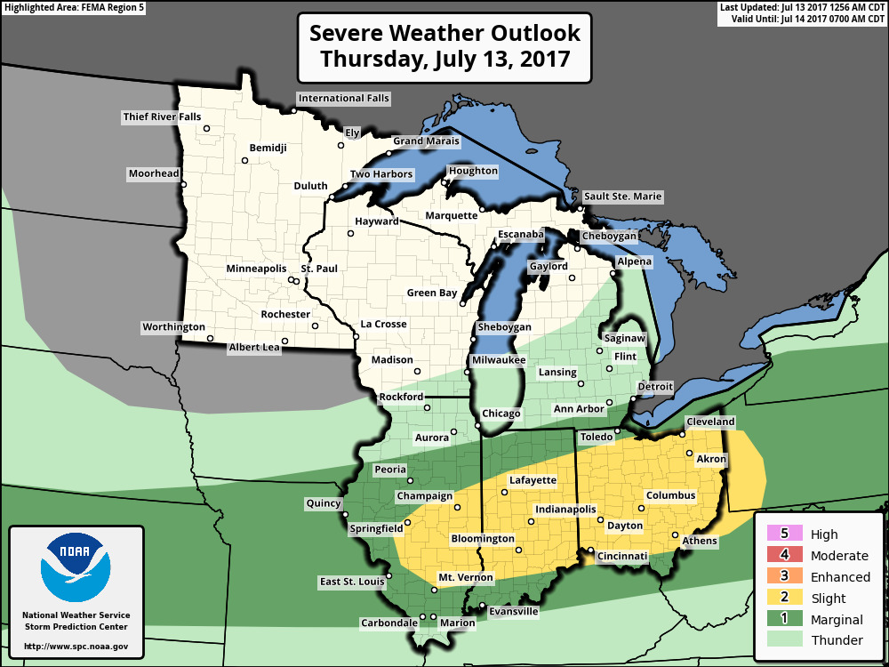
Today’s strong storm risk…yesterday’s updates we mentioned we needed to see the risk extended further into IL which it has this morning…main risks will be gusty winds, very heavy rainfall, isolated hail with an isolated tornado not being ruled out.
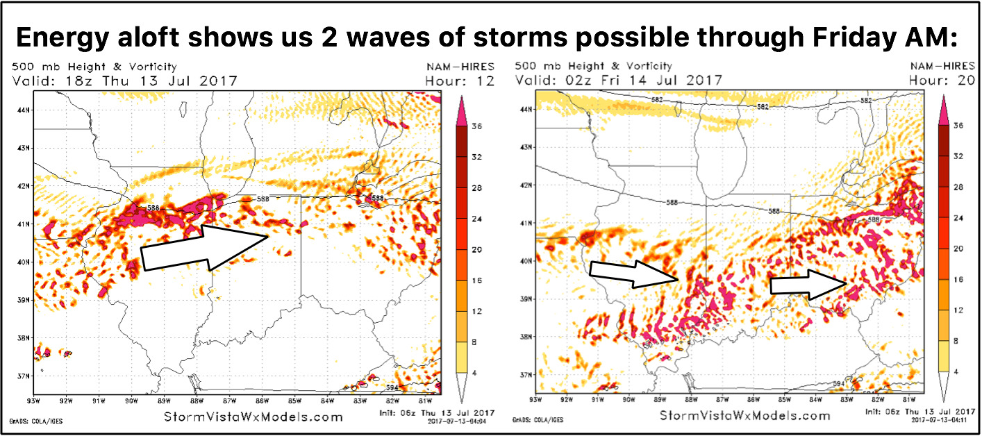
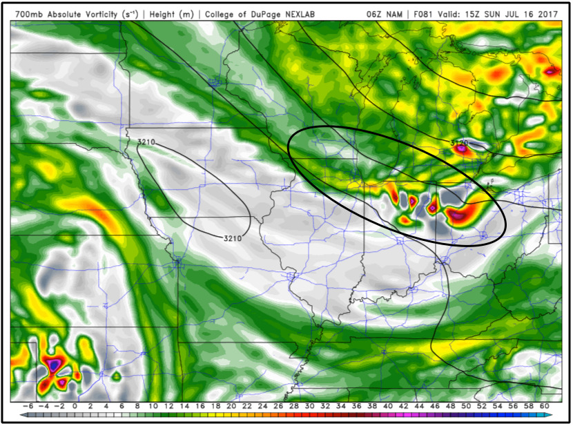
We chose to look at upper-level energy today versus simulated radar guidance because simulated radar guidance had the wave of showers moving east weakening, but when looking at the energy aloft it certainly looks to stick together into the afternoon. Also, watching another piece of energy work in across the central to southern parts of the Midwest into this evening/overnight that will work south and east into Friday morning along the cold front.
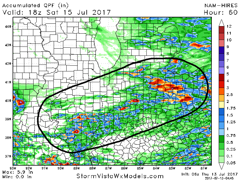
Total rainfall guidance, latest thoughts of 1-4″ on the table for today, have to keep an eye on a potential second wave of storms later today:
Cold front moves through on Friday ushering in much nice and more comfortable weather into Saturday. Sunday a weak disturbance moves northwest to southeast especially across northern IL, northern IN and northern OH…something we will monitor closely:
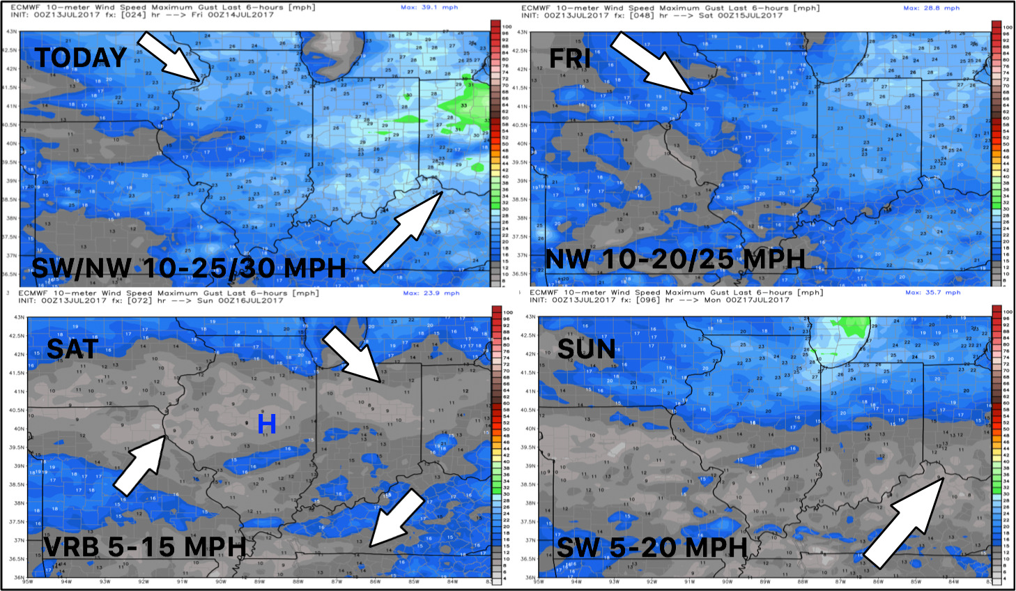
Wind forecast through the weekend:
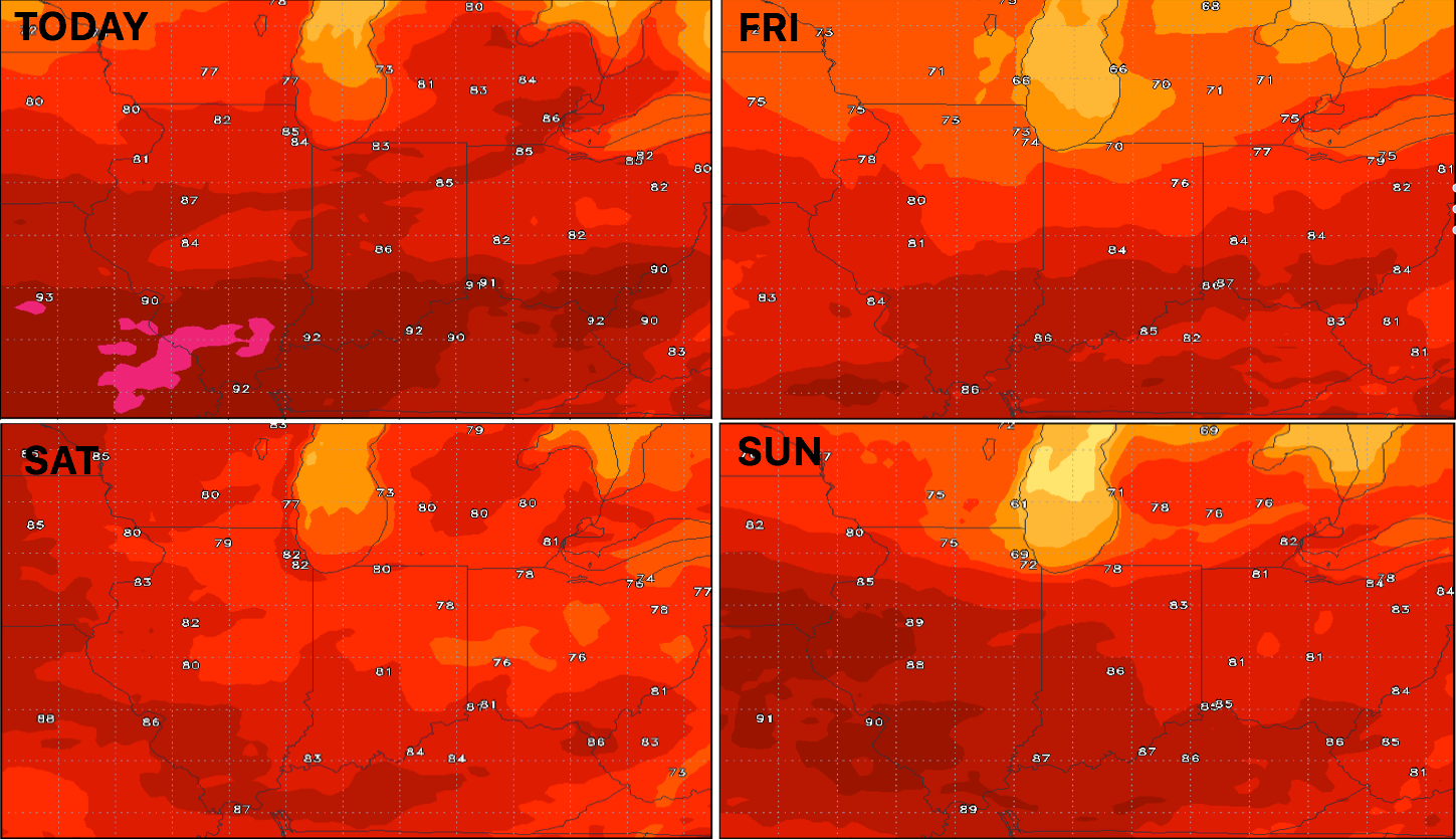
Temperature guidance over the next 4 days:
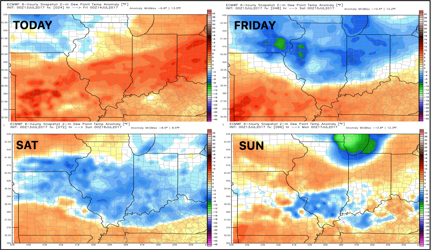
Dew points from normal forecast…much more comfortable air works in Friday/Saturday as the cold front swings through:
Confidence:
- Above average confidence we see additional showers and storms today, some being strong with flash flooding not being ruled out.
- High confidence much more comfortable weather is in store Friday into Saturday under high pressure as a cold front swings through.
- Average confidence of another disturbance works southeast on Sunday.
Video (7 min):