Key Points: Tuesday, August 1, 2017
Good Tuesday morning! We target isolated to widely scattered storms today into Wednesday, with coverage increasing Thursday into Friday as a front swings through the area. Once that front passes, the big story will be very unseasonably cool temperatures settling in on Friday into the weekend. Additional showers and storms possible this weekend as well as discussed in the video. If you have any questions, please let us know. Have a blessed day!
Today’s video (7 min):
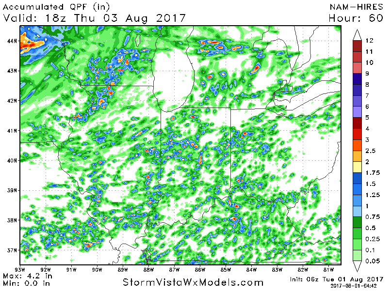
Here is the rainfall guidance over the next 60 hours. Very hit and miss coverage through mid-week with isolated 1-2″ amounts in areas that get under these storms.
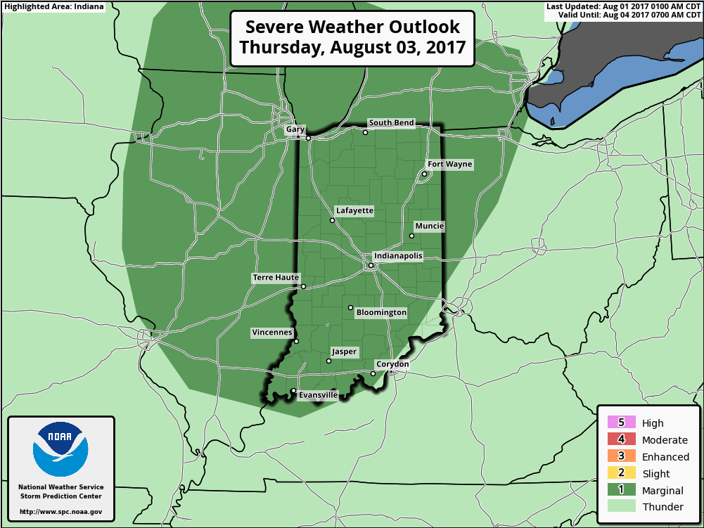
The next chance for any severe storms will come on Thursday. The Storm Prediction Center has placed a marginal risk across portions of the area. We could see this upgraded to a slight risk as we get closer.
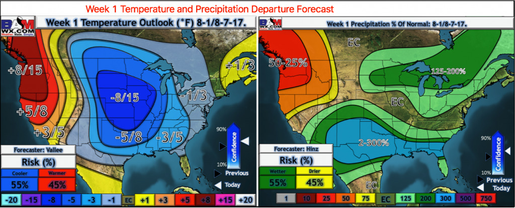
Here is the week 1 temperature and precipitation forecast from normal.
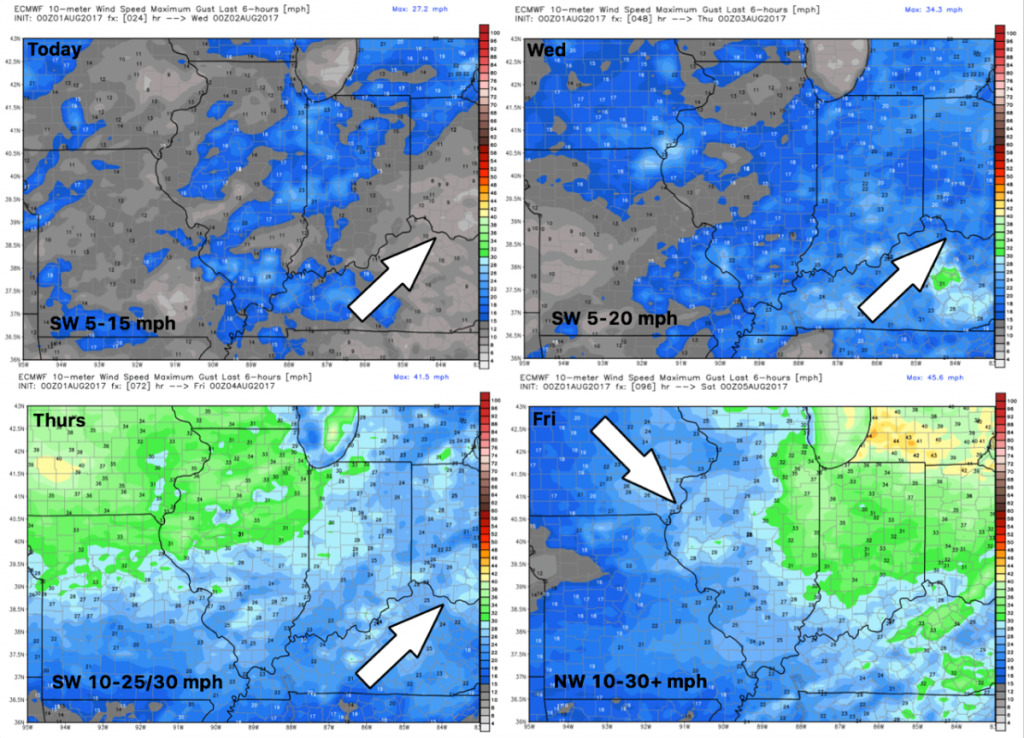
Wind forecast over the next 4 days is shown below.
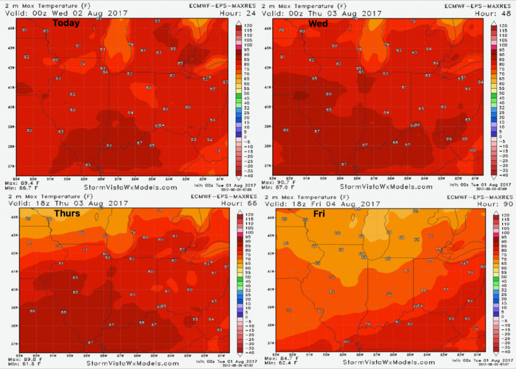
Forecast highs over the next 4 days…turning much cooler on Friday as a cold front passes.
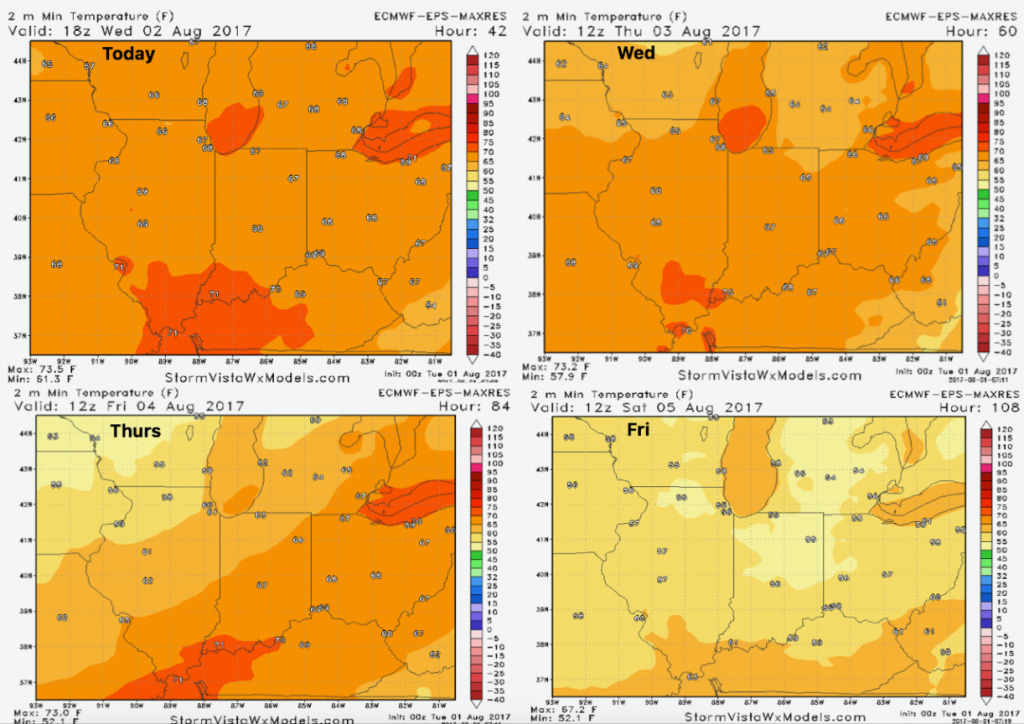
Low temperature guidance over the next 4 days is shown below.
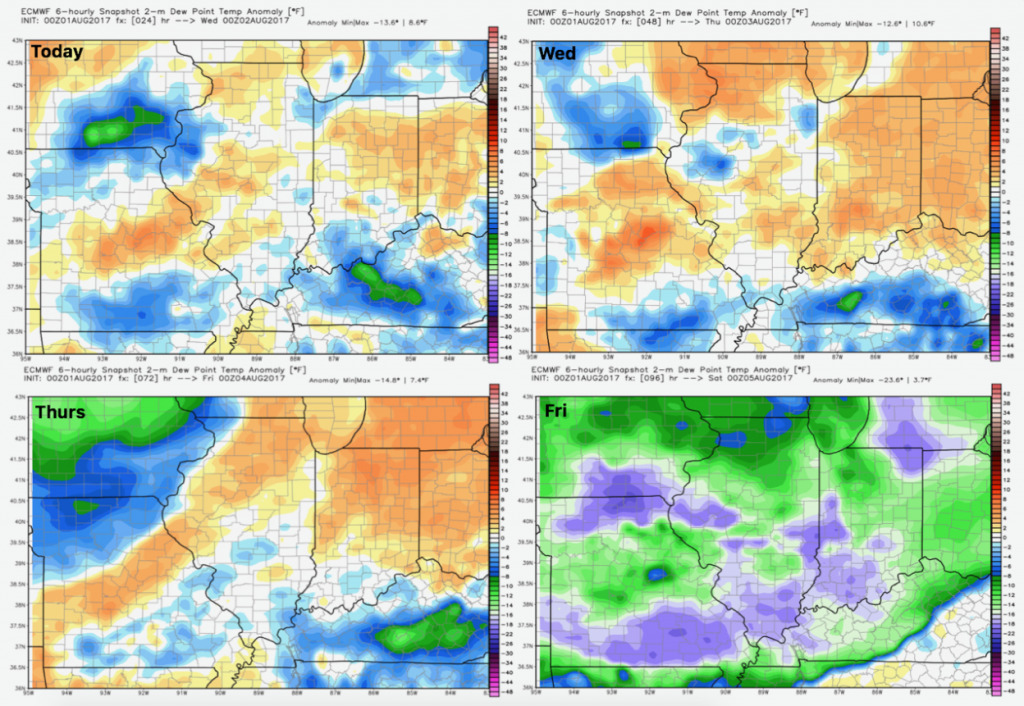
Here are the dew points from normal. Much drier air moves in behind the cold front on Friday.