Key Points – Friday, April 28, 2017:
Synopsis: All the details are packed in the video today, expecting very heavy rainfall to intensify along the warm front later tonight and on the day on Saturday, some strong to severe storms will be possible as well with all modes of severe on the table late Friday and on the day on Saturday. A cold front will then sweep from west to east on Sunday into Monday morning bringing some gusty winds and additional heavy rainfall east. A fairly quiet weather week sets in next week with our next targeted rain chance coming mid-week…it’s the cooler than normal trend in temps that has caught our attention getting into the week 2 timeframe. Have a blessed weekend!
Simulated Radar today into Saturday as the warm front lifts north…coverage of storms and intensifies tonight closer to the Ohio River and slowly creeps north on the day on Saturday near I-70. The further north you are the more scattered the showers will be…but currently thinking is around I-70 south will be widespread heavy rainfall (even flash flooding) and potential strong storms.
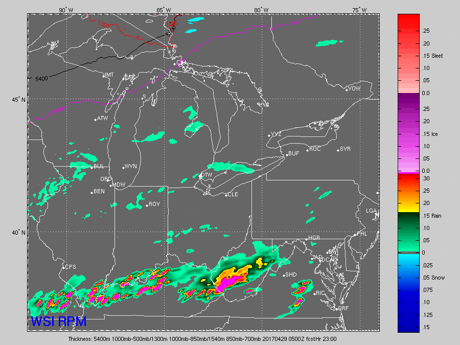
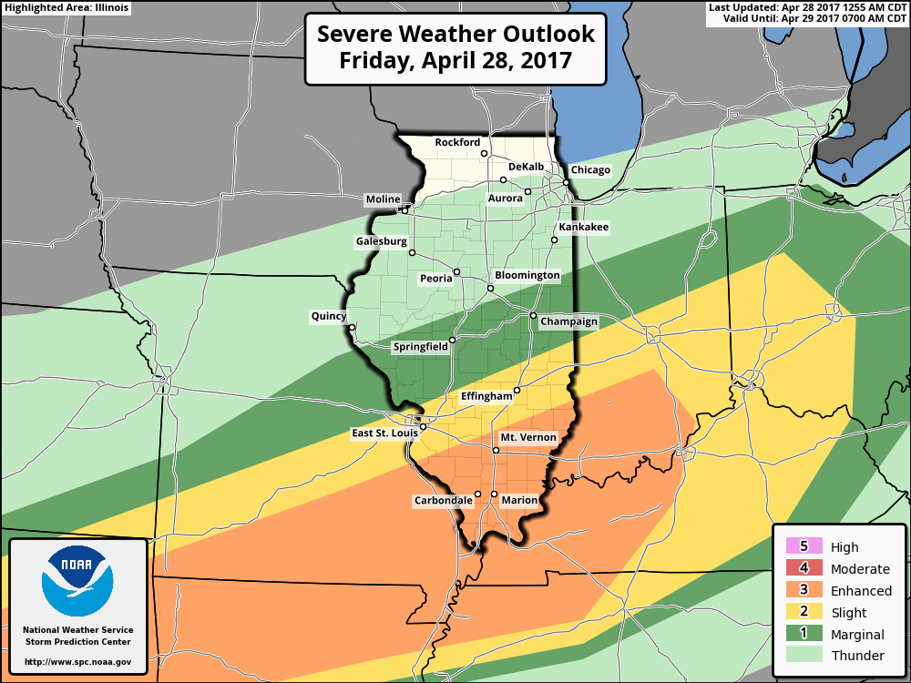
Some strong to severe storms will be possible tonight into Saturday morning as well along the warm front…all modes of severe will be possible including flash flooding, damaging winds, isolated large hail and isolated tornadoes.
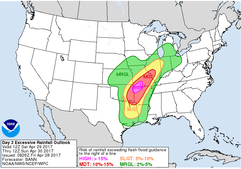
Excessive rainfall including flash flooding will also be a hazard on the day on Saturday into Sunday along the warm front:
Showers and storms continue to linger and push north of the front into the first half of Sunday, and the we start to see the cold front advance east later Sunday into Monday morning that will bring some gusty winds and additional heavy rainfall.
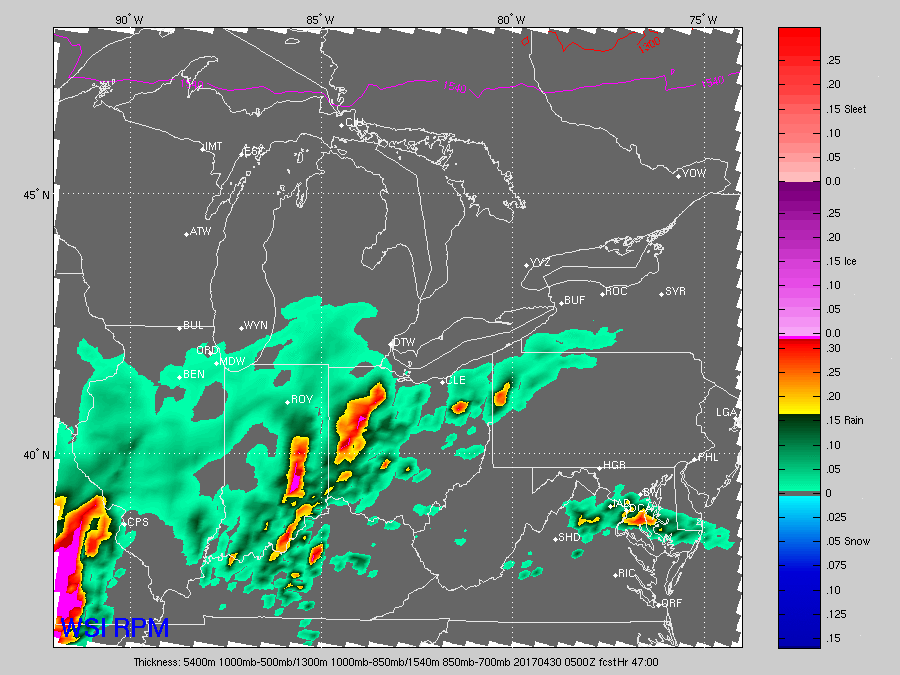
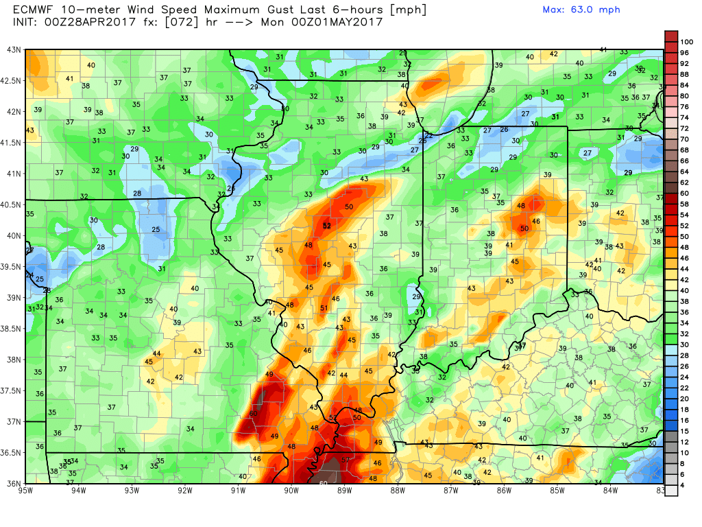
Very gusty winds possible late Sunday into Monday, even Tuesday morning as the cold front advances east and the winds on the backside of the front will bring gusts topping 45mph+.
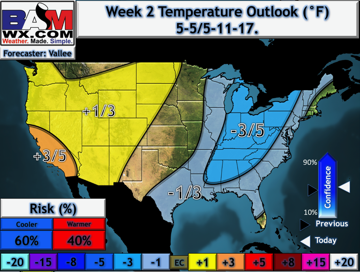
A fairly quiet weather-week expected for most of next week with the exception of a small disturbance we are watching mid-week…the interesting thing to note is the trend to cooler than normal getting into the week 2 timeframe…we will have our official May outlook posted today, but our thinking is that seasonal to slightly cooler than normal temps prevail over the next month; more details in the long-range later this morning.
Confidence and Risk:
- Above average confidence showers and storms lift north of the warm front today into Saturday.
- Average to above average risk for stronger storms with all modes of severe possible mainly south of I-70.
- Average risk heavy rainfall and storms continue Saturday into Sunday, with risks for flash flooding and additional strong storms through early Sunday.
- Above average confidence showers and storms trek east later Sunday into Monday along a cold front.
- Increasing confidence of a fairly quiet weather-week next week across the Midwest.
- Above average risk for cooler than normal temperatures getting into the week 2 timeframe.
Today’s video (8 min):