Key Points – Friday, April 21, 2017:
Synopsis: Good Friday morning! Today we discuss the rain event this weekend that’s currently moving across southern Illinois and southern Indiana this morning. What’s interesting about this scenario is that the models are trying to kill off the showers this morning, we aren’t 100% sold on this. In fact, our hi-resolution forecast models have actually lifted the heavier precipitation north getting into tonight and Saturday. This system lingers east through lunchtime Sunday before getting out of here, and then some dry, nice weather sets in through Tuesday. Our next system moves in Wednesday into Thursday next week as a warm front advances into the Midwest, followed right on its heals is another strong storm system late week that we are watching closely. The pattern continues to be very active next week, we highly encourage you to stay updated with each forecast going forward. Have a blessed weekend!
Current Radar:
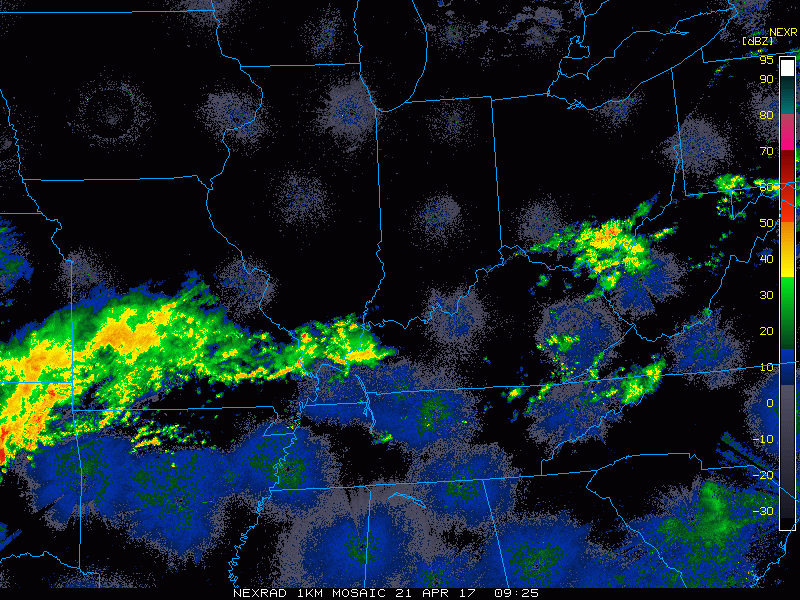
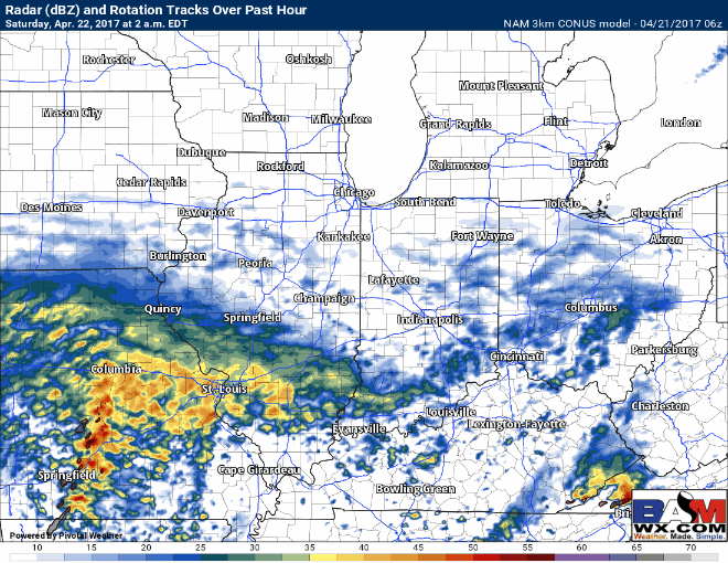
Simulated radar for weekend system…might see a little weakening of rain showers throughout the day, and then things intensifying later tonight into Saturday morning. The storm system really doesn’t get out of here until about lunch time Sunday for our eastern Midwest locations.
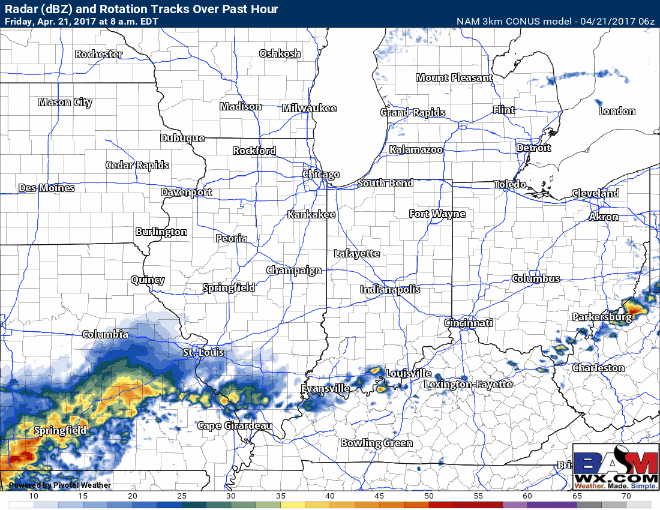
As mentioned above, expecting showers to start to intensify this evening through Saturday before exiting east Sunday afternoon. We’ve seen a shift north of the rainfall on Saturday as well as seen below, it’ll be a pretty wet day from Peoria, Ft. Wayne, Defiance south.
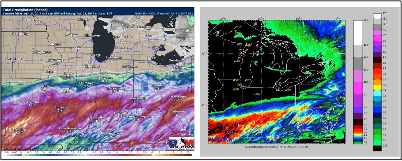
Total rainfall…widespread 1-3″ of rain from Springfield, IL over through central IN and western OH…with the heaviest rainfall expected across south central and southern IL and IN into southwest OH.
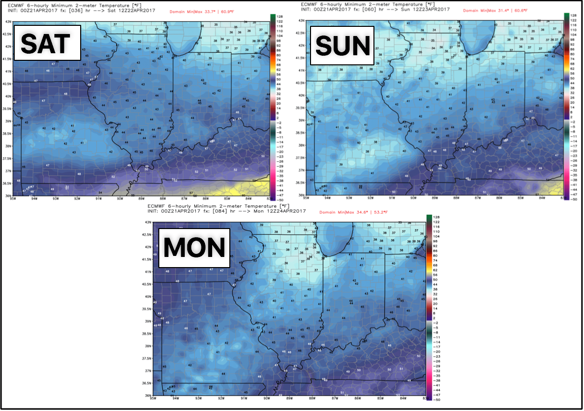
Temperatures expected to become chilly in the upper 30s and 40s this weekend into Monday morning…however, big changes come next week.
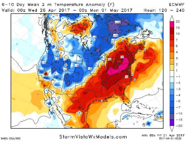
We warm up in a big way next week, check out these temperatures from normal forecasted for the 6-10 day timeframe from the latest European model…some folks, especially the further east may see temperatures over 10º above normal which means the return of the 80s likely! Stay tuned.
We start the week dry, however a warm front lifts north Wednesday into Thursday next week. That storm system goes to the north and then our next system works its way in east into the area, can’t rule out a strong to severe storm to end the month.
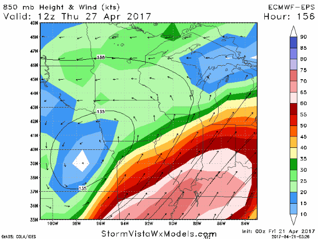
Next storm system follows right behind…check out these 850mb winds forecasted from the European Ensemble for late next week into the weekend…these help us find the low-level jet, and you can see how strong the ensemble is forecasting winds about 5,000 ft above the surface…quite impressive! Need to watch this timeframe closely for strong storm potential.
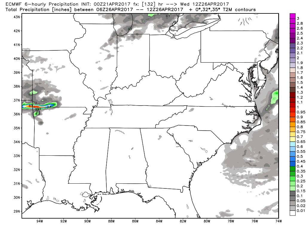
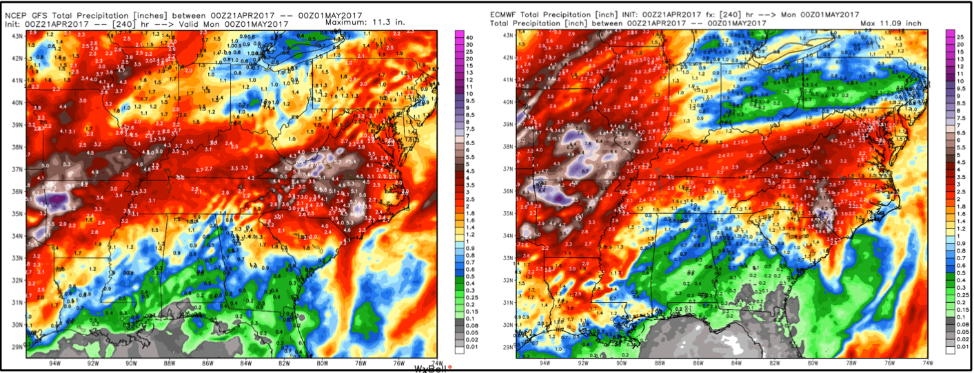
Total rainfall over the next 10 days from the GFS and European…you can see the heavy rains being forecasted across Missouri, slightly drier across the eastern Midwest but the further south and west you go the more wet concerns we have.
Confidence and Risk:
- Average risk that the rainfall pulls further north than earlier suggested by our global forecasted models into the weekend.
- Average confidence some heavy rainfall possible across south central to southern Illinois into Indiana through Sunday.
- Above average confidence later Sunday through Tuesday we see nice conditions!
- Average confidence showers and storms return from a warm front Wednesday into Thursday next week.
- Average confidence we stay active through late week into next weekend with warm temperatures and even a strong storm potential.
- Average but increasing confidence we are warmer than normal into next week across the Midwest.
Today’s video (7 min):