Key Points – Monday, March 6, 2017:
Synopsis: Good Monday morning and thanks for checking out the latest forecast update! We have quite the week of weather ahead of us so make sure watch the video until the end. Most of the Midwest sees continued cloud cover throughout the day today with mild temps…it’ll be windy today as well with winds out of the SSW gusting up to 35mph+! Confidence is on the lower end for strong storms overnight especially to the east, but gusty storms likely as the cold front moves through. Watching for a potential late season snow storm late week into the weekend, which matches our call for a colder pattern ~March 9th-14th…it’s 5 days out, all the models are still trying to get a lock on this so the details are not set in stone. However, a winter storm would match the pattern with a block over Greenland forecasted to set-up…it’s something we can’t ignore and need to keep an eye on…if the models are correct it would definitely require some plowing. Temperatures over the next 5 days are much warmer than normal, turning cooler into the weekend, but confidence on a return of above normal warmth mid-month and beyond is increasing. Have a great week!
Showers and gusty storms possible late tonight into Tuesday morning, the latest Day 1 severe outlook places portions of Iowa and western IL in a “Slight Risk” for stronger storms…it’s something we are watching closely, but winds topping 40mph are definitely possible as the cold front progresses east overnight.
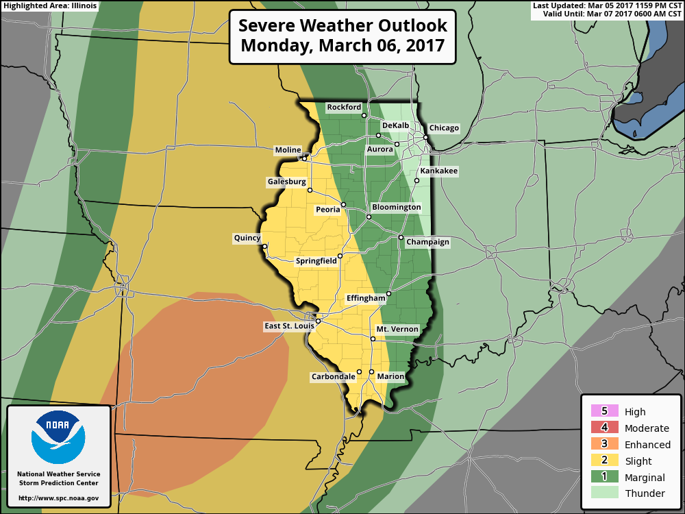
We time out the details in the video, the 3km NAM shows the line of gusty storms progressing east overnight into Tuesday well, with clearing following closely behind it.
In terms of total rainfall, a 0.25-0.75″ is the forecast, with isolated higher amounts possible where the heavier storms move through.
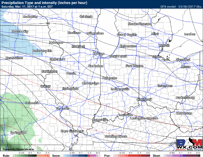
Watching very, very closely for a potential late week/early weekend winter storm to move through the Midwest. The details are not a “slam-dunk” by any means, but all of our major forecast models are picking up on accumulating snowfall in the 5 day timeframe which makes it very hard to ignore. Furthermore, it fits the pattern perfectly with the timeframe we’ve been mentioning to watch for a “colder shot” from March 9th-14th. Basically what we have here is high-latitude blocking from Greenland to Alaska, which forces the cold down into the Midwest up into the Northeast…get temperatures near or below freezing and that’s a recipe for a winter storm.
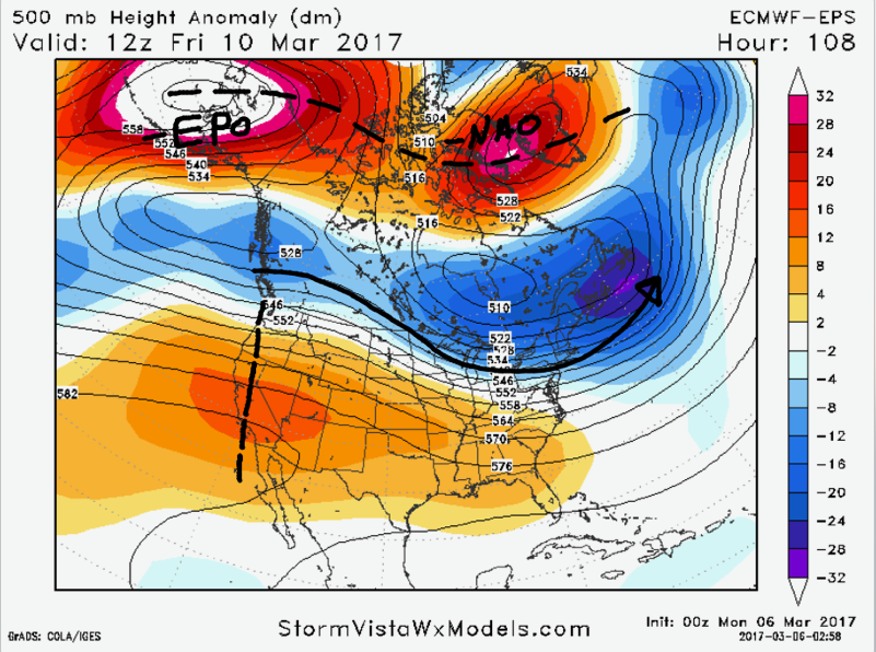
Where this winter storm would set-up is also not set-in stone, but as you can see below this would result in accumulating snowfall, even heavy snow at times so it’s something we are definitely taking seriously and will continue to update on as we progress forward this week.
Confidence and Risk:
- High confidence of mostly cloudy skies, mild temperatures are breezy conditions across the Midwest today…with showers lingering across Zones 1/2.
- Above average confidence in gusty storms along a cold front moving east overnight.
- High confidence we will see above normal warmth once again this week across the Zones.
- Low confidence on the details of the late week/early weekend winter storm…something we are keeping close eyes on.
Today’s video (7 min):