#ILwx #INwx #OHwx Friday short-term update
Synopsis: We’ve seen some changes in the data this morning and wanted to make sure to get out an update so you’re covered for the rest of today through the weekend on the storm system that’s currently moving across the southern Midwest right now. The issue is that the data continues to wobble north and south with how far north the rainfall goes. We know there’s a lot of decisions being made right now on getting out into the fields and we think we have a good handle on things right now. Drier air is in place the further north the rain goes today which is why we anticipate it to weaken throughout the day. As we go into tonight by 8pm, some light showers across the Indy metro area and south central IN and southern IL are expected…as we go forward we run into a wall of dry air north of I-70 (because of lower dew points). A similar scenario plays out for Saturday with much drier north of I-70 so the rainfall is expected to remain south, with the heaviest focused focused from St. Louis east through Cincinnati south. Have a great day.
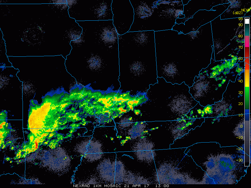
Current radar:
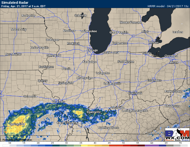
Simulated radar from the HRRR through 3am…note how the showers weaken throughout the day because of dry air to the north. Still expect ongoing showers from St. Louis, Evansville, south of Indianapolis through Cincinnati.
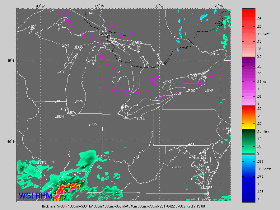
Moving more into Saturday morning where the HRRR left off, we see the heavier rain showers move west to east from St. Louis east all the way through Cincinnati throughout the day (we time it all out in the video) before shifting south and east early Sunday morning.
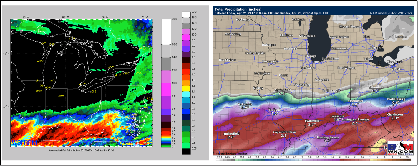
Total precipitation…very sharp cut-off as to the northern-most fringe of the rainfall. As mentioned above, expecting things to stay south of I-70 for the most part because of the rainfall running into drier air as it goes further north into Saturday. 1-3″ across south central IL/IN and southwest OH is expected.
Today’s video (5 min):