#ILwx #INwx #OHwx Fri Short-term
Synopsis: Good afternoon! Today we simply discuss the weekend forecast in terms of showers and storms, rainfall totals and temperatures. Have a wonderful weekend!
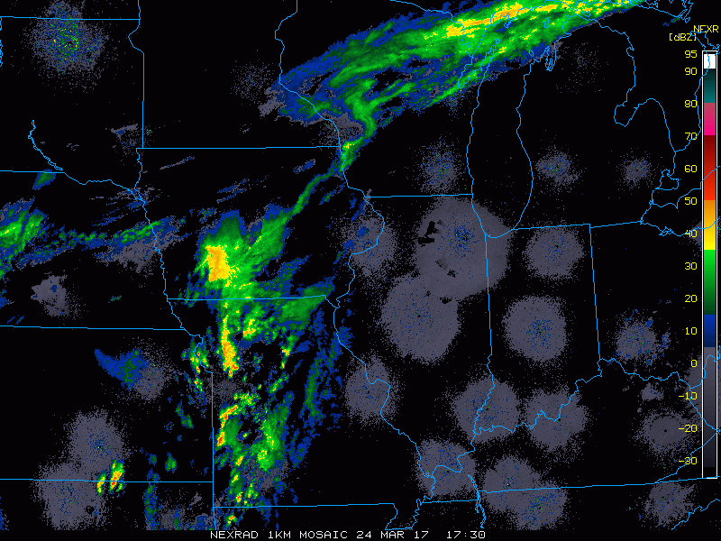
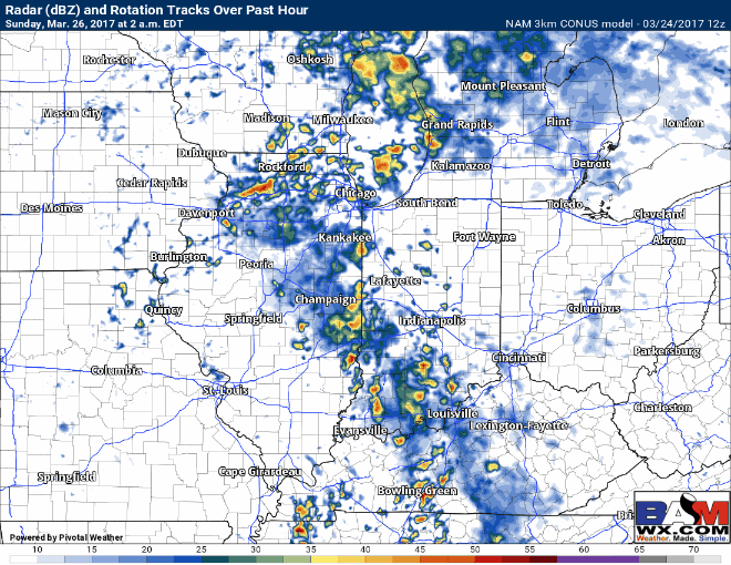
Current radar (3:40pmEDT)…on-going showers across portions of Iowa currently heading slowly east.
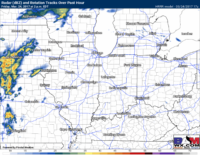
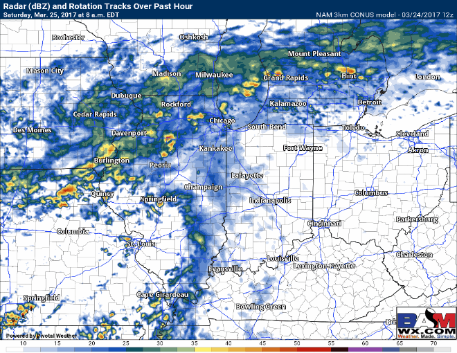
Simulated Radar through 7amEDT Saturday…the majority of any showers and storms stay across eastern Iowa to Illinois…can’t rule out these cells reaching to northwestern IN as well through the overnight. Some gusty winds, heavy downpours and isolated hail are possible. Our latest data also suggests non-thunderstorm wind gusts up to 35+mph possible into tonight mainly out of the south to southwest possible.
Moving to the day on Saturday the threat for storms becomes more widespread at 70-80% as the low pressure near the Zones…it’s not necessarily a washout but the low pressure really lingers throughout the Midwest keeping things wet. I will say that this risk is more so for Indiana and Illinois…western Ohio folks it will be more isolated in nature.
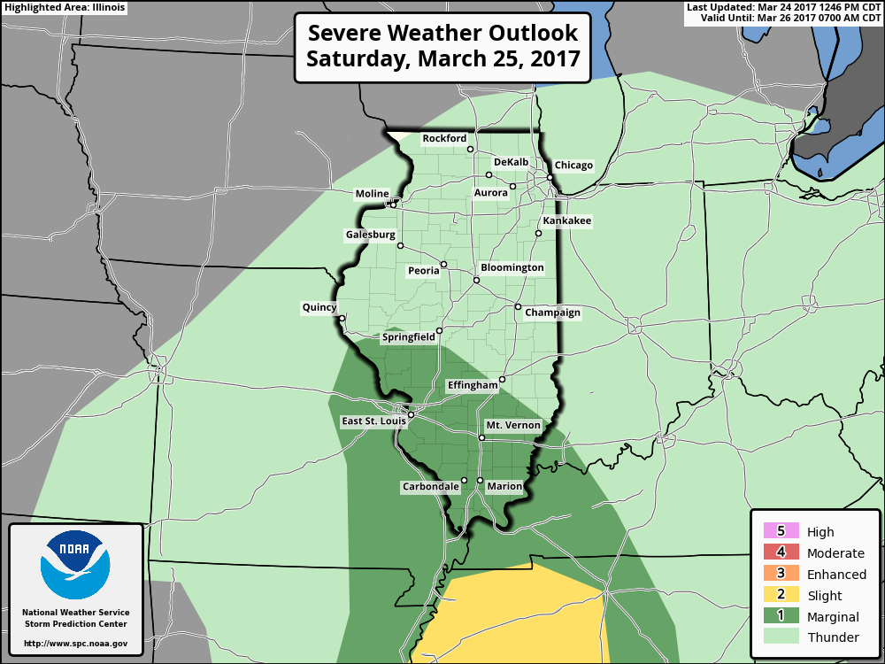
Current risk area for some strong storms on Saturday…main threats will be gusty winds, heavy rainfall and isolated large hail focused across southern Illinois and southwestern Indiana. With that being said, a few stronger storms will be possible north of this Marginal Risk (dark green).
Moving further into Sunday…coverage is slightly less in regards to showers and storms (~50-60%) as the low pressure slowly makes its way east. I do think on Sunday there is a chance for some peaks of sunshine in between the rain showers across the Midwest.
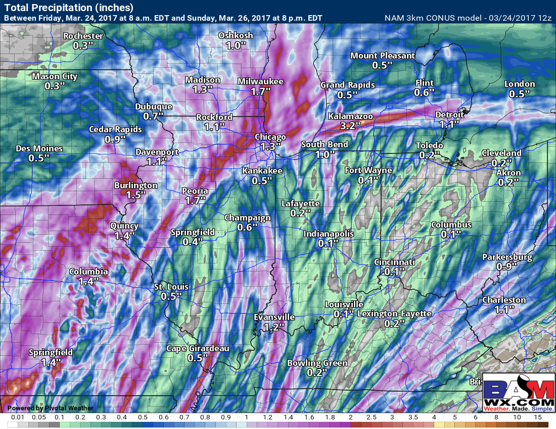
Rainfall totals through late Sunday…not everyone gets in on the heavy rainfall…but those that do could easily see 1.5″+ where the heaviest storms and bands set-up, especially across the northern and western Zone locations.
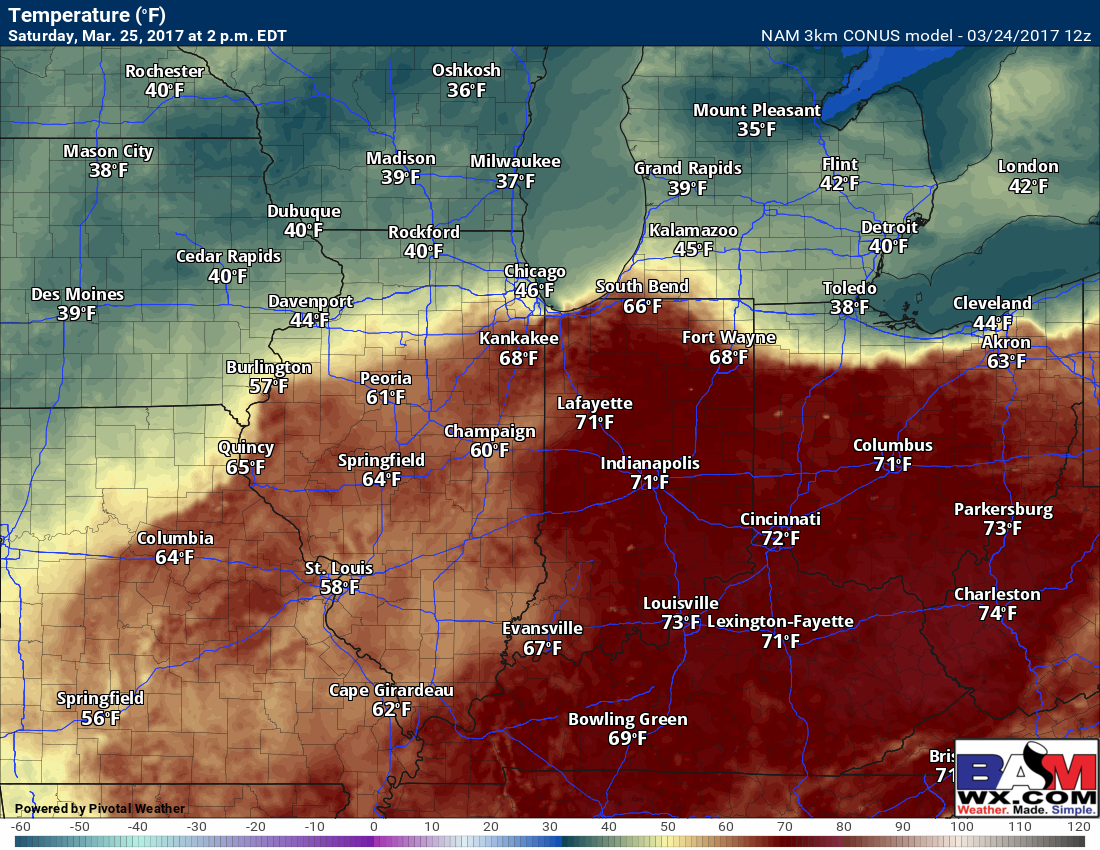
The high on Saturday will be slightly divided with folks north of Peoria potentially staying in the 40s where the boundary keeps them cooler, meanwhile folks south likely hit the 60s and 70s especially east.
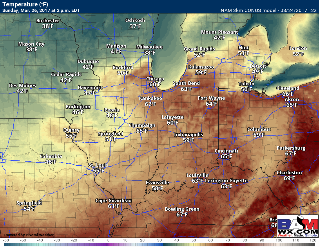
Highs on Sunday a little cooler with most locations hitting the 50s and 60s except for eastern Iowa into western Illinois staying in the upper 40s.
Confidence and Risk:
- High confidence the remainder of today will feature a mix of sun and clouds with way above normal temperatures.
- Above average confidence of showers and storms tonight into Saturday morning mainly across eastern Iowa, Illinois and NW IN.
- Above average confidence of more widespread showers and storms on Saturday and Sunday.
- Above average confidence some folks may see isolated rainfall totals exceeding 1.5″ even 2.0″ in some spots.
- High confidence most locations stay above normal in the temperature department this weekend.