#ILwx #INwx #OHwx Fri PM short-term:
Synopsis: Good Friday afternoon! Data has locked in with good agreement on the timing of our showers and storms this weekend, kept the discussion short and sweet today because the video is packed. Still watching for strong to severe storms overnight and on the day on Saturday as well as flash flooding. If you have any questions please reach out we are happy to help!
Flash food watches have been hoisted across the Midwest for excessive rainfall:
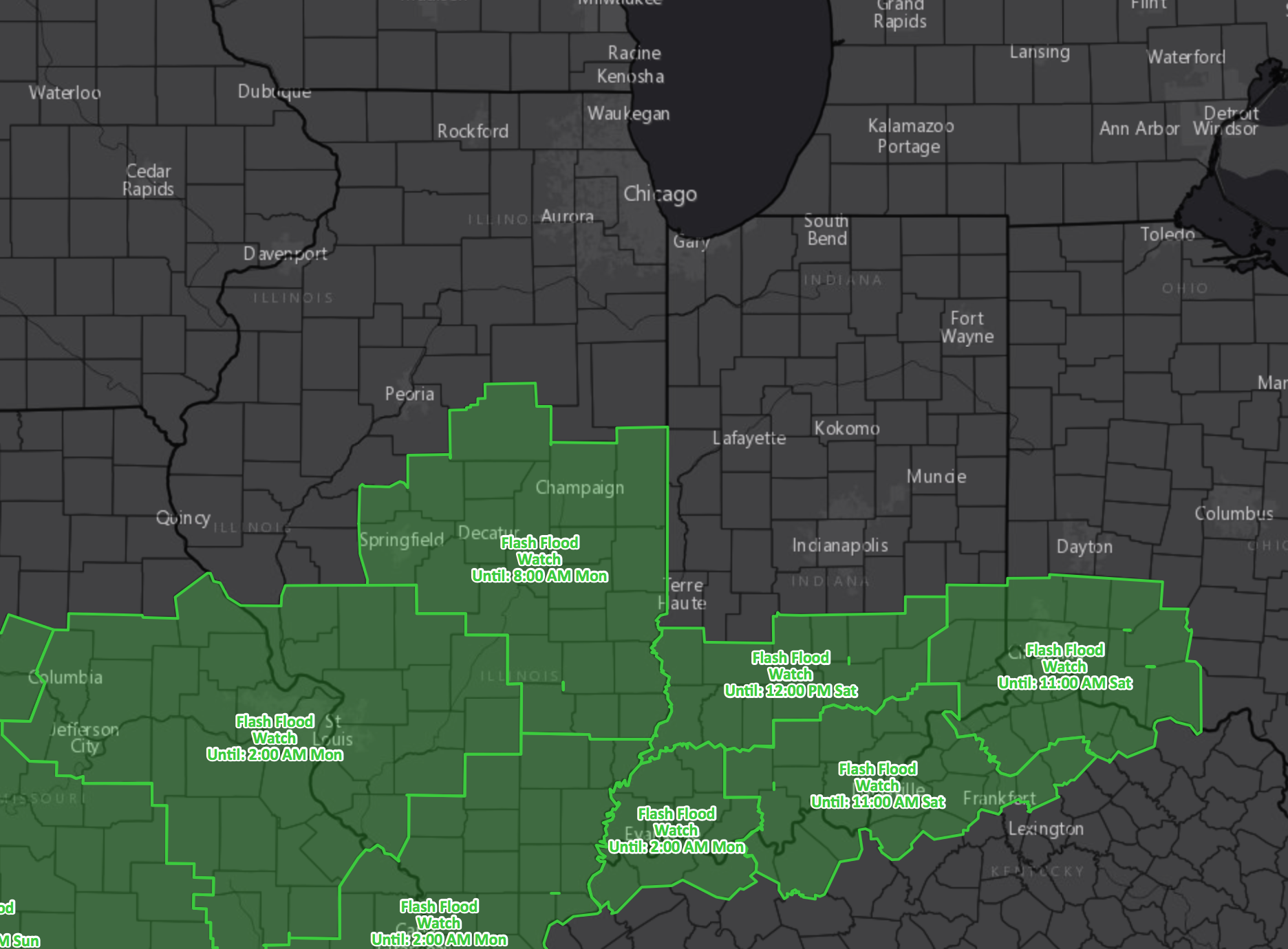
Strong storm threat still exists tonight with all modes of severe weather possible along the warm front into Saturday including: flash flooding, damaging winds, isolated large hail and isolated tornadoes.
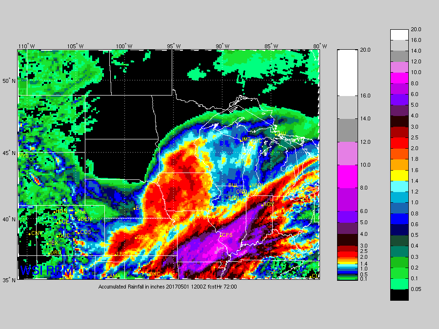
Not much change in total rainfall via the RPM…a swath of 3-5″+ possible across the southern half of Illinois and the western/southern half of Indiana through Monday.
Confidence and Risk:
- Above average confidence a warm/stationary front lifts north into the Midwest tonight into Saturday/Sunday bringing heavy showers/storms.
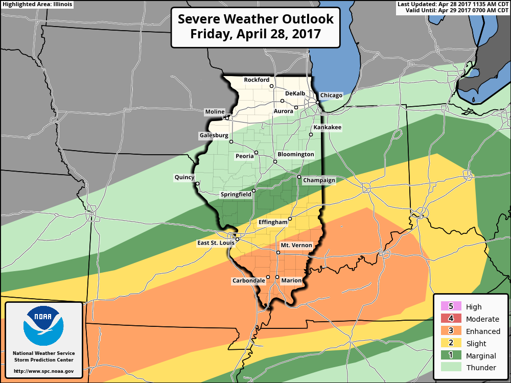
- Average risk for severe storms late tonight into Saturday as well with all modes possible.
- Still average risk to where the heaviest rainfall sets up exactly.
- Above average confidence we get gusty out ahead of the cold front Sunday and on the backside of the low pressure system on Monday.
Today’s video (6:30 min):