Key Points – Thursday, April 27, 2017:
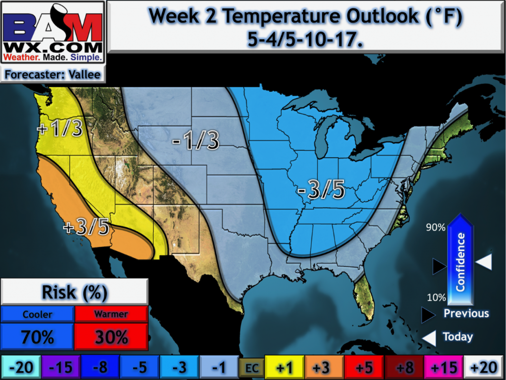
Synopsis: Good Thursday morning! We continue our discussion today on the heavy rainfall and strong storm threat Friday through Monday in the form of a warm front and then a cold front sweeping east. We also discuss the cooler than normal temperatures ahead getting into the week 2 timeframe, which we share our concern for the saturated field to stay wet longer than normal. Have a blessed day.
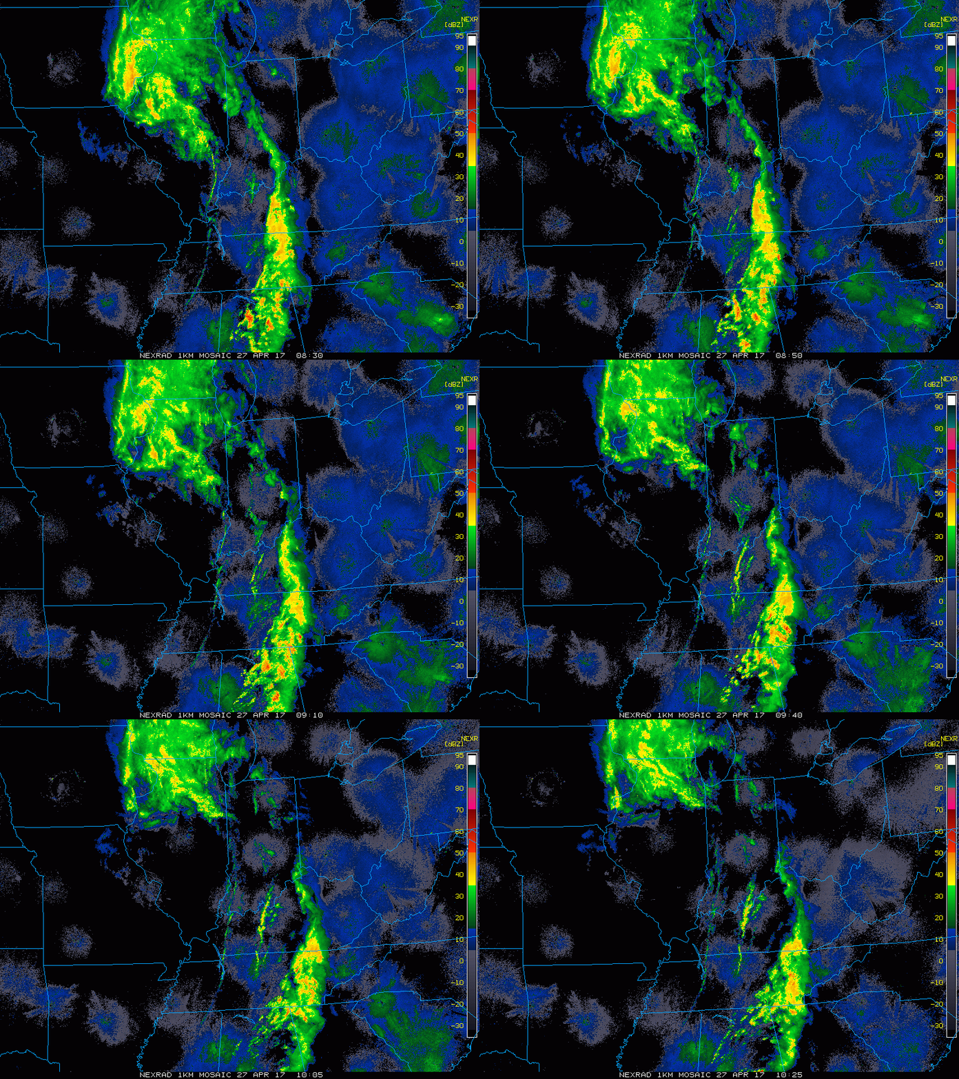
Current Radar:
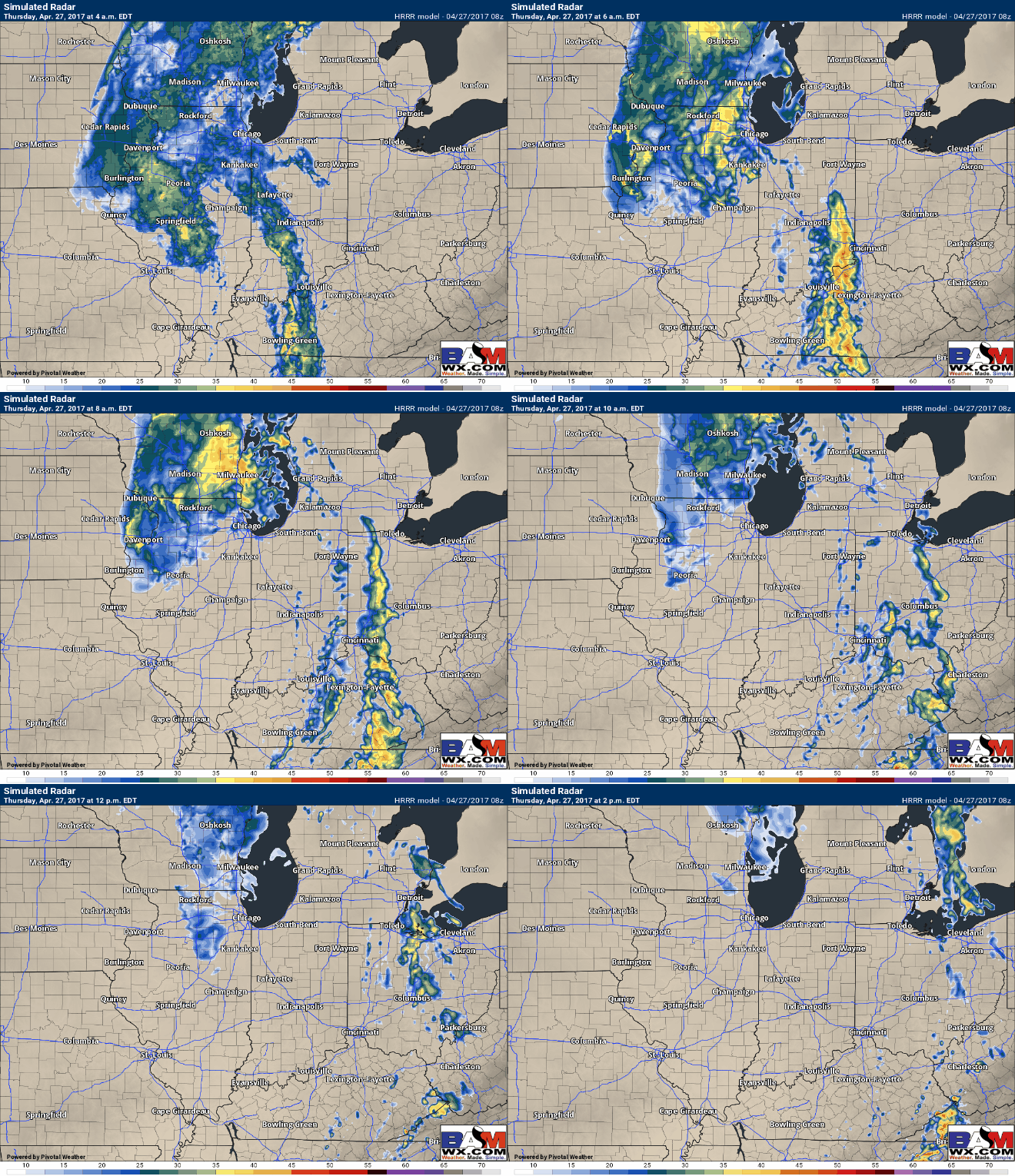
Simulated Radar…a few scattered showers and t’storms will be possible as this system pushes east today, but nothing of major impact.
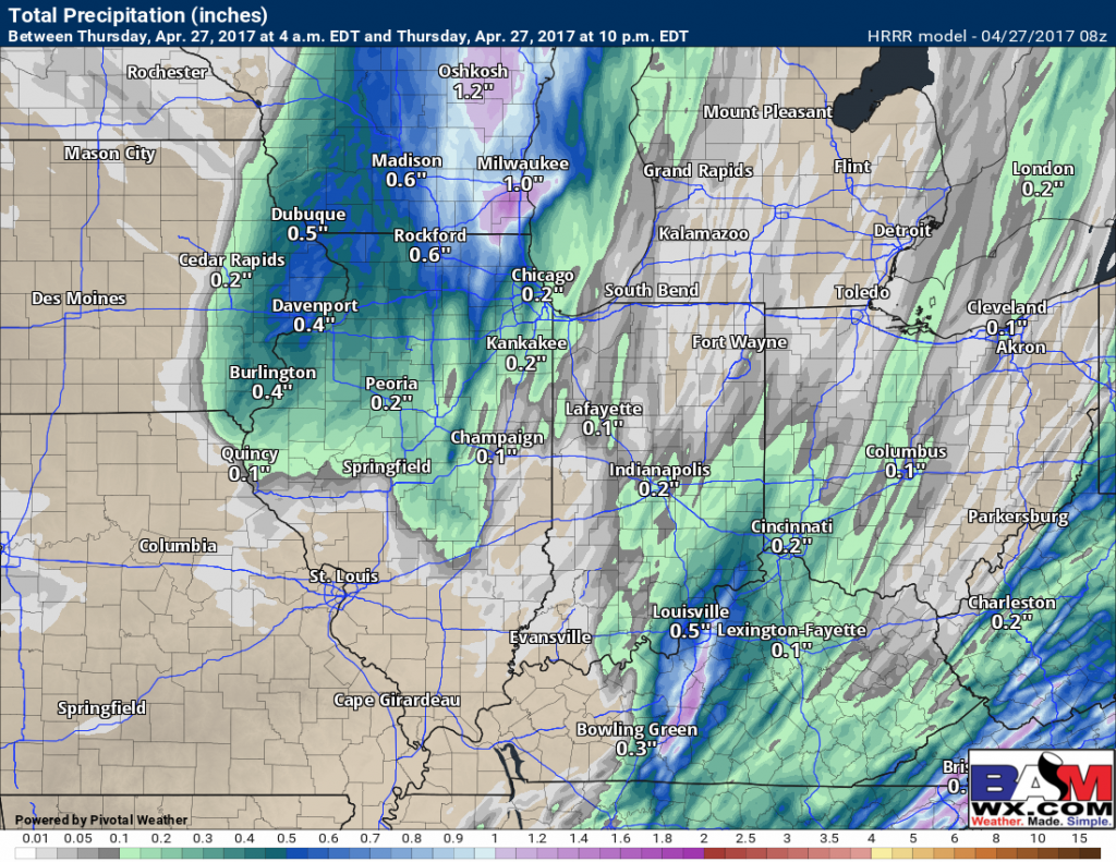
Remaining rainfall today from the HRRR…~0.5″ still possible across northern IL, otherwise ~0.2″ possible with scattered showers east.
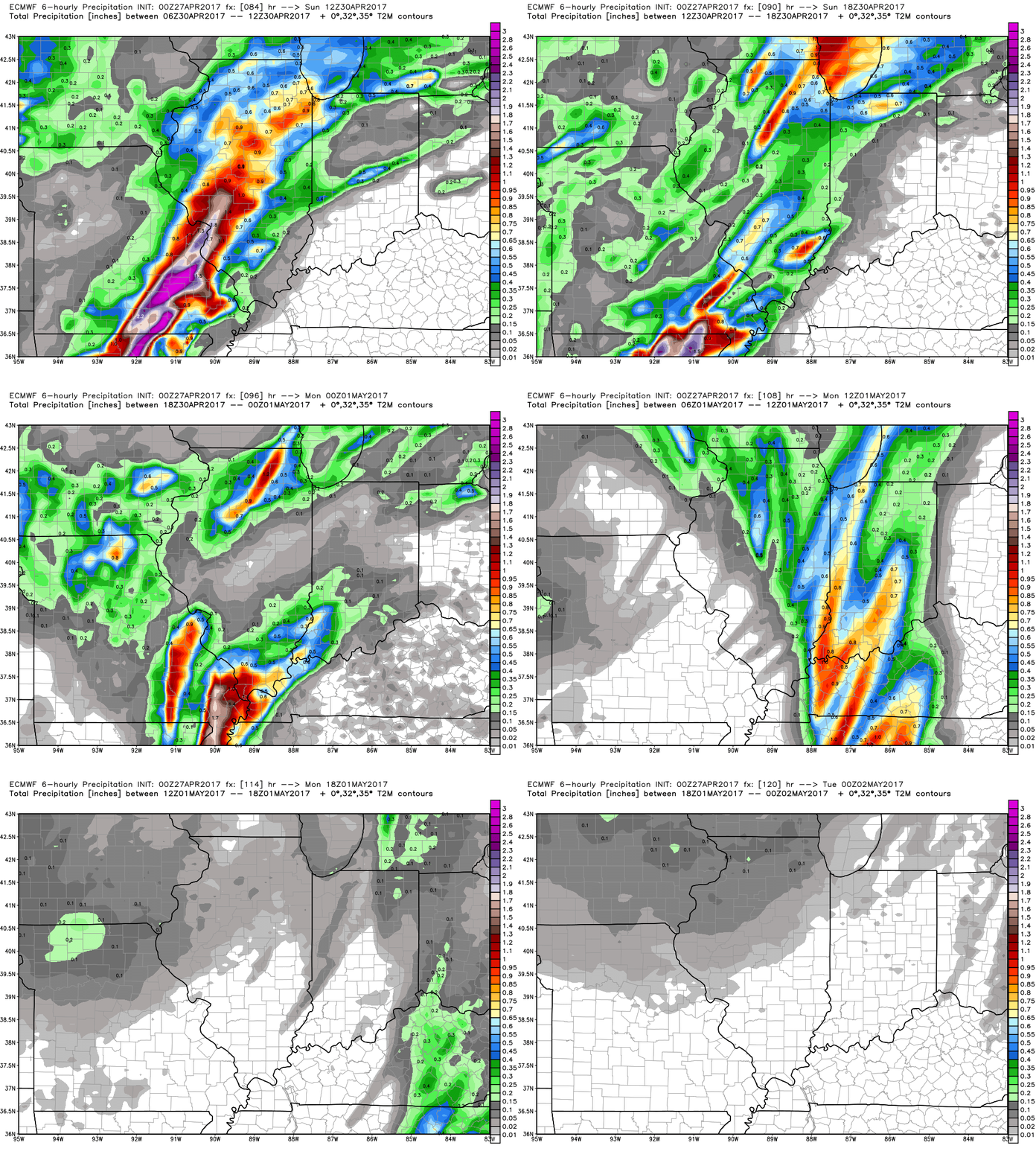
Warm front, heavy rains move in later Friday into Saturday morning…the question becomes how far north does the warm front come? Saturday afternoon into the overnight the storms continue to fire off of the warm front across the northern half of the forecast area.
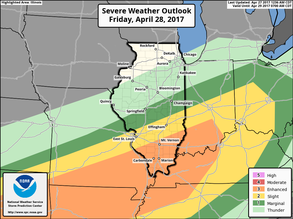
Strong to severe storm threat Friday night into Saturday along the warm front: large hail, damaging winds and an isolated tornado will be possible…also very heavy rainfall:
Waking up Sunday morning to very heavy rain across the Midwest, slowly the low pressure moves east with a trailing cold front. Watching for potential gusty storms as well along the front as the European data has picked up on all week.
Day 3 strong storm risk mainly in the form gusty winds and isolated hail.
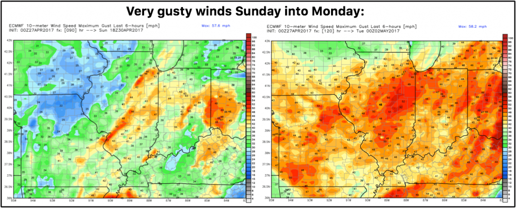
Very gusty winds along the cold front will be possible on Sunday, and then on the backside of the low pressure Monday we have very gusty winds as well upwards of 40mph+.
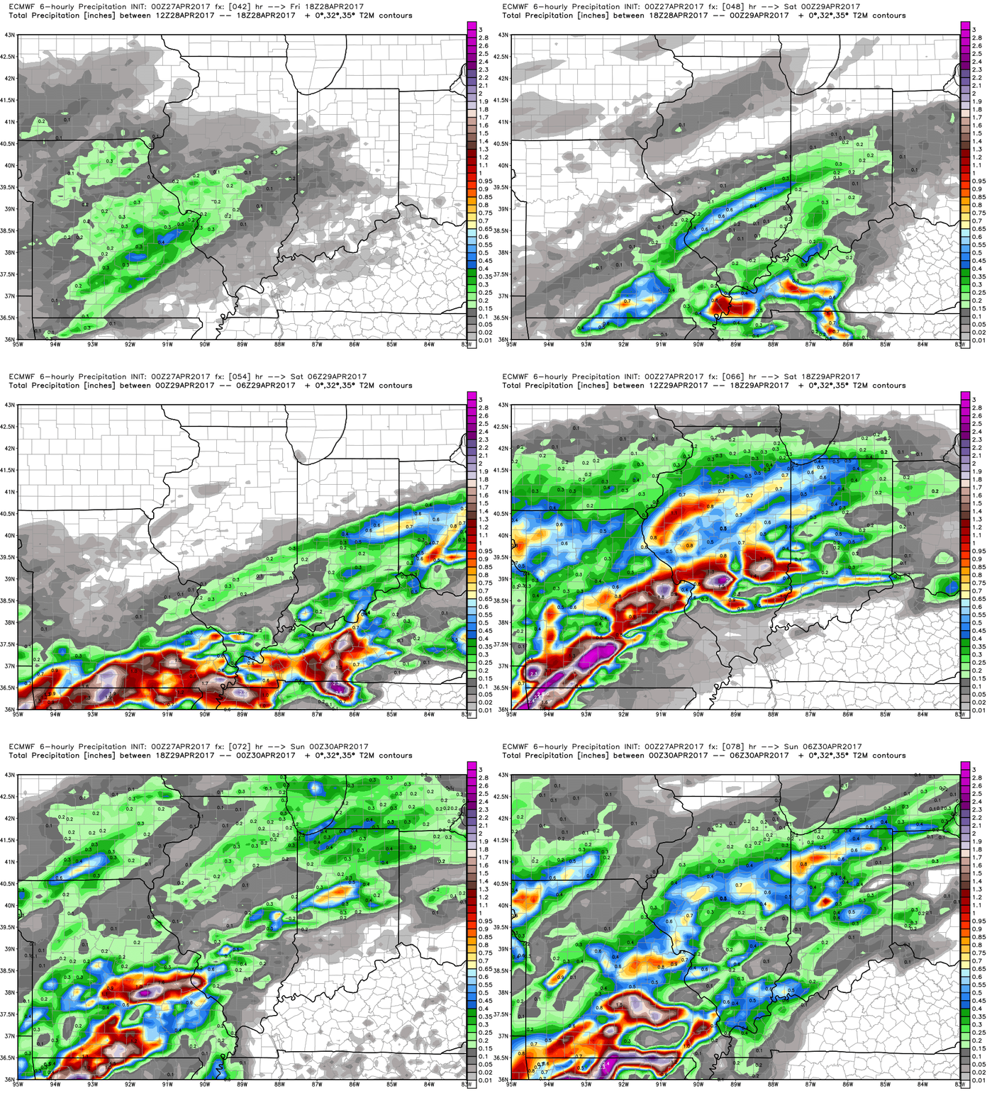
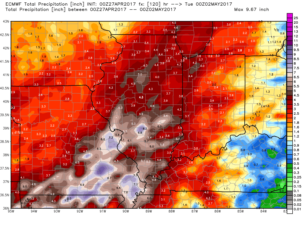
Total rainfall from the European over the next 5 days…still continues to suggest some very heavy rains working in across Illinois and the western half of Indiana.
A dry stretch works in with high pressure in control next week…which may allow for things to rebound a bit. But here’s the problem: temperatures start running cooler than normal getting into the week 2 forecast which certainly won’t help get rid of this heavy rainfall quickly.
Confidence and Risk:
- Above average confidence scattered showers and some storms move east across Indiana and Ohio throughout early afternoon being weakened east.
- Average confidence scattered showers and storms start to slowly lift into the Midwest on Friday with a scattered threat ~40% during the day.
- Average risk for excessive rainfall on Saturday along the warm front as it lifts north…the question still is how far north does it come?
- Above average risk for some strong storms along the warm front as well with all modes of severe possible.
- Above average confidence showers and storms move east across the cold front Sunday into Monday with some gusty winds possible as well.
- Average risk for cooler than normal temps getting into week 2.
Today’s video (8 min):
