Key Points – Monday, April 17, 2017:
Synopsis: Good Monday morning! We hope you all had a very nice Easter Weekend. It was certainly wet, especially for folks near the River yesterday that received 2-4″ of rainfall and flash flood. We do have some showers moving off to the east this morning that will push-off to the south and to the east. Clouds will linger this morning before burning off later this afternoon to a nice next couple of days. Below and in the video we also discuss possible severe storms Wednesday along with heavy rainfall, cooler temperatures coming and continued Plant ’17 concerns. Have a blessed week.
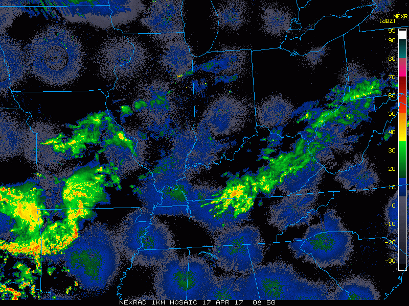
Current radar:
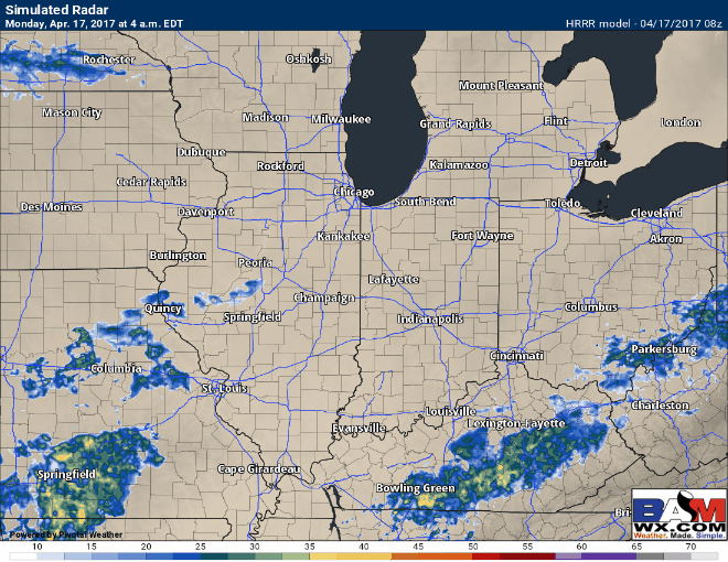
Simulated radar for the rest of the day via the HRRR…showers move off to the south and east today…some lingering showers near the River will be possible. Skies should start to clear throughout the day from west to east and some sunshine will be possible.
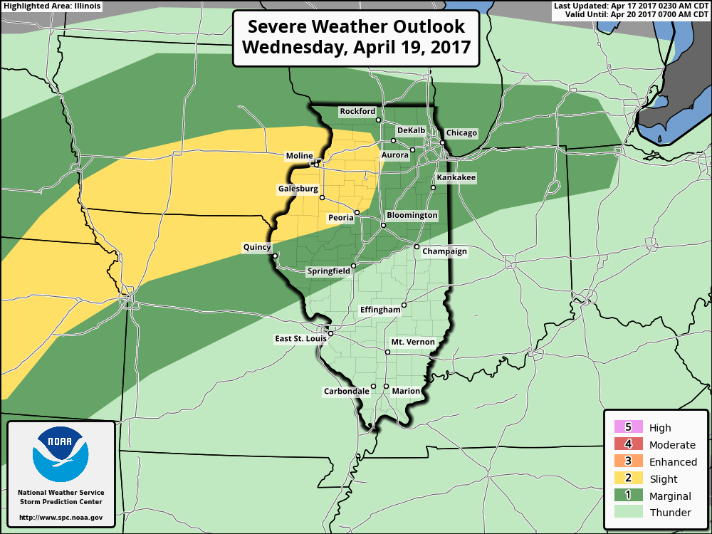
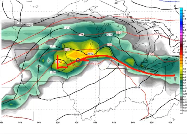
Day 3 slight risk for strong storms possible on Wednesday…we wouldn’t be shocked to see this threat expand and shift further east and north. Risks right now being isolated large hail and gusty winds…but also cannot rule out a couple isolated tornadoes for northern Illinois which is near the warm front.
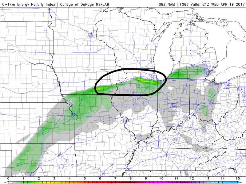
This is the area where we think there could be an enhanced risk for severe storms including tornadoes along the warm front. Watching this closely.
Warm front moving north Wednesday…north of this will be a risk for very heavy rainfall (can’t rule out some flash flooding from this) mainly focused across eastern Iowa to northern Illinois at this time. By Thursday morning the low pressure shifts further east that will introduce some additional storm chance.
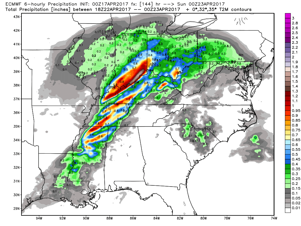
Total rainfall from this system…you can see the heaviest rains right now are across eastern Iowa and northern Illinois with totals over an inch possible..

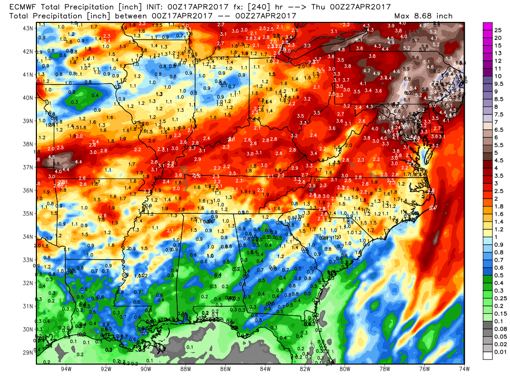
By next Saturday night we have another surface low moving through the Midwest in areas that have already been saturated.
Latest 10 day rainfall totals…the exact track of the heaviest rainfall needs to be fine-tuned and is not exact…confidence is on the lower end on this. BUT, we know we have heavier rains in the forecast, it’s a matter of fine-tuning exactly where.
Temps from normal in the 6-10…a risk for much below normal temperatures further south that what previous data has suggested.

Lastly, we discuss in the video how the Pacific jet extension continues over the next 10 days…if you’ve been watching the videos for a while, you know that this means our pattern will remain very active in the Ag Belt.

Confidence and Risk:
- Above average confidence skies begin to clear across the Midwest today, with scattered showers possible near the River.
- Above average confidence showers and storms increase in coverage on Wednesday into Thursday…heavy rainfall possible north as well with the warm front.
- Average risk for strong to severe storms on Wednesday…details need fine-tuned, but a few tornadoes near the warm front will be possible.
- Increasing confidence of another low pressure moving into the Midwest Saturday into Sunday that has potential for additional heavy rainfall where we’ve been saturated.
- Average to above average confidence some cooler than normal anomalies possible in the 6-10 day timeframe.
Today’s video (8 min):