Key Points – Tuesday, April 18, 2017:
Synopsis: Good Tuesday morning! Mostly sunny skies expected today, we get in on some rain and storms this week for sure. Warmth overspreads the area today into Thursday, even some 80s by Wednesday! We have a warm front that lifts north on Wednesday that could spawn some strong storms to the north and west, and then a cold front swings through on Thursday that will bring some gusty storms and potential heavy rains as well. We also discuss a weekend system that will be moving from west to east that will bring some additional rainfall mainly to folks I-70 south. Have a terrific Tuesday!
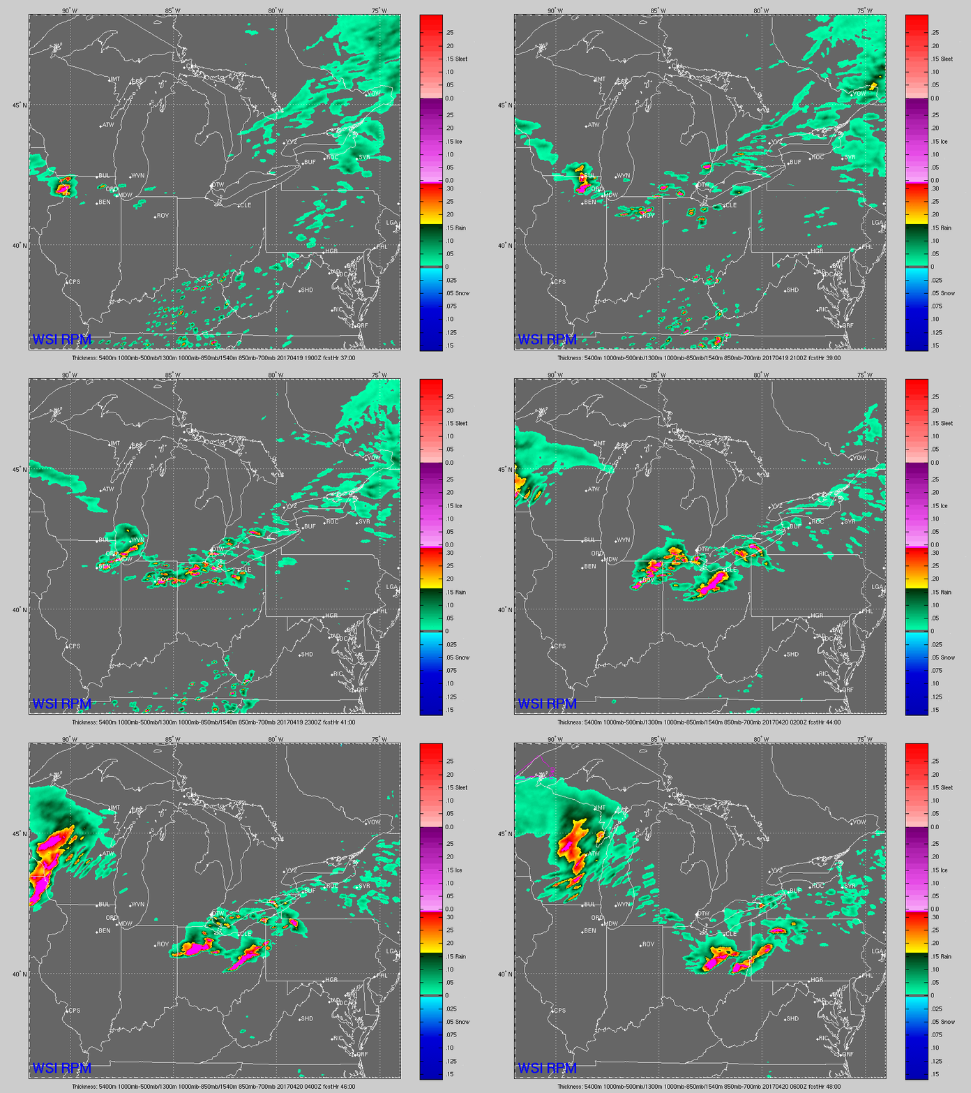
Simulated radar for Wednesday…a cold front turns into a warm front here that could bring some heavy rains and gusty storms via the RPM. However, data continues to differ (as seen below) on this solution so confidence is still lower on the exact set-up.
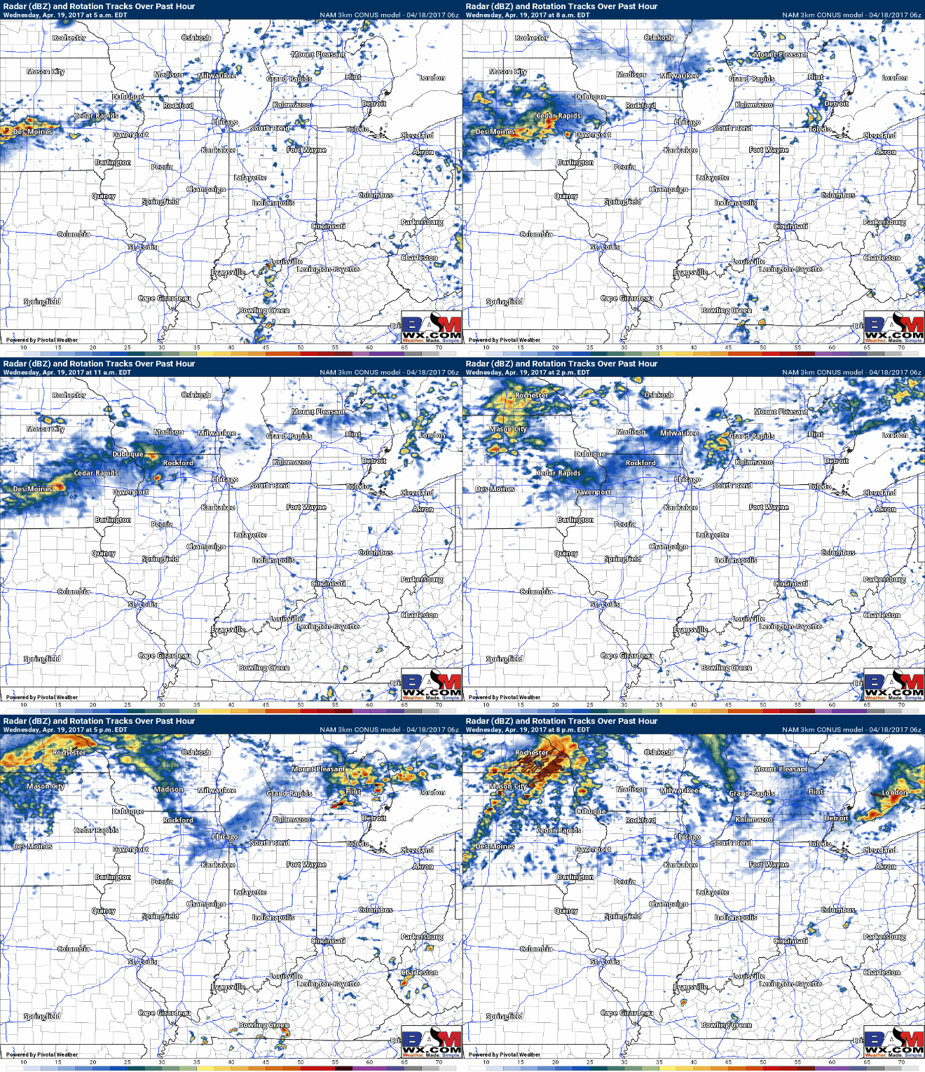
Here’s the solution from the NAM-3km that’s slightly different not bringing those heavy storms to northern IN into NW Ohio, but rather keeping them across eastern Iowa into northern Illinois on Wednesday. We will see what the morning and afternoon data come in with and update you all accordingly.
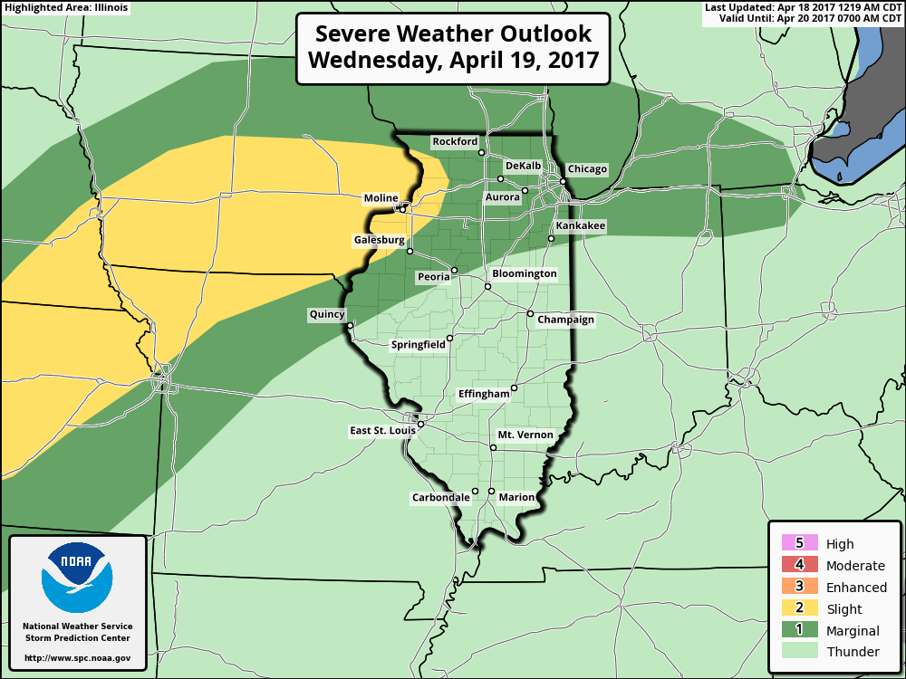
Current risk for strong to severe storms on Wednesday…we will still think there is a chance for isolated tornadoes along the warm front across eastern Iowa and NW Illinois, along with isolated large hail and gusty winds. We also still have suspicions that the threat could shift further east across northern Illinois into Northwest Indiana.
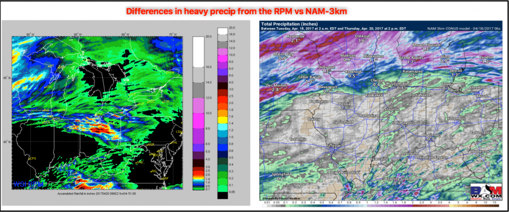
Rainfall totals from Wednesday (RPM vs NAM-3km), you can see the differences in the data here as well with the RPM bringing heavier rainfall to NE IN and northern OH, meanwhile the NAM-3km keeps the heavy rains to the north and the west. I’d say right now confidence is higher with the NAM-3km, but we can’t totally rule out the solution via the RPM.
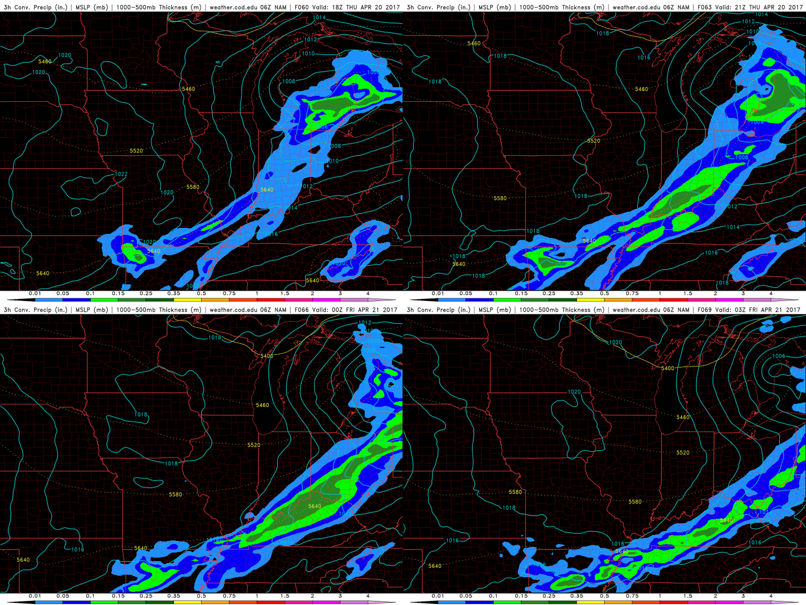
Cold front swings through Thursday into Thursday night that could bring some gusty storms even some heavy rainfall across the southern and eastern Midwest locations. There’s a slight chance that this may stall out or slow down (which would bring heavier rains near the River), but confidence is lower on this solution.
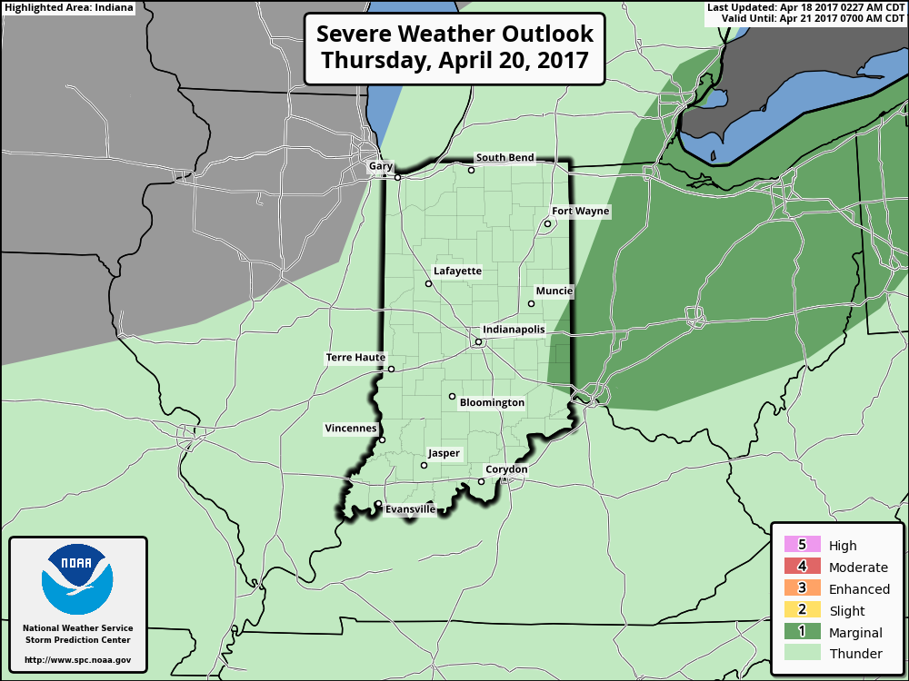
Thursday risk for strong/gusty storms and heavy rainfall across eastern Indiana into western Ohio. If the cold front develops further north and we get some daytime heating…could see this threat shift further west.
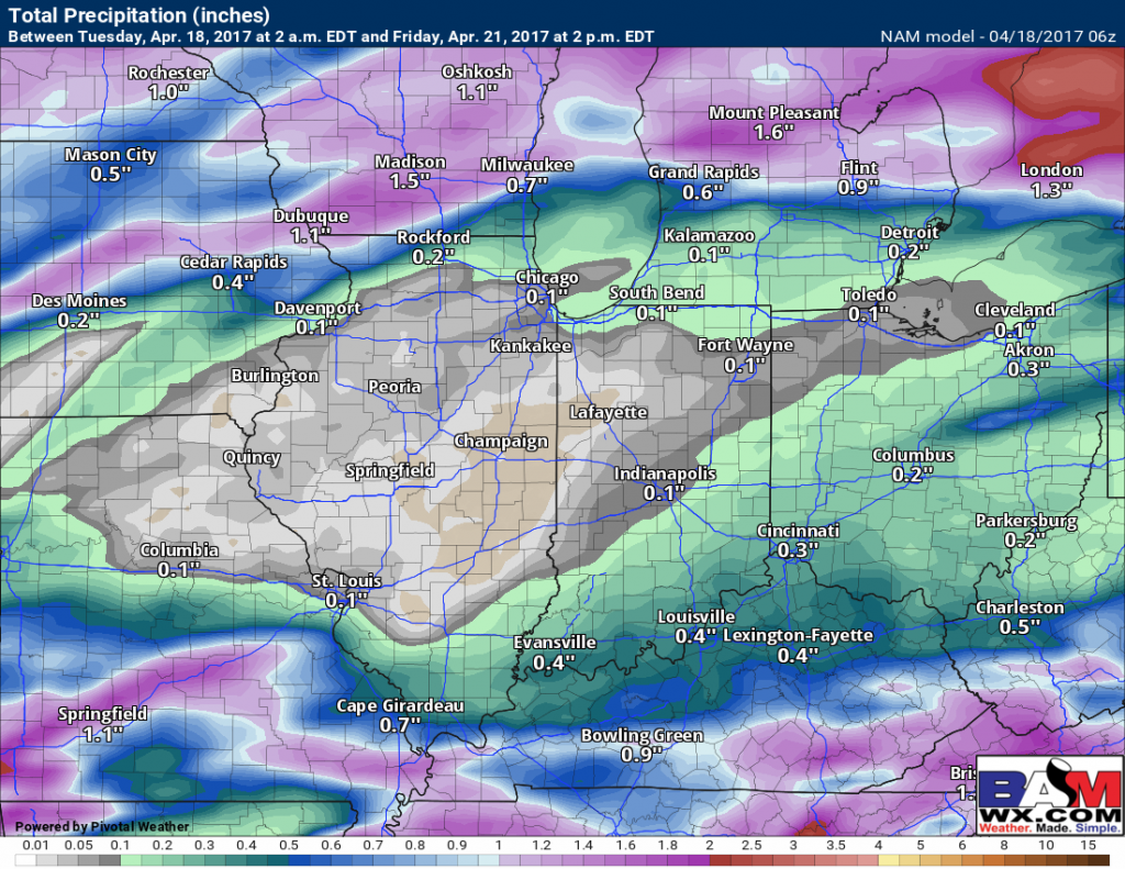
Total rainfall via the NAM…we need to watch to see if things stall out which could intensify heavier rains…but overall not a lot of rainfall associated with these disturbances at this time except for eastern Iowa into northern Illinois.
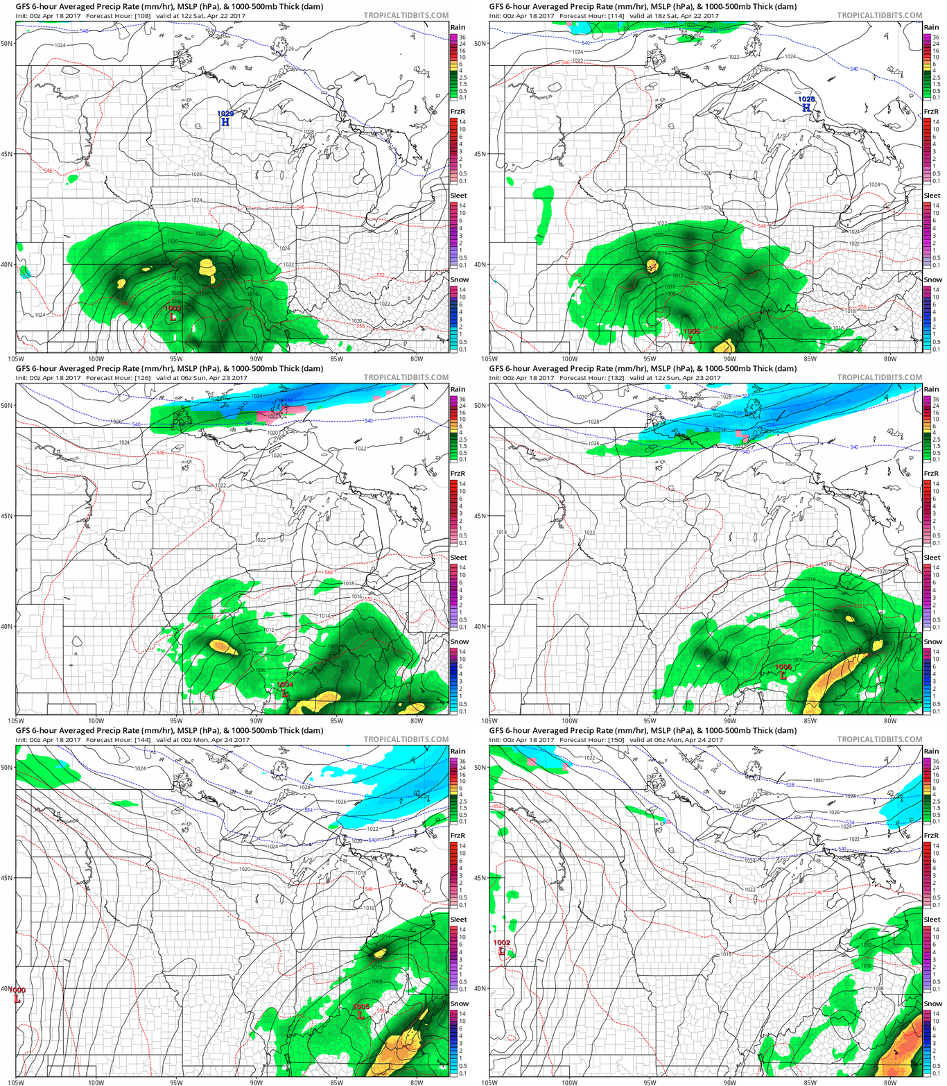
We have another system moving through this weekend from west to east that will bring some rainfall mainly to I-70 south Saturday through the first half of Sunday via the latest GFS.
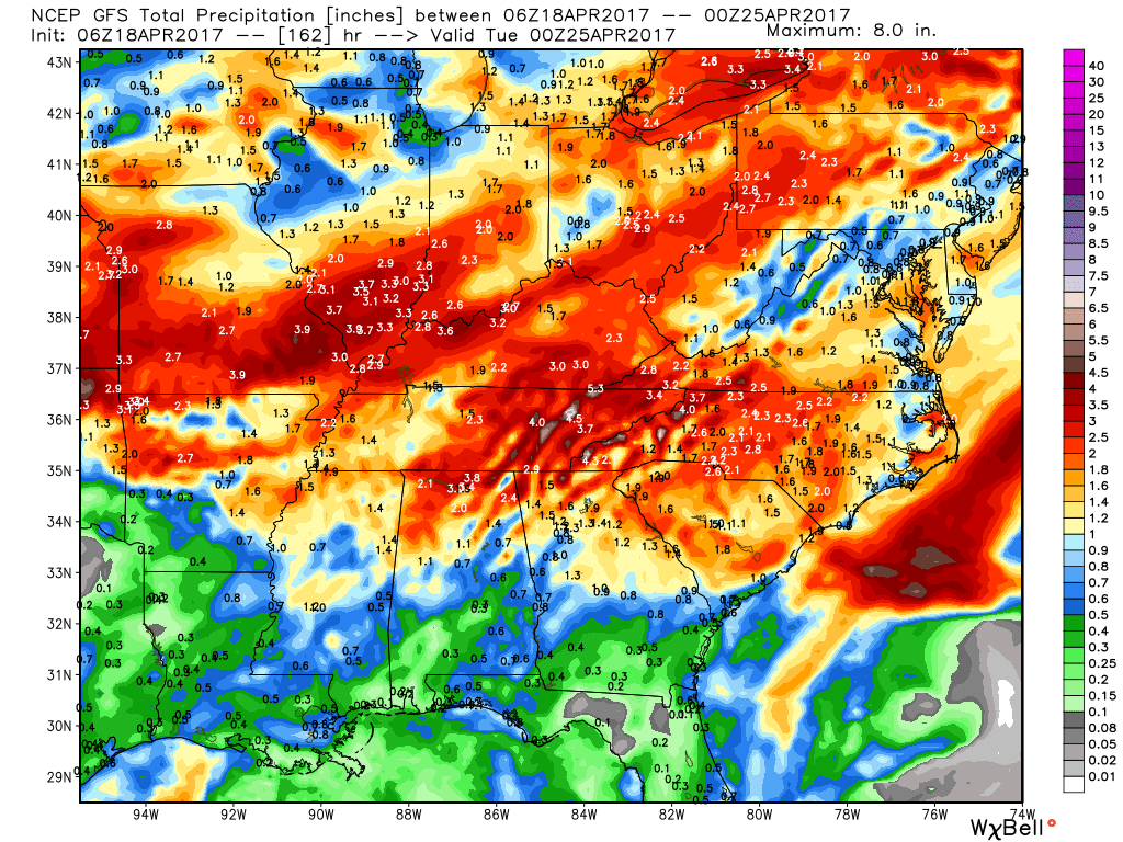
Latest 7 day rainfall totals via the GFS suggests heavier rains possible I-70 south over the next week, so continued saturated fields throughout portions of the Midwest remain possible.
Confidence and Risk:
- Above average confidence we see plentiful sunshine and temps in the 70s today across the Midwest.
- Above average confidence a warm front lifts north later Tuesday into Wednesday across the Midwest that will bring a chance for showers and storms.
- Average risk still for strong to severe storms on Wednesday along the warm front.
- Below average confidence on where the heaviest rains set up as there still is big differences between hi-resolution model data (RPM vs NAM-3km).
- Above average confidence additional gusty storms possible on Thursday as a cold front swings through.
- Above average risk for strong storms here given the differences in the data at this time.
- Average confidence on the details of the weekend system, but all global models are picking up on a disturbance moving through from west to east.
Today’s video (8 min):
