Key Points – Tuesday, April 4, 2017:
Synopsis: We highly encourage folks to pay close attention to today’s video as it’s packed with details spanning from strong to severe storms Wednesday, very gusty winds, a chance for a wintry mix on Thursday, heavy rains and a big weekend warm-up. New European Weeklies are in and continue the wet and active theme through all of April across the Midwest and Ag Belt.
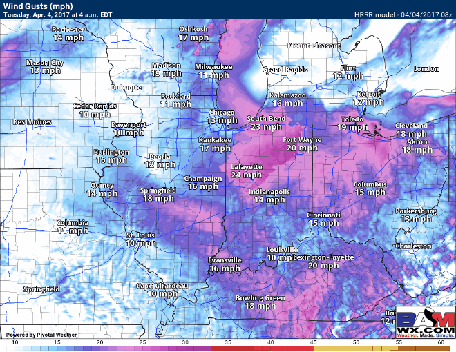
A few showers and some drizzle lingering across the Midwest today, meanwhile Indiana, southern Michigan into Western Ohio stay windy today with winds out of the west to west-northwest gusting upwards of 25-30mph at times.
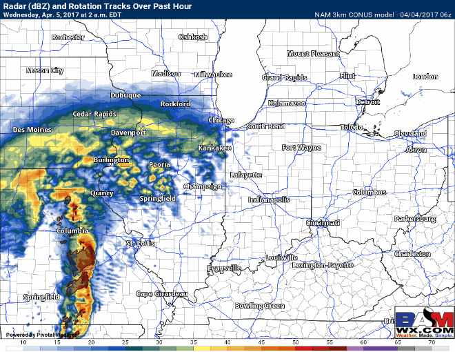
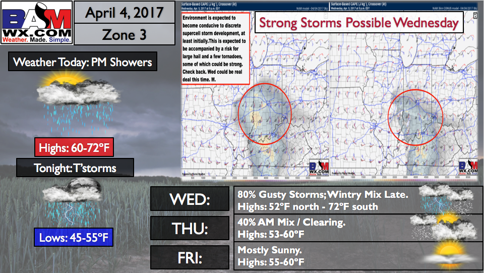
The main story begins on Wednesday with a very robust low pressure system tracking through the Midwest. Models are coming much further north and west with the warm front which would shift the severe threat further off to the west ~200 miles as well. ALL MODES of severe weather (including even a few strong tornadoes) will be possible Wednesday given the set-up, it has our fullest attention. We wouldn’t be shocked to see this upgraded to a Moderate Risk for severe storms later today or by tomorrow. All the details on timing are in the video.
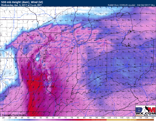
Very impressive mid-level jet stream that exits right over the Ohio Valley on Wednesday which helps increase lift for these storms to rise and potential to become strong to severe.
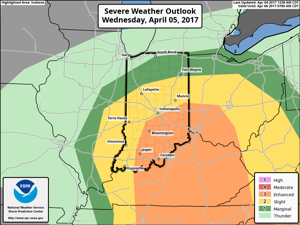
Our Risk area for severe storms including large hail, damaging and a few tornadoes…some may which be strong. It should be noted though that we still have low confidence on how the severe weather threat will evolve given some differences in the data still…so we highly encourage folks to check back often.
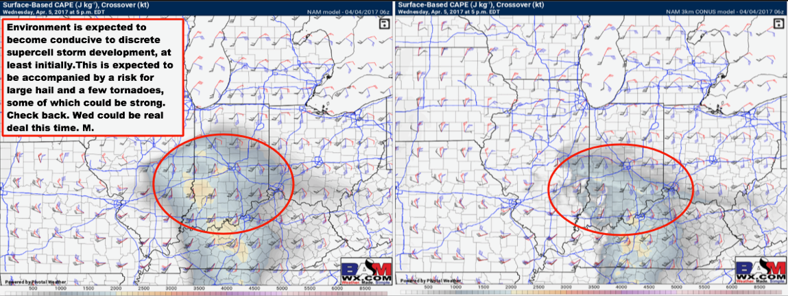
Here’s where the SPC has the slight to enhanced risk placed as of right now. We mentioned above we wouldn’t be shocked to see this upgraded to a Moderate risk and be shifted ~200 miles west given the set-up.
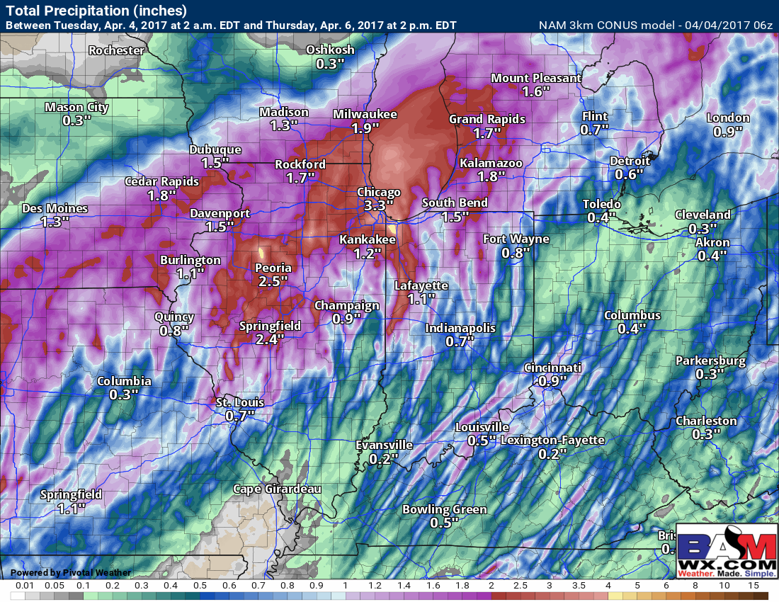
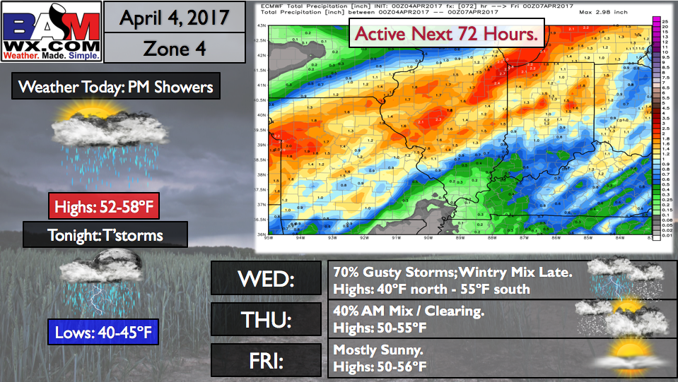
Heavy rainfall will be possible with these showers and storms as well on Wednesday in excess of 1-2″+. Our confidence is slightly below average on the placement of the heaviest of rains as there certainly could be isolated 3″+ amounts in the heavier storms.
The inclement weather doesn’t stop on Wednesday, as the strong winds and cold air on the backside of this low pressure system will mix in some wintry precipitation late Wednesday into the day on Thursday from west to east.
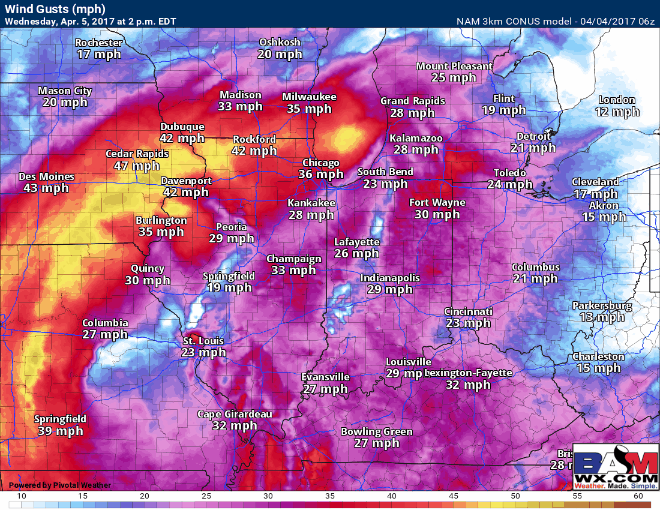
We are very windy on later Wednesday into day on Thursday as well with winds out of the northwest gusting in excess of 45mph at times…wouldn’t be shocked to see a wind advisory issued with this.
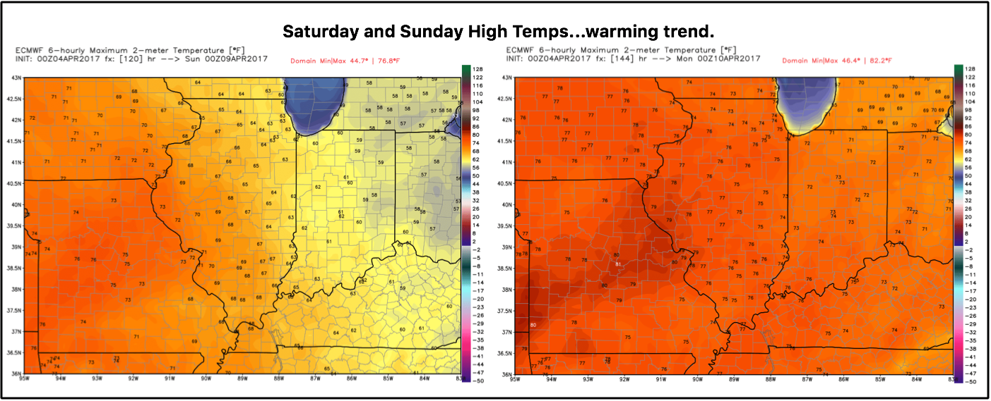
We warm back up this weekend with highs in the 60s and widespread 70s by Sunday with plenty of sunshine working in.
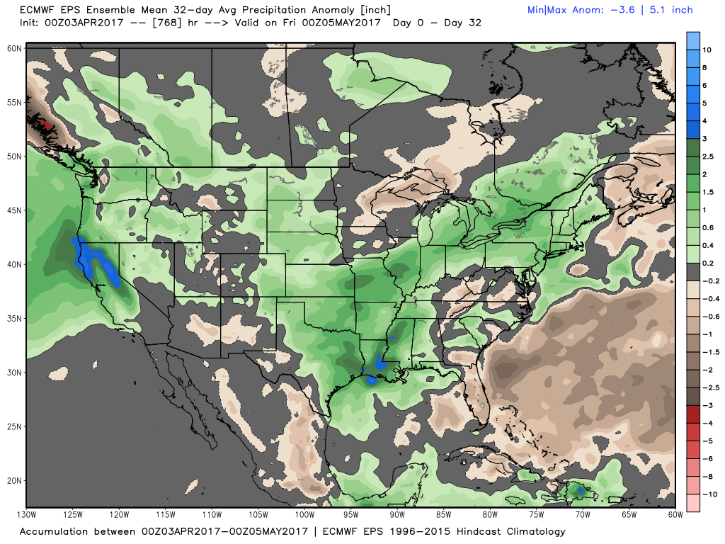
New European Weeklies continues the active theme through all of April, it’s hard telling when this active pattern will shut off for the Midwest and Ag Belt.
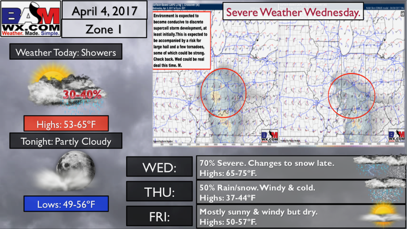
Zone 1 Quickcast:
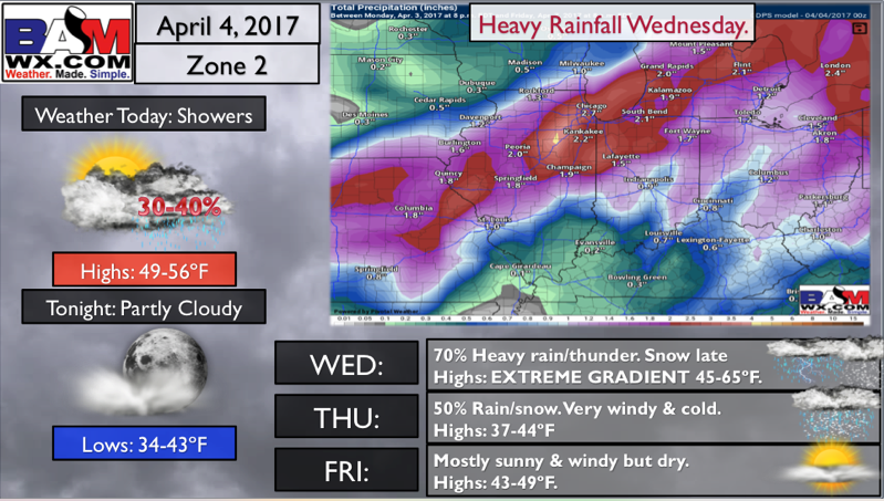
Zone 2 Quickcast:
Zone 3 Quickcast:
Zone 4 Quickcast:
Confidence and Risk:
- High confidence showers and storms work into the Midwest on Wednesday.
- Above average risk on how the severe weather might evolve on Wednesday.
- Above average confidence some heavy rainfall in excess 0f 1-2″ will be possible with this event.
- Increasing confidence some wintry precipitation will be mixing in on the backside of the low late Wednesday into Thursday.
- Above average confidence of 60s/70s this weekend and some sunshine across the Midwest.
Today’s video (8 min):