Key Points – Thursday, March 9, 2017:
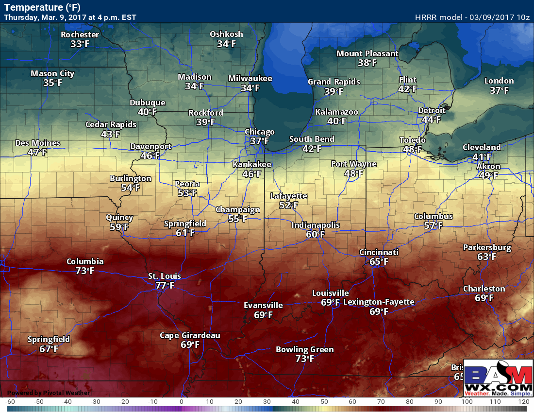
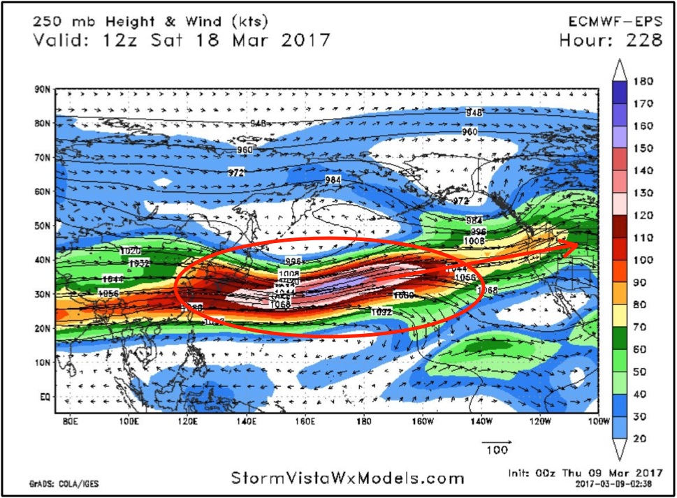
Synopsis: Good Thursday morning and thanks for checking out the latest forecast update! A stationary front hangs around I-70 today, keeping temperatures in the 40s/50s to the north and mainly 60s (even a few 70s) to the south…clouds will be increasing throughout the day as well. We continue to watch for a wave of energy to move west to east overnight bringing a chance for rain showers…as temperatures get colder overnight, a changeover to wintry precipitation will be possible as the wave crosses closer to the IN/OH border. We discuss our latest thoughts on the weekend wintry weather (or lack there-of?) and the cooler pattern settling in over the next week. With that being said, we continue to target a big warm-up mid-month to settle back in as we see the pacific jet ramp back up and the response to the major ridging in the North Pacific.
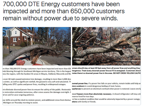
Here’s an interesting story we thought we’d share first from DTE Energy, 700,000 customers were impacted by the high winds yesterday in southeast Michigan, with 670,000 customers still without power…pretty incredible for non-thunderstorm type winds.
A stationary front keeps things cooler in the 40s/50s to the north of I-70 today with largely 60s and even 70s to the south. Enjoy the warmth today, our colder period sets back in Friday.
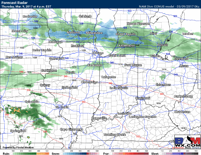
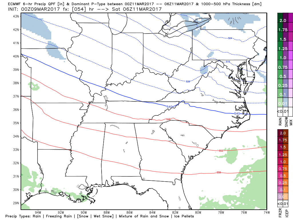
Watching a disturbance move through overnight that will initially bring rain showers from west to east…as we trend colder overnight some wintry precipitation mixing in to even snow showers getting closer to the IN/OH border.
A few slick spots possible in this area as temperatures plummet overnight into the upper 20s and lower 30s.
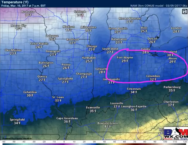
In terms of any type of accumulation…most of the Zones stay accumulation-free, folks further east getting more into west/central OH may see slight accumulations…something we will watch and update on later this afternoon in our short-term.
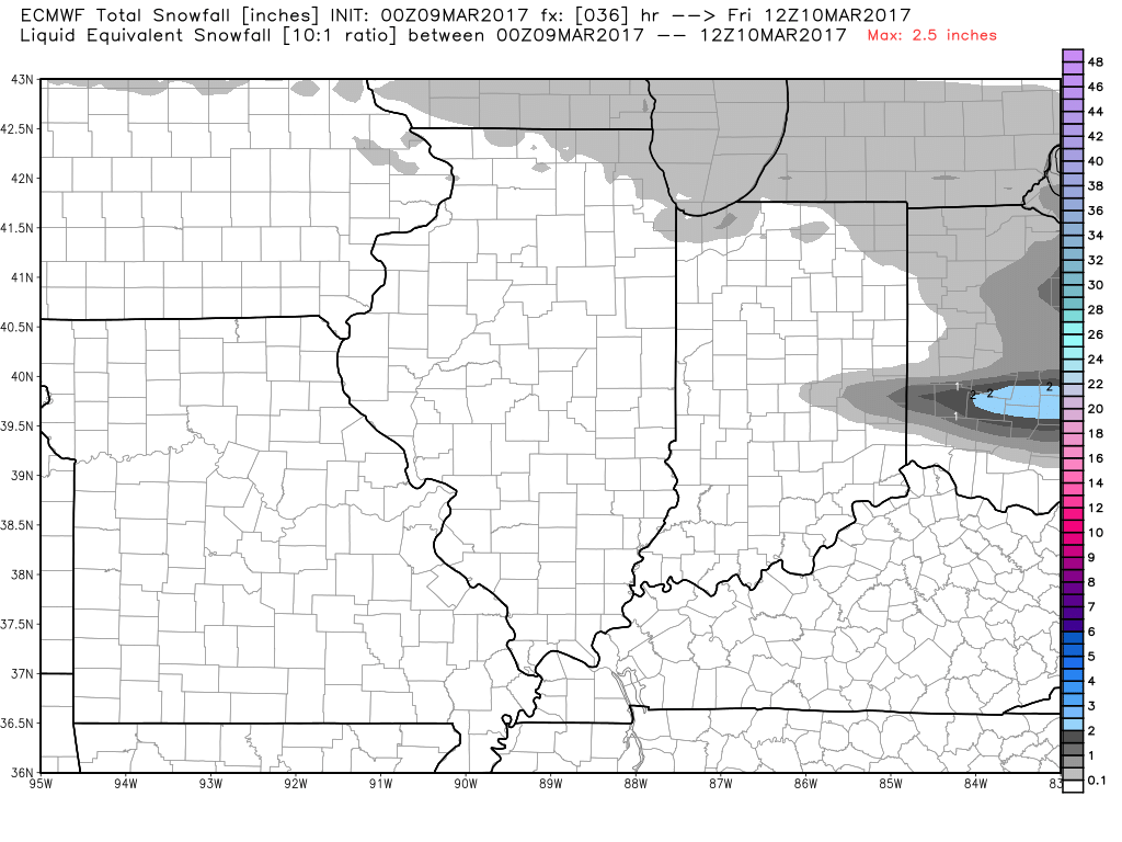
Our data continues to shift the bulk of the snow this weekend to the south out of the Zones…folks near the Ohio River could potentially see small accumulations…we discuss the risks in the video.
A colder pattern settle’s in over the next week throughout the Midwest as we’ve been discussing would occur over the past 2-3 weeks before we warm back up again.
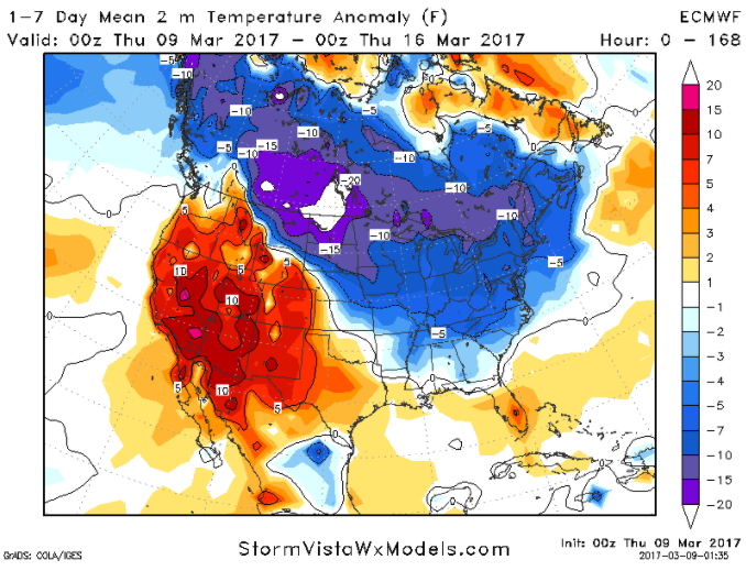
With this being said, we are expecting mid-to-late March to see a return of warmth as the Pacific jet ramps back up and we see the response to the major ridging in the North Pacific.
Confidence and Risk:
- High confidence we see another mild day across the Zones especially south of I-70.
- Above average confidence of a small disturbance moving west to east overnight that will bring initially some rain showers, then a little frozen precipitation mixing in overnight near the IN/OH border.
- Above average confidence we see below normal temperatures over the next week starting Friday.
- Above average confidence Saturday’s wintry weather event stays largely a non-even for most of the Midwest, with the exception of folks near the Ohio River who could still see small accumulations at this time.
Today’s video (6 min):