#ILwx #INwx #IAwx #MNwx #WIwx Strong storms possible overnight. K.
Synopsis: Today’s video discusses the strong storm risk over the next 24-36 hours from the central Plains to the Midwest. Data still has a poor handle on how things exactly shake out tonight in regards to how far east these storms will carry on. One thing’s for sure, we would recommend keeping your severe weather alerts turned on across the northern Midwest overnight.
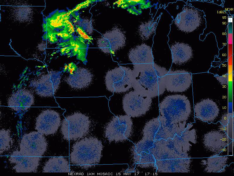
Current Radar:
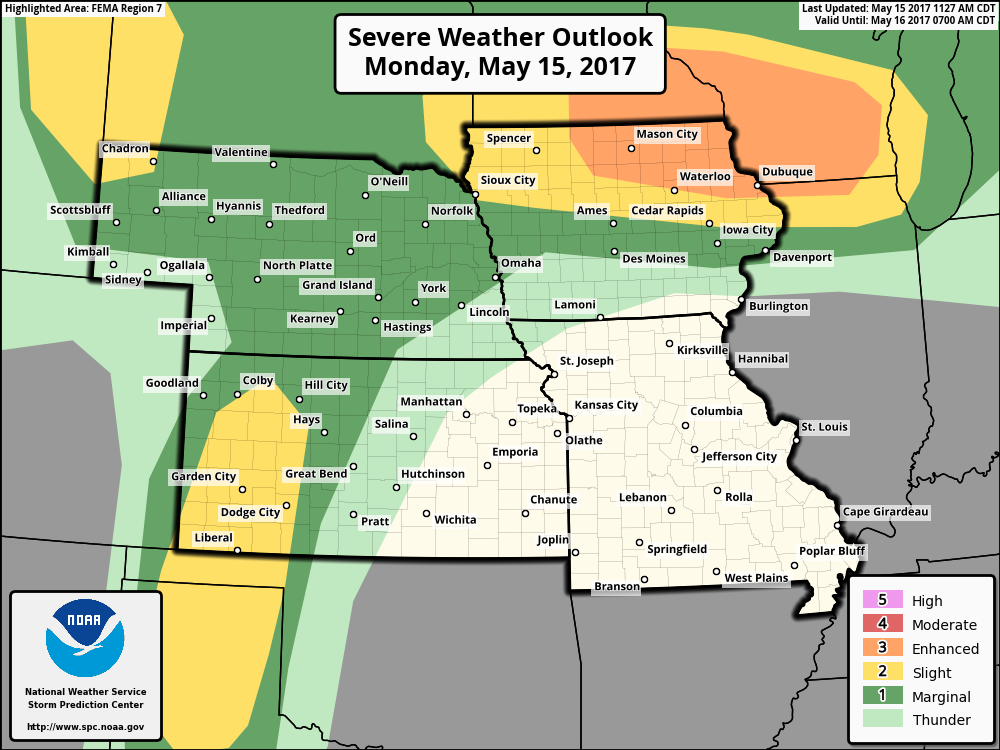
Current Day 1 Risk…we mentioned this morning how we wanted to see the risk shifted further east to include southern Wisconsin and northern Illinois and that’s what we have here. The risk is generally for damaging winds and large hail, but an isolated tornado along the warm front near southern MN, southern WI and northern IA cannot be ruled out.
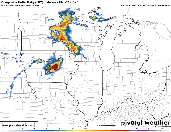
Simulated radar from the NSSL-WRF model which has the best handle on things currently. There will be 2 rounds of storms across the central Plains to the Midwest overnight…on the flip-side, locations in central IL east through Indiana and Ohio most likely won’t see a drop a rain from this.
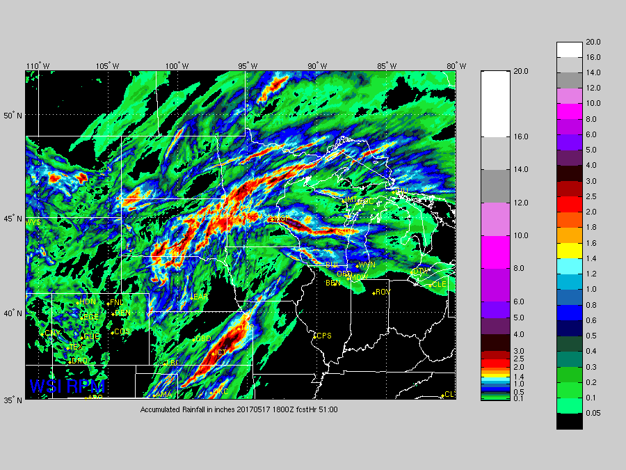
Total rainfall over the next 2 days from the RPM…isolated 2″+ amounts will be possible from the central/northern Plains, but there is a large area that also doesn’t see any rain from Illinois, Indiana into Ohio.
Confidence and Risk:
- Above average risk to the exact track the storms take overnight from west to east.
- Average confidence strong storms will be possible across the central to northern Plains into Tuesday morning.
- Above average confidence some locations across Illinois, Indiana and Ohio won’t see a drop of rain from this as well given the energy will be mostly north.
Today’s video (5 min):