#ILwx Active Pattern With Severe Threat Next Few Days, Warmer Into Next Week and Beyond. E.
Key Points: May 9, 2017
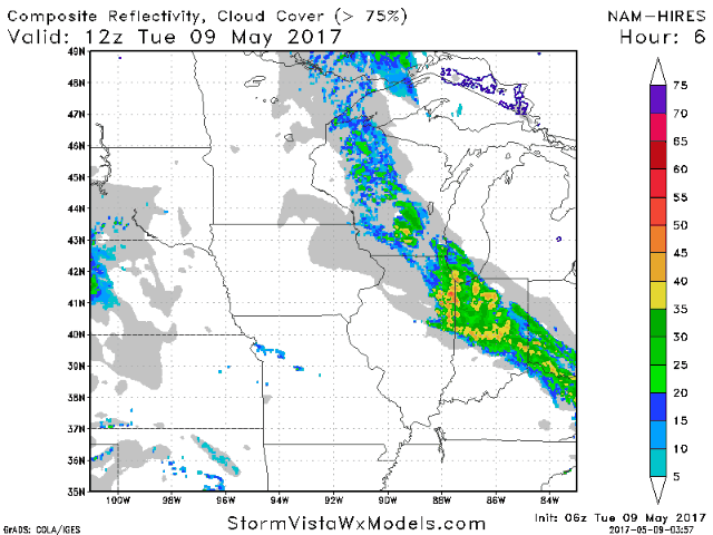
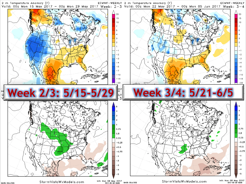
Synopsis: Good Tuesday morning! We are tracking a cluster of storms tracking across northern Illinois bringing heavy rain and even some thunder. This complex will move southeastward through the morning leaving the region dry with some sunshine. Unfortunately, the active times look to continue through much of the week as a slow moving front lingers across the region. More showers and heavy thunderstorms will move through the region tomorrow along the front, leading to an isolated flooding threat along with some hail as well. We talked yesterday about how the speed and location of the front will be key to mid-to-late week rains and latest data is actually a bit further north. This would imply more showers and thunderstorms further north across the state through Thursday night before things push south and east. I’ll also touch on the new Euro weeklies that were released last night – this data takes us into June! Have a great day!
- Current radar shows the complex of storms moving through northern portions of the state.
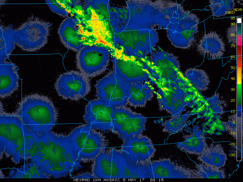
- Moving through today, storms will quickly push east leaving most dry. However, notice the NAM model tries to develop some storms this evening and overnight along an outflow boundary across central and southern Illinois. I’ll touch on this more in the video!
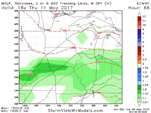
- As a cold front slowly moves toward the region, more rain and storms are expected Wednesday into Thursday, some of which will be strong to severe with gusty winds, torrential rain, and hail.
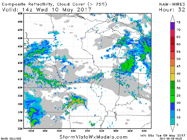
- The SPC has highlighted much of Illinois in their day 2 marginal severe threat because of of the approaching front – more on this in the video.
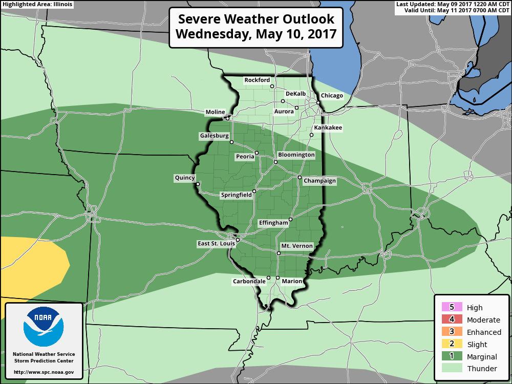
- As the front slows across Illinois Thursday, additional showers and storms are expected. Some may be severe once again, especially south of I-70. Conditions slowly improve Friday and into the weekend.
- Total rainfall will be dependent on whether your exact location gets under a persistent storm. If so, some will see 2-4″ of rainfall while some may not even see 0.50″!
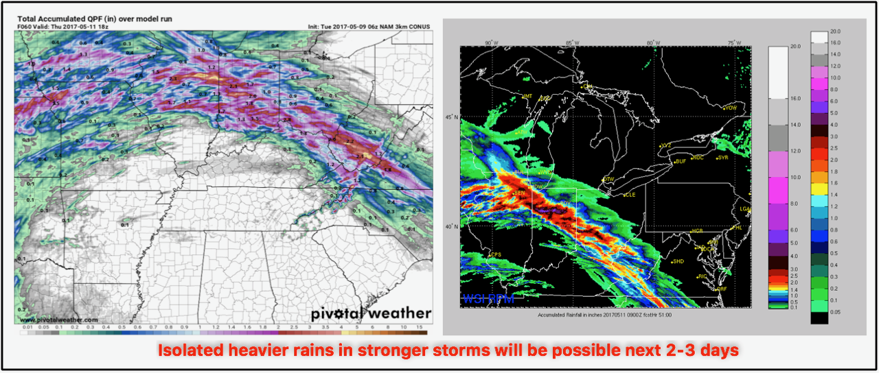
- Rainfall through the weekend will likely be a bit more uniform, but still heavily dependent on whether you see a stronger storm or not.
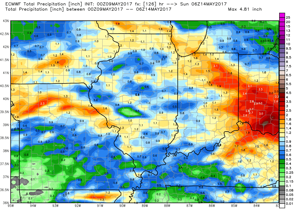
- Briefly looking into the longer range, the data continues to look wetter and warmer as we move into the end of May and into the beginning of June.
Confidence and Risks:
- Above average confidence in a very active week with severe weather possible.
- Above average confidence in locally heavy rains this week, but it will be very dependent on exact storm placement for heaviest rains.
- Increasing confidence on a drier and warmer weekend coming up.
- Increasing confidence on a warmer, wetter pattern persisting through May and even into the very start of June.
Today’s Video (7 minutes):