#IAwx Short-term update on severe storms today #AGwx
Synopsis: Good Wednesday morning, this is a special update in terms of the threat developing tonight across Iowa. Rain continues to push east, but we do think some clearing develops later today which would help increase the chances for strong to severe storms. The threats remain the same as this morning: large hail, damaging winds, localized heavy rains and even a strong tornado cannot be ruled out.
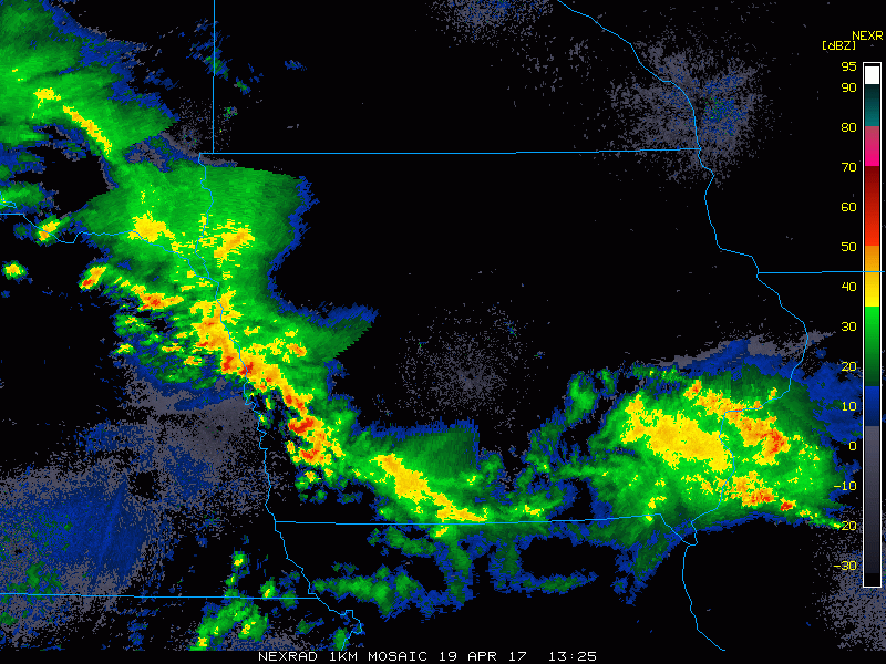
Current radar:
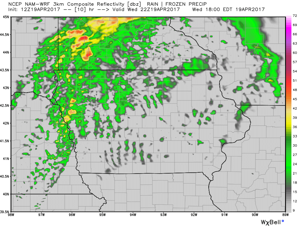
Simulated Radar…watching storms to fire up around 5-10pm. The main tornado threat occurs when these storms start out as discrete (supercells) earlier on before they congeal more into clusters and lines.
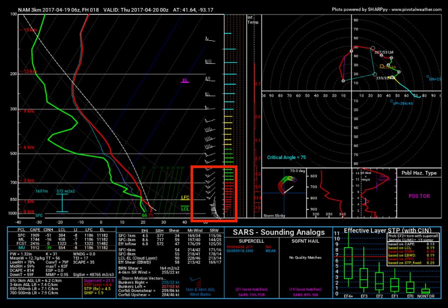
When you get veering or turning of winds from the surface up throughout the atmosphere from the southeast to the southwest, we look for storms being able to rotate as seen below.
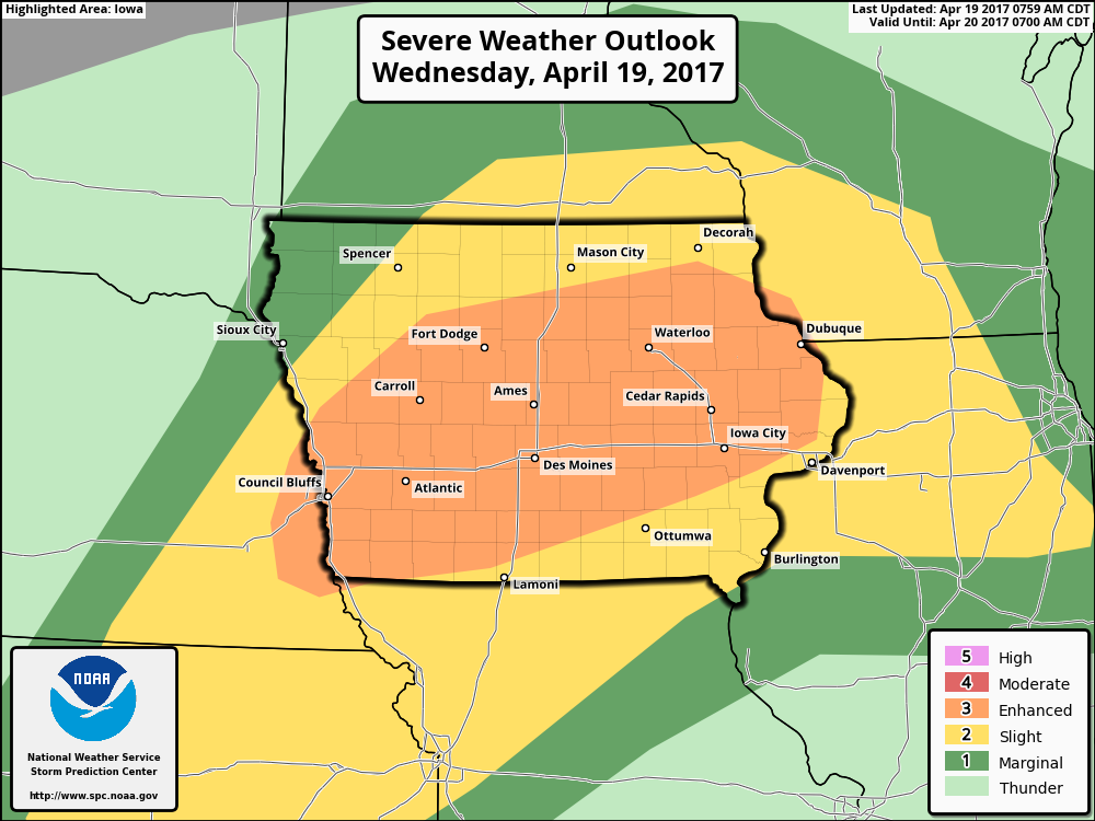
Latest risk area…overall we agree with the placement of where the strongest threat is for severe storms. As mentioned above, damaging winds, large hail and isolated tornadoes are possible (some even being strong are not out of the question).
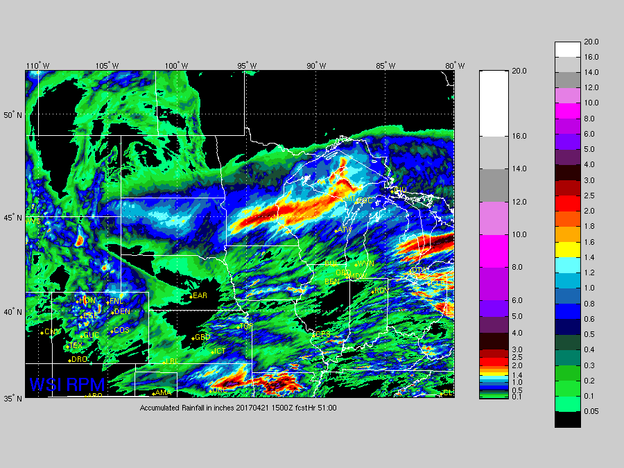
Total rainfall…not a widespread rainmaker, but folks who get underneath a strong storm could see rains over 1.0″+.
Today’s video (6 min):