#IAwx #NEwx #KSwx #MOwx Multiple Storm Chances This Week, Heat Continues. E.
Key Points: June 13th, 2017
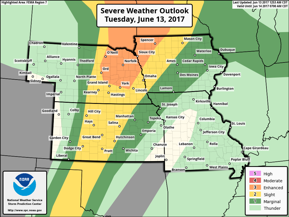
Synopsis: Good Tuesday morning! We are tracking an area of low pressure to our north this morning which will bring a severe risk to eastern Nebraska, central Kansas, and Iowa this afternoon and evening. These storms will bring gusty winds, hail, torrential rains, and even an isolated tornado. Additional storms are expected across Iowa, Missouri, and Kansas Wednesday as a boundary moves south and east across the region. Temperatures continue to look hot across the region through the end of the week, but more active conditions are expected with numerous rainfall chances, especially across Iowa and Missouri. Have a blessed day!
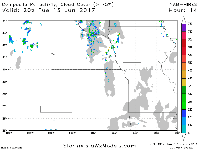
- Current radar is quiet across the region, but a complex of storms is pushing through the Dakotas.
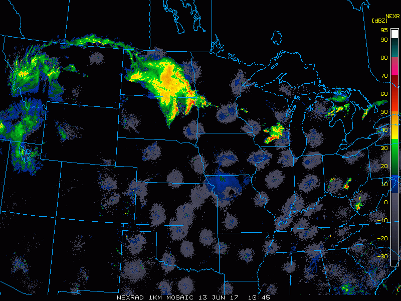
- This large low pressure system will combine with the heating of the day and spark severe weather across Nebraska and Kansas, then push east.
- The SPC has outlined portions of the region for severe weather as discussed above.
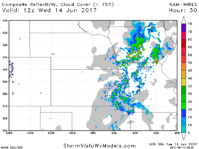
- The boundary will push east tomorrow into tomorrow night with additional storms in Iowa, Missouri, and Kansas.
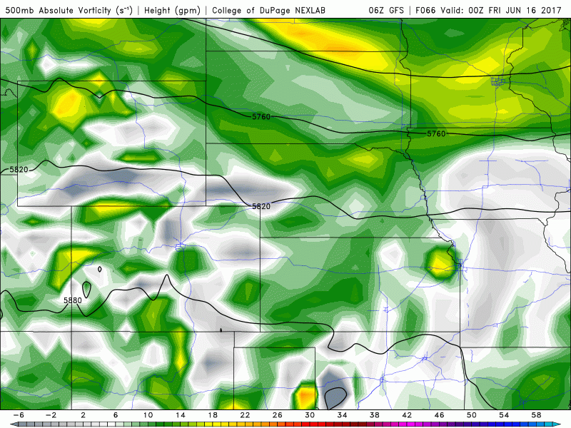
- Additional storms are possible Thursday night and Friday night across the eastern portion of the zone which is discussed in the video thanks to energy moving through.
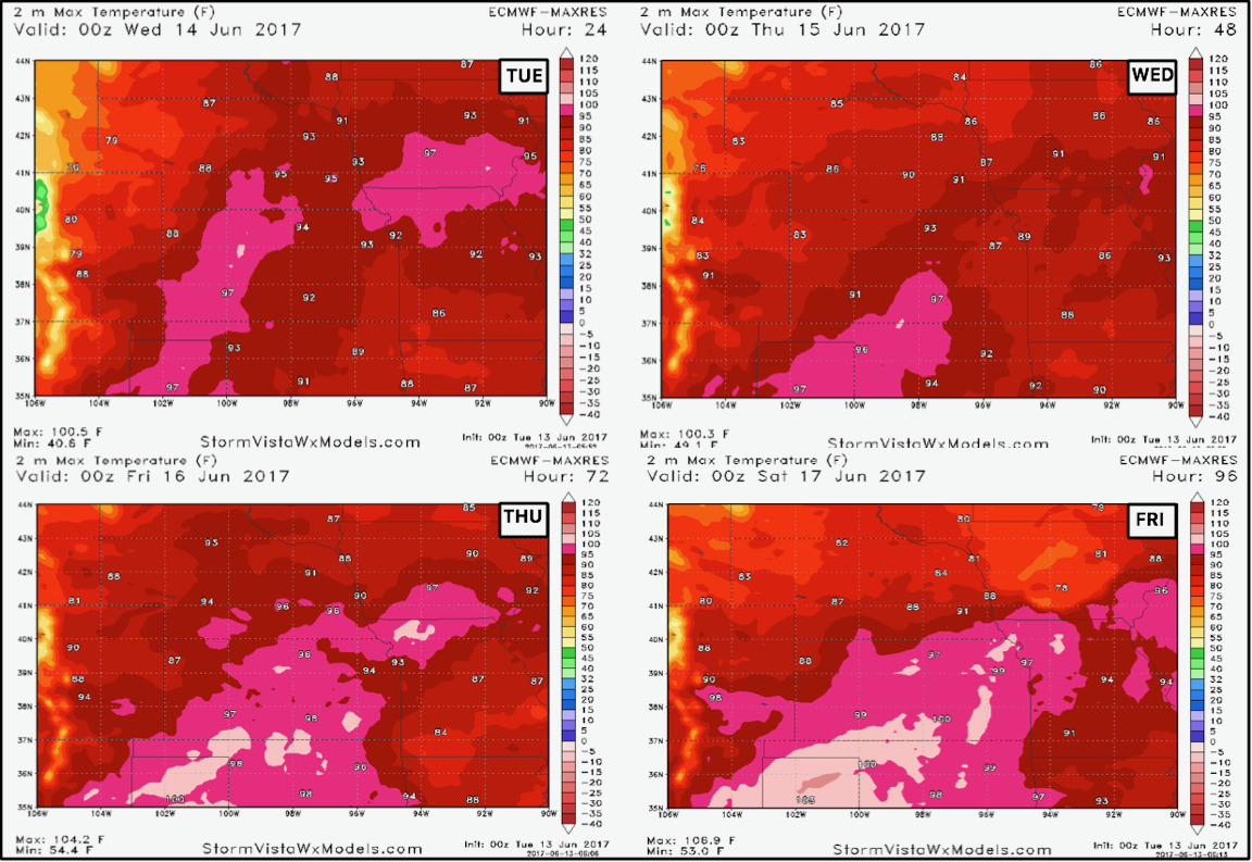
- Temperatures look to remain hot through the end of the week even with those storm chances.
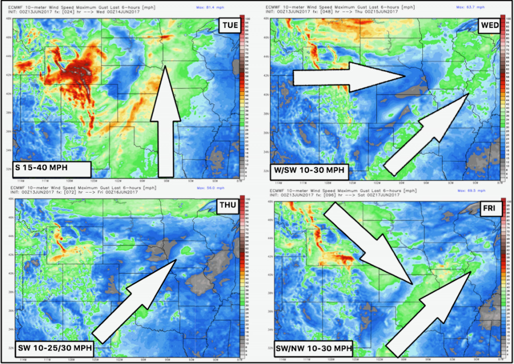
- Winds also look gusty each day as well.
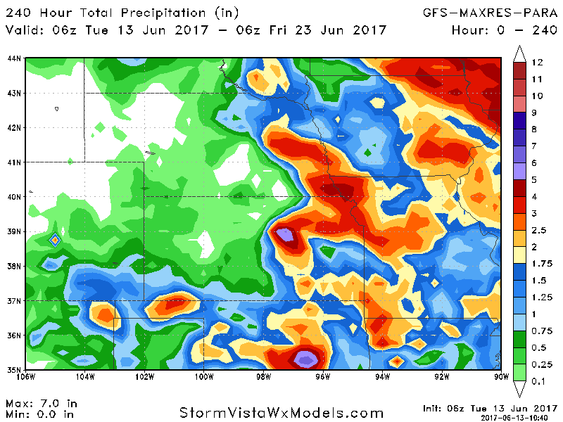
- Total rainfall shows how storm dependent it will be through day 10 with best threat for rain the further east you travel.
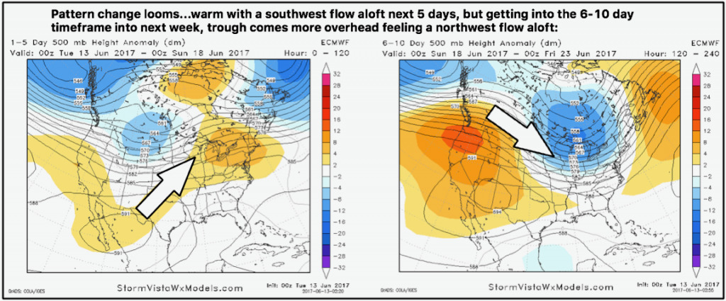
- As we push forward into week 2 the pattern continues to evolve into a cooler regime. It will likely be more active in eastern portions of the zone as well!
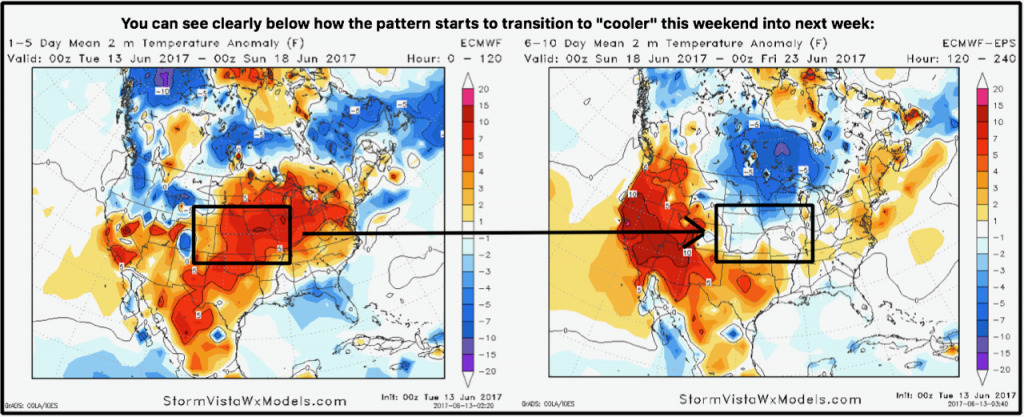
- This is shown well in temperature forecasts as well.
Confidence and Risks:
- Average confidence on an isolated/scattered storm threat through Friday this week across parts of the central Plains…tough to nail down exactly where.
- Above average confidence we are overall above normal in temperatures this week.
- Increasing confidence of “cooler” times ahead getting into next week as a trough replaces a ridge.
- Increasing confidence in active times in eastern portions of the zone with drier risks further west.
Today’s Video (8 minutes):