#IAwx #MOwx #NEwx #KSwx Dry Stretch This Weekend, Turning Active and Warmer Next Week. E.
Key Points: May 11, 2017
Synopsis: Good Thursday morning! We are tracking showers and thunderstorms across Kansas and Missouri this morning as a frontal boundary slowly sags south. Showers and storms will continue to fire along this boundary today, mainly across Kansas and southern Missouri. The boundary sags even further south tomorrow with showers and thunderstorms confined to southern Missouri. This system will give way to a very nice weekend with warming temperatures and sunshine. This regime will last into early next week before we turn active once again with renewed shower and storm chances. If it’s any consolation, we should get quite warm into next week, allowing fields to dry out a bit after all the rain we’ve seen. Have a great day!
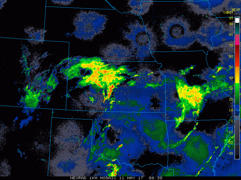
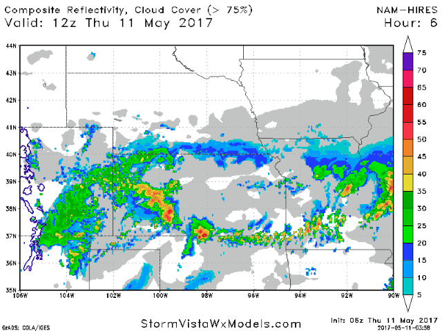
- Current radar shows the ongoing showers and storms across Kansas and Missouri.
- Over the next 36 hours, the front slowly sags south and east, taking the rains with it. However, southern Missouri and Kansas likely do see some additional heavy rains through tonight.
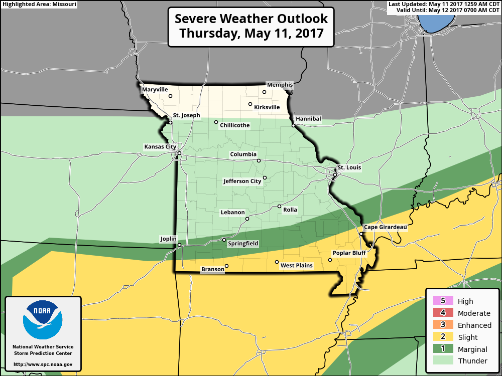
- Severe weather will be a threat along the boundary in southern Kansas and Missouri today as well with large hail, damaging winds, and even an isolated tornado possible. Here’s the latest day 1 SPC outlook.
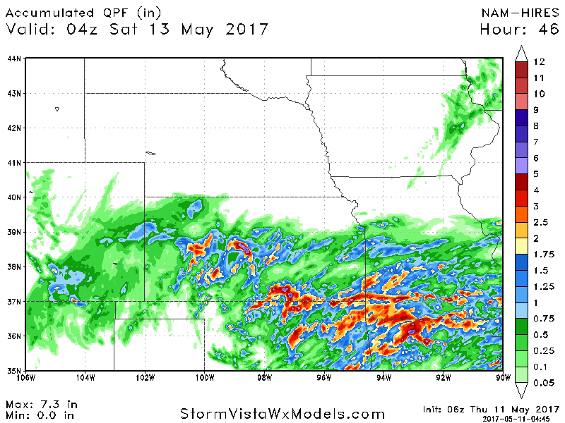
- Total rainfall through tomorrow will be highest in most persistent storms. Some places may see 2-3″ of additional rains while others see under 0.25″!
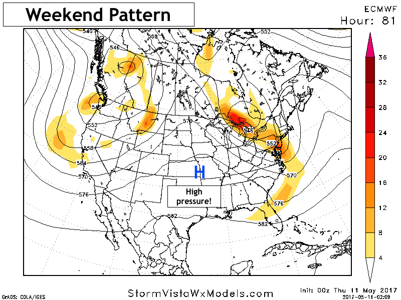
- The weekend looks dry and warm across the region thanks to a ridge of high pressure.
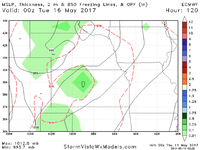
- Next week likely starts dry, but as the ridge breaks down, shower and storm chances return from west to east throughout the week. Here’s a look at the latest European model. This is discussed in detail in the video!
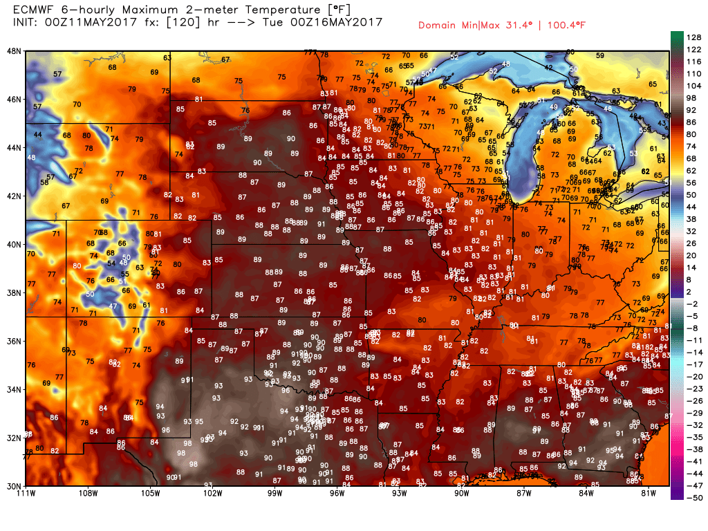
Temperatures next week will be warm to even hot in some spots. Model data has widespread 80s and low 90s across the region Monday.
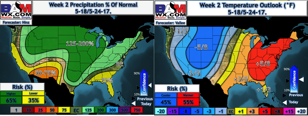
- We foresee a wetter regime taking hold in week 2 as a battle zone sets up across the region with cooler air west and warmer air east. Here’s a look at our week 2 temperatures and precipitation forecast.
Confidence and Risks:
- Above average confidence additional showers and storms continue today into Friday as the low pressure and front pushes east.
- Above average risk for strong storms across southern Kansas and Missouri today into Friday morning.
- Average to above average confidence we see a brief window of warm and drier into early next week before we turn active again.
Today’s Video (8 minutes):