Key Points: May 8, 2017
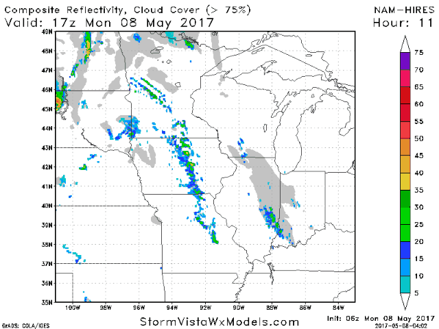
Synopsis: Good Monday morning! I hope you all had a wonderful weekend as we move forward into the second week of May. As discussed last week, this week will be warmer thanks to an upper ridge nearby, but it will still be quite active across the region. We are tracking some of that active weather out there this morning with showers and thunderstorms across Iowa and northern Missouri. These will push eastward today ahead of the next complex of storms overnight tonight into Tuesday. A slow moving front will bring more showers and thunderstorms Wednesday and Thursday, possibly lasting into early Friday across southern Kansas and Missouri. The details are discussed in the blog and video below. Have a great day!
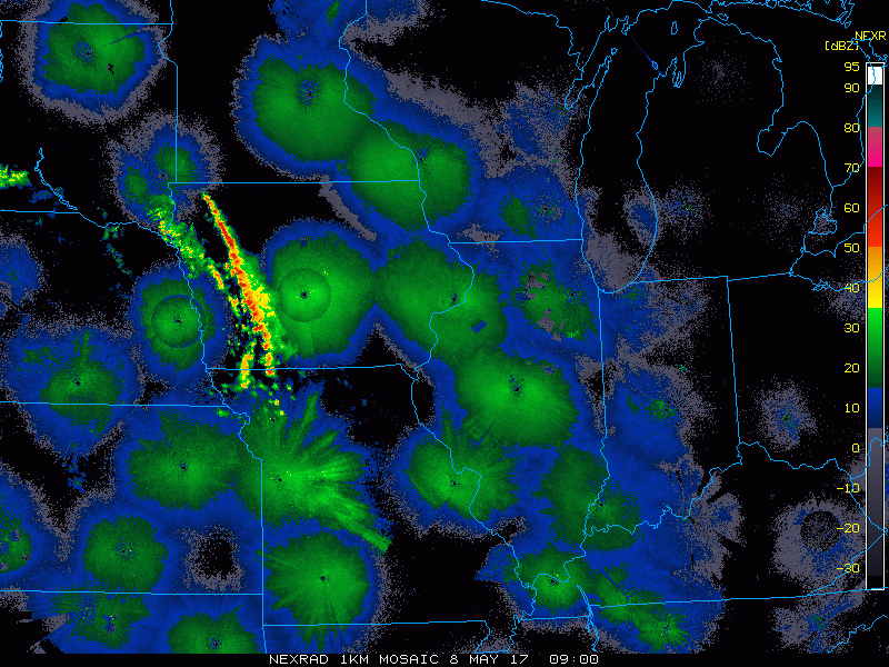
- Current radar shows the storms across Iowa and northern Missouri this morning.
- An active early week is expected ahead of a slow moving front.
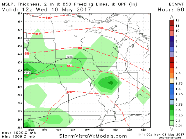
- The front slowly sags south through the week, bringing the main moisture axis over much of the forecast area. This will especially be true Wednesday and Thursday.
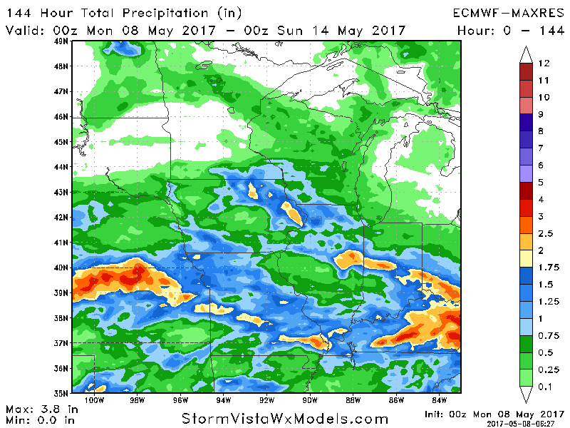
- Total rainfall for the week will again be dependent on where the front ends up, but here’s an idea. The take home message is that under heavier showers you can see 2-4″ of rain, otherwise a widespread 0.50-1.50″ is expected through the week across the region.
- Temperatures start quite warm in the 70s and 80s through Wednesday, then fall into the 60s with rain behind the front to end the week. As a whole, this week will be near to slightly above normal with respect to temperatures.
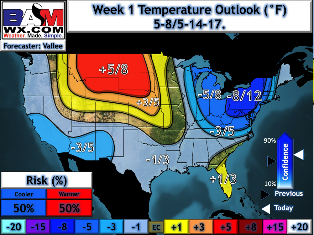
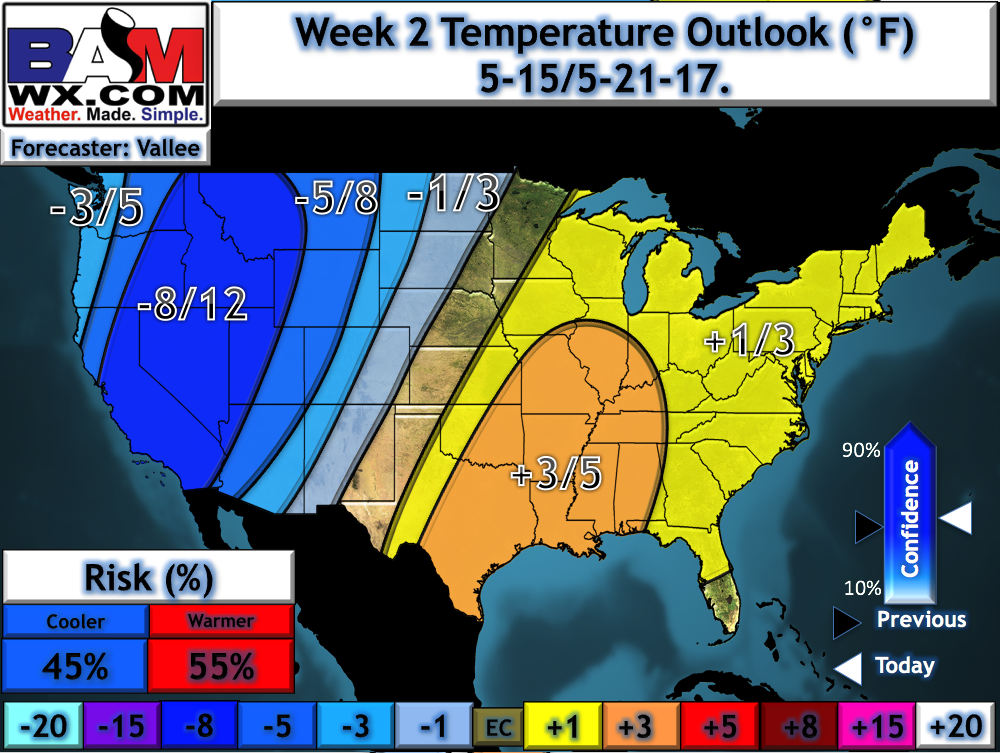
- Active times last into week 2 as the forecast remains in a battle zone between cooler temperatures west and warmer temperatures east.
Confidence and Risks:
- Above average confidence in an unsettled week with a frontal boundary nearby. As is usually the case with storms, not everyone will see a lot of rain, but if you get under a heavy storm, you will see some serious rainfall.
- Increasing confidence in heavier rains north to start the week, trending south through the week. Some uncertainty remains on how far south the front stalls, so be sure to check back!
- Above average confidence in warm temperatures to start the week, trending cooler toward the end of the week as the front sags south.
- Average confidence of this active regime continuing into week 2 and even beyond with cool temperatures west and warmer conditions east.
Today’s Video (8 minutes):