#IAwx #ILwx #INwx #MOwx Threat for severe storms increasing tonight, special update here. K.
Synopsis: Good afternoon! We wanted to get an update out as soon as possible on the potential for severe storms later today into tonight across the Midwest. All the details are in the video, but we will be watching things very closely tonight. If you have any questions please don’t hesitate to reach out.
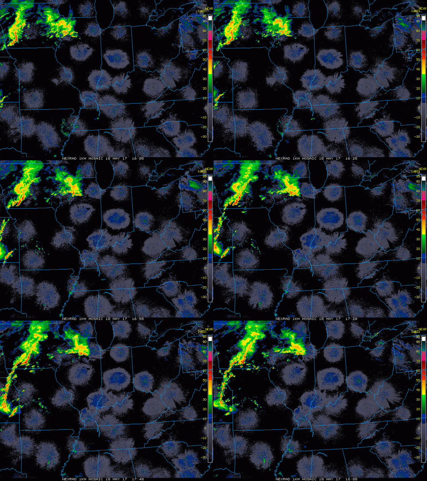
Current Radar:
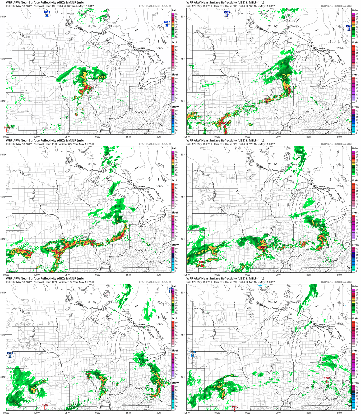
Simulated Radar: initially could be some discrete supercells out ahead of the main line across northern Missouri, southeastern Iowa and western Illinois ~4-5pmEDT tonight. By 10pmEDT we start to see a cluster develop…despite what models say we know these types of events like to dive southeast and will continue into the pre-dawn hours of Thursday into Indiana and western Ohio. There does appear to be a secondary wave to form across central Missouri moving east into Illinois and Indiana waking up early Thursday morning we need to keep our eyes on for heavy rain and additional strong storms.
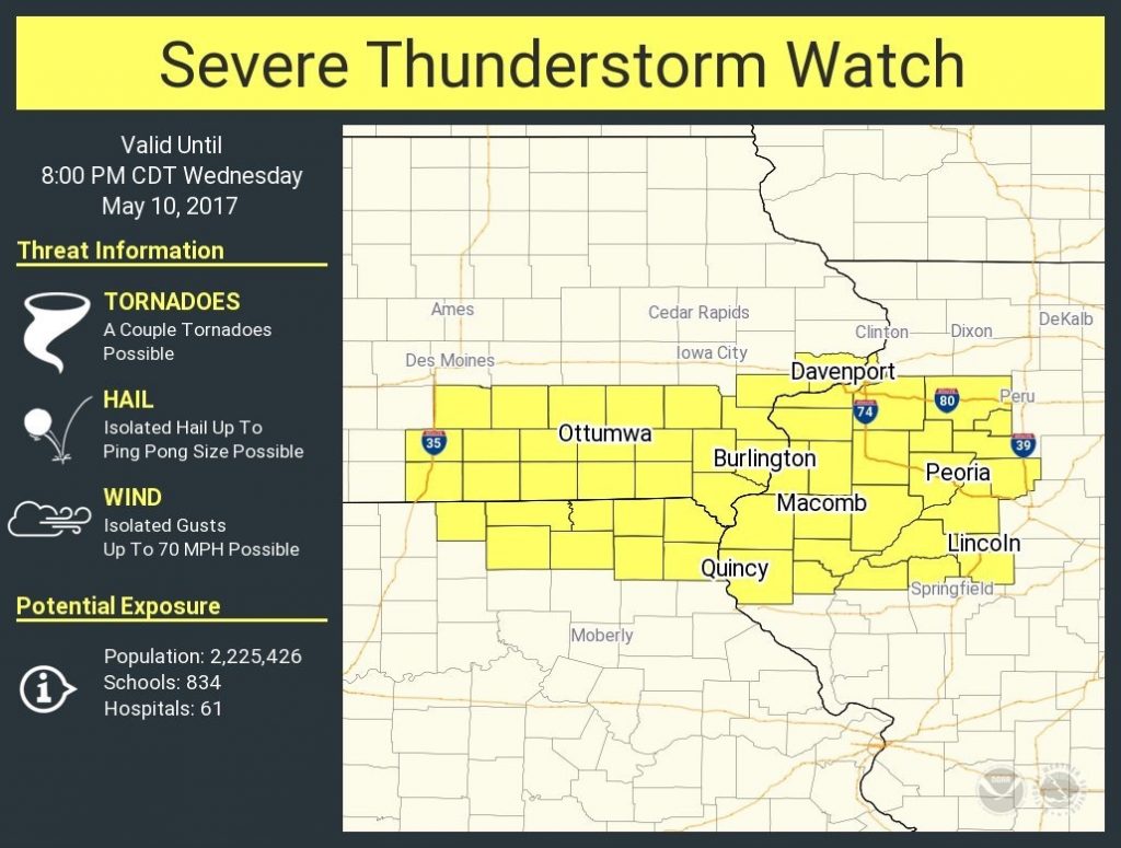
In fact, a new severe t’storm watch was just issued until 8pmCDT for SE IA, NE MO, into W IL until.
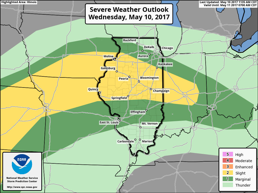
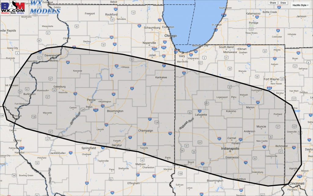
Current thoughts on severe weather tonight, we mentioned this morning that we thought the risk needed pulled further east into Indiana and we agree with the current placement. Risks include: damaging winds, isolated large hail, heavy rains and can’t rule out an isolated tornado as well.
We wouldn’t be shocked to see an uptick in fire calls tonight due to cloud-to-ground lightning from the explosive amounts of CAPE (energy) in the atmosphere today. Here’s an enhanced lightning threat forecast below:
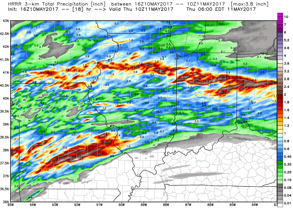
Total precipitation through 6am Thursday morning…we wouldn’t be shocked to see these totals to be slightly southeast especially into Indiana and Ohio given these events like to dive to the south and east. 2-3″ isolated amounts will be possible here.
Confidence and Risk:
- Above average confidence of showers and storms moving across the Midwest today into tonight.
- Average risk for strong to severe storms including damaging winds, dangerous lightning, large hail and a low risk for isolated tornadoes.
- Above average confidence of localized heavy rainfall of 2″+ as well.
- Increasing confidence on morning wave in southern IL/IN that needs watching as well.
Today’s video (6:30 min):
