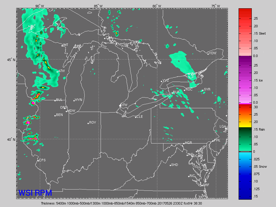
Synopsis: The forecast for Friday evening continues to suggest T’storms, Some could be strong with heavy rainfall and gusty winds and frequent lightning. Any setup going on Friday evening needs to keep an eye on radar as we get later into the evening. Below is latest model data showing the storm threat in the area from 10pm-1am. These storm clusters can often trick most forecasters so if you don’t hear of storms in the forecast from other sources this can be why.
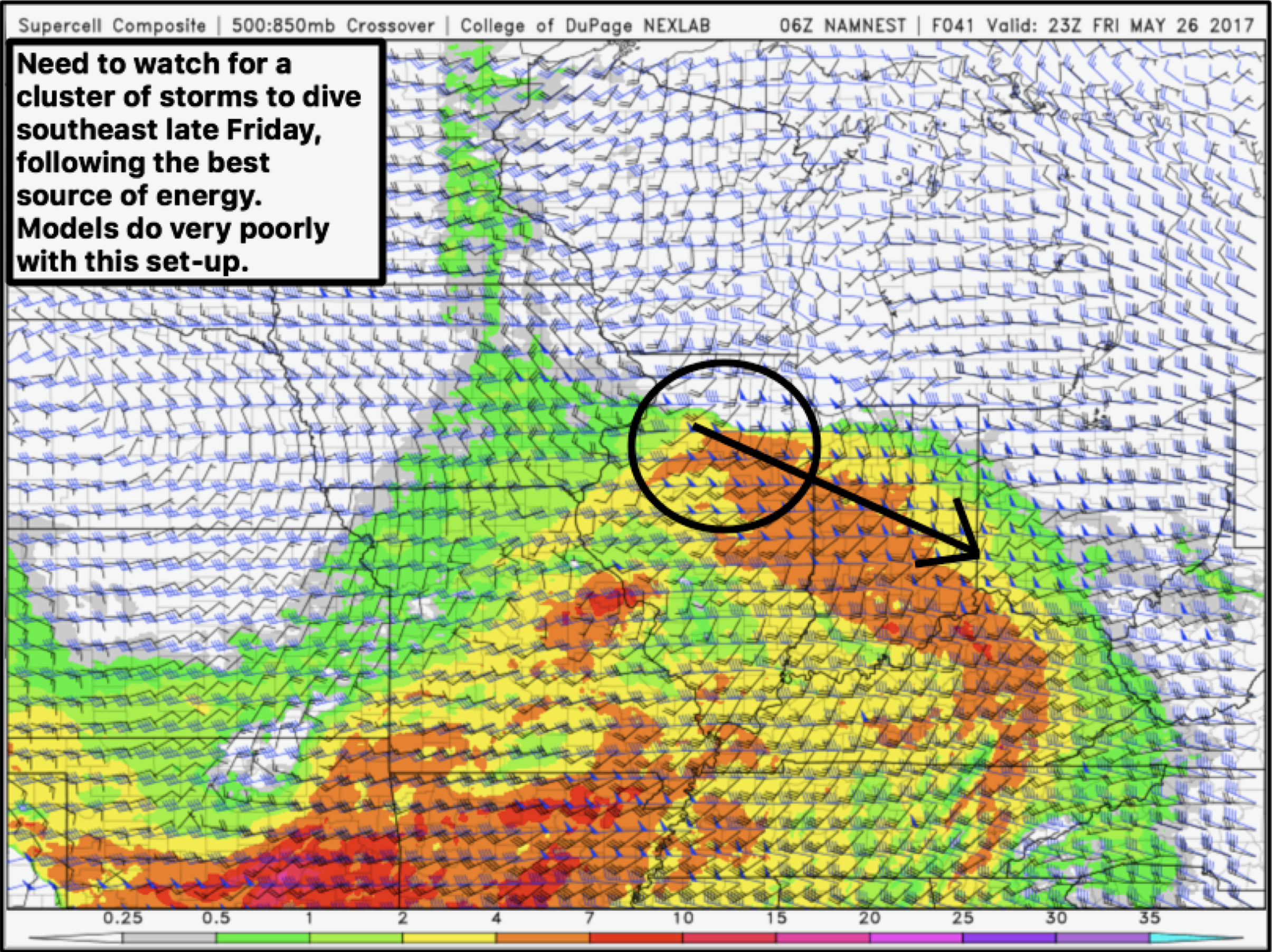
These storm clusters are tricky little devils they like to track east in IL and make you think they will miss you and then the last min they will dive SE. Thats what we believe will happen here tomorrow evening. With that being said we do anticipate some weather related hazards Friday night for any setup that needs to take place.
As we rumble into Saturday for the parade it really is a tricky forecast. I do think a window of dry time is certainly on the table the question becomes when is it dry and how long is it dry for? The thing that has us concerned is we will be in the “warm sector” of our storm system so any sun that can break through at all can nearly instantly trigger storm development. Forecast models struggle with this immensely. We believe a morning round of storms is possible followed by severe storms Sat evening. The challenge is what happens in-between with the front lingering.
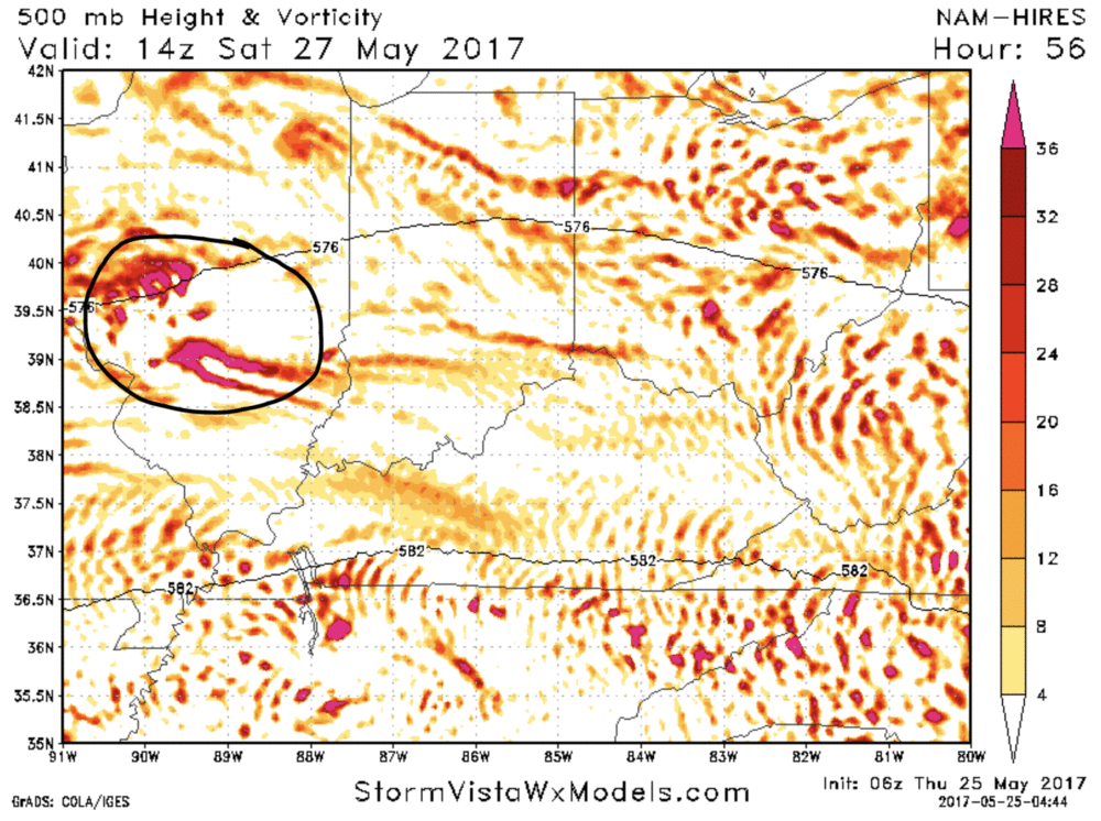
You can see below there is energy in the area for storm development all day Saturday. The question right now is just simply timing.
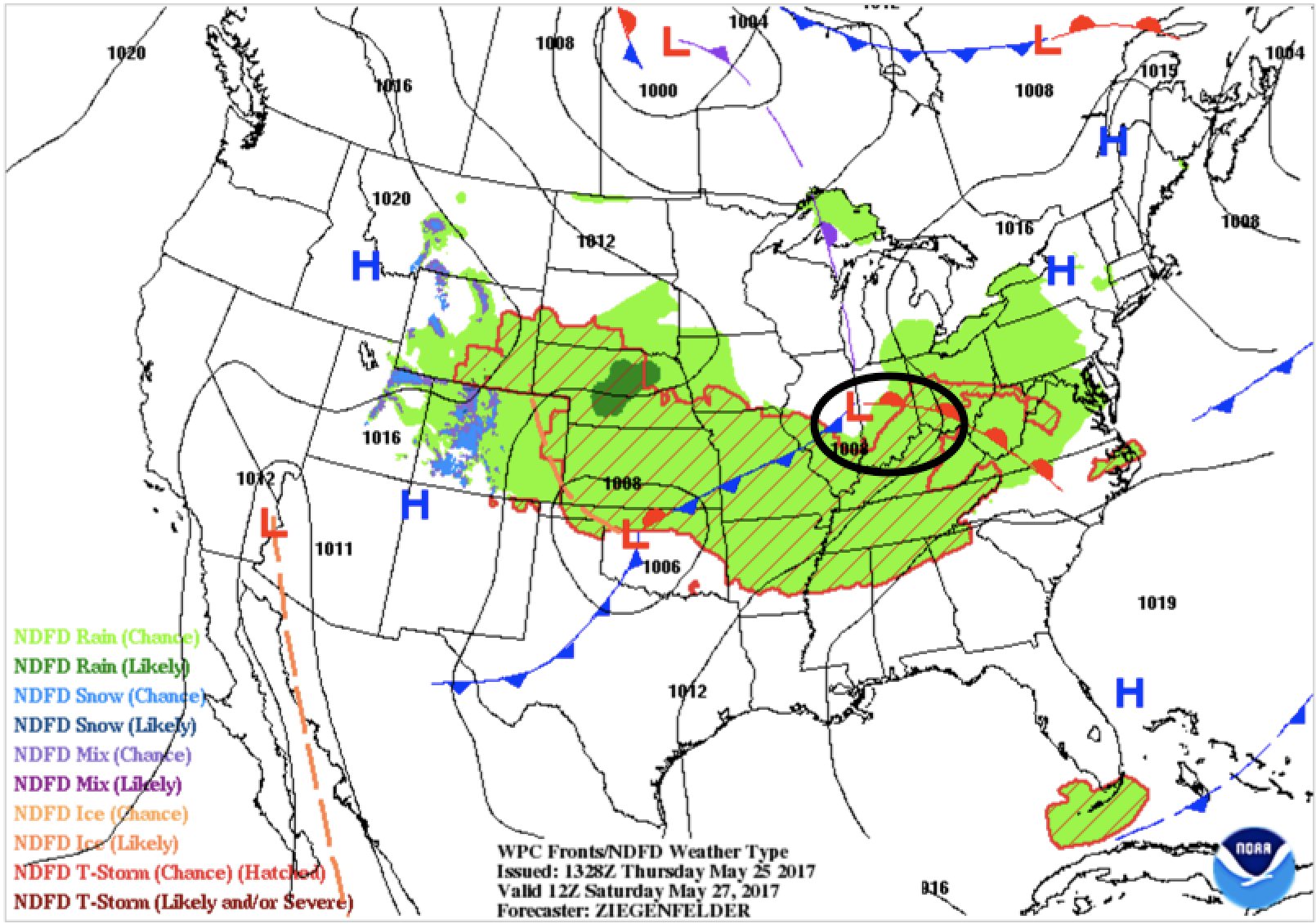
With the warm front in the area this is why we are concerned. The front will provide all the lift necessary for storms to quickly develop and even be severe later in the day.
We will update again this afternoon and start giving you hour by hour predictions but just beware these can change drastically until we get within 15-18 hours of the event. If you have any questions please let us know!
Respectfully,
Michael Clark