Good afternoon! We are fine tuning the details of the weekend forecast as we continue to get new data in. Overall, it looks quite unsettled, but the devil is in the details. Here is what I’m thinking with respect to timing and impacts:
- Snow or perhaps a mix of wintry precipitation will break out Friday across Ohio and western PA, but will turn to rain rather quickly after warm air rushes in. Some slick spots are possible before the changeover.
- East of the Appalachian mountains in central and eastern PA, snow breaks out tomorrow evening into the overnight hours. At night this time of year, snow can more readily accumulate, so an inch or two of snow is possible in these areas. The best chance for accumulation will be across the higher terrain of northern PA and NY including the Poconos and Catskills.
- Further east, a bit snow will break out toward dawn Saturday or Saturday morning, but temperatures Saturday will be mainly above freezing. Some light accumulations are possible on grassy surfaces during the day Saturday. Rain and snow showers will continue Saturday across the entire region, but temperatures will be largely above freezing.
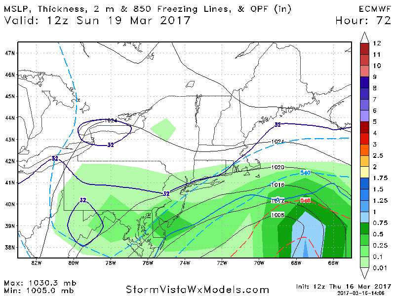
- Saturday night into Sunday we will watch to see where an “inverted trough” – or a band of snow – sets up. First indications are that it may set up from northern NJ, NYC, Long Island into coastal southeastern New England. There may be a small corridor of accumulating snow where it occurs, but uncertainty is very high.
Here’s a look at the high resolution NAM as to how this radar may look through Saturday evening.
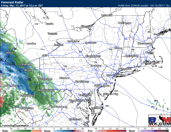
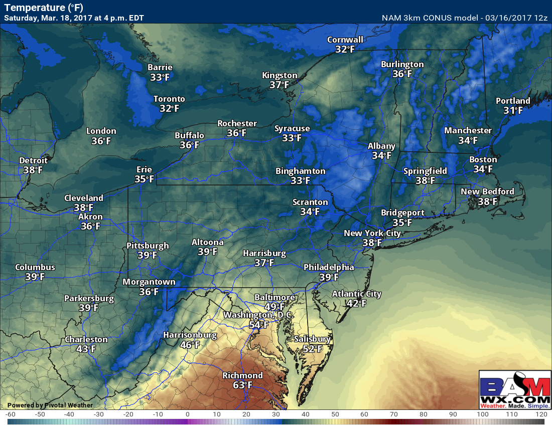
Notice temperatures Saturday are largely above 32, so roads should be fine in most places. The only exception may be in the highest elevations (above 2,000 feet) of PA, MA, and NY where temperatures will be colder.
With respect to Saturday night, there are major differences in where the inverted trough will set up. The NAM (shown above) has the snow closer to NYC and Long Island. The Euro (shown below) is much further south across NJ.
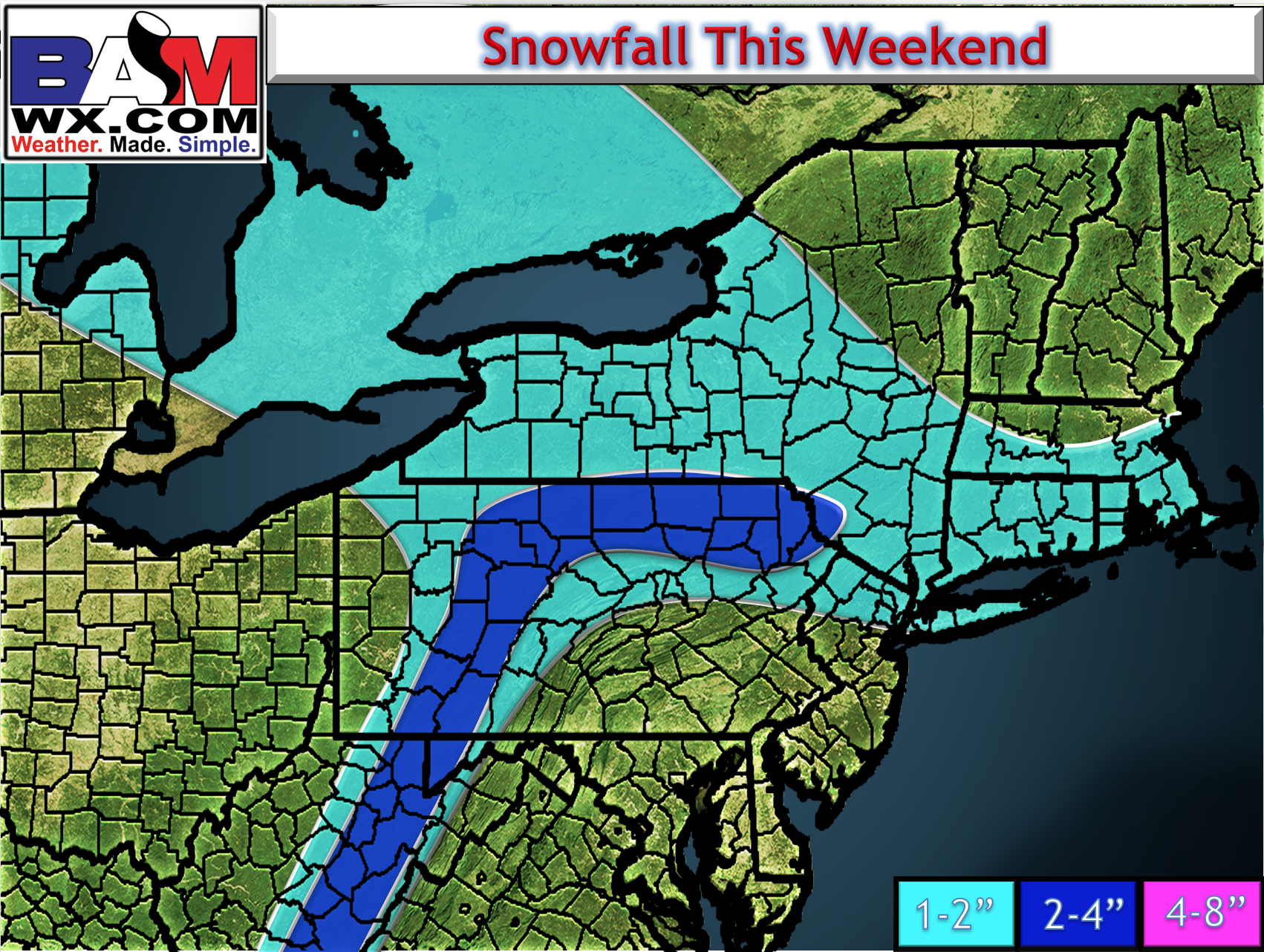
 Here’s my first shot at a snowfall map. Keep in mind most of this will be on colder surfaces and not necessarily on pavement. This will be refined tomorrow as new data continues to come in.
I’ll have a full update on this event tomorrow morning. ~Ed