Good afternoon. New data continues to stream in regarding Tuesday’s storm and it’s going to be a big one – no other way to say it. Midday data remains in two distinct camps with most data pointing toward a blockbuster snowstorm, while the GFS is further east, sparing interior areas from the worst. I am siding with the majority of guidance here and expect likely the biggest storm this season in some areas.
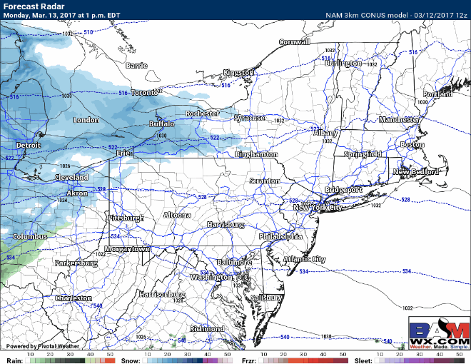
In terms of timing, I think the latest 3km high resolution NAM has a good idea. Snow comes in late Monday night and last through much of the day Tuesday. I’ll have details in the video below.
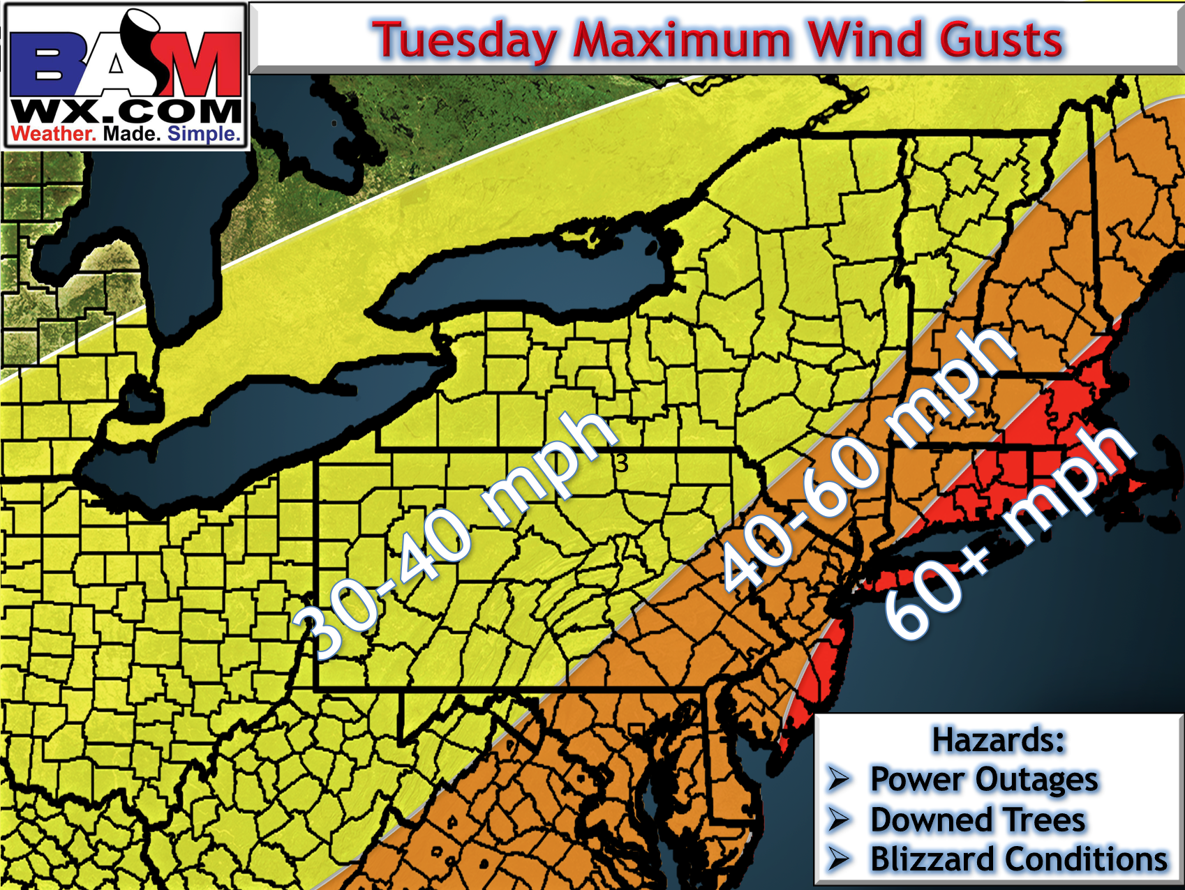
Winds are going to be a tremendous issue as well as the storm strengthens during the day Tuesday. Latest wind gust forecast is below.
Updated snowfall map has added an 18″+ area. This looks to be a big one, folks.
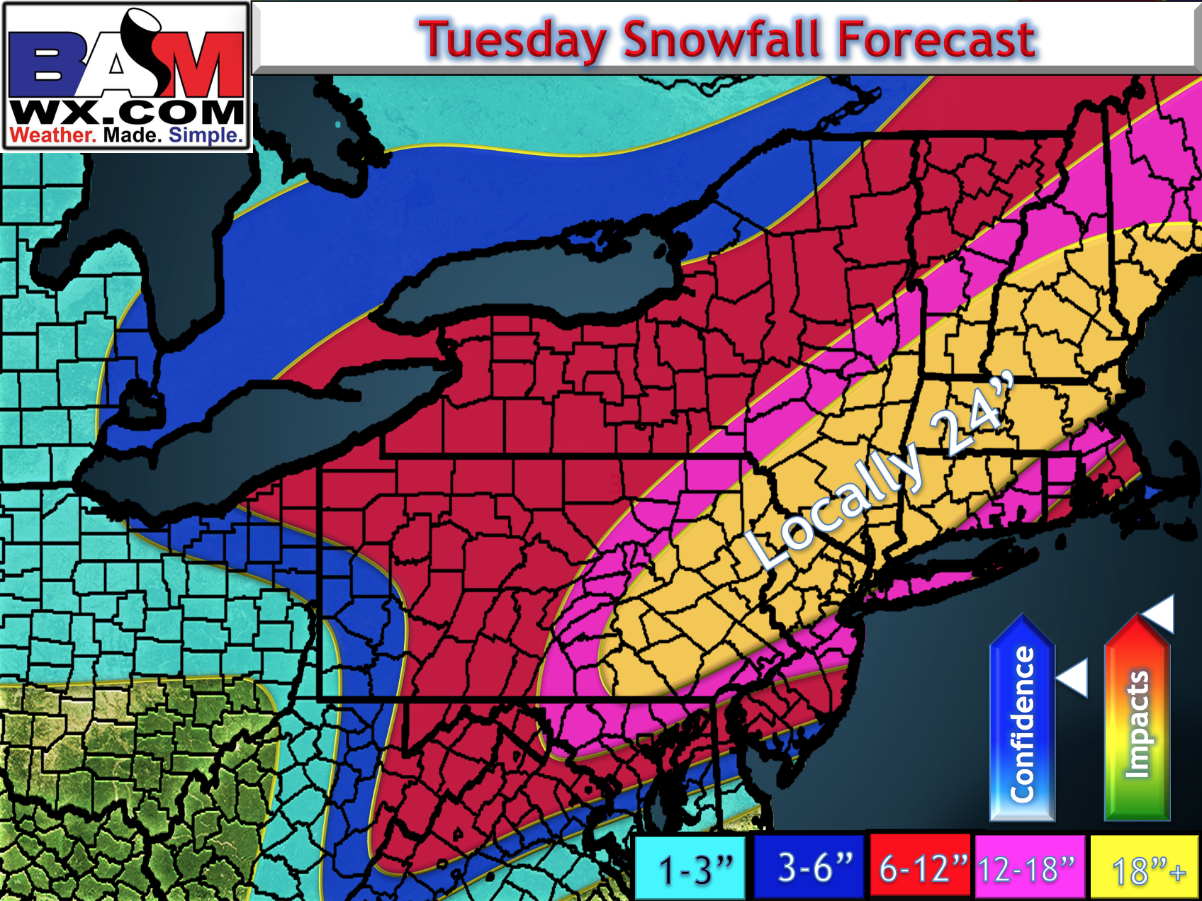
*The biggest risk to this forecast is trying to nail down exact banding and the mixing line. There likely will be some haves and have nots with respect to banding and also some sleet and rain mixing in across Southeast MA and perhaps southern RI, SE CT, and eastern LI as well. This will be fine tuned during the day tomorrow after new data comes in!