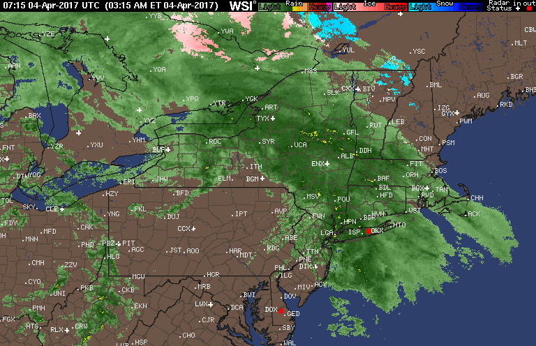
Good morning! We are tracking some very heavy rain across New England with showers farther to the south and west. Here’s the latest radar.
The QuickCast for the day discusses an active pattern going through much of this week.

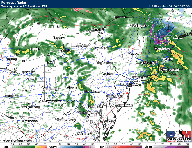
Rain will taper across New England this morning, but additional showers and even a few thunderstorms will fire across the Mid-Atlantic through the afternoon.
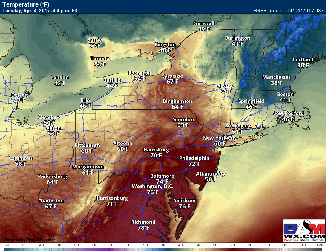
Where we can get a few breaks of sunshine today, temperatures will rise quickly into the 60s and even lower 70s across PA and NJ. Southern New England will once again have a large spread in temperatures today.
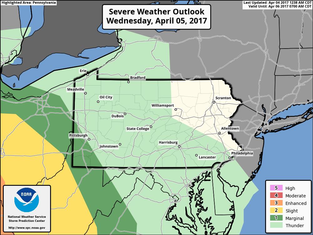
Wednesday looks like a quiet day with warmer temperatures and some sunshine east, but gusty storms will develop across Ohio in the evening. The SPC has issued a “slight risk” across that region for that time frame.
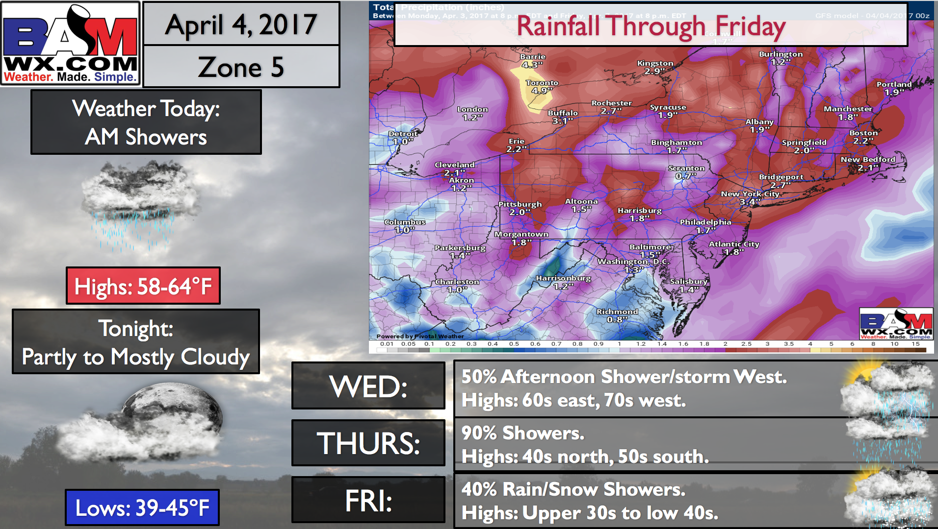
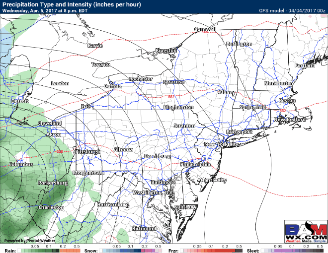
Our next rain maker comes Thursday and Friday. On the backside Thursday night and Friday, some snow likely mixes in across PA and OH with little to no accumulation expected. Here’s the latest GFS model.
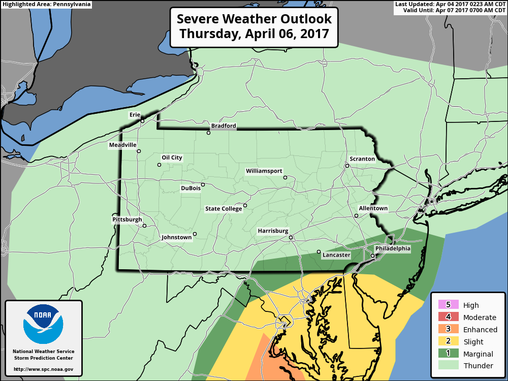
Thursday afternoon will also feature some stronger thunderstorms across southern portions of the forecast area. Here is the SPC day 3 outlook.
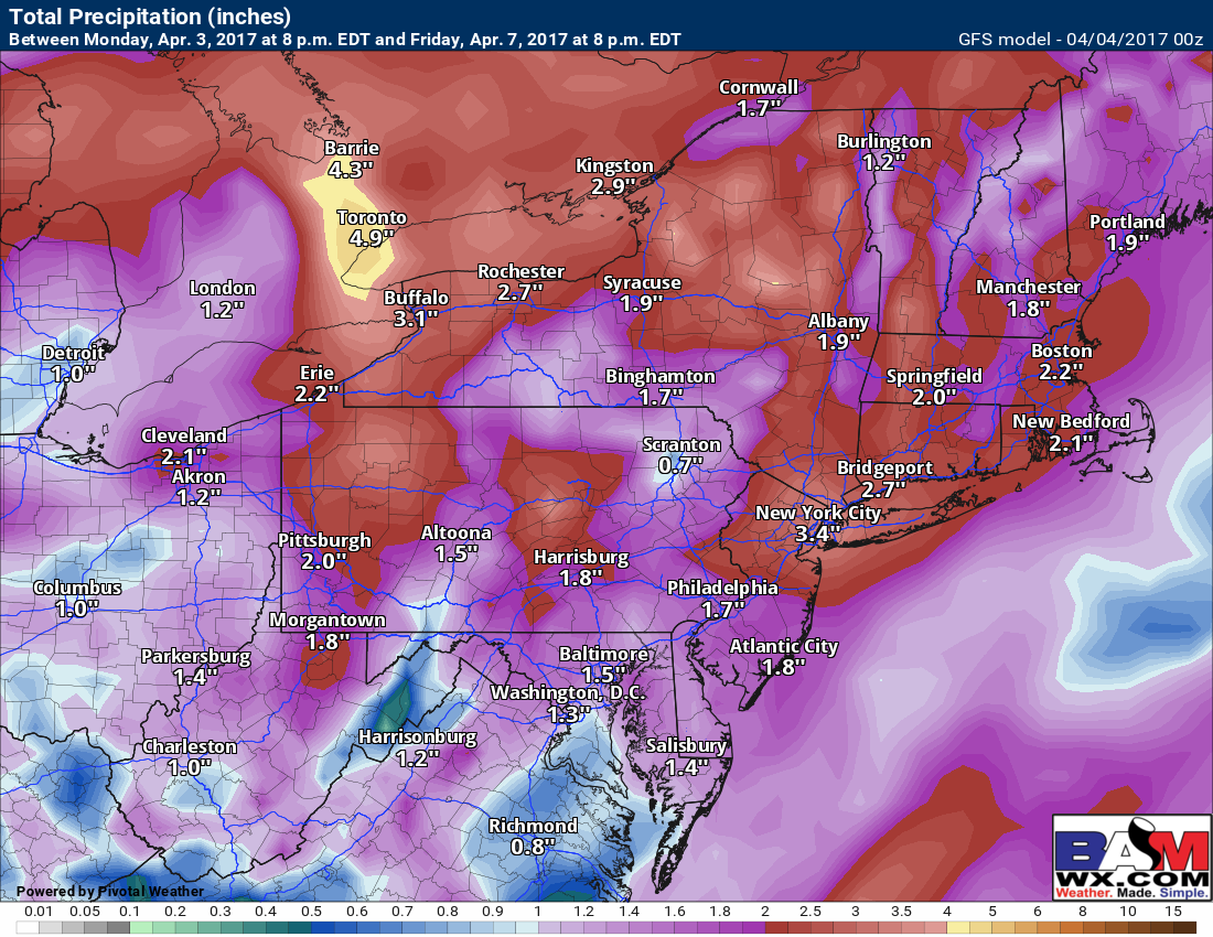
Total rainfall through Friday evening is impressive – a widespread 2-4″!
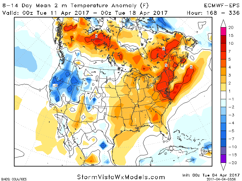
This weekend into week 2, temperatures look to rebound nicely 4-8°F above normal!
Confidence and Risks:
- High confidence on an active regime with 2-4″ rain between this morning and Friday across the region.
- Moderate confidence on thunderstorm development across Ohio Wednesday, then across the Mid-Atlantic Thursday.
- High confidence on a warmer regime developing into week 2.
The video (6 minutes) breaks it all down! ~Ed