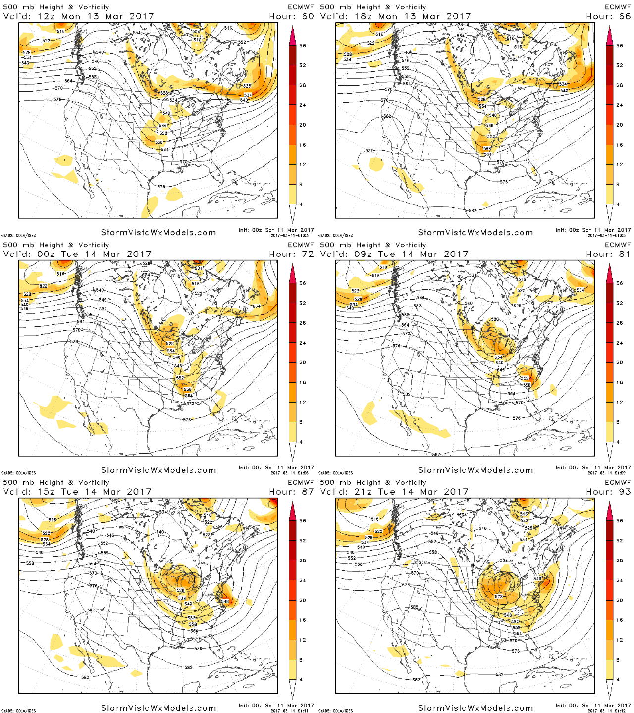
Good morning! We continue to track a major winter storm on the way for Tuesday. I’ll break down the risks and uncertainties as well as some of the potential impacts in the post and video below. Here’s the latest upper level energy track of the European model. Overall this would not be a “complete phase”, promoting a track just off the Mid-Atlantic coast. I’ll have more on the track possibilities in the video below.
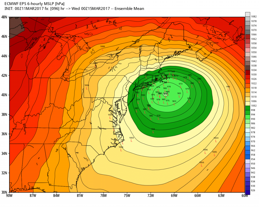
With those possibilities I am seeing one glaring feature. Many European ensemble members are WEST of the ensemble mean, indicating the risk for some mixing along the coastline.
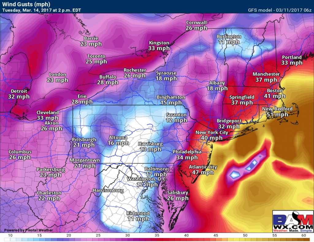
Not only will snow be an issue here, but wind will also cause issues, potentially gusting past 50mph during the storm.
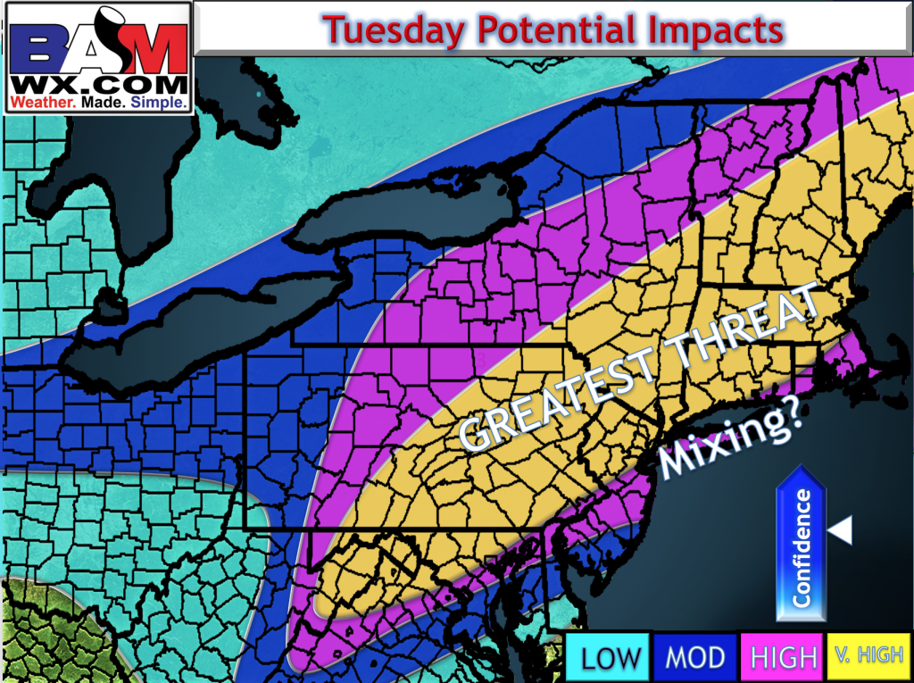
I whipped out an impact map this morning, highlighting very high impacts across much of the region. I’ll expand on this in the video.
Risks and Confidence:
- High confidence in a major winter storm Tuesday with high impact.
- Moderate confidence in where the storm tracks…mixing area still TBD with future data.
- High confidence in strong winds near the coast line.
I’ll go over the details in the 7 minute video below and have an update out this afternoon! ~Ed


