Good morning. We are tracking a major blizzard poised to impact the Northeast Tuesday. Thoughts have not changed much, but I have honed in precipitation type and amounts with new overnight data. Here’s a look at the new European model, closest to what I believe will happen. Note the 32°F line moves into SE New England indicative of mixing issues.
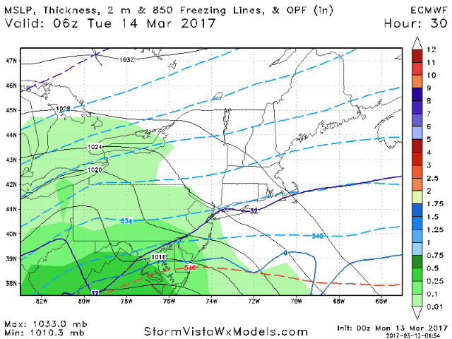
Temperatures will likely rise above freezing from central LI to eastern CT into SE MA Tuesday afternoon, then crash back below freezing Tuesday evening.
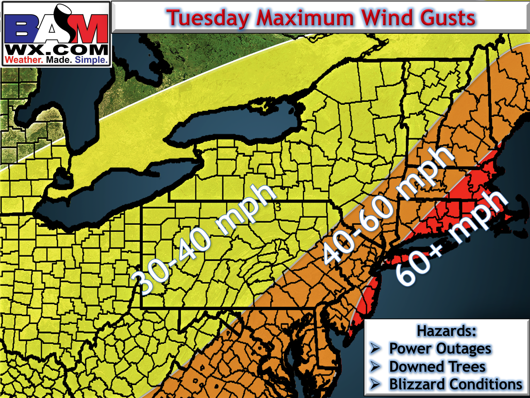
Winds will be a big issue with this system, gusting past 60 mph at the coastline. This will lead to power outages, downed trees, and blizzard like conditions across the region.
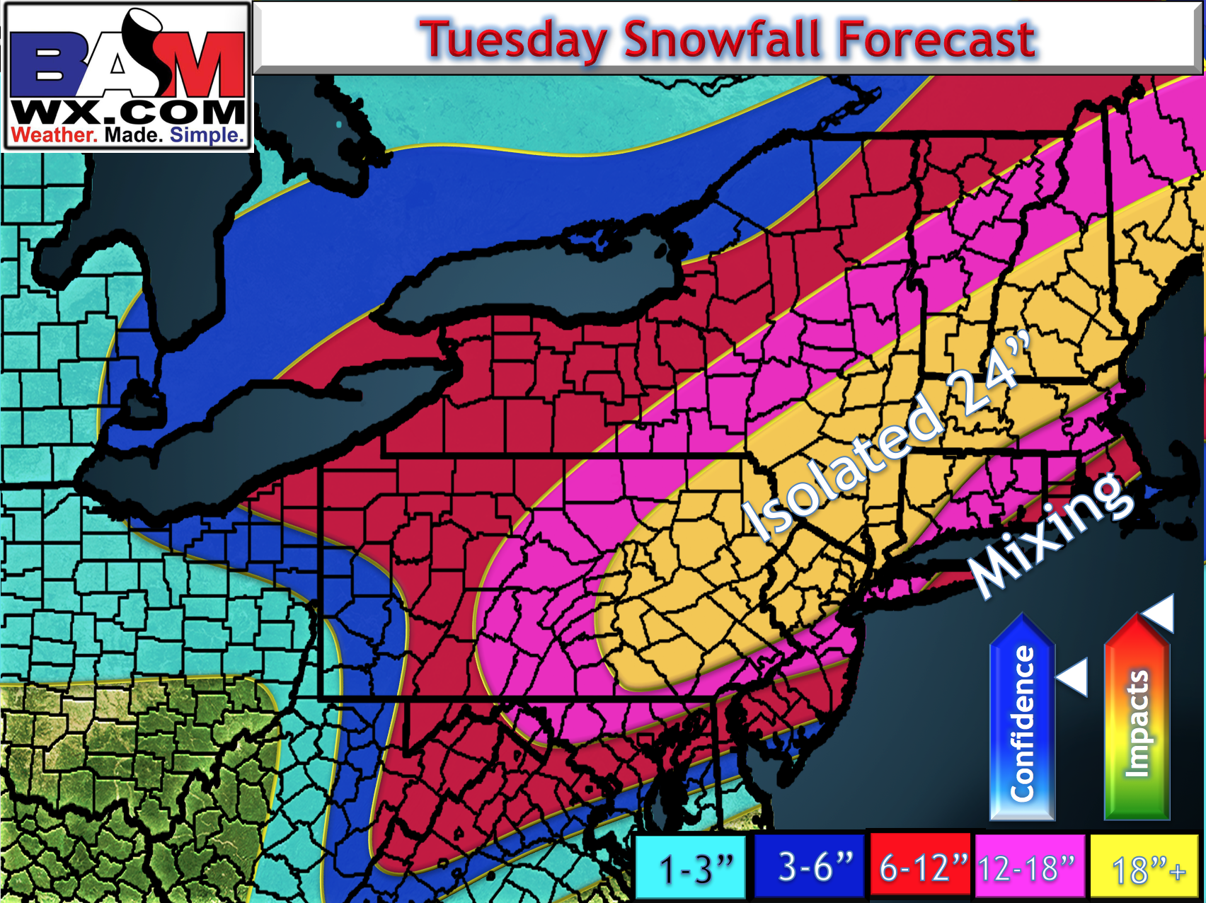
I tweaked the snowfall map just a bit this morning to account for some of the warmer changes in southeastern areas. Much of the rest of the map still looks good from yesterday. THIS WILL BE A EXTREME IMPACT EVENT.
Some risks to the forecast:
- Where exactly does the storm track? This will dictate the mixing line. Right now, I think mixing gets to an area from coastal NJ to central Long Island into central CT up to near Boston.
- Where do precise bands of snow set up? This will decide who sees 16-18″ and who sees 22-25″. This will be a “nowcast” type thing to figure out.
The video below (7 minutes long) covers it all. ~Ed