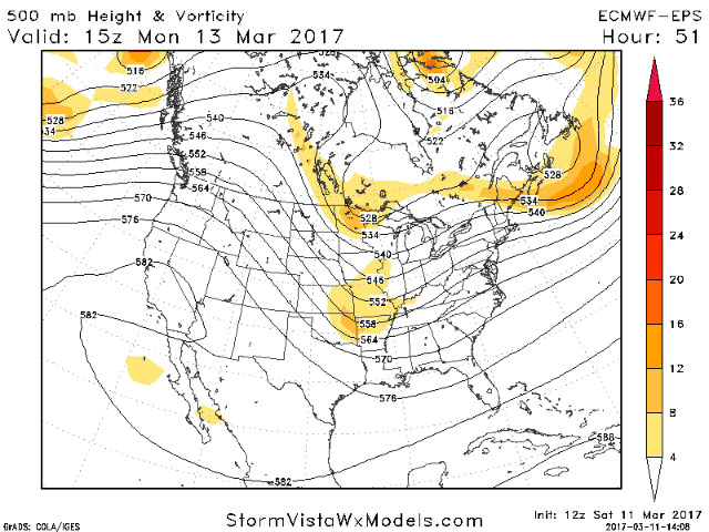
Good afternoon. In this blog, I’ll have the latest updates regarding the winter storm for Tuesday.With new midday data in, we are honing in on where the largest impacts will be for this system. We continue to lean on our ensembles to give us the best idea of what is going to happen. The latest upper air pattern from the European ensemble is shown below. In the video I will dig into the details of this pattern.
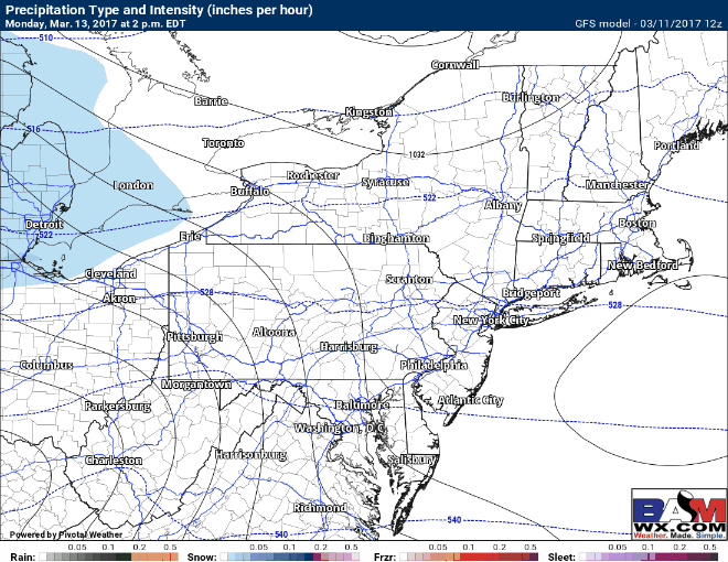
As for timing, here’s the latest GFS model. The track still remains uncertain (more on that below) but confidence timing is fairly high. Snow begins across western areas Monday evening and spreads eastward Monday night. Tuesday morning looks dicey for many areas.
Ensemble members still show some risk to the forecast. While things are coming slowly aligned, the latest European ensembles show may members west of the mean, indicating this model may shift a bit west overnight.
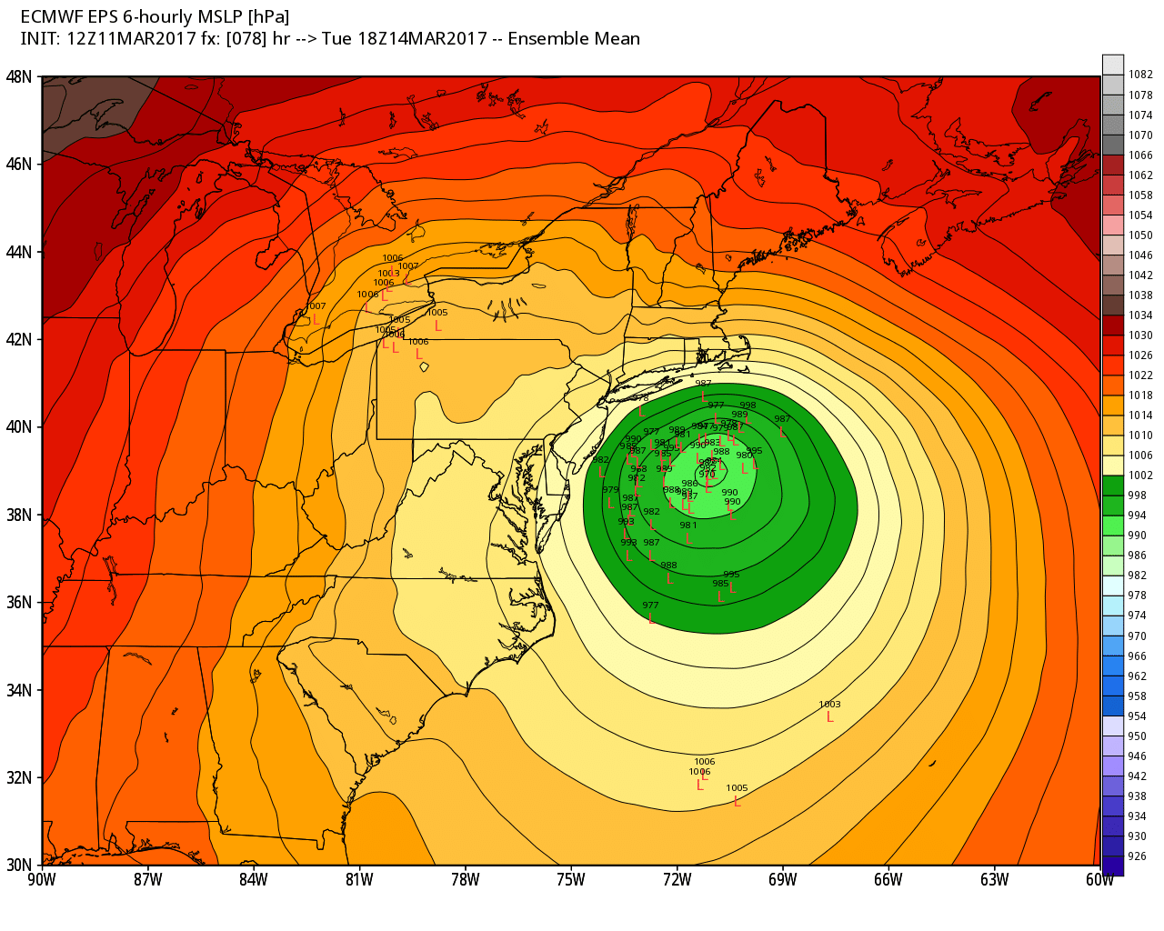
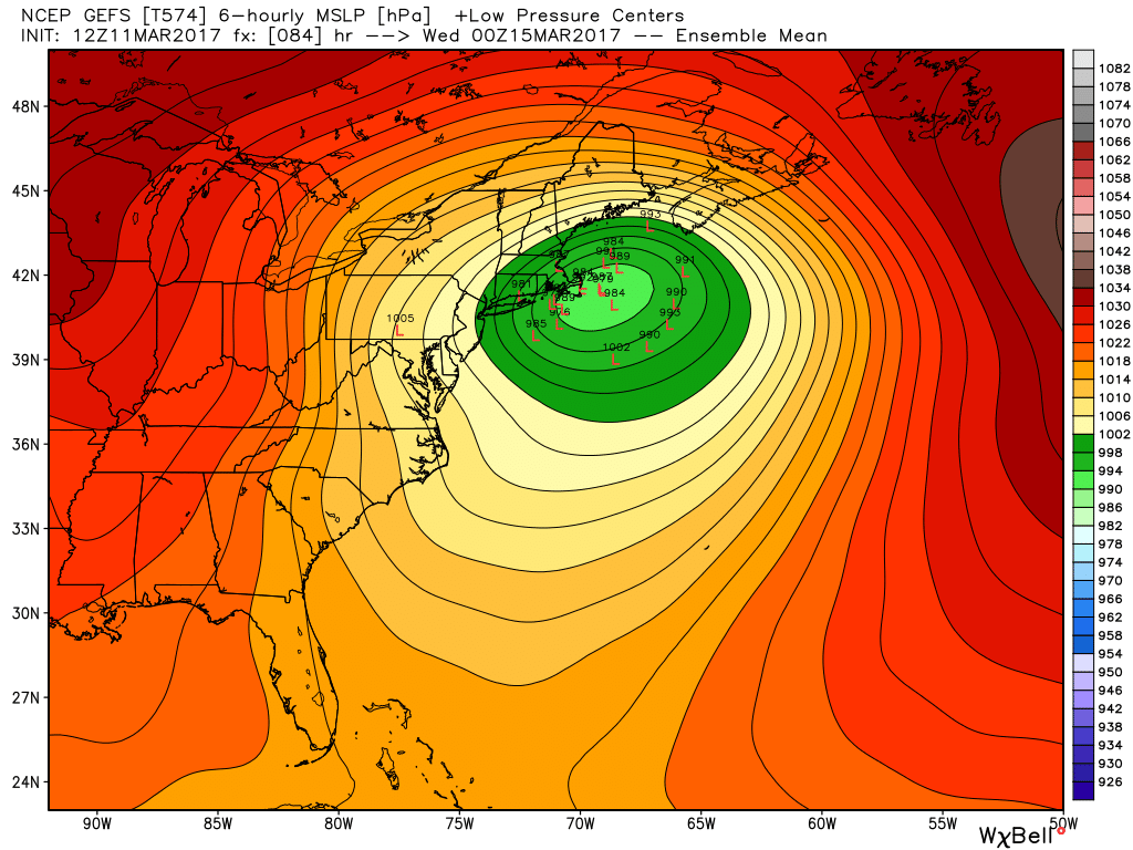
The GFS ensembles also remain further west with plentiful spread. Moral of the story: no one track can be correct here. Models aren’t done moving around.
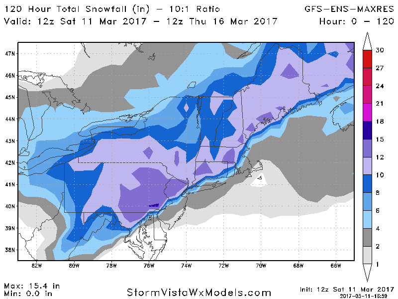
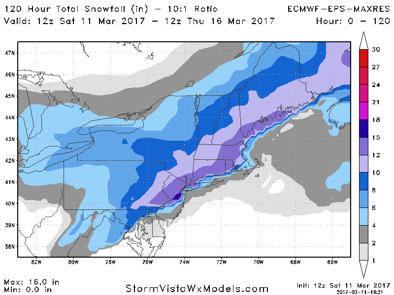
Snowfall looks impressive here. If a GFS solution were to verify, we would be dealing with some mixing in coastal areas. The European would be an all out heavy snow storm. Here’s a look at the snowfall comparison.
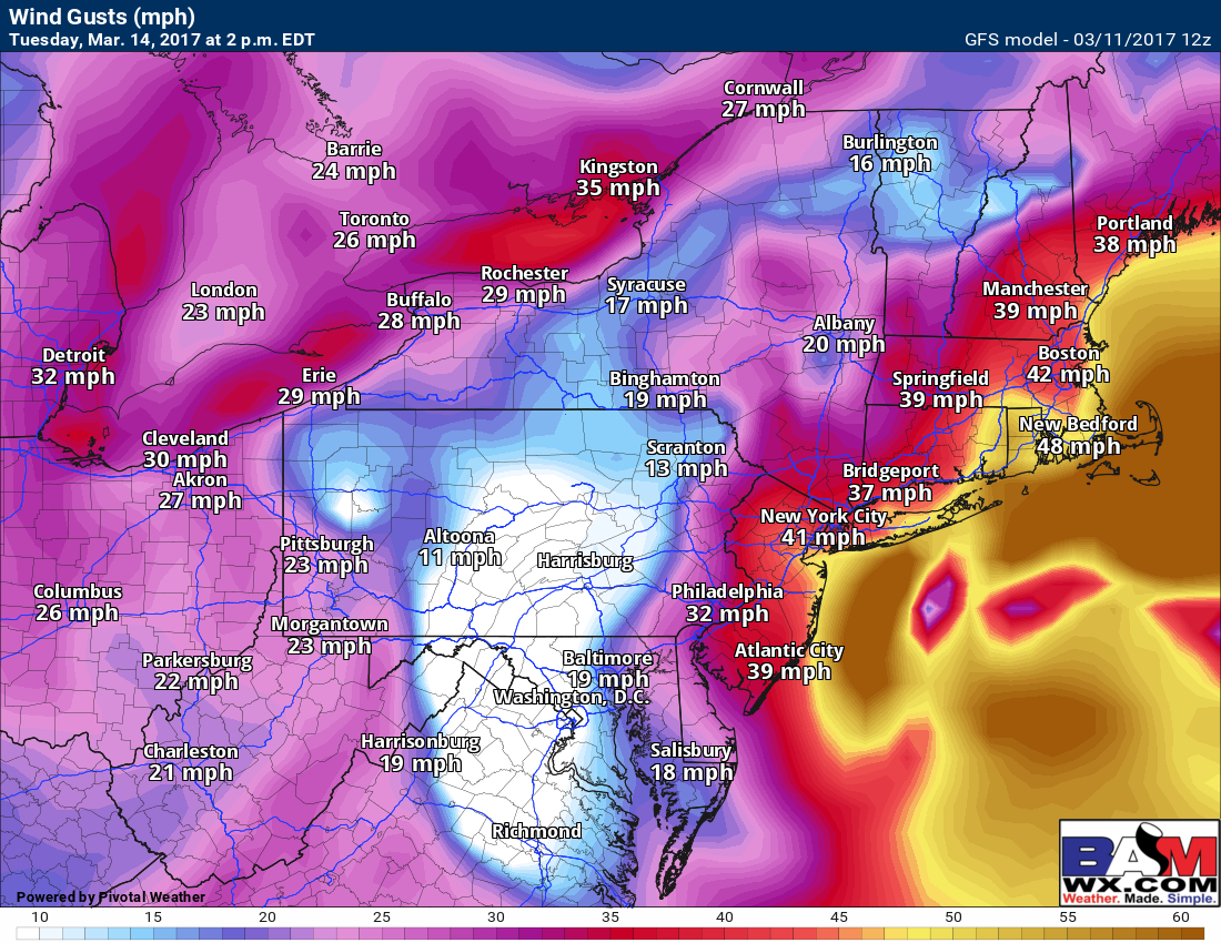
Winds will also be an issue with this system, gusting past 50mph from coastal NJ to Cape Cod. Blizzard conditions are possible from NJ to Cape Cod if data holds.
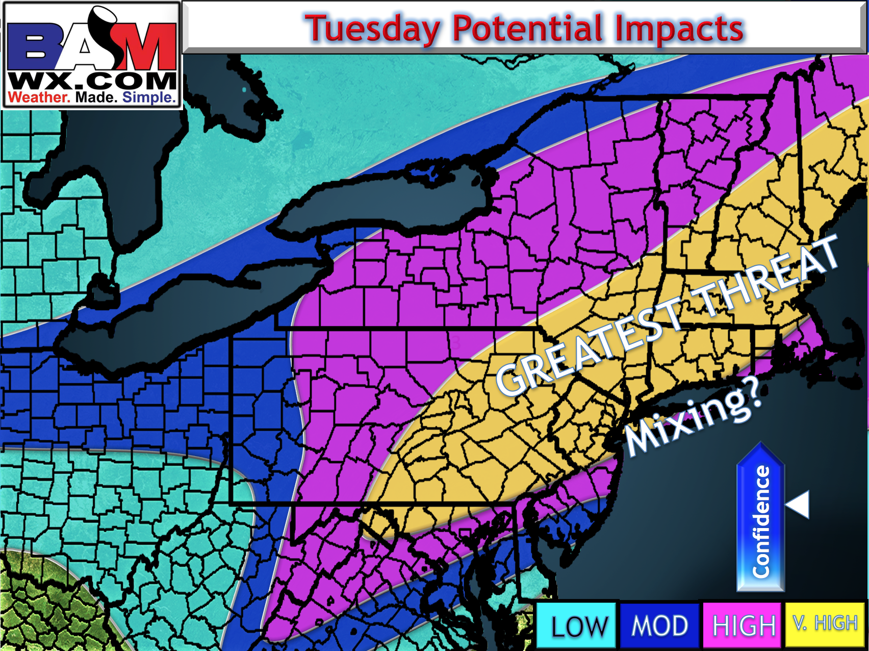
For now I will not put out snowfall numbers, but rather highlight where the impacts will be highest. I will say that I think total snowfall in the greatest threat area will surpass a foot.
Confidence and Risk:
- Only big risk now to the forecast is any mixing possible in southeastern New England and where the storm exactly tracks. This should come into better focus over the next 24 hours.
Watch the video for all the details! I will have an update tomorrow morning with the latest. ~Ed