#CTwx #MAwx #RIwx #NYwx #NJwx #PAwx #OHwx Warm Weekend Coming, Some Rain?
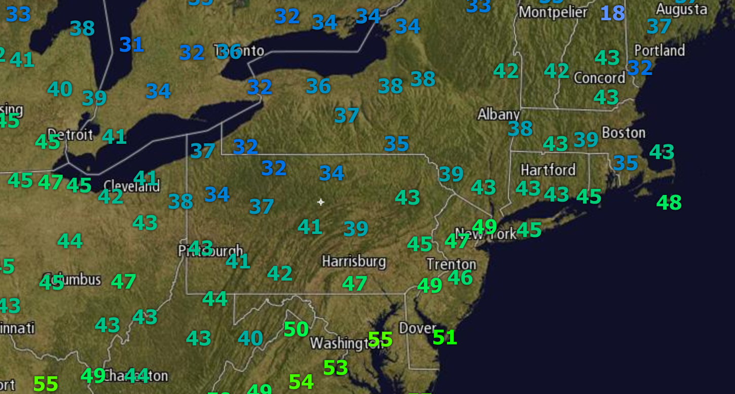
Good morning! Cooler conditions have settled in across the region behind a cold front. Here’s a look at current temperatures.
QuickCast through the weekend:
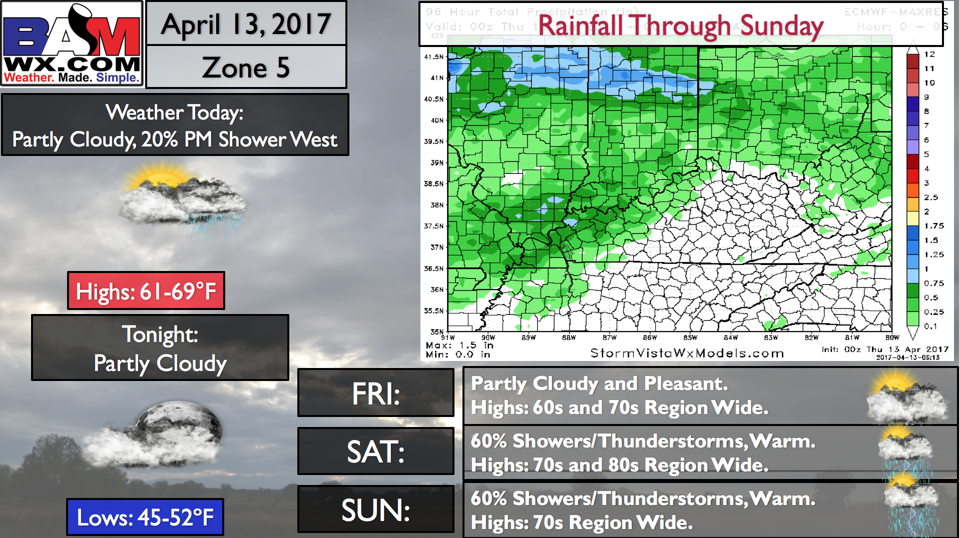
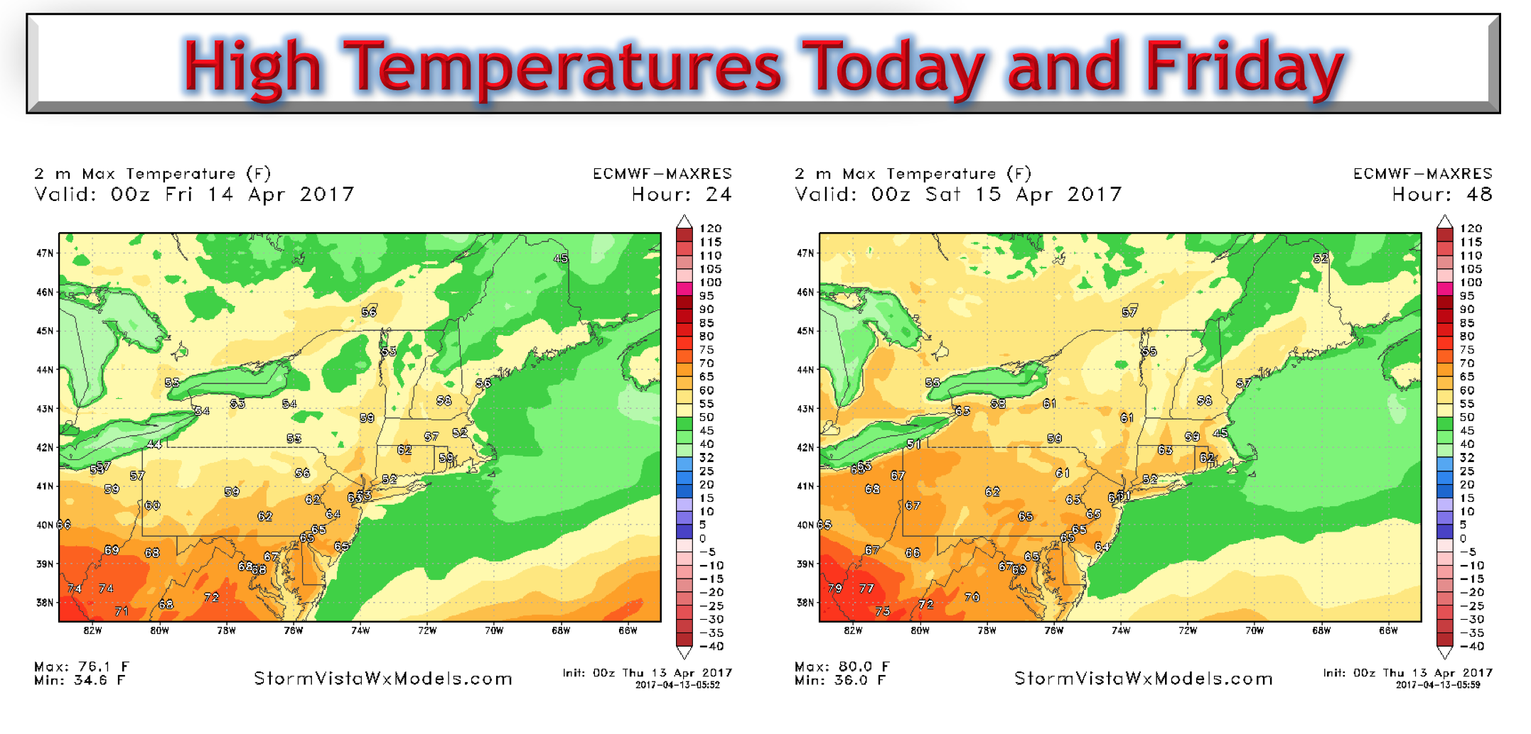
High pressure will control our weather through Friday with warm conditions. Here’s a look at projected highs today and Friday.
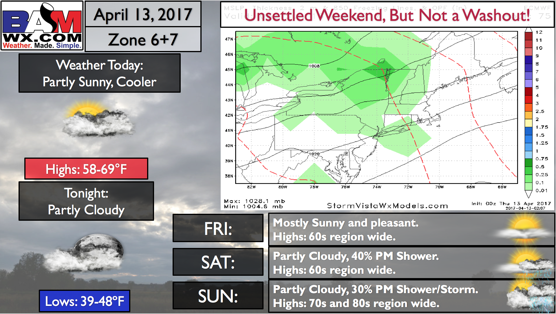
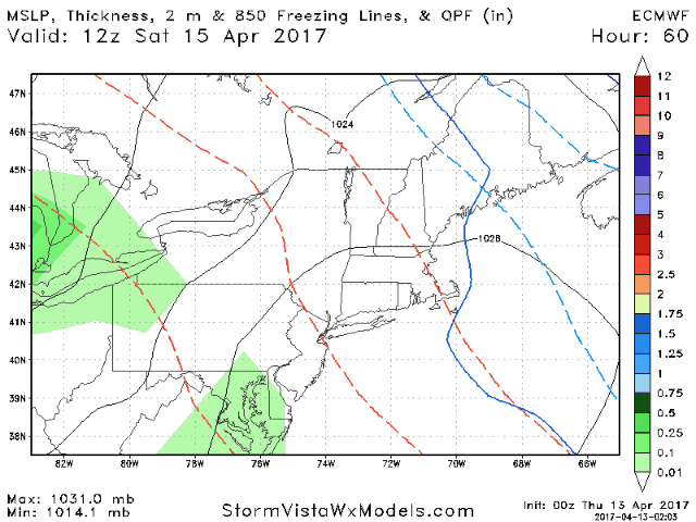
High pressure moves east this weekend allowing warmer air to enter the region. With this comes the threat for showers and thunderstorms, especially inland. Here’s a look at the European model through Sunday.
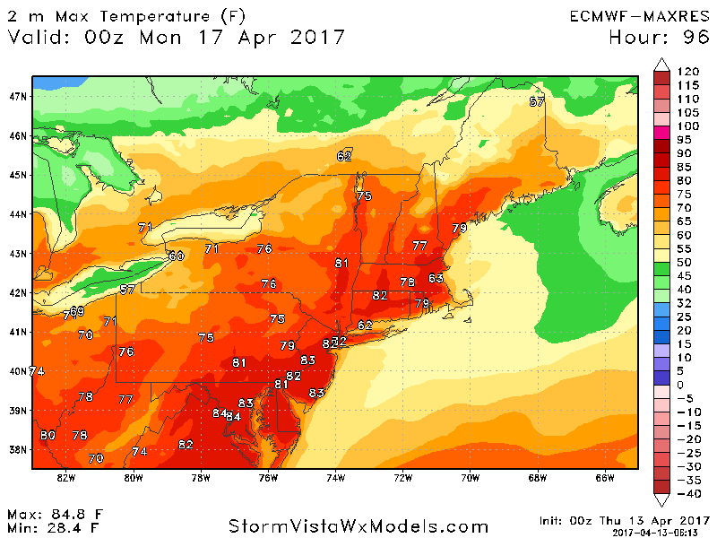
Temperatures by Sunday look very warm once again ahead of a cold front, getting into the 70s and 80s region wide!
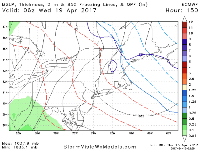
Cooler temperatures will return early next week with some sunshine. Our next threat for rain comes Wednesday and Thursday as another cold front moves through the region.
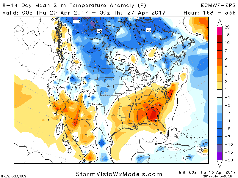
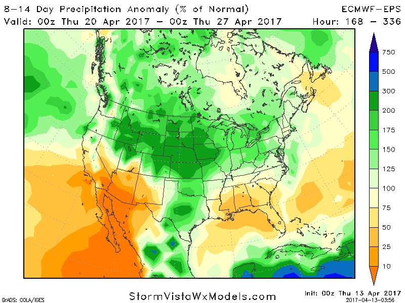
Overall, cooler than normal conditions will be the theme for week 2 across much of the Northeast with near to above normal rainfall.
Confidence and Risk:
- High confidence on a tranquil end to the week with seasonable temperatures.
- High confidence on a warmer, unsettled weekend. Even still, it will NOT be a washout!
- Average to high confidence on cooler conditions returning next week along with near to above normal rainfall.
NOTE: I will be out of the office next week. My colleagues Michael and Kirk will update the forecast as needed. Have a great day!
Today’s video (6 minutes):