#CTwx #MAwx #RIwx #NYwx #NJwx #PAwx #OHwx Active Weather Week Ahead! Details Here. E.
Good morning! Another busy weather week coming up this week with multiple rainfall chances Tuesday and then again on Thursday. Temperatures look near or even above average through the week as well! Today’s QuickCast:
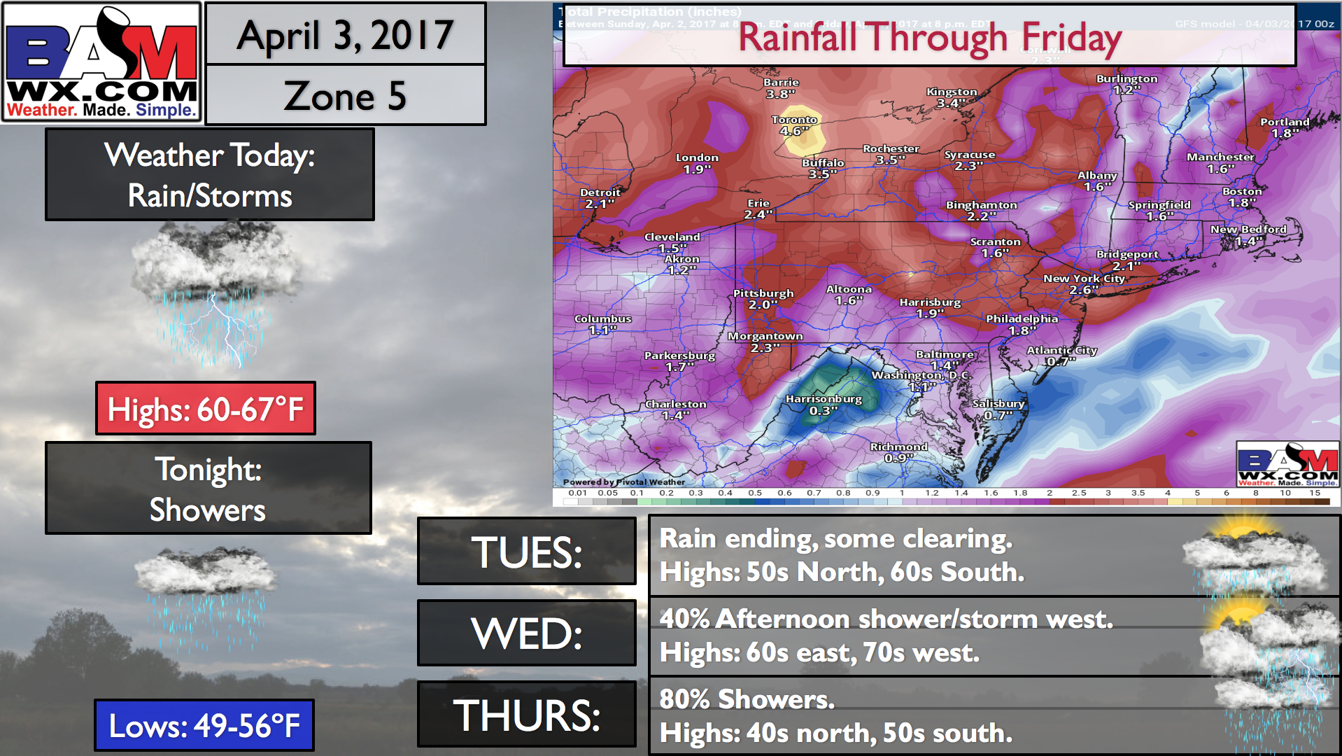
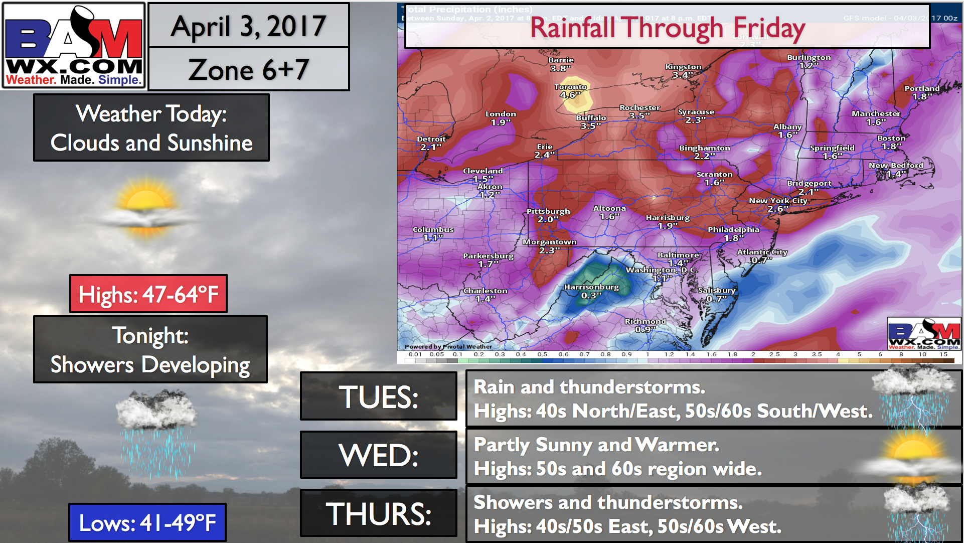
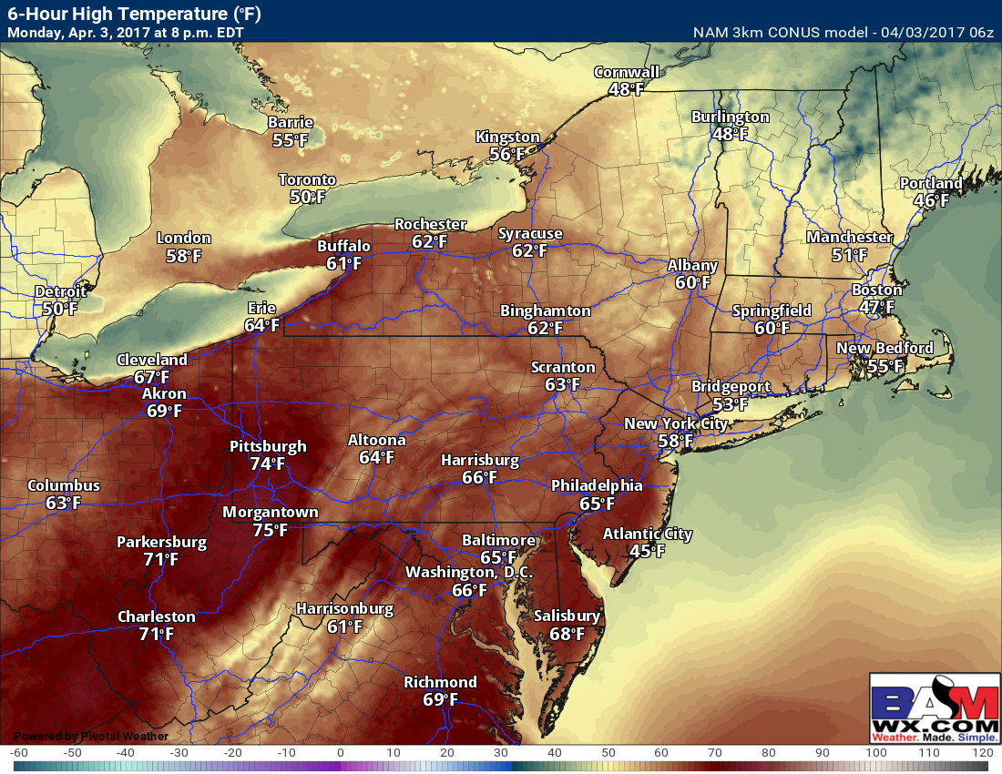
An area of low pressure will move toward the region today with increasing clouds west and sun and clouds mixed east. Temperatures look very warm today – above average region wide!
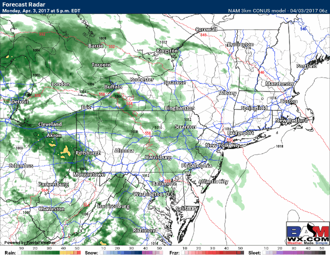
Rain will overspread western areas today and elsewhere overnight. Projected radar through Tuesday.
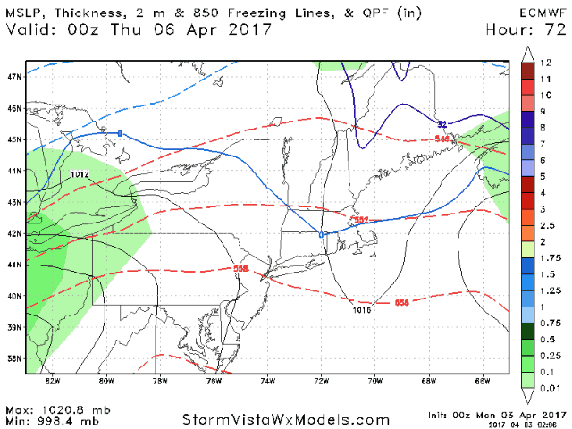
Wednesday is a nice day with warm temperatures, especially across New England. Our next system approaches late in the day across Ohio with some showers. Those overspread the region Wednesday night into Thursday.
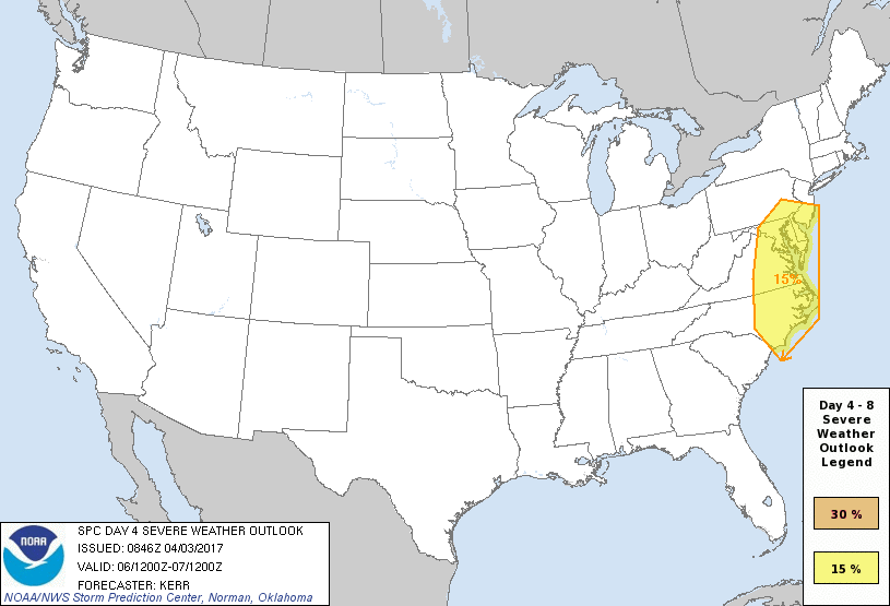
With this event Thursday, the SPC is highlighting southern parts of the forecast area for possible severe weather – something to monitor through the week.
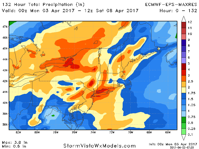
Total rainfall with these two systems combined are impressive – another widespread 2-4″ rain event!
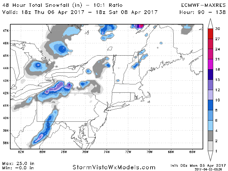
On the backside of this storm, some higher elevation snowfall is also possible Friday from northeastern Ohio into western PA, WV, and NY.
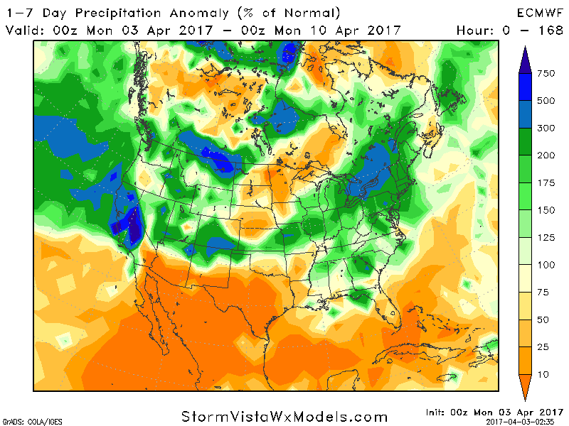
Week 1 looks quite wet, with 150-300% of normal precipitation expected across the Northeast.
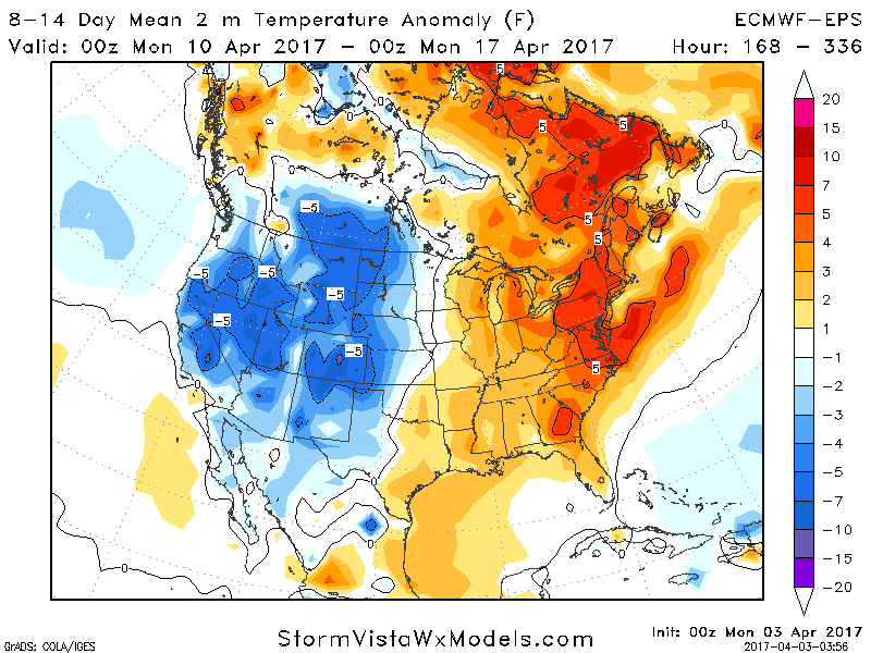
By week 2, (finally) a warmer signal is emerging with latest ensemble guidance 4-8°F above normal.
Confidence and Risk:
- High confidence on a wet week ahead with 2-4″ of rain expected between now and next weekend.
- Moderate confidence on some backside snow in higher elevations of Ohio, Pennsylvania, West Virginia and New York.
- Increasing confidence on a warmer than normal week 2 across the region.
Today’s video (6 minutes) explains it all. ~Ed