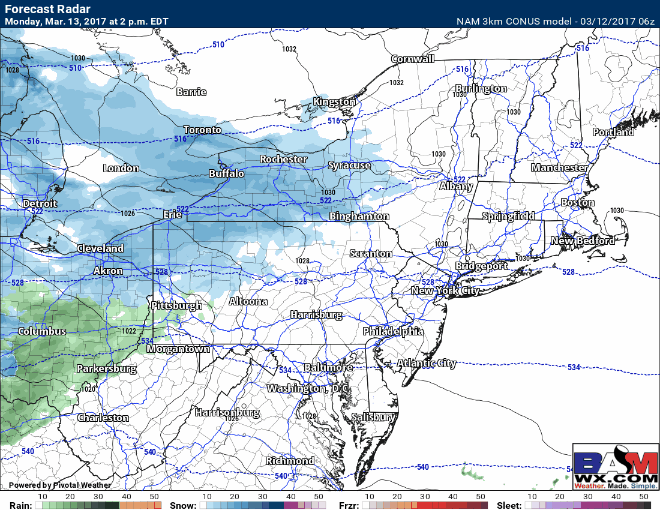
Good morning. We are fine tuned the forecast for a major winter storm to impact the Northeast Monday night into Tuesday. Confidence is very high in a storm occurring with moderate to high confidence in storm track at this time. Here’s a look at the latest 3km NAM for timing. I’ll have more exact details in the video below.
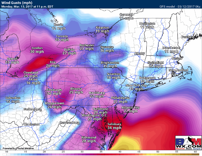
Winds will also create blizzard conditions at times along the coastline gusting to 60mph through the day Tuesday!
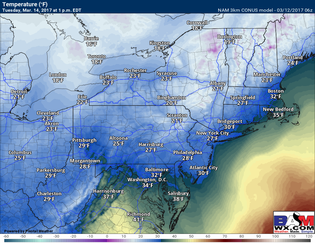
Temperatures throughout the event will be highly dependent on the track of this system. Some guidance is still suggesting that temperatures may get above freezing from SE CT toward Cape Cod as well as in coastal NJ. This is a risk we need to monitor on guidance today since it will dictate snowfall amounts.
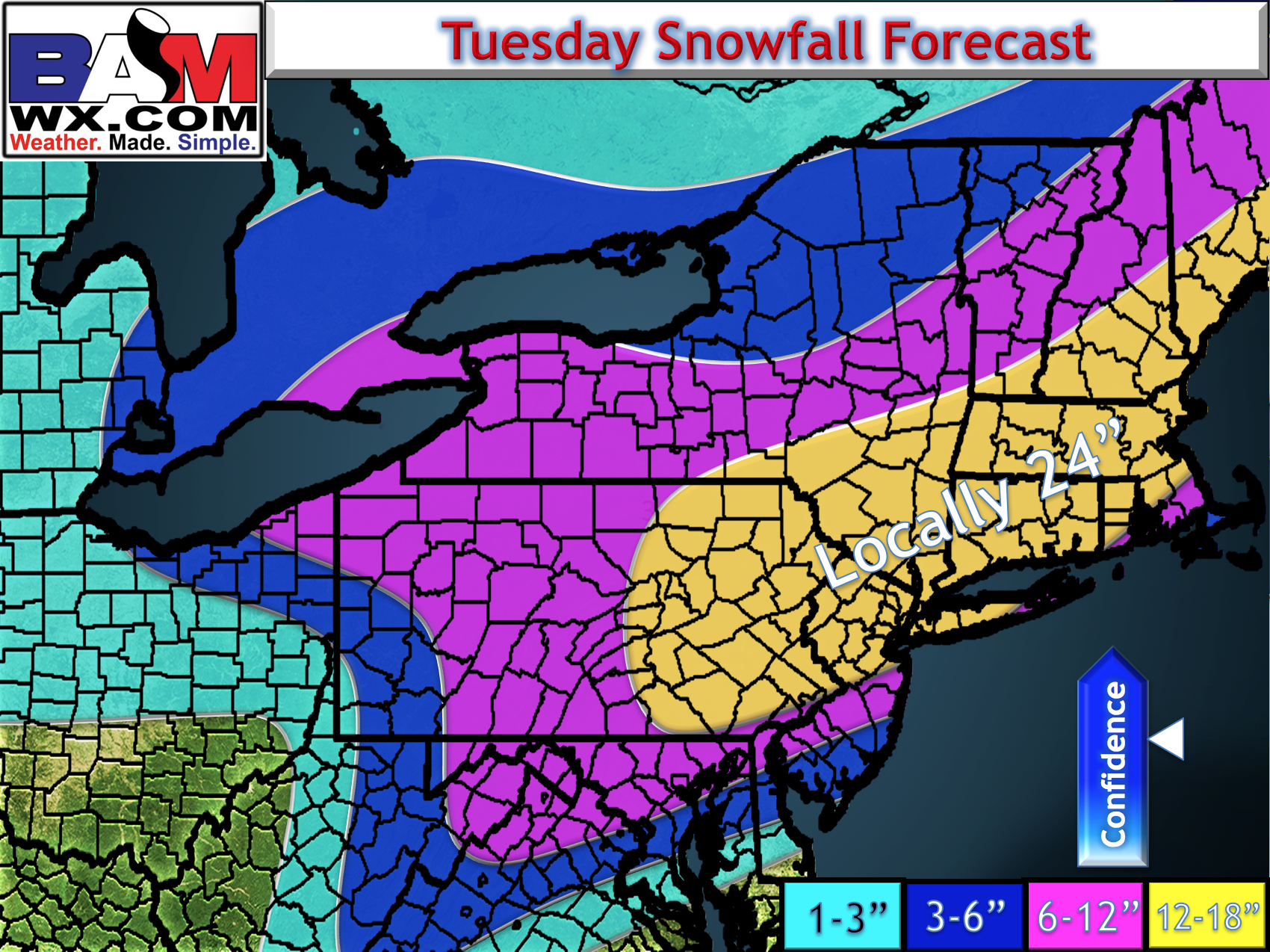
Snowfall amounts will be large with this system causing hazardous driving conditions from late Monday night through Tuesday evening. Remnant impacts may even be felt into early Wednesday. Here’s my first call map. I’ll discuss in detail regarding the risks and reasoning behind it.
Confidence and Risks:
- High confidence in a MAJOR winter storm coming to the Northeast Tuesday with heavy snow and strong winds.
- Moderate confidence in precipitation type forecast. Some mixing is possible in southeastern areas.
- Moderate confidence in the extent of the northwest edge of snow across PA and NY- this remains a bit uncertain.
The video below covers it all.