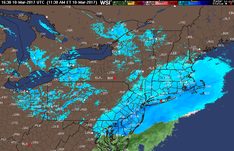
Good afternoon! Wanted to update you guys on the latest regarding the Tuesday threat as well as a quick short term forecast over the next 12 hours. Snow will wind down in places it is still snowing over the next few hours. However, some snow squall are around in PA and NE OH and those will dive southeastward this afternoon leaving a fresh coating in some spots. Latest radar:
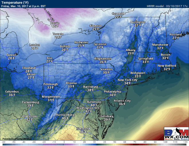
Temperatures will rise above freezing this afternoon for a few hours allowing some melting before a rapid drop in temperatures this evening. This will create a flash freeze risk. Temperature forecast overnight:
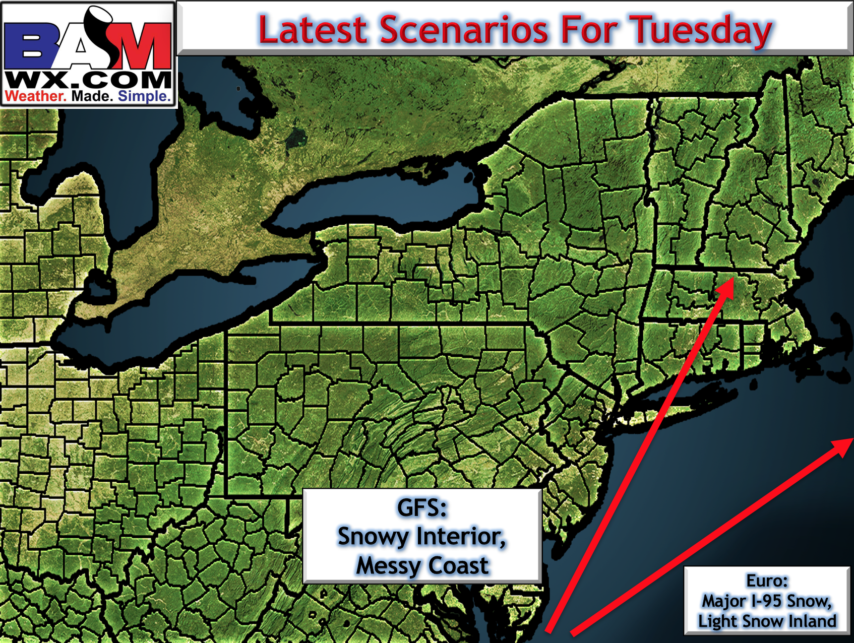
The next storm threat is Tuesday and it might be a big one. Those who know and follow me know I am one of the more conservative meteorologists out there, but this signal for a storm is probably one of the strongest we have seen all year. However, there is still a lot of uncertainty in guidance as to whether this storm tracks over southern New England, or even off the coast with minimal impacts similar to the Canadian. Latest scenarios from midday guidance.
I discuss the why behind the uncertainty and what I think can happen in the video below. I will be off the rest of the night resting up for more updates this weekend. I’ll be around via phone or Twitter for any questions you have! Have a great evening! ~Ed