#CTwx #MAwx #RIwx #NJwx #NYwx #PAwx #OHwx Active Midweek, Warm Late Week. Details Here! E.
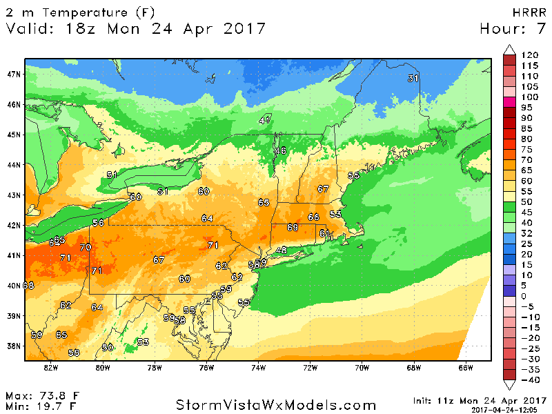
Good morning! The theme for today will be for some increasing clouds south along with plenty of sunshine north as an area of low pressure slowly rides up the coast. Temperatures today will get fairly warm where there is some sunshine. Where there is more cloud cover, temperatures will be held down. Here’s a look at approximate high temperatures today.
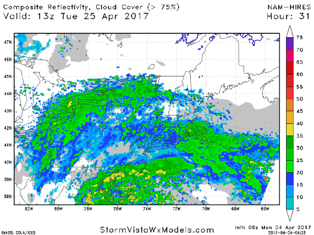
The area of low pressure will move up the coast for the day tomorrow leading to shower and thunderstorm risks from Pennsylvania on east. Here’s a look at the high resolution NAM for the day tomorrow.
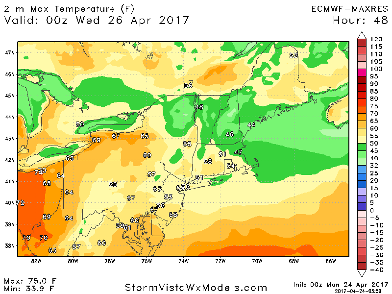
Showers likely linger into Wednesday across New England with clearing and warmer conditions expected elsewhere. Here’s a look at high temperatures Wednesday.
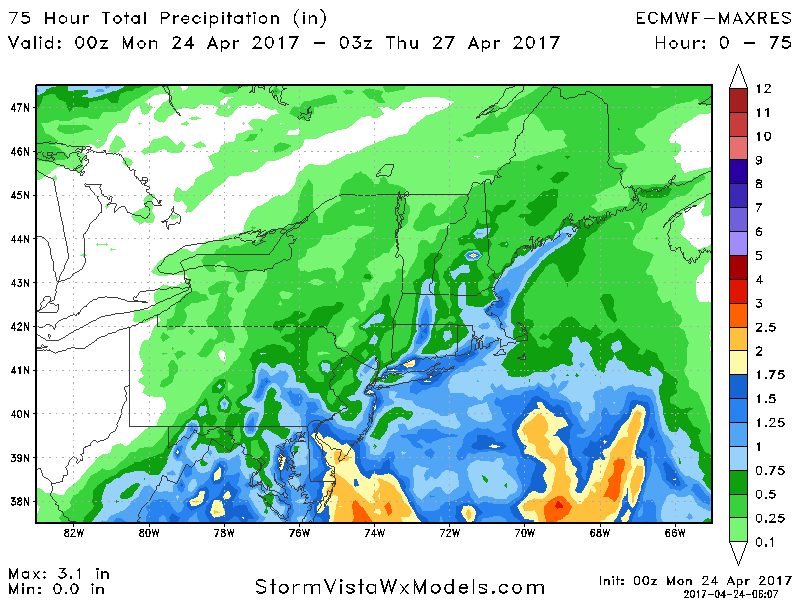
Total rainfall for the midweek system is impressive for southern areas with some seeing more than 1 inch of rain.
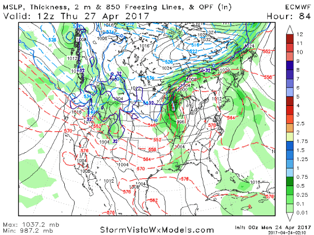
By Thursday, a strong ridge will bring warmer conditions to much of the region as a cold front approaches Ohio and western Pennsylvania by the afternoon. Here’s a look at the European model Thursday into Thursday night.
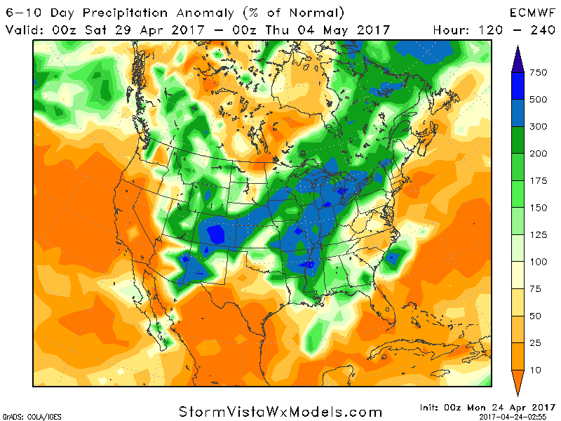
This cold front likely stalls across Pennsylvania, Ohio, and into northern New England this weekend with disturbances riding along it. This is shown well in the 6-10 day precipitation compared to normal. Notice areas along I-95 are below normal east of the front while western areas are very wet.
Overall temperatures this week look warm with most areas 6-12°F above normal.

Week 2 temperatures lower closer to normal as the front eventually moves through about a week from now.

Confidence and Risks:
- High confidence in warmer than normal temperatures persisting into week 2.
- High confidence in precipitation remaining above normal west and near to below normal east through week 2.
Have a great day!