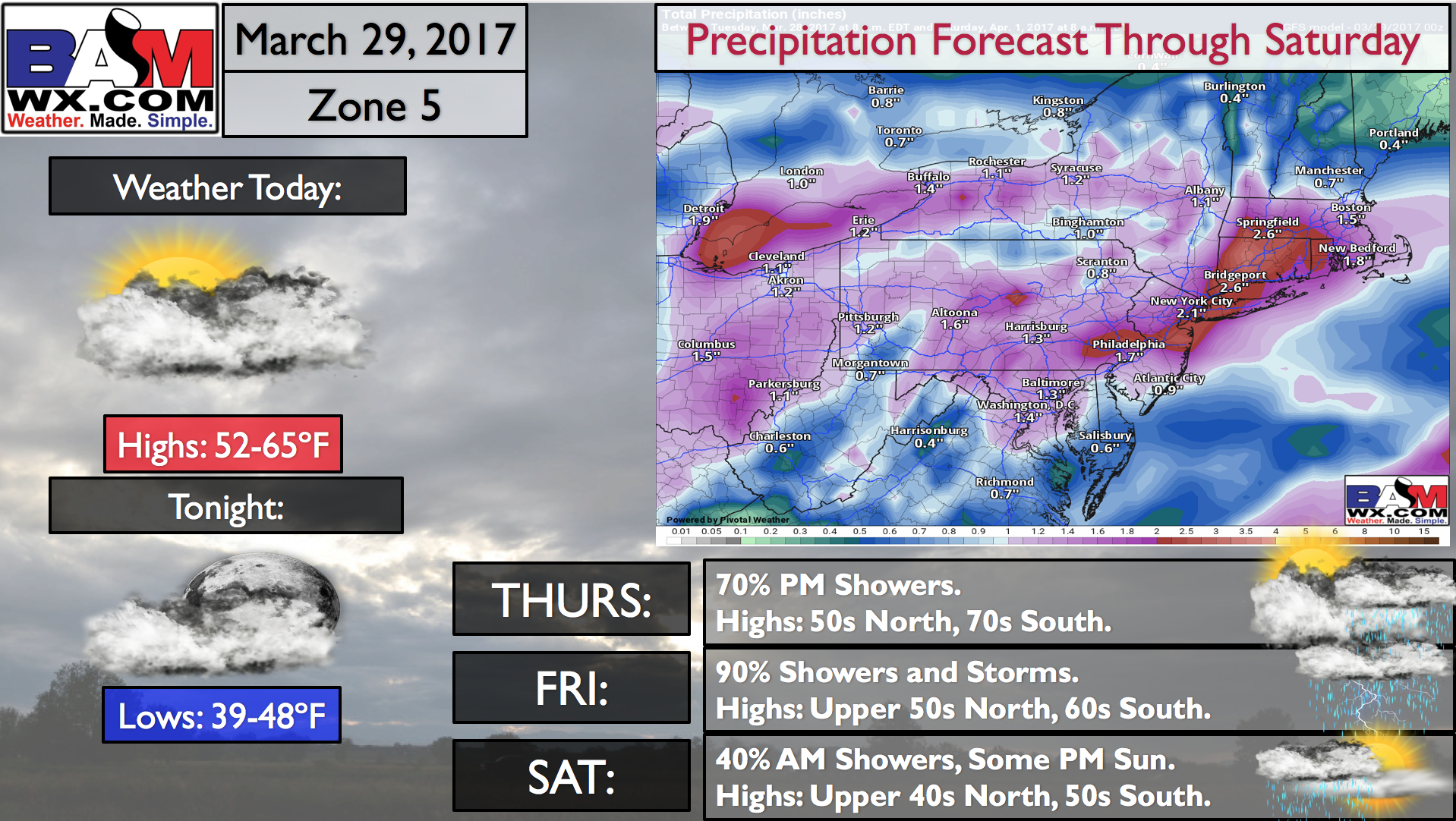
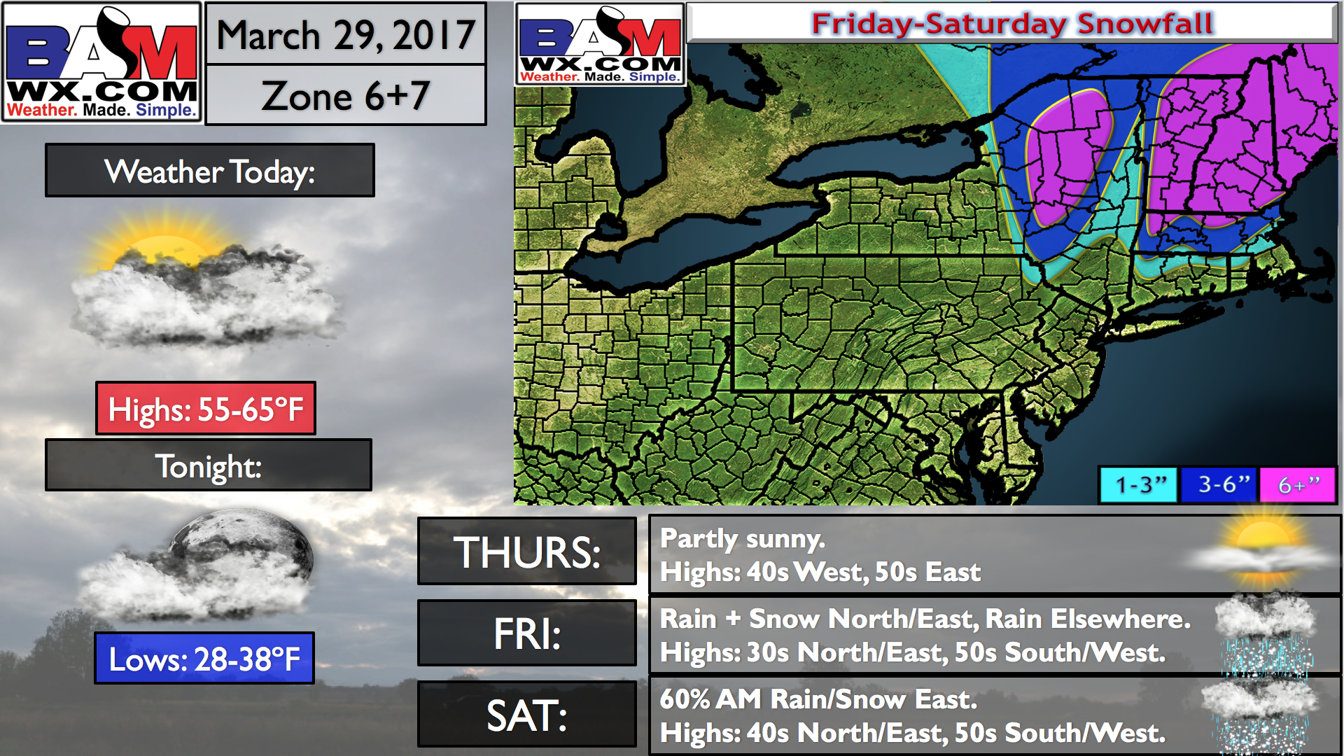
Good morning! We are debuting some new “QuickCast” products today, allowing you guys to get information quickly on the go. Here they are broken down by Zones.
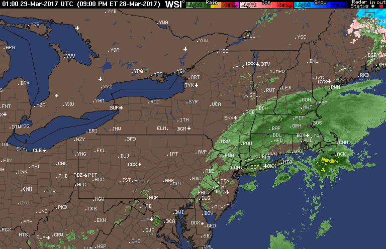
Rain is exiting off the coast this morning, leaving us with clearing and much warmer conditions for the day today. Here’s the latest radar as of 6 AM.
High temperatures will be mainly in the 50s and 60s today with some sunshine.
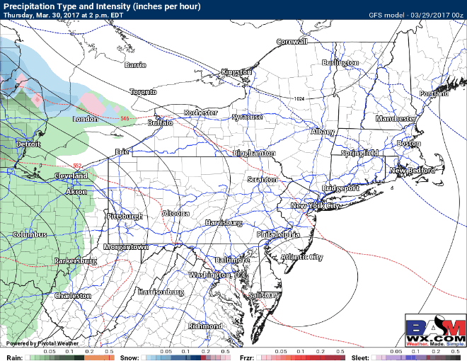
We then turn our attention to our next storm coming with rain Thursday afternoon and evening west, spreading into New England by Friday morning. Cold high pressure will be situated in northern New England allowing some snow and ice to fall across interior southern New England Friday into Friday night.
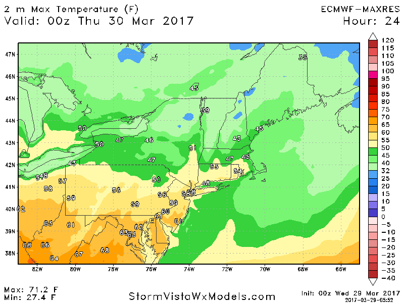
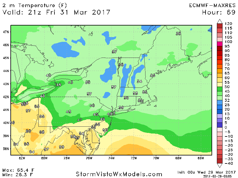
How much snow that fall remains uncertain and very dependent on surface temperatures and temperatures above the ground as well. Notice temperatures in the higher elevations will be close to freezing Friday afternoon, allowing accumulation to be more likely here. Closer to the coast, it may snow, but temperatures above freezing should limit any appreciable accumulation.
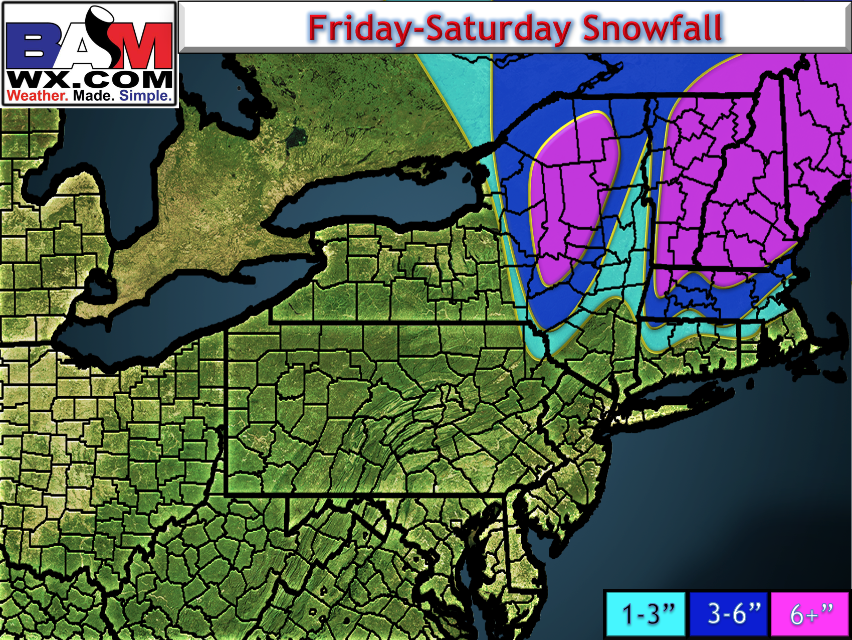
More information will be in the video so make sure to watch, but here is my first snow map.
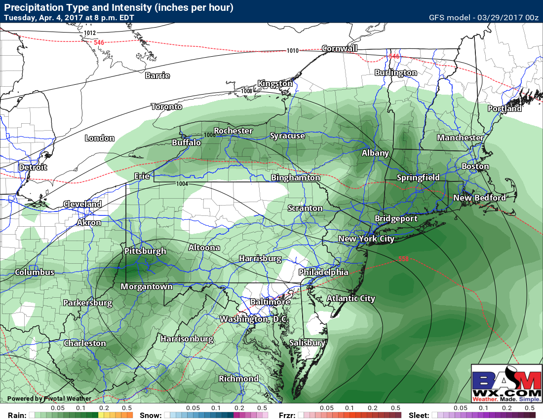
The active times to look to continue early next week with another shot for rain Tuesday.
Confidence and Risk:
- High confidence on a storm Thursday night through Saturday with rain in western areas.
- Moderate confidence on accumulating snow in interior New England, but LOW confidence on exact amounts.
- Low confidence on snowfall in coastal southern New England. Some snow is possible before a change to rain.
Today’s video (7 min) covers it all!