Key Points – Monday, August 7, 2017:
***We are so excited for this week and all of you that have signed up for our open house! As a reminder, you will receive all of our product via email, just make sure you’re looking at the right forecast locally; remember, the advantage of having a team of meteorologists at your fingertips can be priceless. With our service you will have access to our team of meteorologists 24/7.
Throughout the week we really want you to take advantage of the content we put out and use it to your advantage! At anytime this week you feel like you have seen enough to make a decision and you’re ready to sign up we will offer you a 20% off discount if you sign up BEFORE your trial expires August 11th. Please do not hesitate to reach out to us at anytime if you have any questions. Have a blessed week! -BAM staff.***
Synopsis: Good Monday morning! This very active pattern to the south and west continues this week as a continuous stream of energy moves west to east. As we go throughout the day today showers remain mainly west…it’s not really until Wednesday morning and afternoon where we see more widespread rainfall as a front swings east. The cooler than normal pattern will continue over the next week as well with widespread highs in the 70s and lower 80s…incredible for early August. All the details in the video below, if you have any questions please let us know…have a blessed day!
Today’s video (7:30 min):
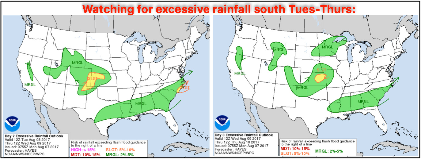
Excessive rainfall risks this week focused mainly south and west for localized flash flooding:
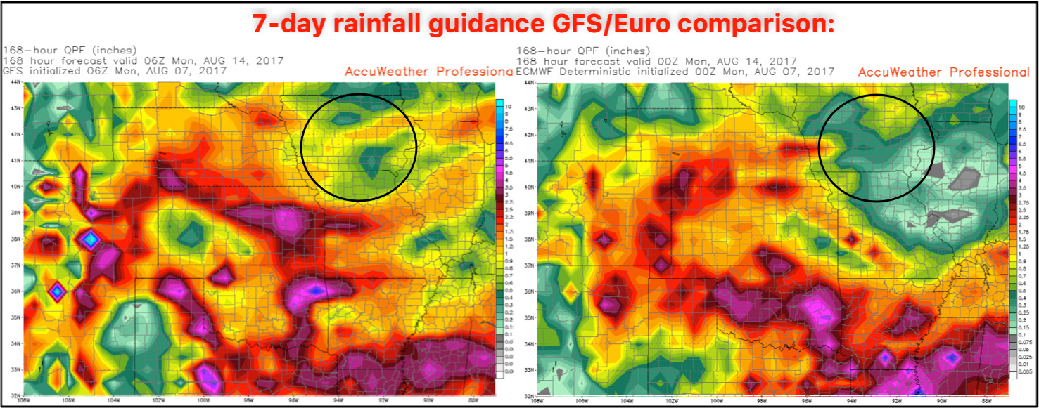
7-day rainfall guidance from the GFS and European forecast models…data agreeing the heaviest totals focused south and west over the next week. We circle the black area below across parts of central Iowa/northern Missouri where we believe stay drier here overall, but a few areas of precipitation can’t be ruled out.
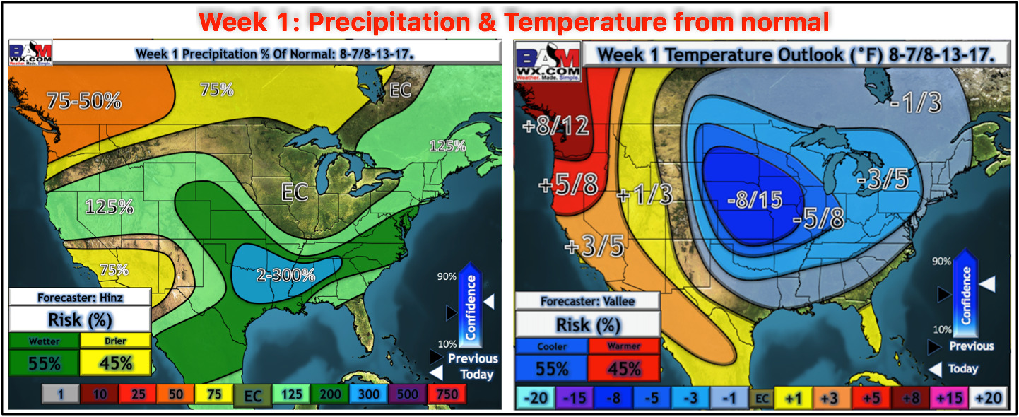
Precipitation and temperature from normal over the next week…the cooler regime continues across the central Plains and we stay active especially southwest.
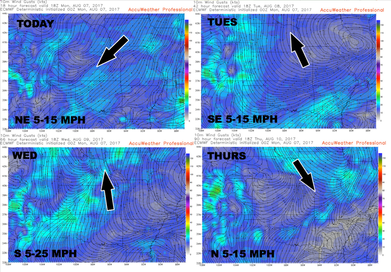
Wind forecast into mid-week:
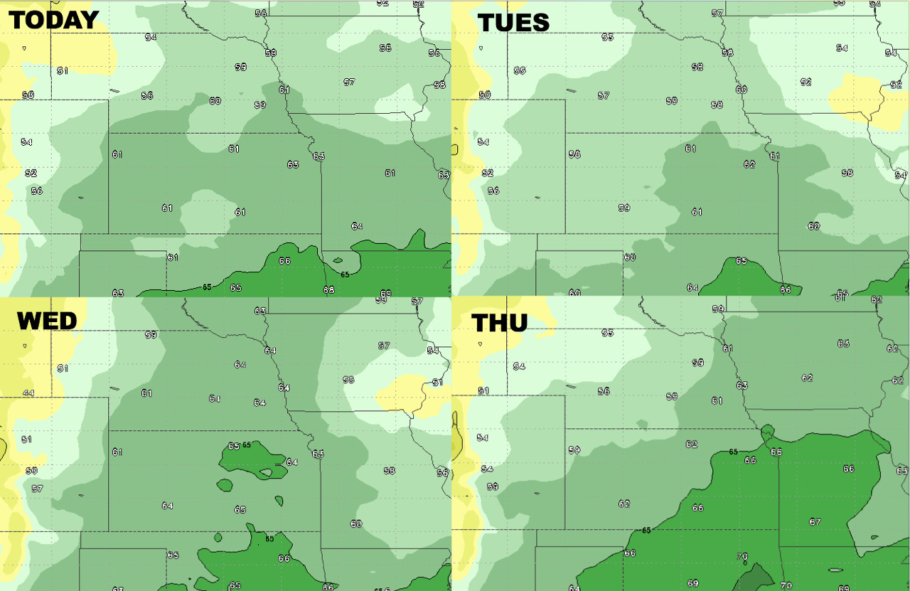
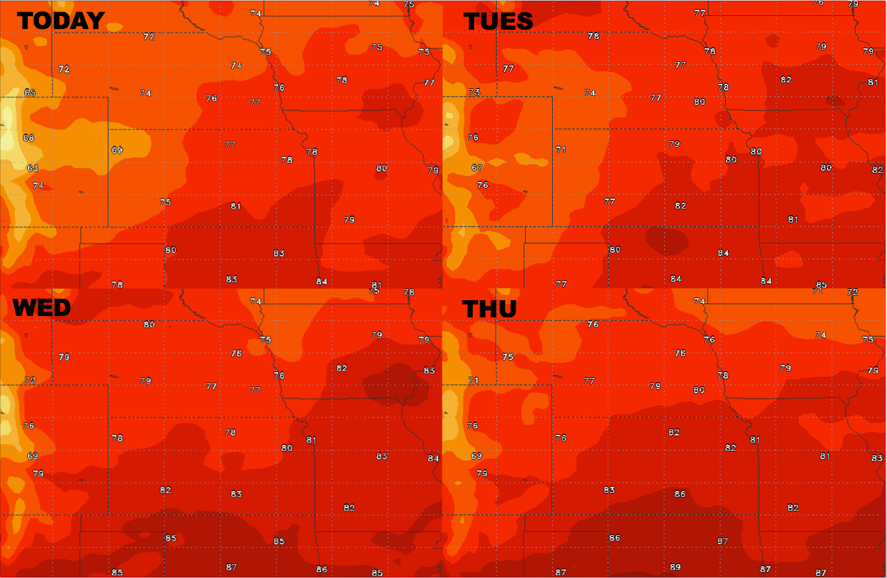
High temperature guidance over the next 4 days:
Overnight low temperature guidance here as well:
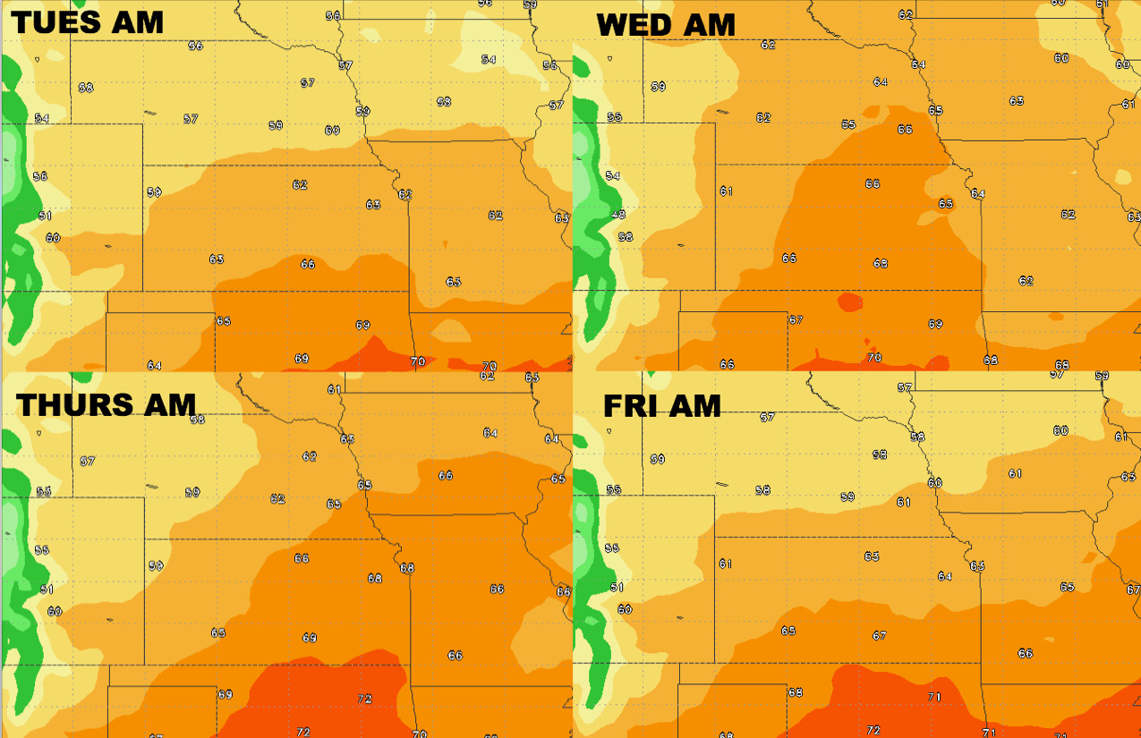
Dew points forecast into mid-week: